Design a site like this with WordPress.com
Get started

Wrapping up in Kathmandu

After returning from our trek, we had just a week remaining in our trip in Asia. We spent it in Kathmandu, catching up on our blog, packing gifts for friends and family back home, exploring the city, and reminiscing about all we’d just done. We splurged and stayed in a huge, comfortable suite at the Hotel Ganesh (ok, it was still only $20/night…), complete with warm showers, a nice writing desk, and plenty of beer to help us recover from our long trek.

Here is Steph giving me ‘the look’ for messing around instead of packing those gifts over on the left. (We were running late for our flight back to the U.S.)
Screen Shot 2014-12-11 at 11.06.49 AM
Packing to leave. Kathmandu, Nepal

Some photos from our week in Kathmandu–

Screen Shot 2014-12-11 at 11.08.16 AM Screen Shot 2014-12-11 at 11.08.35 AM
Kathmandu, Nepal

Even religious sights are a messy beautiful chaos in Kathmandu; below, an electronic clock hastily perched to the left of the Nepali god and the bird droppings covering the prayer candles.
Screen Shot 2014-12-11 at 11.08.02 AM
Kathmandu, Nepal

Rooftops and an abundance of pigeons in Durbur Square, Kathmandu
Kathmandu, Nepal

Pictured below is the outside of a building called the Kumari Ghar, the palace home of the Royal Kumari of Kathmandu. The Kumari is a young girl who is worshipped by many Nepalese Hindus as a living goddess. More on that here. The Kumari is rarely allowed outside of her home but can be seen occasionally by the lucky passerby when she makes an appearance at her second story window. We stood for several minutes below her window, and Steph actually managed to catch a glimpse of the young Kumari as she scampered past the upstairs window!
Kathmandu, Nepal

Dinner at La Dolce Vita, one of many Western-influenced restaurants in the city.
Kathmandu, Nepal
Kathmandu, Nepal
Kathmandu, Nepal

On the walk back to our hotel on the very last day of the trip, Steph’s flip flops bit the dust. These were the shoes that had lasted for 8 months on the road and had taken her from Thailand to Bali and Cambodia and Mt. Everest and more…..and they finally managed to break on the last day….wow.
Kathmandu, Nepal

Breakfast soup at a favorite Chinese restaurant in Kathmandu. I apparently accidentally ordered a biggie size– which comes with a biggie spoon of course.
Screen Shot 2014-12-11 at 11.07.38 AM
Kathmandu, Nepal

While at breakfast, a “bandh” began in the city. In Nepal and other neighboring countries, a bandh is a form of protest, similar to a strike, that typically occurs across an entire city. During a bandh, shopkeepers, taxi drivers, and generally all business owners are expected to close up their shops (or they will be vandalized by the protestors), effectively bringing the city to a standstill, often for many days. We were lucky that this particular bandh was tame, but it was nerve-wracking to watch an entire street shut down as storeowners sequentially slammed their metal doors shut, almost like Dominos, as we finished our breakfast one morning! We didn’t know whether we would be stuck in the restaurant for days, whether we would make it back to our hotel or not, or whether our flight to the U.S. would be cancelled. Although the streets in the city were abnormally tense and crawling with police in riot gear, we were able to return to our hotel and eventually catch our flight out…although we did stay close to home in the hotel for the next few days. (Below, storefronts closed for the bandh.)
Screen Shot 2014-12-11 at 11.07.16 AM
Bandh! Kathmandu, Nepal

The final picture of our trip (on the ground, anyway) from our taxi on the way to the airport in Kathmandu. Although we were able to find a taxi driver to take us to the airport during the bandh, he charged a very inflated price (at least three times what we had paid on the way to the hotel) to compensate him for the danger of driving his car during the strike. We made it to the airport without incident, but we and the driver were noticeably on edge as we passed through the major squares of the city.
Screen Shot 2014-12-11 at 11.03.29 AM
Heading to the airport. Kathmandu, Nepal

Advertisement

EBC Trek, Days 11-15: descent from Gorak Shep to Kathmandu

Total mileage on Day 11: 9

Beginning altitude (Gorak Shep): 17,047 ft

Final altitude (Pangboche): 13,254 ft

I woke up the morning after visiting Everest Base Camp and rolled my head towards Scott, his head hidden beneath the warmth of his down sleeping bag. “I am really, really, really cold. I’m ready to be back in Kathmandu, like… right now.” My own face was clammy from rebreathing my own air all night under the safety of my own sleeping bag, and my hair felt like ice.

But before we could leave Gorak Shep, we had a choice to make. Many trekkers who visit EBC include an extra hike up a small mountain called Kala Pattar (“black rock” in Hindi) before leaving Gorak Shep and descending back to Lukla. Kala Pattar is reportedly the best place to view Mount Everest, certainly better than any views you get at EBC itself. For a lack of words that describe how incredibly cold and tired we were after reaching EBC and sleeping at 17,000 feet in Gorak Shep, I need only say that climbing Kala Pattar for an amazing view of EBC (probably the only good view of it in our lives) did not even cross our radar. Our hike to EBC had been amazing – amazing!!– but we were tired. And did I mention cold? I think our conversation went something like this:

Me: Do you really want to climb Kala Pattar before we hike down?

Scott: Nope. You?

Me: Nope. See you in Pangboche.

Although it had taken us 10 days to ascend to EBC, we planned to hike down the trail in just 3 days. The funny thing is, the 25 mile trek down to Lukla is not that much easier than the way up (the trail is riddled with ups and downs regardless of whether you are coming or going), but the trek up to EBC takes so much longer due to the requirement to go slow and acclimatize. Also, walking at high altitudes is physically harder before that acclimatization has occurred, making the way down drastically easier. So, our plan for today was to hike as far as we comfortably could, getting at least as far as Pheriche (about 7 miles away).

[All packed, ready to leave Gorak Shep.]
Screen Shot 2014-12-11 at 12.18.17 PM
Everest Base Camp Trek, Nepal

[The blue tin roofs of Gorak Shep. Kala Pattar, the small black peak behind Gorak Shep, in the distance.]
Screen Shot 2014-12-11 at 12.20.52 PM
Everest Base Camp Trek, Nepal

At this point, we had spent 10 days hiking at high altitudes, and the extra burst of oxygen we were getting fueled us down the trail. About 1.5 hours from Gorak Shep, we made a quick stop in Lobuche to pick up my backpack that I had stored at a lodge. The lodge’s caretaker and her friend were enjoying the sunny, albeit cold, weather at some tables outside.
Everest Base Camp Trek, Nepal

[Between Lobuche and Dingboche.]
Everest Base Camp Trek, Nepal

IMG_2556     [The trail was empty, save for the occasional porter.]
http://www.flickr.com/photos/scottjehl/7164977990/in/set-72157629567131202/IMG_2534

Leaving the Himalayas behind…
Everest Base Camp Trek, Nepal

Everest Base Camp Trek, Nepal

IMG_2533 [Sherpa memorials lined the mountain ridge.] IMG_2528 IMG_2524
Everest Base Camp Trek, Nepal

Everest Base Camp Trek, Nepal

Everest Base Camp Trek, Nepal

[The trail, hugging the mountainside through the valley from EBC to Namche Bazaar.]
Everest Base Camp Trek, Nepal

Still fighting the sinus infection, I finally gave up and just allowed the TP hanging from my nose to blow gloriously in the wind….
Everest Base Camp Trek, Nepal
IMG_2543

We hiked for hours, through Lobuche and Dingboche and Pheriche (where an incredible wind tunnel that lasted for over a mile sapped our last reserves) and finally to Pangboche. We stayed with Ang Sherpa again, whose cozy lodge had coaxed me back to health on the way up the trail. Scott and I both paid for our first shower in 7 (SEVEN!) days, and although I wish I could say it felt amazing, Lobuche was not much warmer than the villages on the upper trail; it was tortuous getting hit with spitting needle-like burning water in a 30-degree bathroom, even if the water warmed us a bit.

As we settled into the lodge’s common room for the night, we managed to eavesdrop on the conversation going on at the table next to us. We learned that the 3 hikers at the table had been on a hiking expedition bound for the summit of Everest, and their expedition had just been canceled! Totally shocked that such a thing could happen, we gradually found out from them that they had each paid about $65,000 for an attempt to climb Everest with the legendary Everest expedition organizer Russell Brice (from one of my favorite TV shows, “Beyond the Summit)”. Due to the unfavorable conditions on Everest this season, Russell had just canceled the expedition. The ice was melting faster than in years past and causing dangerous icefalls and avalanches, at least one porter had already died laying ropes on the trail, and the rumor was that the death toll was at 3 so far this year. Russell’s hikers wouldn’t get their money back. What a bummer.

—————————————————

Total mileage on Day 12: 7
Beginning altitude (Pangboche): 13,254 ft
Final altitude (Namche Bazaar): 11,286 ft

Since we had arrived in Nepal, we’d heard rumors of yetis living in the forests of the Himalaya. Reportedly, a yeti’s hand had been found right here in Pangboche and was kept safe by monks living in the hills above the village. Hoping to catch a glimpse of the rarity ourselves, we gathered our bags and hiked out of lower Pangboche and straight up a hillside leading to upper Pangboche and the monastery.

[Upper Pangboche]
Everest Base Camp Trek, Nepal
IMG_2552

When we arrived, the monastery was closed, but we found a villager who agreed to have the doors unlocked for us. He fetched an old woman who maintained the monastery when the monks were away. We poked around the monastery for a few minutes and, when we didn’t see it, motioned that we were looking for a hand. The old woman motioned back that it was upstairs but unfortunately remained locked away while the head monk was out of town! Before you say that every person who comes to see the alleged artifact is told the same story….we did speak with our Zimbabwean friends who we had met earlier, and one of them did in fact have a picture of the hand on his camera. The hand really does exist, and the only question today in archaeologists’ minds is its origin. The show “Unsolved Mysteries” and various scholars have deemed it to be “human-like but not human”…. In the end, it was determined to likely be the hand of a Neanderthal.

[Leaving Pangboche, looking back at Ama Dablam.]
Everest Base Camp Trek, Nepal

We thanked the old woman and then continued down the trail for a couple of hours. We made a quick stop to visit the beautiful Tangboche monastery, which we had also missed on our way up the trail.

IMG_2564 2IMG_2565 IMG_2563   IMG_2555

Everest Base Camp Trek, Nepal

Everest Base Camp Trek, Nepal

Although the large wooden doors to the temple were closed (it turns out the monks were having lunch) we hung around the entrance until one monk saw us and gave us a private tour (the monastery survives on donations from visitors…).

Everest Base Camp Trek, Nepal

Everest Base Camp Trek, Nepal

The rest of the day’s hike was relatively uneventful, save for a gnarly thunderstorm that threatened to soak us on the side of a very exposed mountainside. Scott and I both fear lightening, so we ran the last mile or so to Namche, our backpacks bouncing furiously on our backs, catching the town’s edge just as the storm unleashed.

In the lodge, we ran into a friend that we had met and talked with several times over the course of the week. Sadly, he said one of his friends had actually been killed the day before in an avalanche on one of the other most popular trails in Nepal, the Annapurna circuit. Any time I heard stories such as these over the course of our trip, I couldn’t help but think about all the near-misses we’d had. Amazingly, this incident wasn’t the last time we would hear about deaths and near-misses in Nepal before we headed home.

That night, we settled in for a beer at Liquid Bar, the bar we had visited on the way up the trail. It was our first drink in a week, and it was so. very. good. The bar owner remembered us and had even remembered what we had ordered to eat on the way up– wow. This night though, I had a huge yak steak dinner with French fries. The meat was tough and tasted like kerosene, but it was warm and delicious and perfect all the same.

—————————————————

Total mileage on Day 13:
Beginning altitude (Namche Bazaar): 11,286 ft
Final altitude (somewhere between Namche Bazaar and Phakding…): 8,200 ft

Today we hiked for about 7 long hours from Namche Bazaar to just outside of Phakding. Over the course of the day, the scenery returned to rolling woodlands as we officially left the Himalaya behind.

[Seeing green again… but what had happened to the trees? Could it be the yeti??]
Everest Base Camp Trek, Nepal

Everest Base Camp Trek, Nepal

[Donkey caravan carrying kerosene.]
IMG_2582 2

Everest Base Camp Trek, Nepal

Everest Base Camp Trek, Nepal

Everest Base Camp Trek, Nepal

We tried to make it as far as Phakding but collapsed in a cozy lodge somewhere just outside of town. We were the only guests there, and they had a prayer wheel just outside the lodge that trekkers hoping for safe travels would ring on their way up or down the trail.

Everest Base Camp Trek, Nepal

They also had a homemade alcoholic fermented rice beer called chang that we obviously had to try… It was served hot and was extremely sour and a little sweet. And yeasty.

Local Chang (rice beer)

Local Chang (rice beer)

Local Chang (rice beer)

—————————————————

Total mileage on Day 14:
Beginning altitude (somewhere between Namche Bazaar and Phakding…): 8,200 ft
Final altitude (Lukla): 9,383 ft

Today was the final hike of our trip to EBC and the final hike of our 8-month journey. It was a beautiful, bittersweet day of reminiscing as we worked our way down the last few miles of the trail. Mostly, we talked about the things we had learned along our trip. I wish I’d written them down at the time, as there are so many points that I’ve now certainly forgotten. I do remember commenting that I had been surprised that American music was so popular throughout Asia; I hadn’t remembered that about Europe or Central America, but maybe I just hadn’t been paying attention. We learned how happy we were without our materialistic tendencies we seem to have back home, and the many “things” to maintain, and we promised ourselves that we’d try to bring that insight home with us, despite how difficult that is in America.

[Nepalese cutie outside of Phakding. Check out the baby Crocs!!:)]
Everest Base Camp Trek, Nepal
IMG_2597 2

Along the trail there were several boulders painted with the words “Way to Lukla” next to an arrow, reminding us that our trek was almost complete. In a few short hours, it would all be over.

IMG_2598 2
Everest Base Camp Trek, Nepal

[Outside of Phakding, Scott stopped to check in with his job back home. Although he’d taken off work for several days during the trek, he was somewhat back on the job by this point and pumping out enough work to be convincing.:)]
Everest Base Camp Trek, Nepal

[Adorable baby jumping goat.]
Everest Base Camp Trek, Nepal

[Despite 14 days on the trail, we were still impressed by the porters’ loads.]
IMG_2605
Everest Base Camp Trek, Nepal

[Saying goodbye to the Himalayas and the Khumbu.]
IMG_2607 2
Everest Base Camp Trek, Nepal

Everest Base Camp Trek, Nepal

The trail seemed endless, like there was always another curve or another hill that we hadn’t remembered from the first time we had passed this way. Eventually, sights became more familiar, as the trail gave way to a large field on our right, where local children were playing soccer in a field. We rounded another mountain, just as we saw a small plane fly overhead– Lukla airport! We had made it. We once again passed through the gates that had wished us happy travels here two weeks ago and found ourselves back in Lukla.

We dropped our bags at a lodge and immediately headed to Lukla airport to reserve ourselves on a flight for the next day. Just as before, we had plane tickets, but the tickets were not specific for a specific date or time. Unfortunately, the airport has closed for the day, so we would have to come back the next morning to try to get ourselves on a flight out. Before leaving, we milled around the runway, gawking once again at how incredibly impossible it was that an airstrip had been built on this little mountainside. We eyed the cliff at the end of the runway, which we would be hurling ourselves off tomorrow morning, hopefully with air under our wings.

IMG_2609
Lukla runway
(If you don’t ever plan on flying out of Lukla, it’s definitely worth watching a takeoff and landing of it on YouTube!)

We hadn’t celebrated nearly enough along the trail, so that night we found ourselves in a cozy bar where another hundred or so travelers were also celebrating their successful hike to EBC.

[Below: Battered, burnt, bruised, and never happier…]

IMG_2611
Trek complete.

I ordered a beer and a much needed hamburger (which apparently really is just a piece of ham between two pieces of bread in Nepal):

IMG_2610
Everest Base Camp Trek, Nepal

That night we stayed out way too late dancing  with our new hiker friends. There were hilarious pictures of the debauchery, but I’m told they’ve conveniently been deleted.

We woke up around 6:30 the next morning so that we could walk to the airport and try to book ourselves on a flight for the day. The earliest seats available were on the 10:30am flight to Kathmandu, which meant a lot of nervous waiting to see if our flight would be cancelled; as it gets later in the day, the window for passable flying conditions gets smaller and smaller as the clouds roll in by mid-morning each day (the noon flight never makes it off the ground…). We sat in the airport waiting room for hours, jumping each time a flight was called to load. Finally, we were called around 11:30, and we had to weigh our bags on a scale so that they could be properly loaded on the plane (without causing the plane to crash, that is).

[Nervously awaiting our flight. (Notice the decline built into the runway towards the left side of the picture– that’s no accident!!!)]

Everest Base Camp Trek, Nepal

Everest Base Camp Trek, Nepal

Although I wish I could say that that was the end of our EBC adventure, the plane ride was the most adrenaline-packed hour of the trip. The flight was certainly bumpier and hit more drops than our previous flight had, but without anything to compare it to, it was hard to say whether the flight was normal or not. At one point, I knew all was not well when, instead of landing on the airstrip in Kathmandu, the pilot aborted the landing and made a hard left turn, nearly clipping a mountain. I think the woman sitting next to Scott had it right when she asked the rest of us, “Are we crashing?” Mind you, we later learned that she is a high-altitude doctor who works at EBC every year for Russell Brice and has made this flight many times. The summit guide sitting just behind us commented when we landed, “That was some s*** flying!”, as the 6-foot-something tough guy in the way back put his head between his knees and cried.

We arrived at our hotel in Kathmandu with dazed expressions and raging headaches from the stress of the flight. The next day, I called my parents to say hi, when my mom asked, “Did you hear about the plane crash in Nepal?” Thinking she was joking (since she hadn’t yet heard how bad our flight was the previous day), I scrambled to pull up the news on my computer. There it was on the front page of CNN.com: “Plane crashes in Nepal, killing 15.” As I read further, the circumstances sounded frighteningly familiar; the plane had attempted to land, aborted, and pulled back in a hard circle, clipping the mountainside, just as our plane had nearly done the day before. Even more unnerving was the fact that this was the exact airline that we had flown the day before, and the airline only has (had) 3 planes. Was that the plane we had taken, we wondered? Was that our pilot who had died?

Our trip was winding down. A couple more days in Kathmandu and we would be on our way home to the U.S., nearly 8 months since we left.

EBC Trek Day 10: Reaching Everest Base Camp

Total mileage on Day 10: 5
Beginning altitude (Lobuche): 14,272 ft
Final altitude (Everest Base Camp!): 17,700 ft

————————————————————

After 10 days of cold nights and exhaustive hiking, today we would finally set foot on historic Everest Base Camp. Although we wouldn’t be hiking to the top of Mt. Everest, today was our own “summit day” in a way, and we both sensed that this day was about much more than reaching EBC.

With less than a week before our flight back to the US, today would mark the final adventure of our 8-month journey that had taken us to 9 new countries and enamored us with experiences we would treasure and covet long after we had left. Since leaving home, we had been in a constant state of change, regularly shuffling by foot, bus, scooter, train, sometimes plane, and only stopping briefly to take in the sights, foods, and conversations of one place before stuffing our backpacks and moving on to yet another. Change, in a way, became the only thing that stayed the same, and yet, that in itself was finally about to change too. We knew that once we reached Everest, we would have to turn our backs on EBC–on this entire trip–and literally begin walking towards home.

———

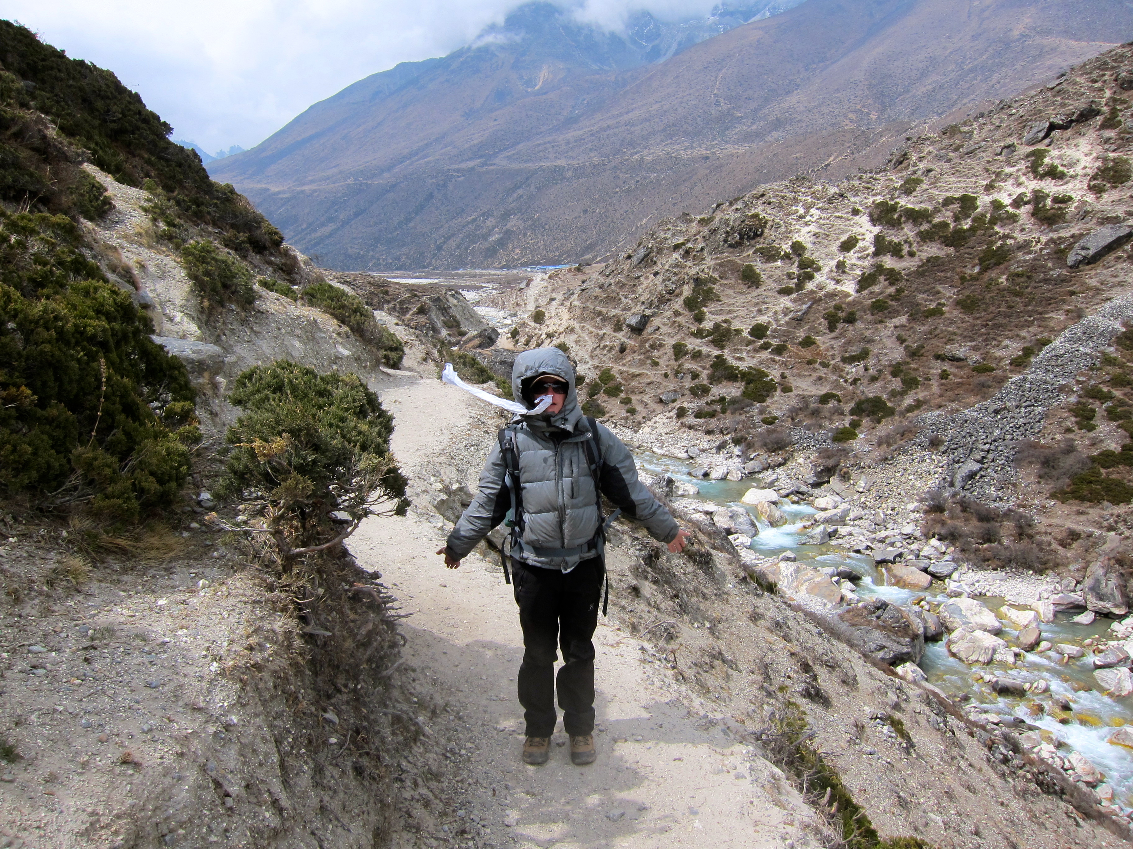
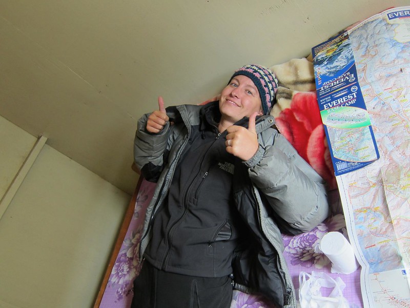
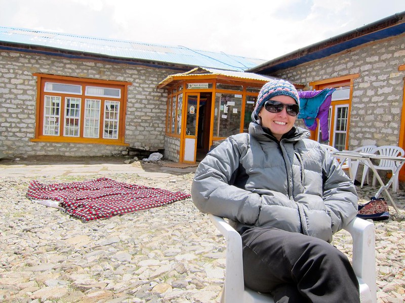
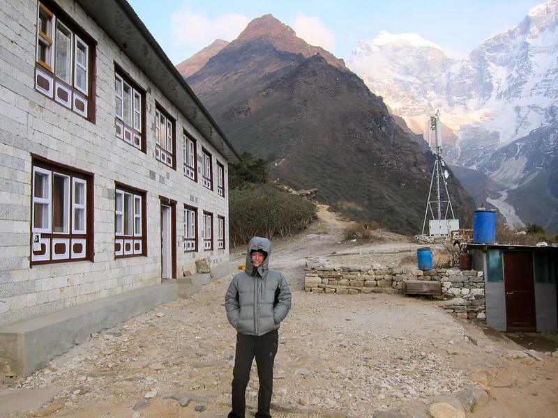
We set out from Lobuche early, around 7 in the morning, with a lighter pack than usual. Last night we had reorganized all of our belongings so that we had the essential gear that we would need for only one night in just one backpack. We left my pack (with nonessential items) in the storage room of our hotel in Lobuche and carried in a single bag: 2 sleeping bags, 1 flashlight, toothbrushes, shard of  bar soap for washing hands, scarf for drying face/hands after washing, toilet paper, and altitude meds, but no books or clothing except what we were already wearing. (The frigid temperatures had already made changing clothes impossible, anyway.) Not only would this lighten our overall load, but this would also allow me (still battling a sinus infection) to hike without a pack and thus increase the chances I would reach EBC without needing altitude meds.

Our plan for the day was to:

  1. Trek to Gorek Shep, the last village before EBC
  2. Reserve a room for one night in Gorak Shep and drop our remaining bag
  3. Trek to Everest Base Camp and explore for a couple of hours
  4. Return to Gorek Shep before dark to sleep and then begin our descent in the morning

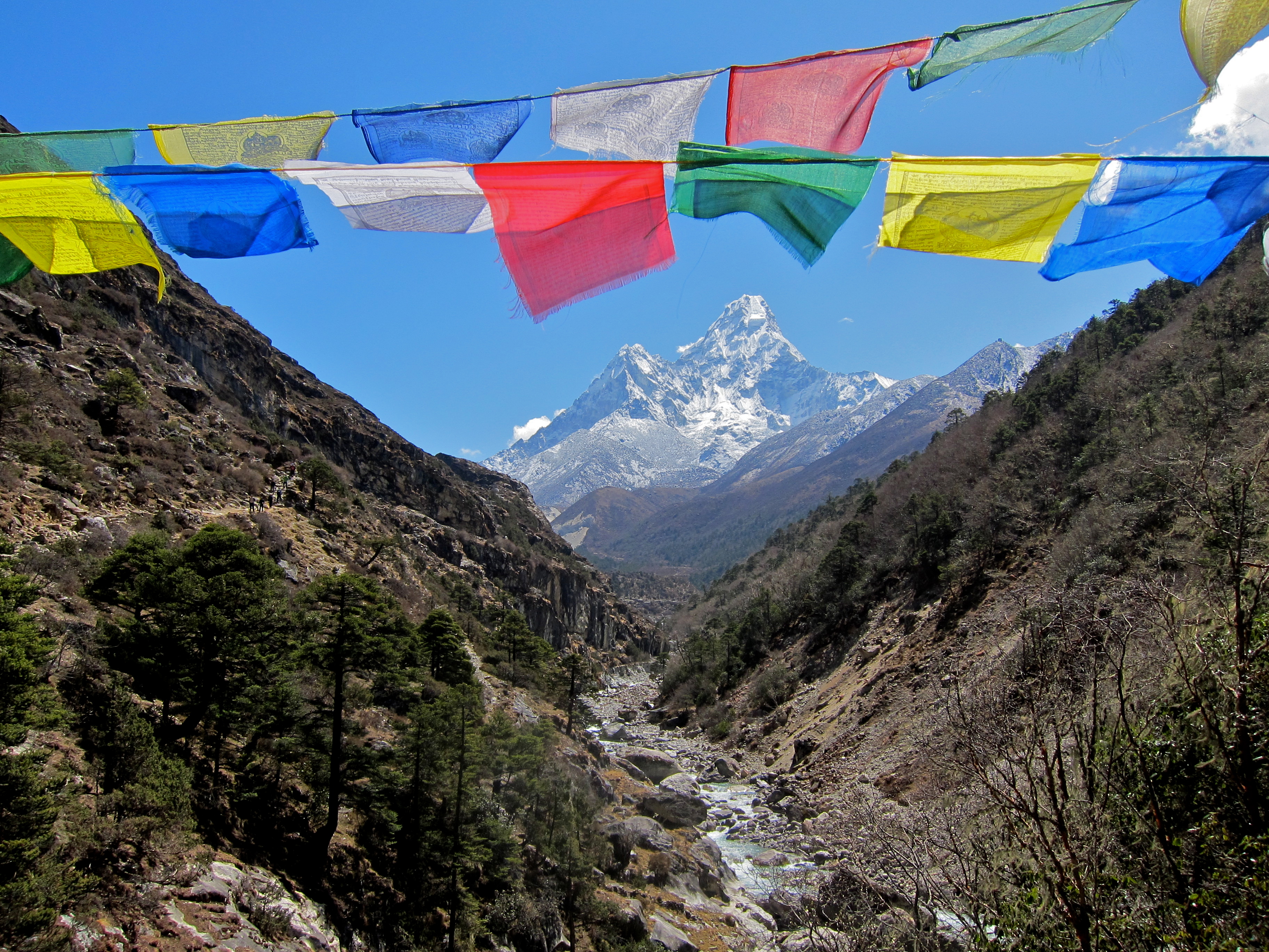
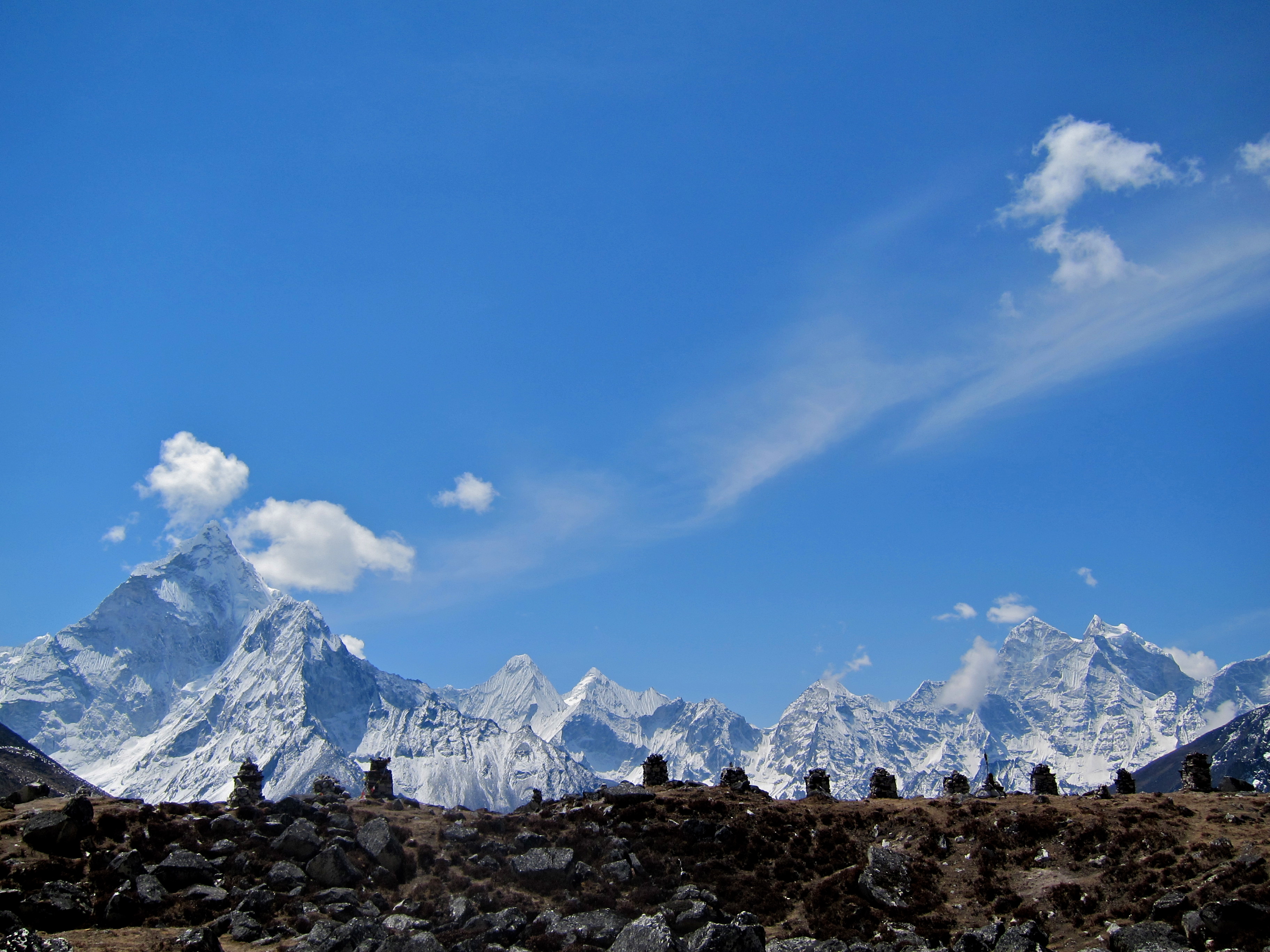
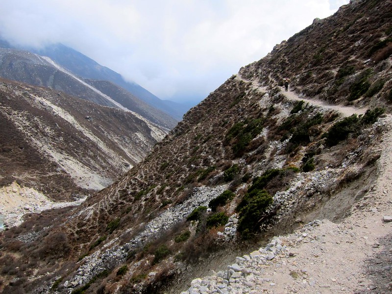
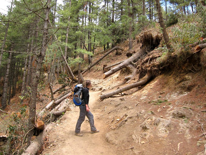
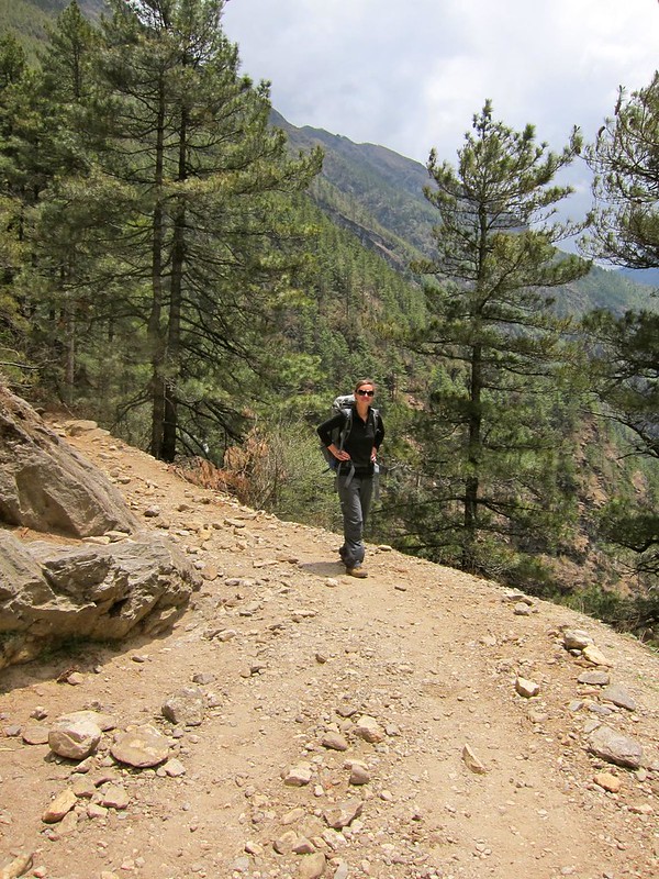
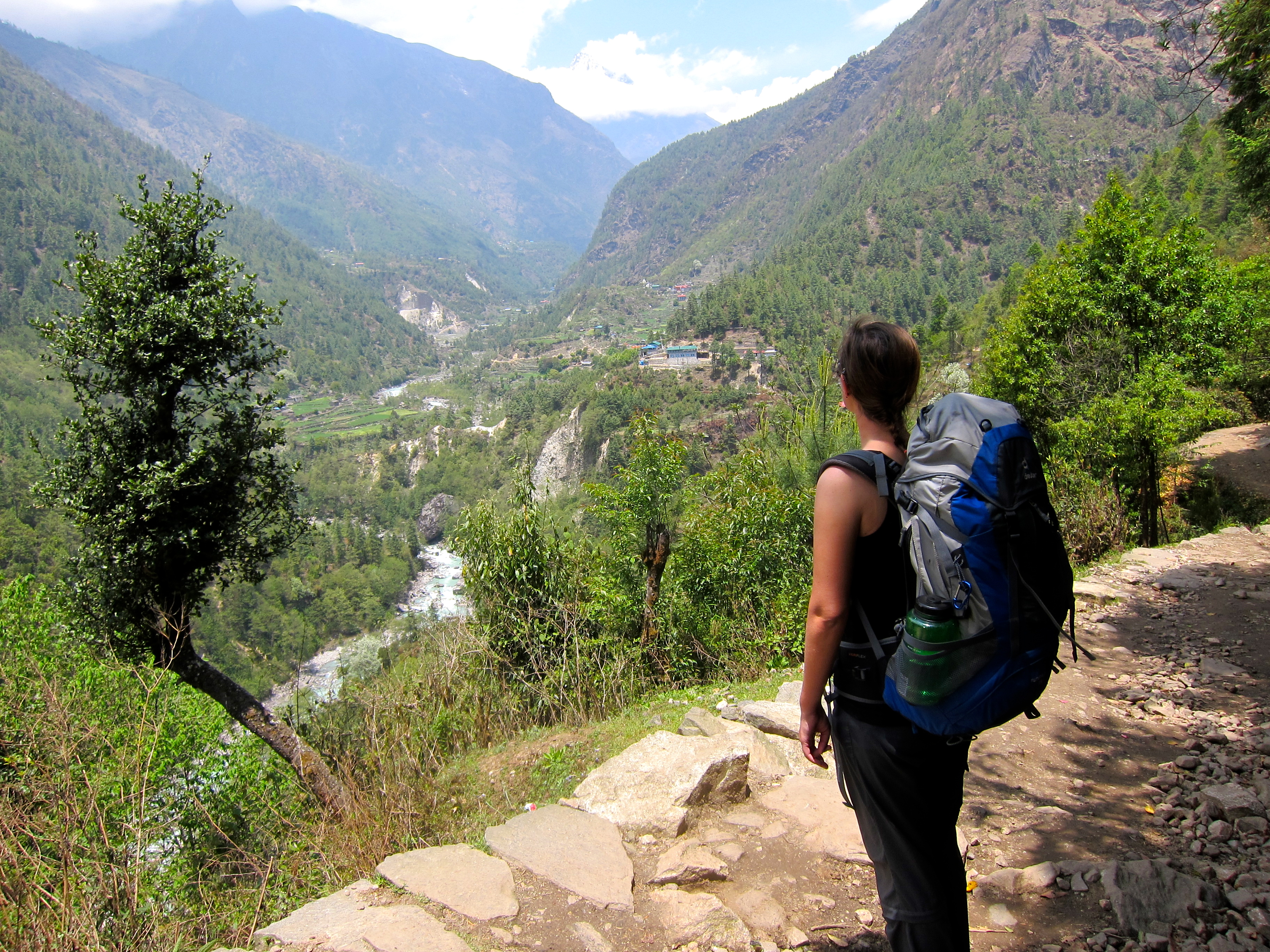
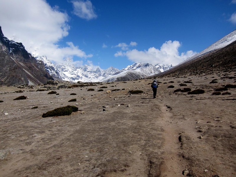
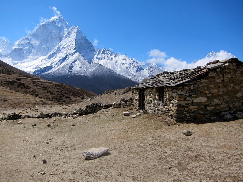
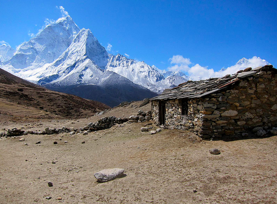
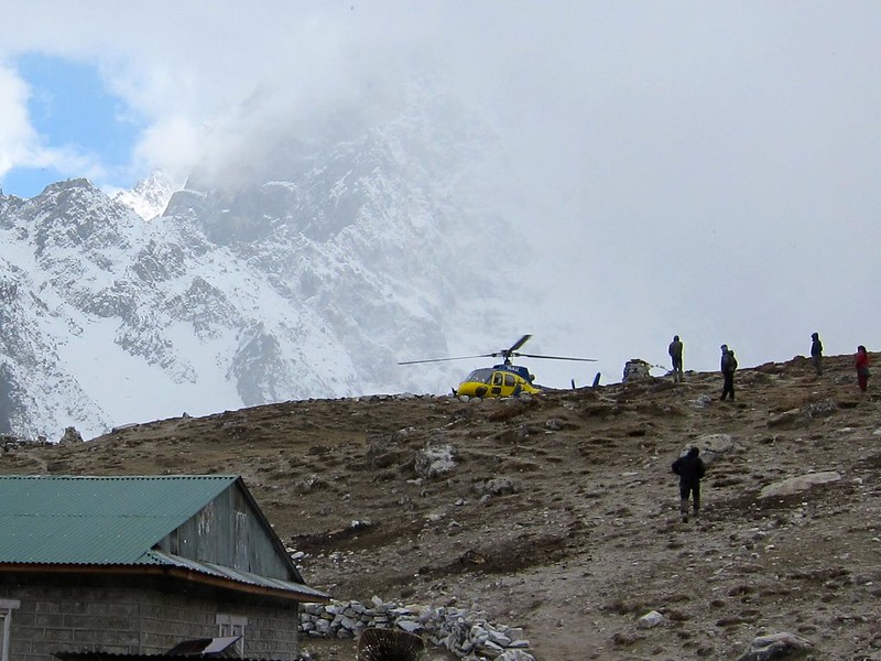
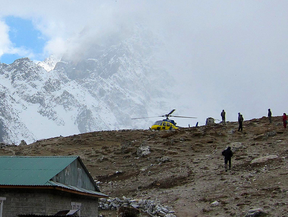
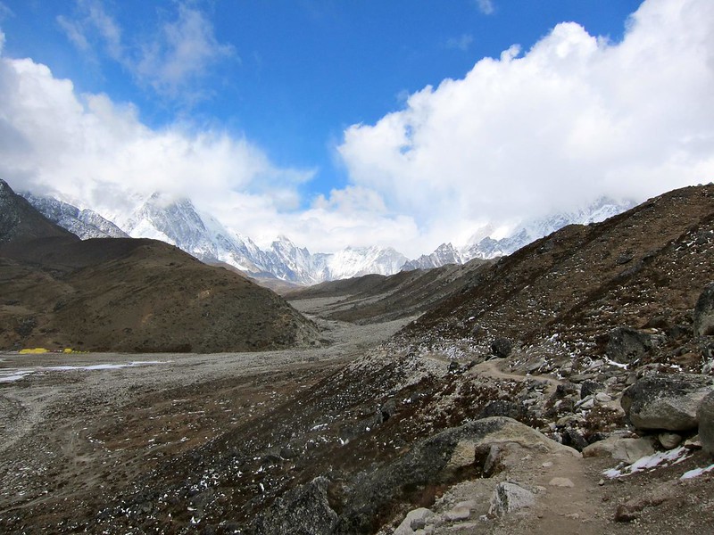
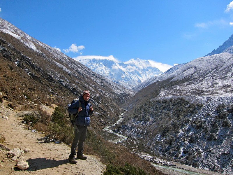
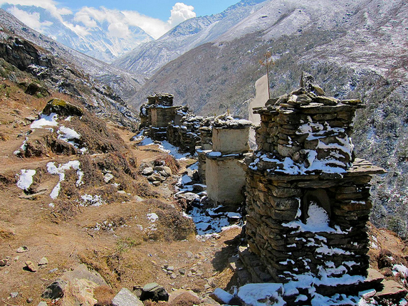
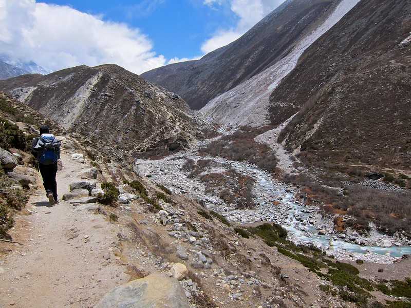
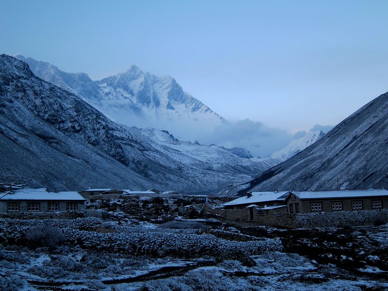
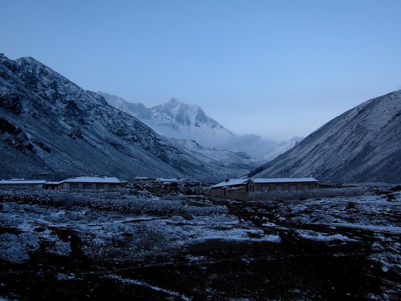
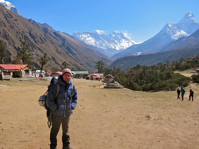
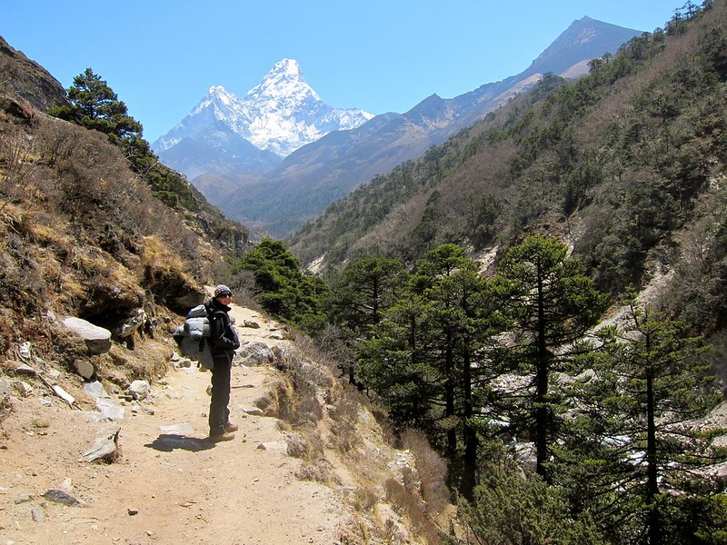
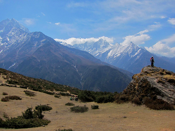
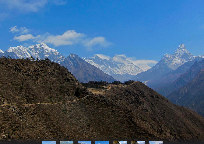
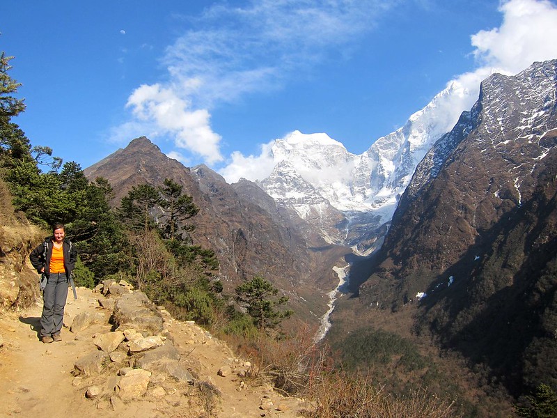
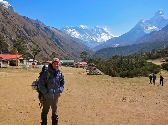
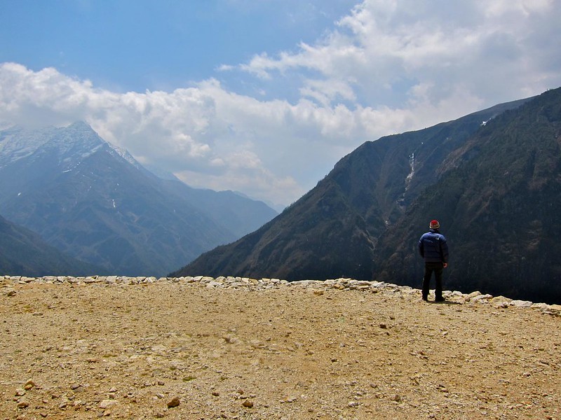
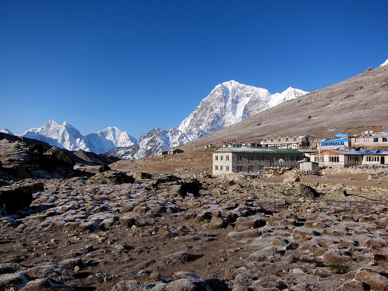
The trek out of Lobuche reminded us of the surface of the moon; there were no trees, due to the lack of oxygen, and the frozen terrain was grayish brown, with scattered boulders that had once rolled down from the peaks that surrounded us. We walked slowly to avoid over-exertion and headaches and took in the stunning topography.

[Looking back at Lobuche.]
IMG_2465

Everest Base Camp Trek, Nepal

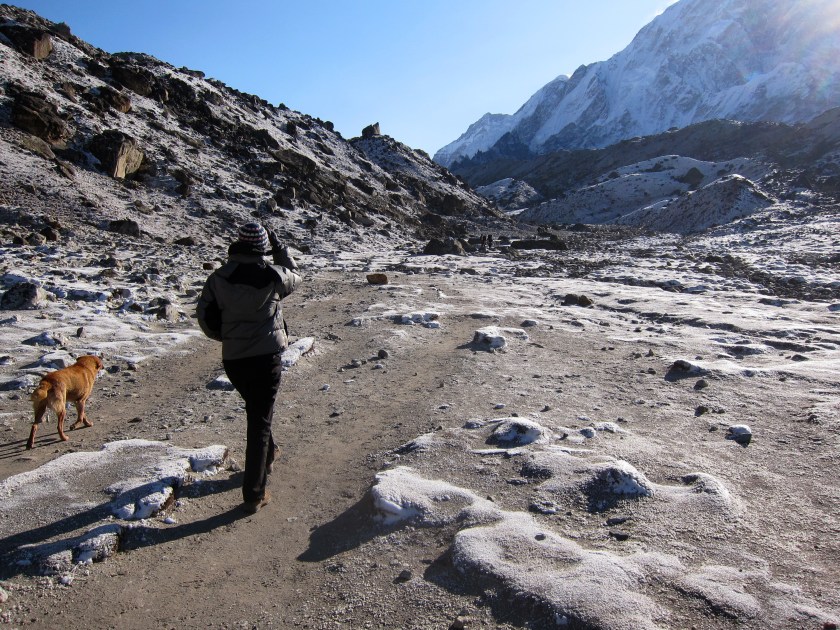
[Me leaving Lobuche, and a dog we hoped wouldn’t follow for too long.]
IMG_2450

Everest Base Camp Trek, Nepal

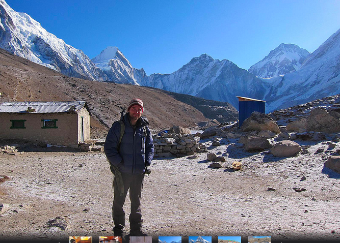
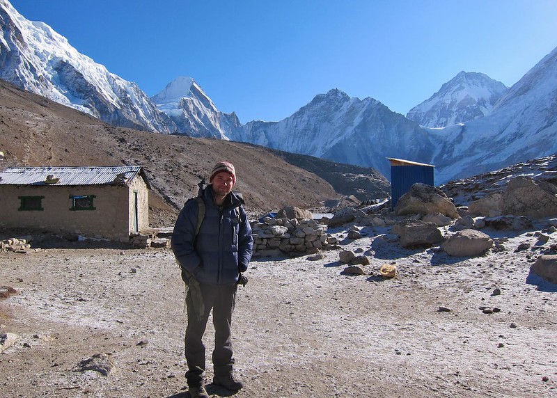
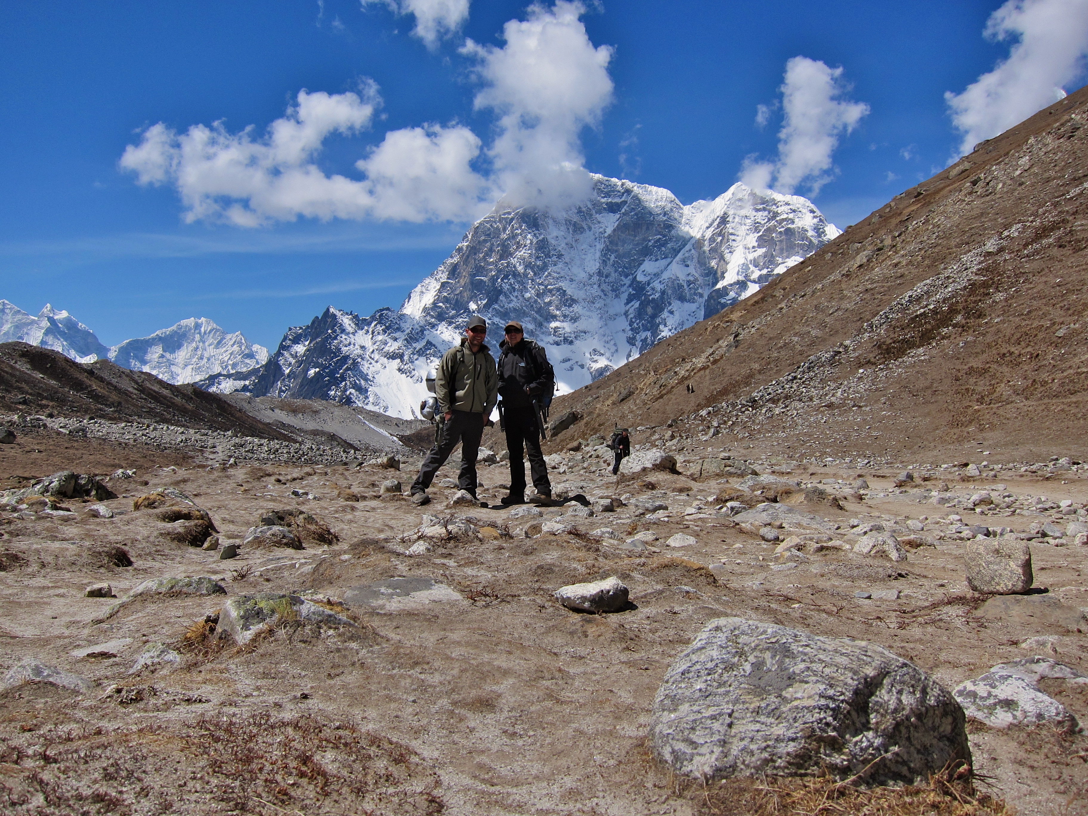
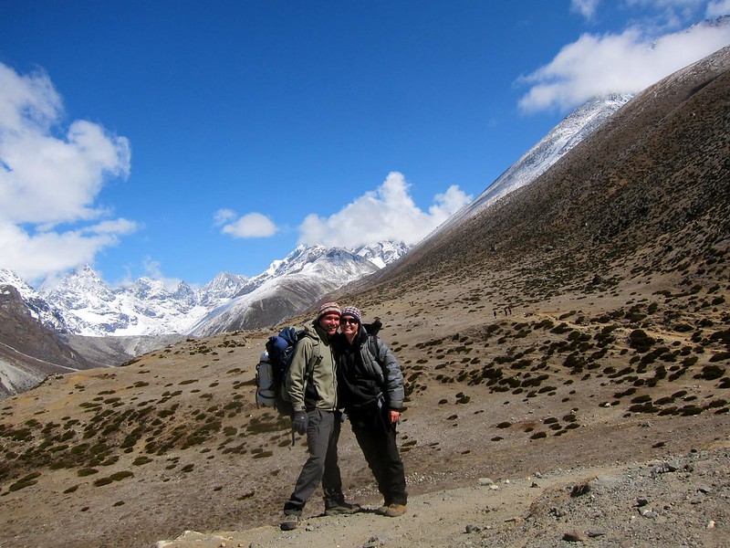
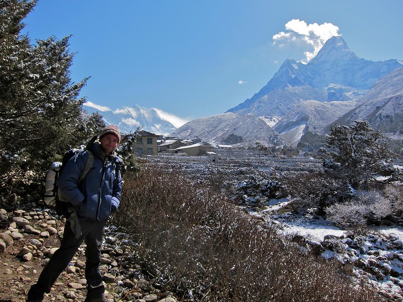
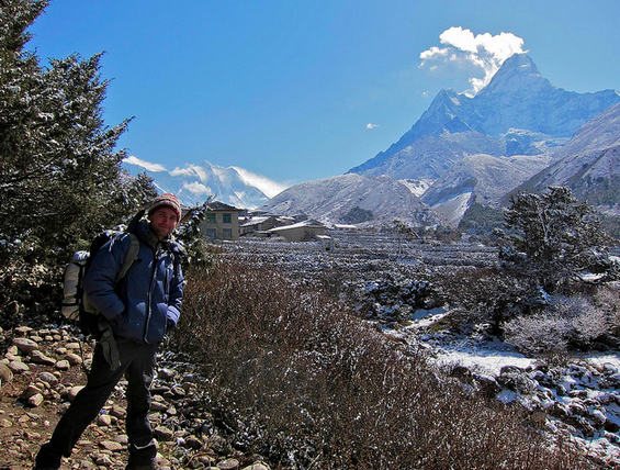
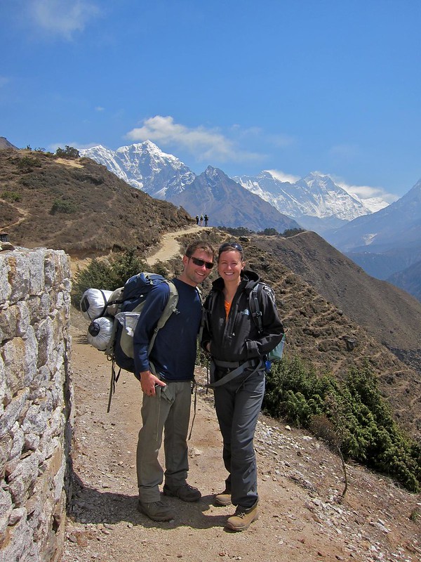
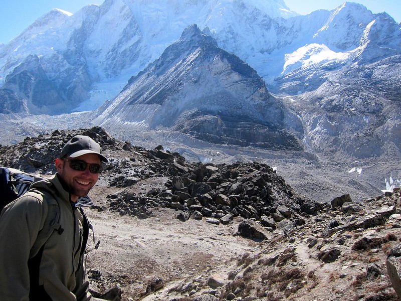
[Scott, packed light, with all of our gear]
IMG_2451

Everest Base Camp Trek, Nepal

[“Moonscape”]
Everest Base Camp Trek, Nepal

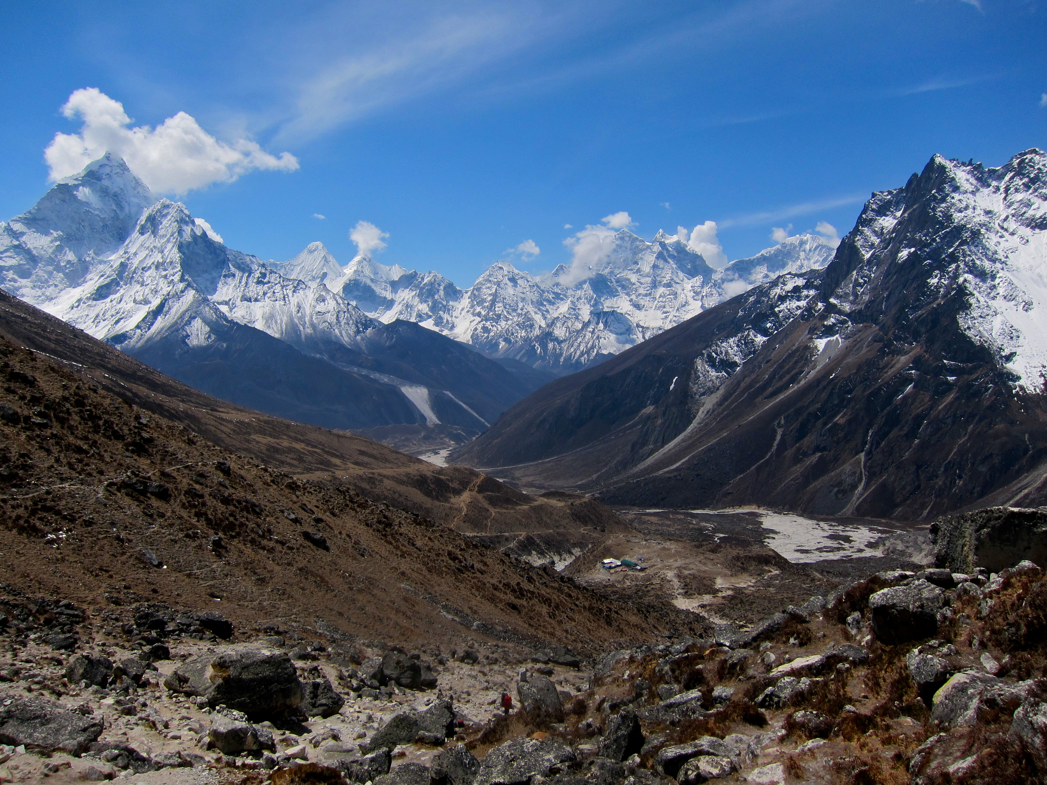
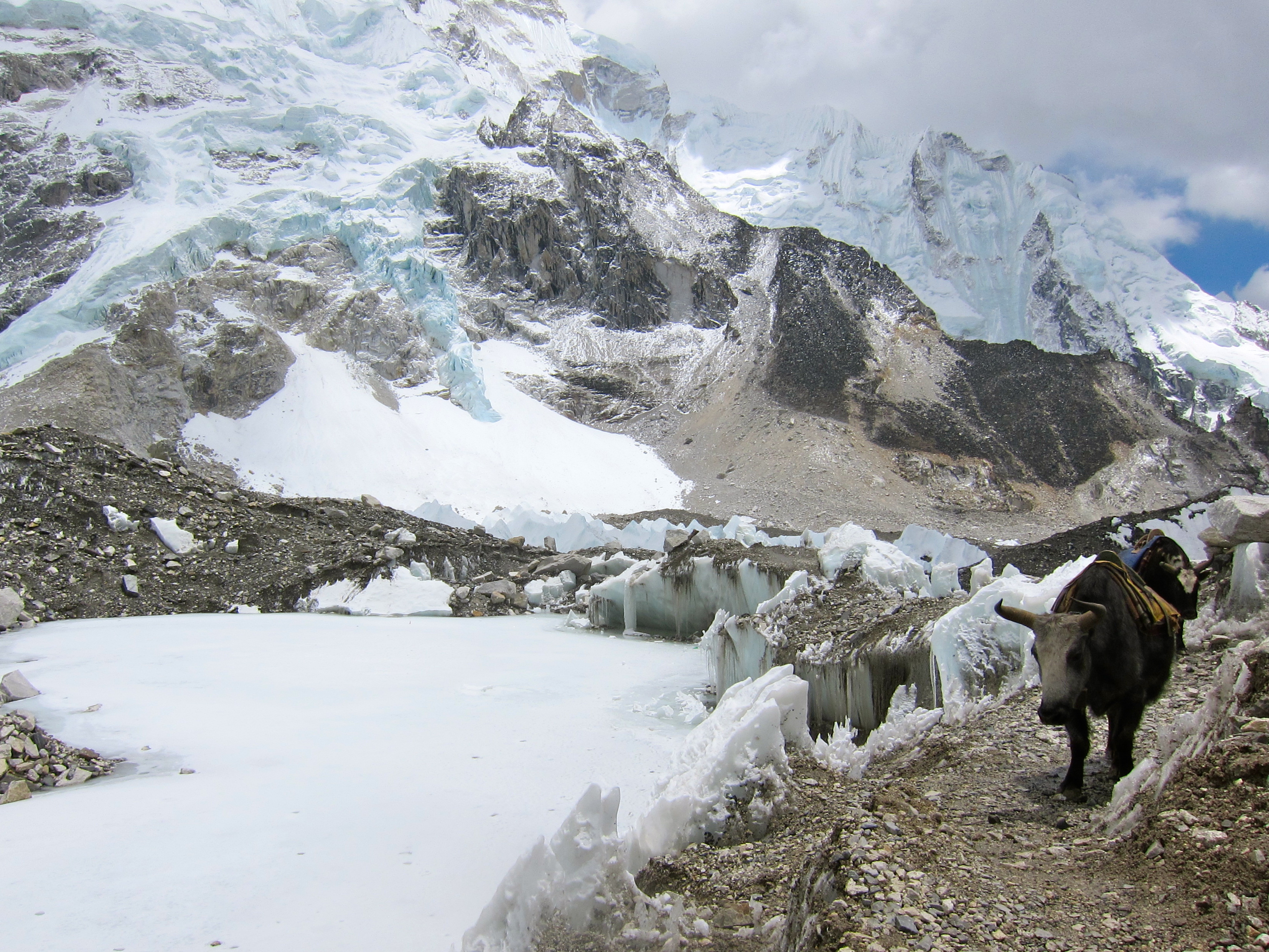
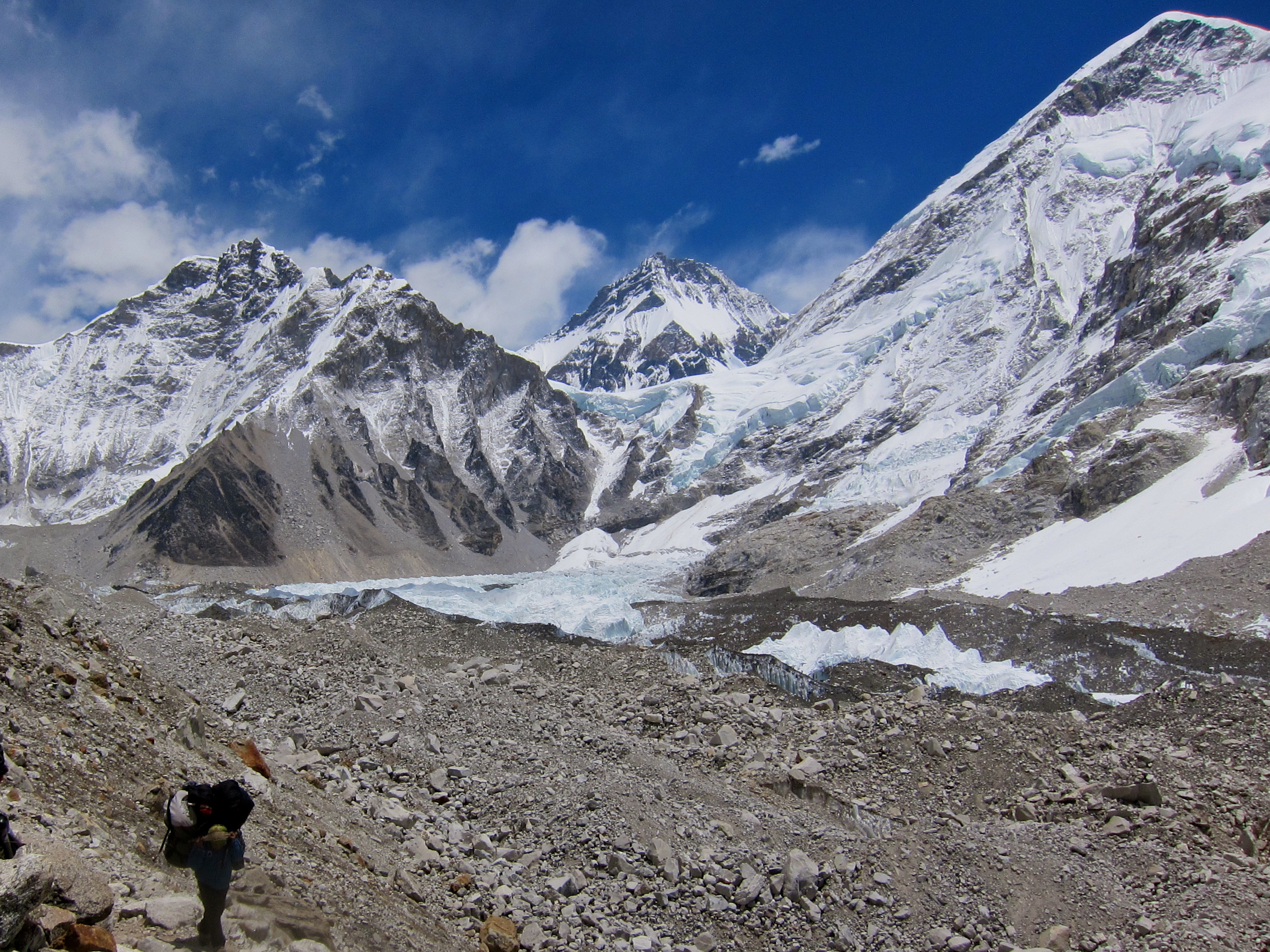
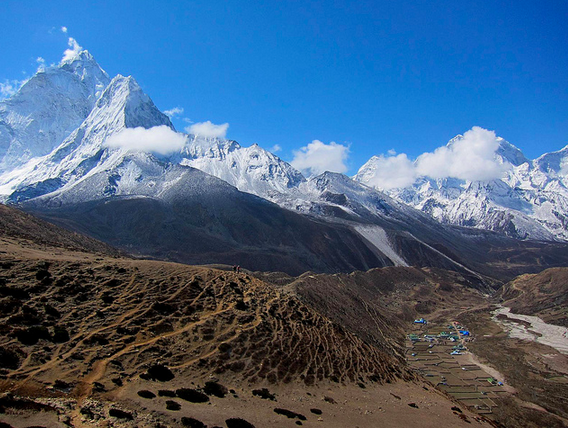
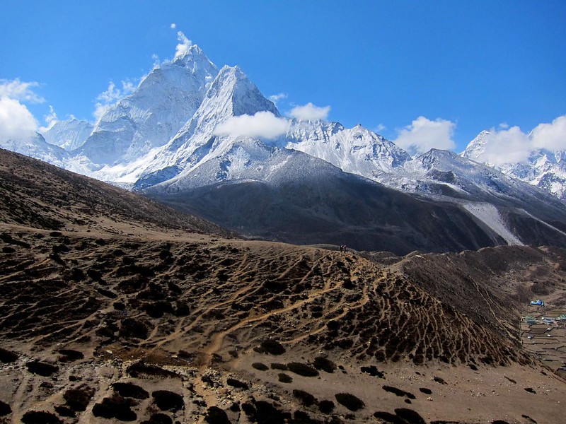
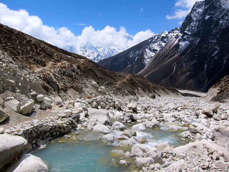
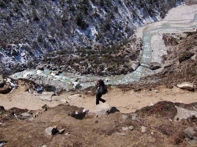
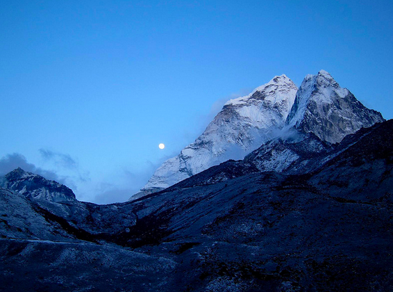
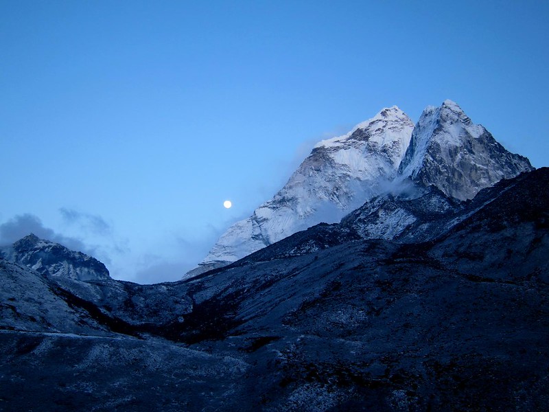
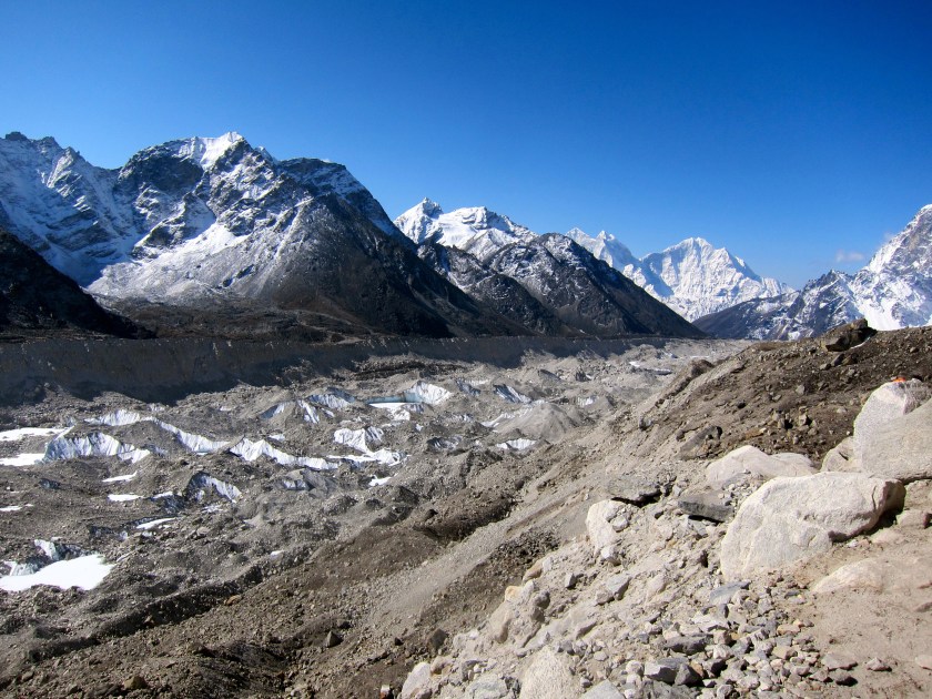
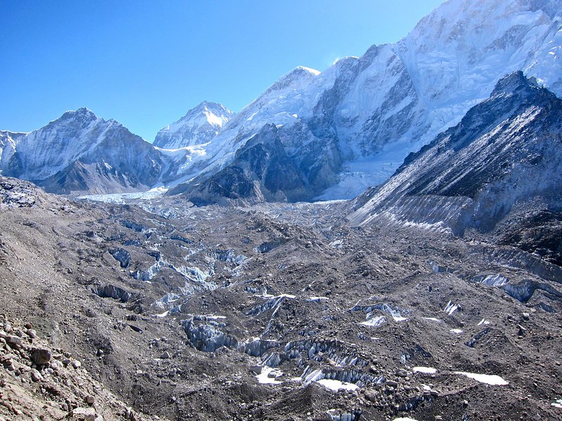
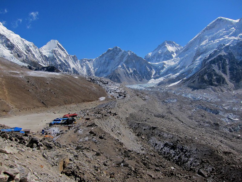
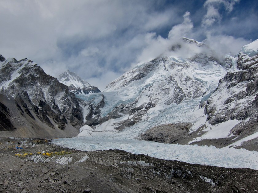
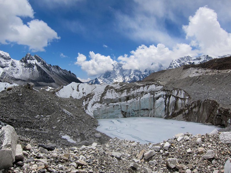
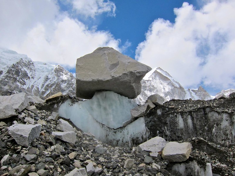
After about an hour, the landscape began to change dramatically. To our right, there was a valley in which the ground was nothing more than crumbled piles of rocky spires and blocks, where brown dust mixed with dusty gray boulders of ice. Looking at our map, we quickly realized were looking at the Khumbu Glacier, the highest glacier in the world.

The Khumbu Glacier is an enormous frozen river that begins halfway up Mt. Everest, crashes down the face between Everest and neighboring mountains Nuptse and Lhotse, and runs parallel to the final part of the EBC trail between Gorek Shep and Base Camp.

The glacier is constantly changing, reshaping, popping, and sliding. As a whole, it is said to move about 120 feet per year, though the top portion just above Base Camp, known as the Khumbu Icefall, moves much faster– about 3 feet per day!

[Khumbu Glacier]
IMG_2461

Khumbu Glacier

[The always-moving Khumbu Glacier]
Khumbu Glacier

Khumbu Glacier

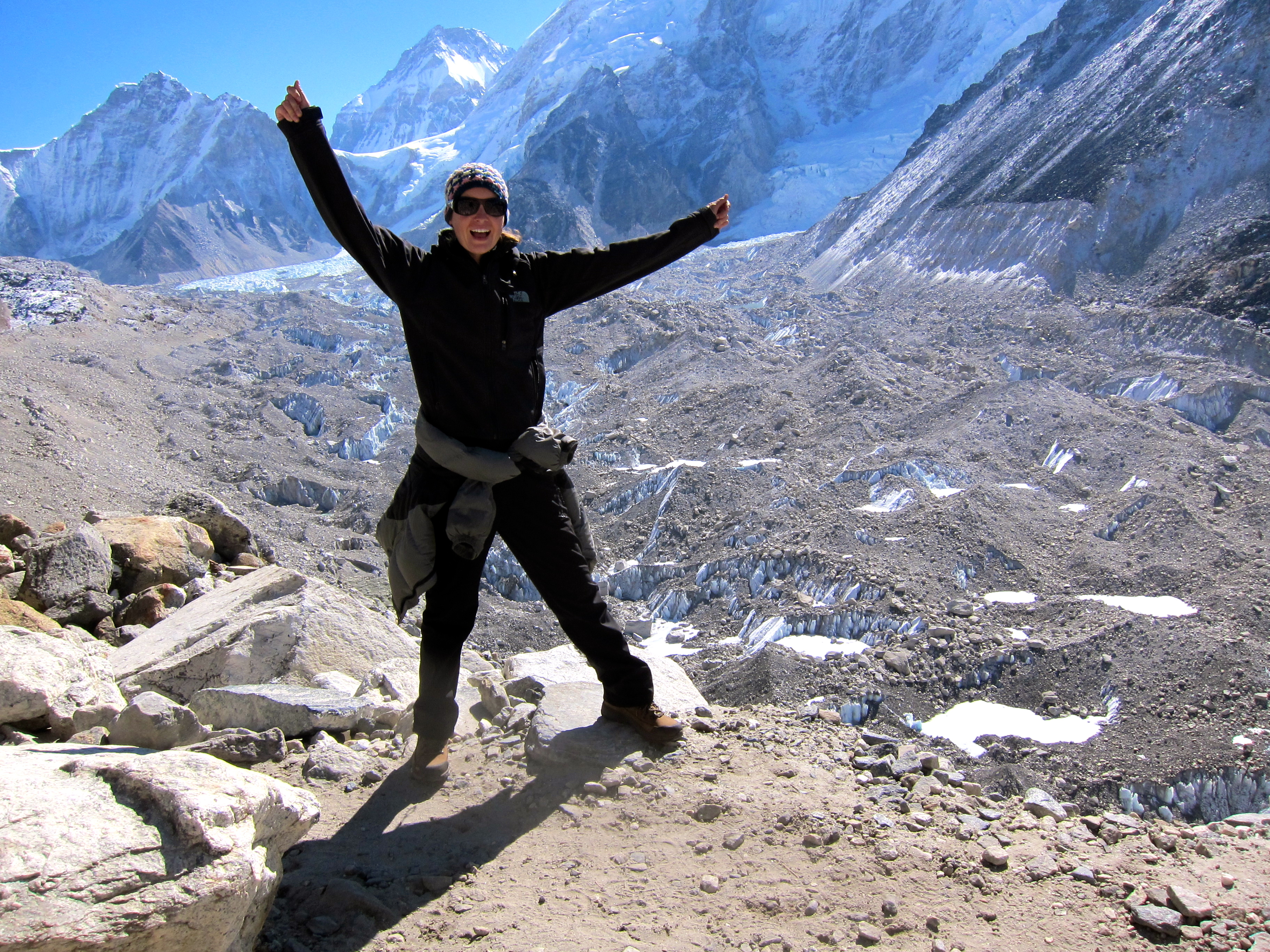
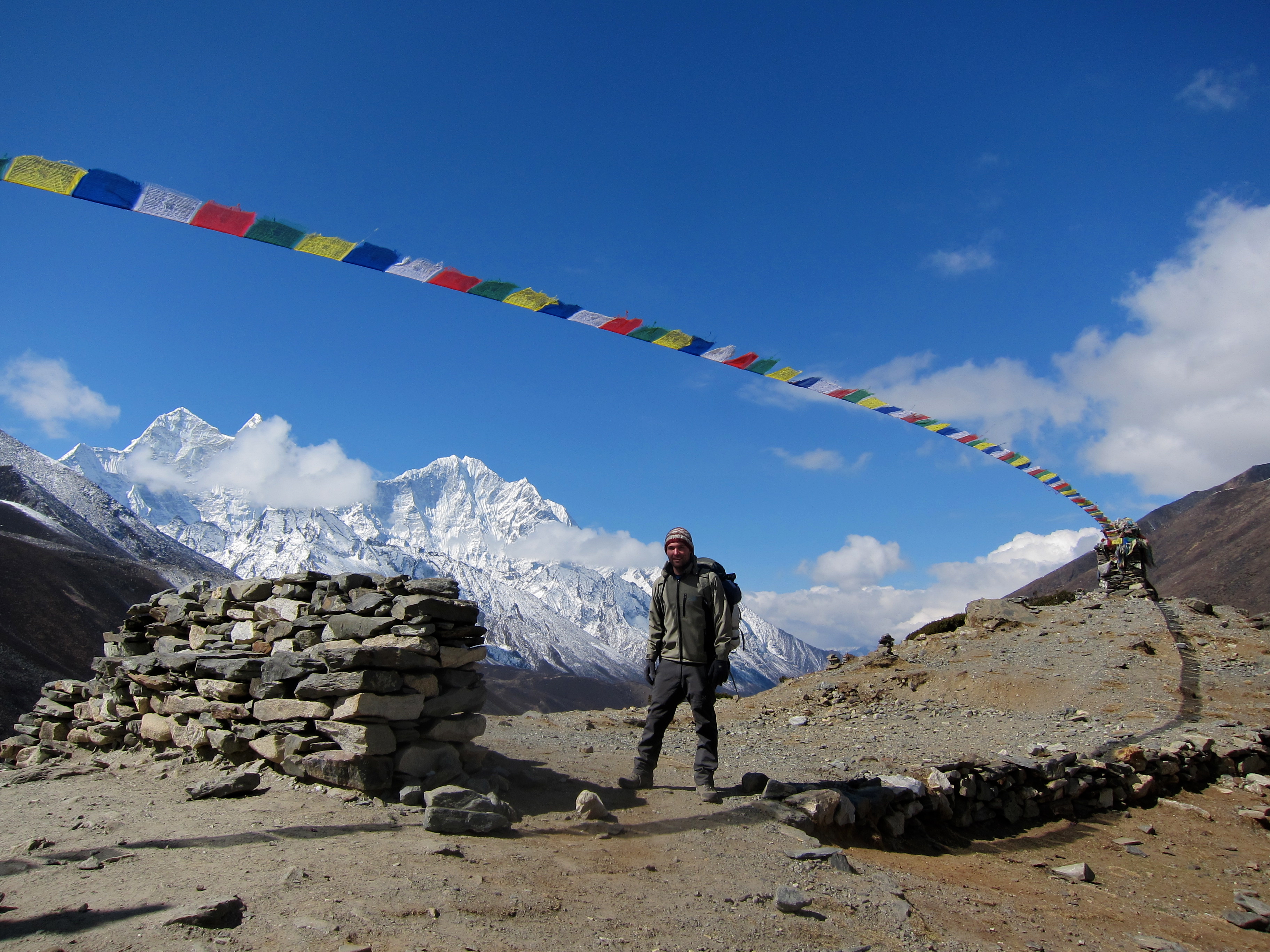
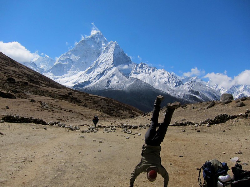
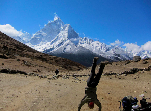
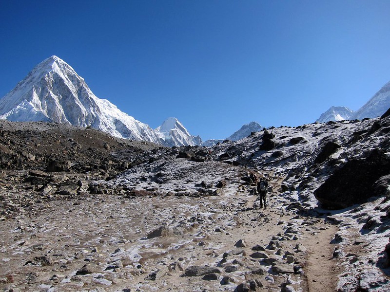
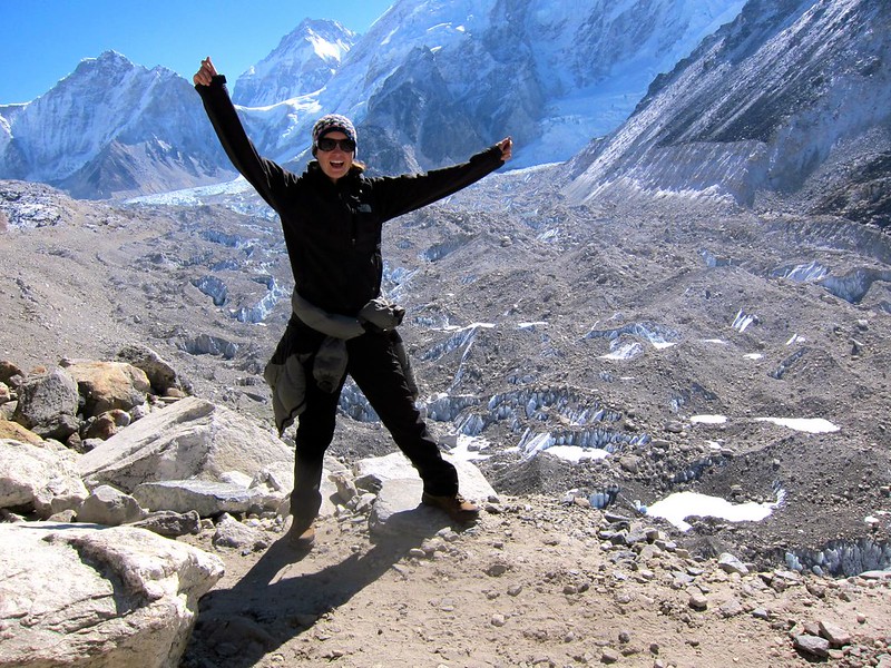
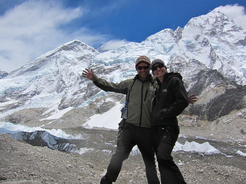
[Celebrating prematurely]
IMG_2459

Khumbu Glacier

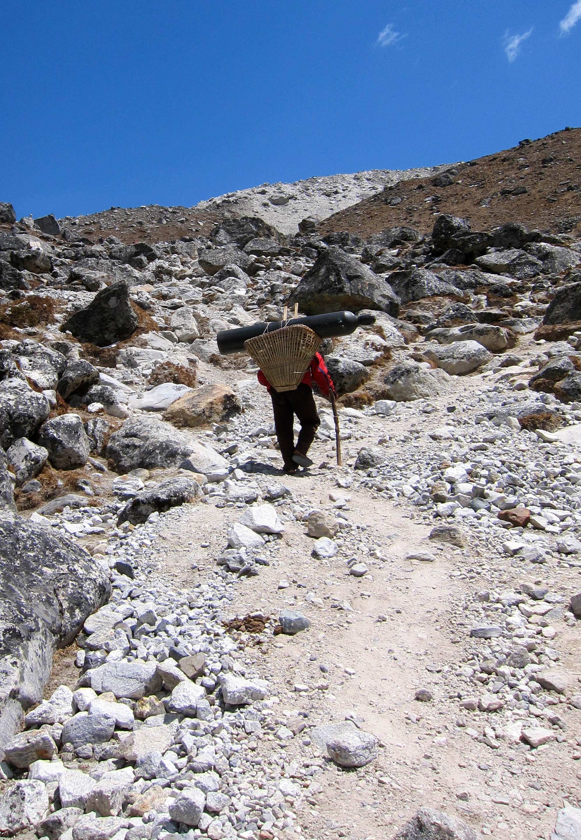
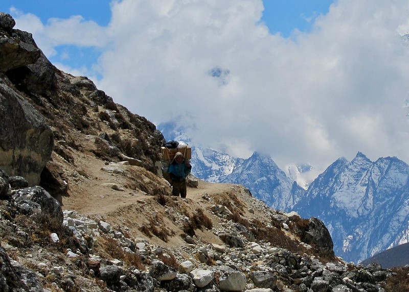
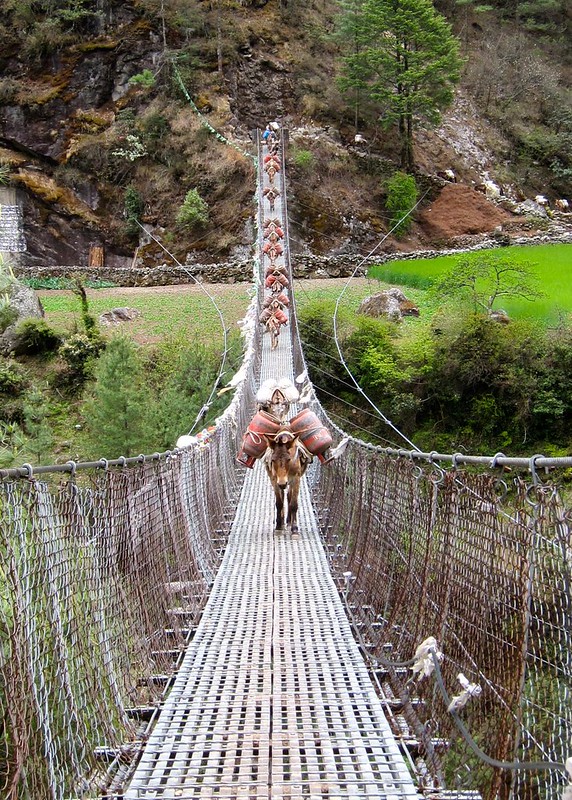
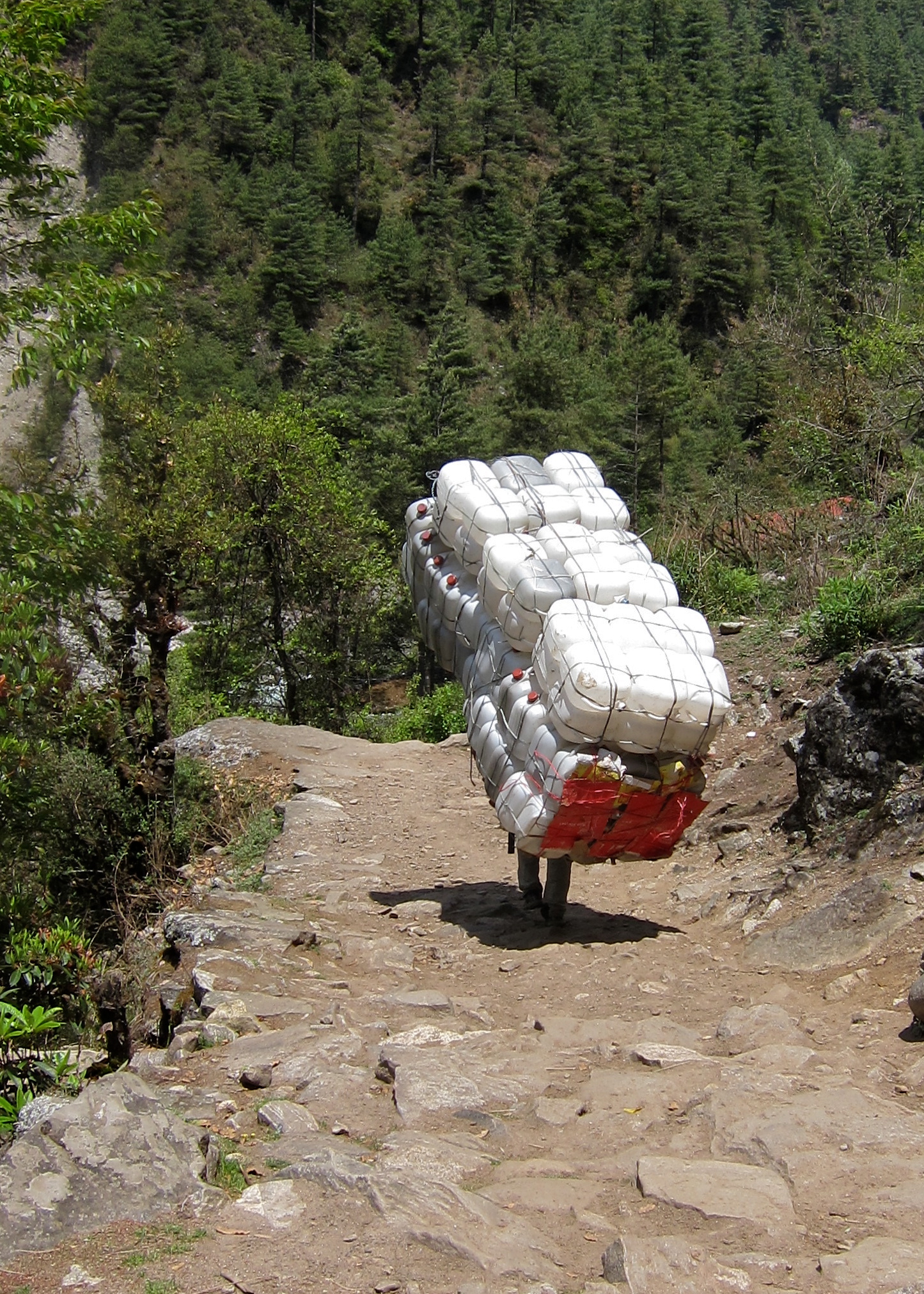
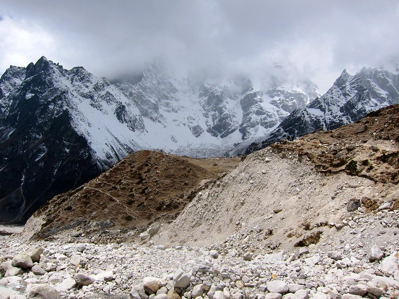
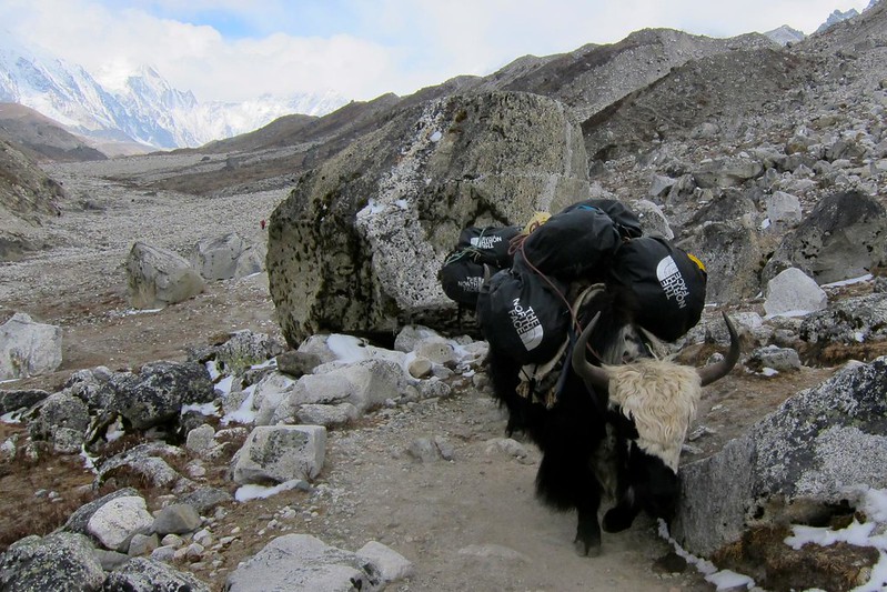
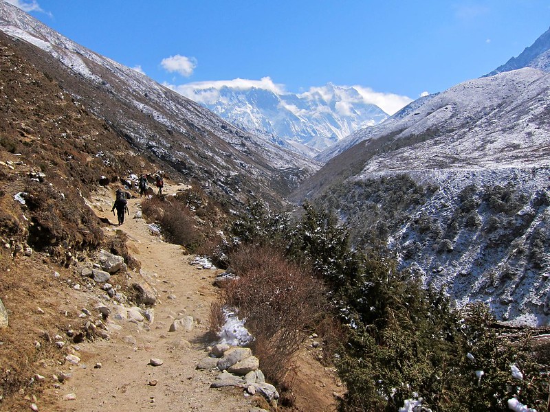
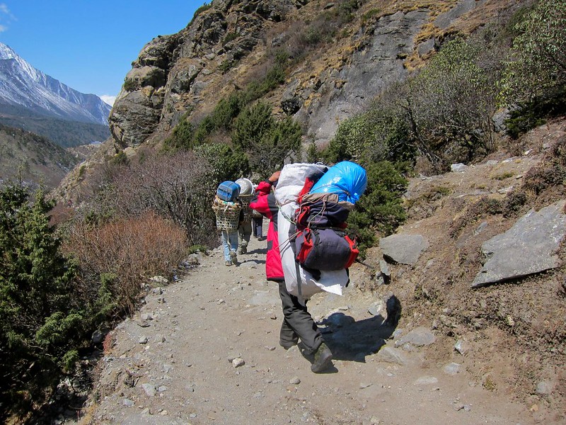
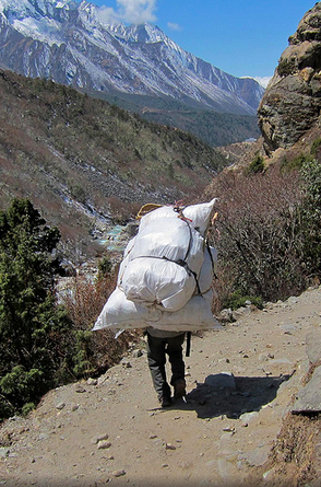
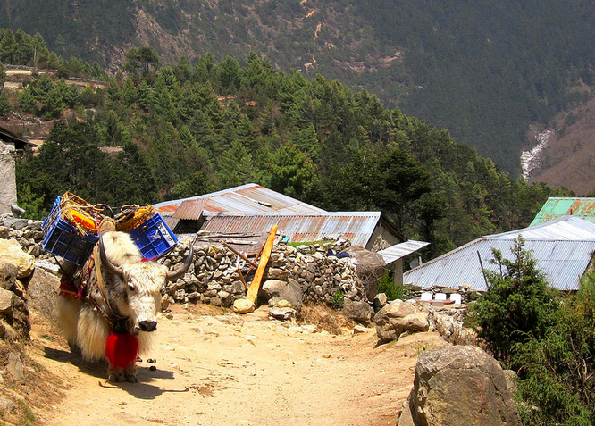
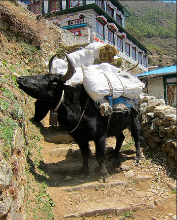
The trail was eerily empty, save for the occasional yak train or Sherpa with supplies headed for Gorak Shep. Although still well-defined, the trail was noticeably more rocky and slippery than it had been over the past week, and we had to noticeably more careful not to slip and land on a jagged rock or stream.

IMG_2482

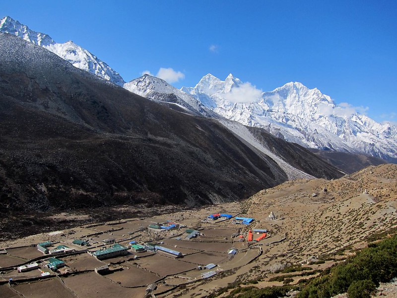
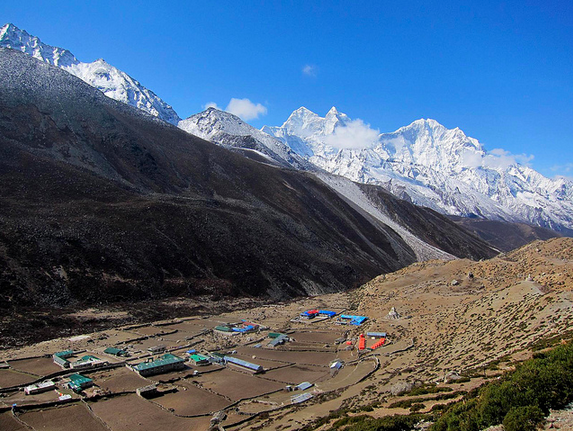
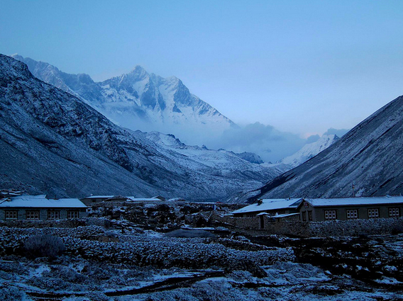
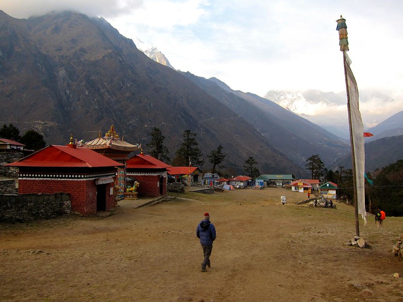
About 2 hours after leaving Lobuche, Gorak Shep appeared in the distance as we climbed over a tall ridge.

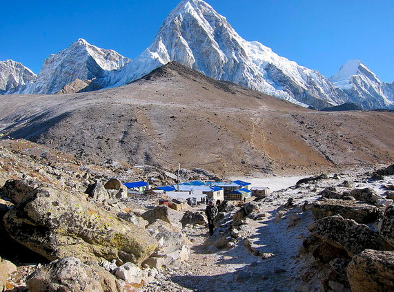
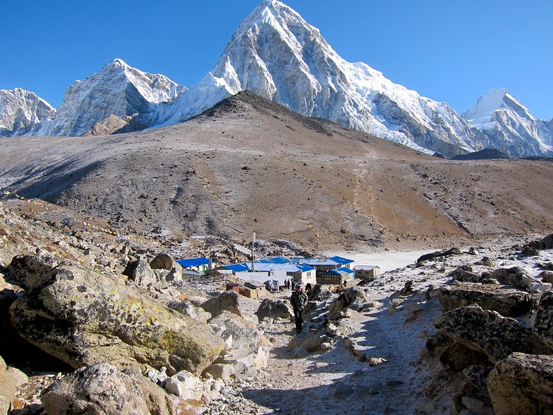
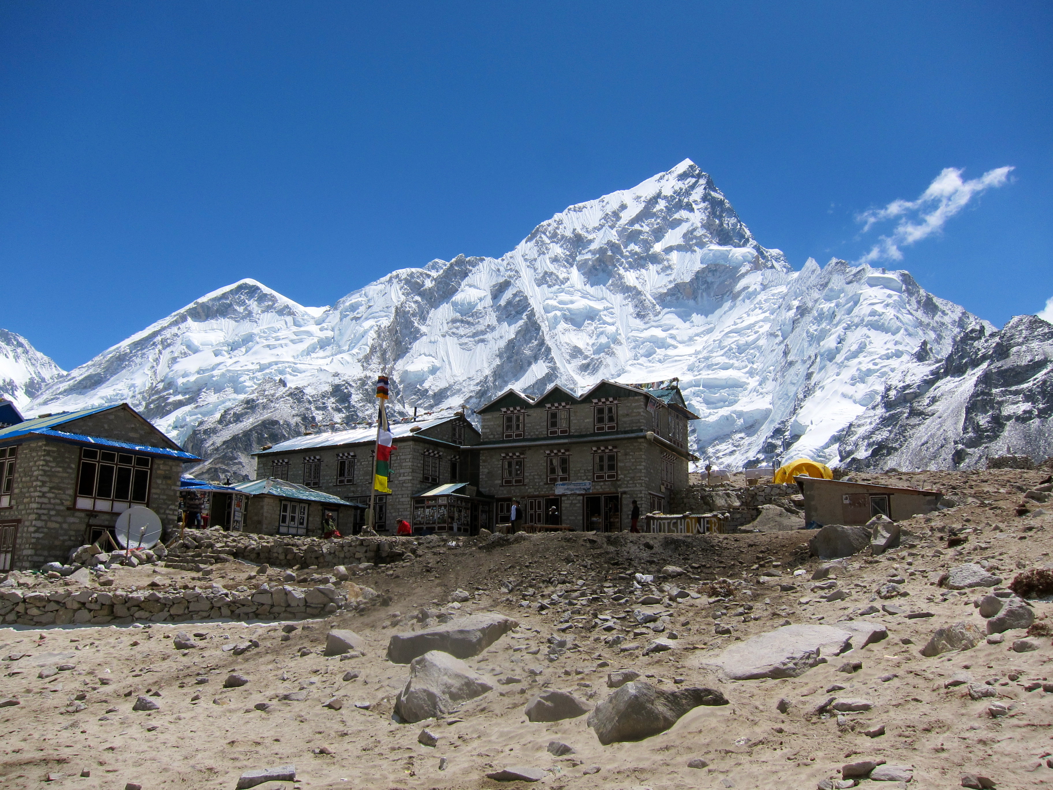
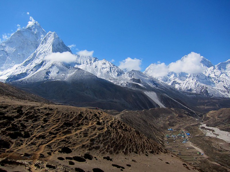
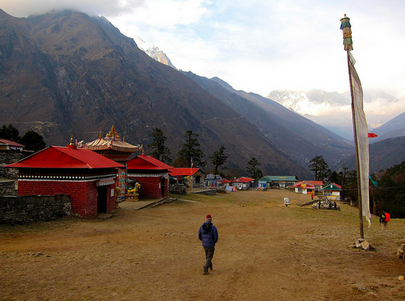
[Entering Gorak Shep. The village’s red- and blue-roofed lodges at left, and the Khumbu Glacier at right, leading to Everest (the shoulder of Everest is visible on the far right)]
Khumbu Glacier

[Gorak Shep]
Hotel, Gorak Shep

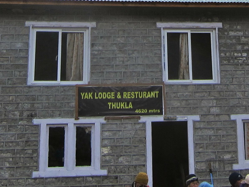
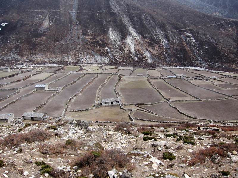
Gorak Shep is a makeshift hiker’s village, open only during the Everest summitting seasons (late spring and early fall), with no permanent residents due to the cold and lack of supplies. The town is notorious for being terribly cold and unpleasant for sleeping, due to the lack of breathable air. (One guide described Gorak Shep to us as a “s***hole”. We did not find it nearly that unpleasant.)

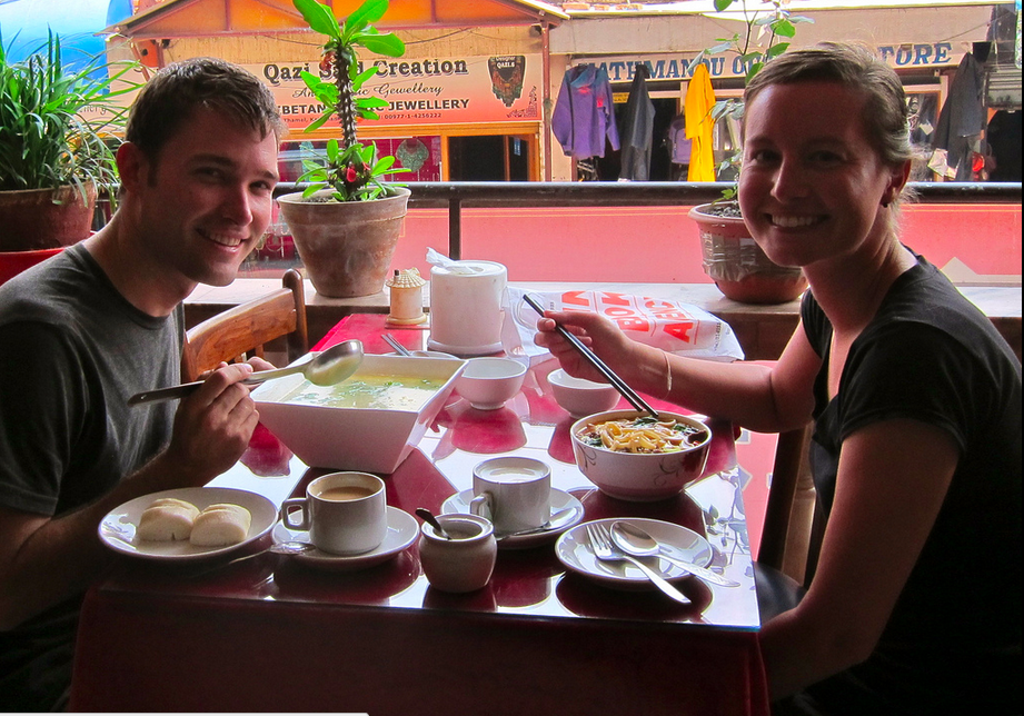
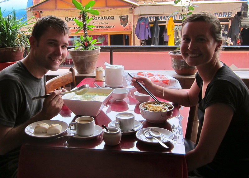
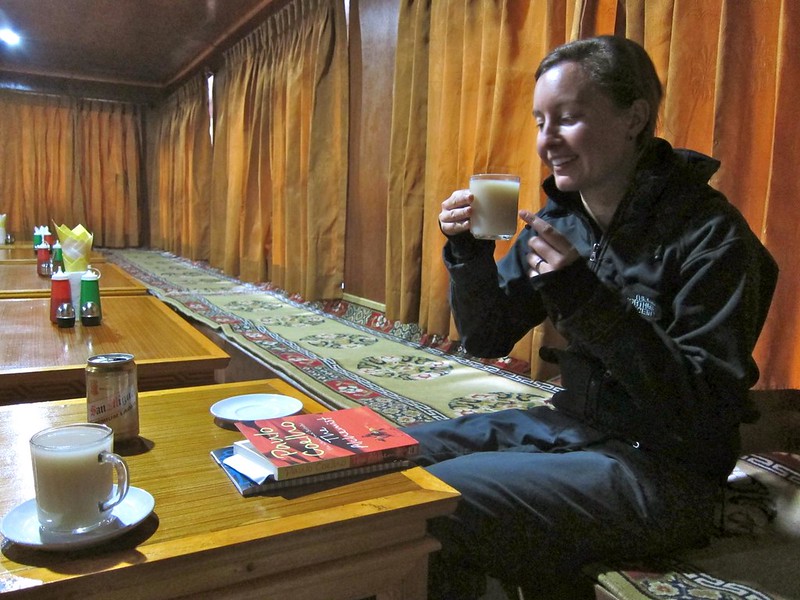
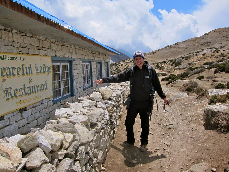
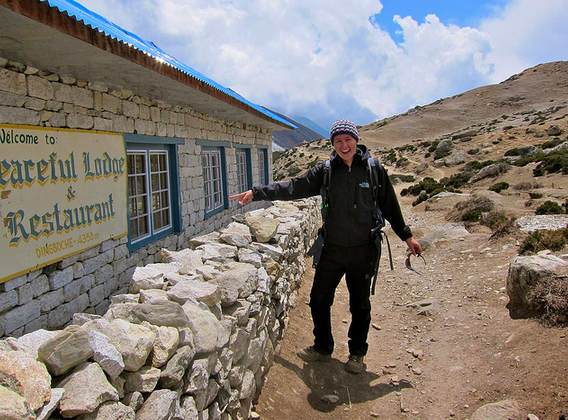
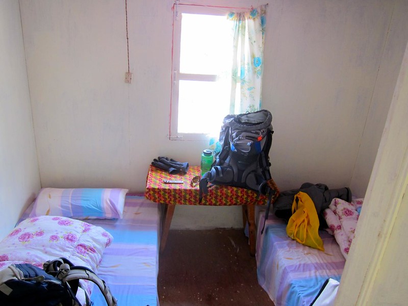
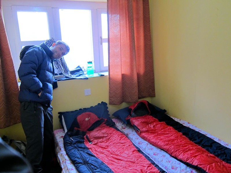
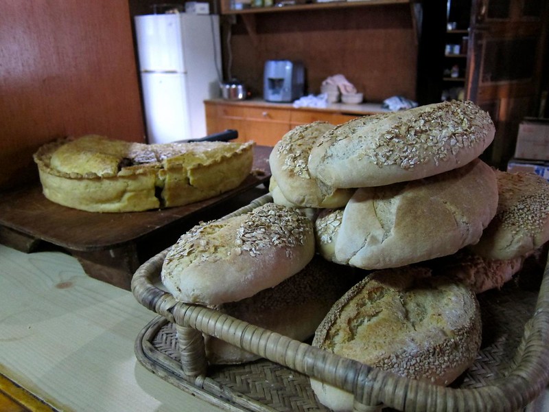
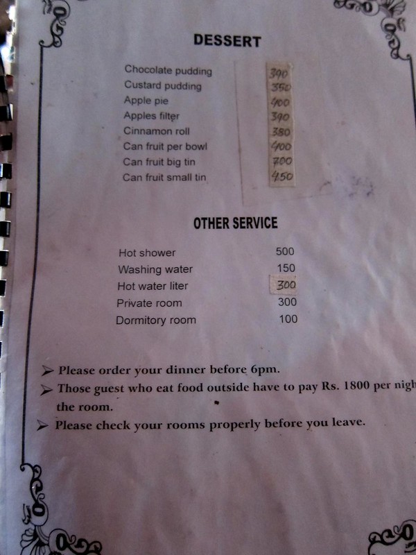
Once at Gorak Shep, we reserved a room at the first lodge we found (we were worried about not being able to get a room, due to all of the hiking groups), tossed our belongings into it, and went to the hotel’s main lodge, where we refueled on a midmorning European-style cinnamon roll, milk tea, and hot Nepali soup.

Everest Base Camp Trek, Nepal

[Below, the menu at the hotel lodge. Food prices had gone up substantially (although ludicrous for Nepal, $4 for a piece of hot thick apple pie is nothing after you’ve just spent your last reserves climbing to the base of Mt. Everest), and hot showers were now $5 a pop. Luckily, it was too cold to shower, and our room still only cost $3…….. we couldn’t complain.]

Everest Base Camp Trek, Nepal

We were ready to make our push for Base Camp at last.

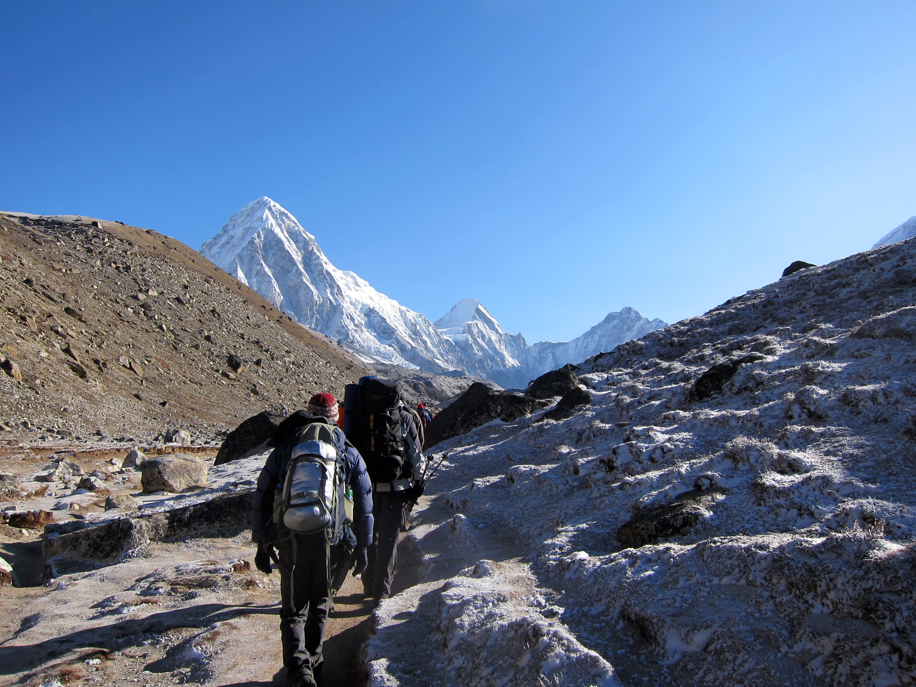
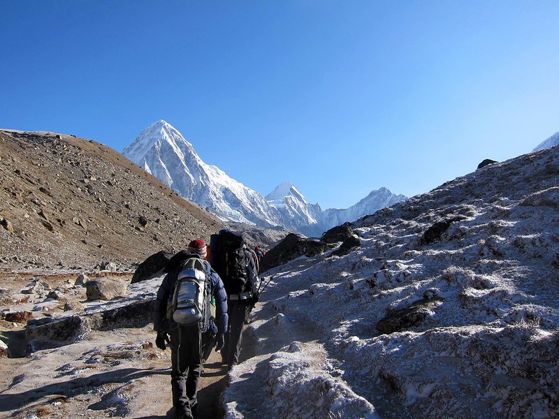
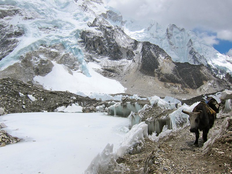
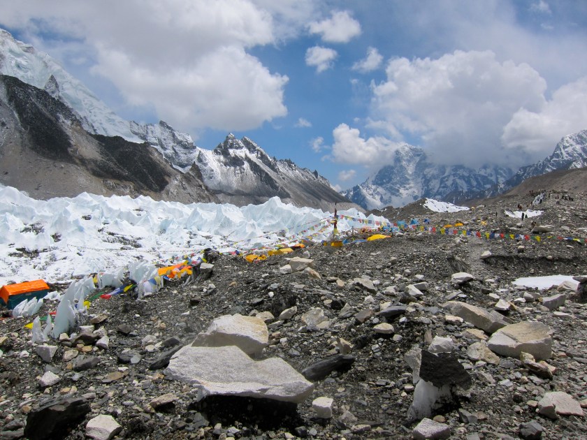
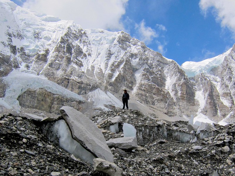
[Trail alongside the Khumbu Glacier, between Gorak Shep and Base Camp]
IMG_2472

Base Camp, Mt. Everest

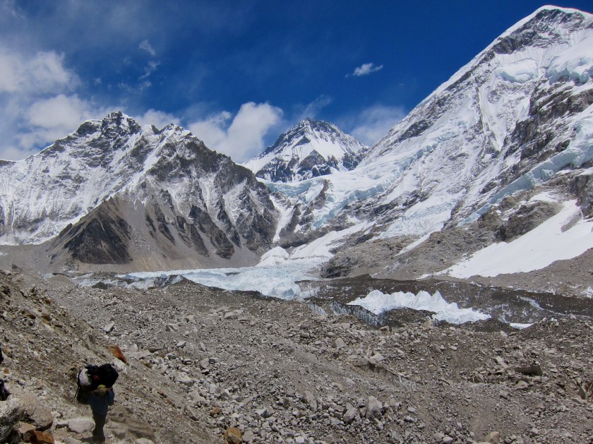
I suppose I can best describe this last leg of our ascent as introspective. The air was eerily still, and our labored breathing was the only sign of life in this rather desolate but beautiful place.

[A sweeping view of Nuptse and Everest, the Khumbu glacier, and the trail leading into EBC. Scott’s audible breathing is a reminder of how hard breathing had become. This is how we sounded for about 2 days.]

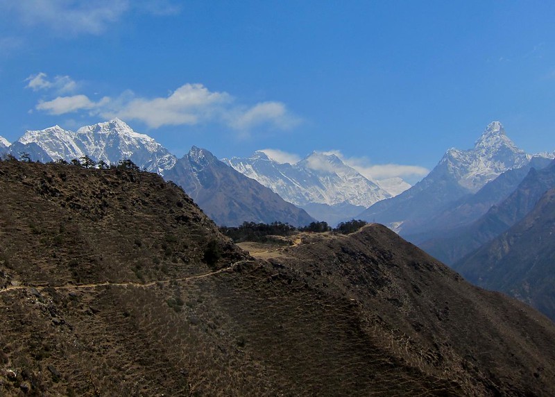
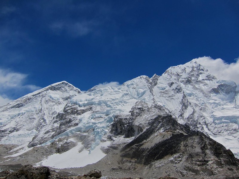
There’s no exact moment when the peak of Mt. Everest suddenly becomes clear, as if to mark your arrival more officially than where you were a few steps before. For most of our afternoon walk, its peak hovered in our peripheral vision, still another 12,000 feet higher than us, but close enough to see some of the details at the top.

[The peak on the far left is one shoulder of Everest. The summit can be seen a little farther to the right, with clouds nearly obscuring its peak.]
Base Camp, Mt. Everest

The gravity of knowing where we really were grew heavier the closer we got, and it didn’t take long for sentimental emotions of reaching EBC, of being in this place, of realizing our trip would soon be ending, to come crashing to the forefront of our thoughts.

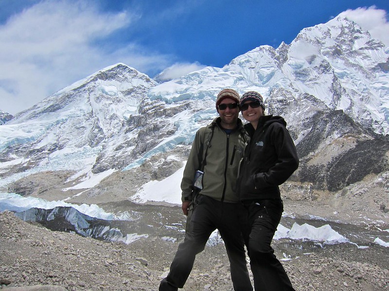
Noticing that a storm would soon cover its peak, we stopped to take a quick picture of us with Mt. Everest, fashioning our camera to a rock with our mini tripod. With the clouds moving in, this would be the last time we’d see its summit on our trek.

[Us with Everest’s peak behind us (left-center, mostly covered by clouds)]
IMG_2477

Base Camp, Mt. Everest

Base Camp, Mt. Everest

Base Camp, Mt. Everest

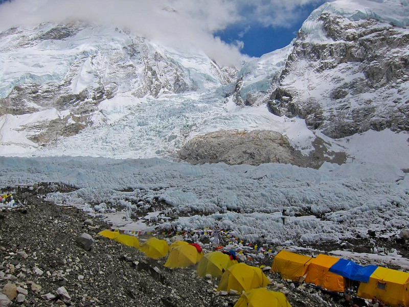
Soon, we could see a tiny yellow tent-village in the distance. We soon realized that we were finally looking at Everest Base Camp. [The now well-defined Khumbu Glacier is on the right.]

IMG_2479
Base Camp, Mt. Everest

With EBC in our view, we walked for what must have been at least 45 more minutes along the edge of a mountain. As we got close, we swung down and to the right over a “bridge” made of ice and crumbled glacier rock, with a drop off into the icy pool below to our left.

Base Camp, Mt. Everest

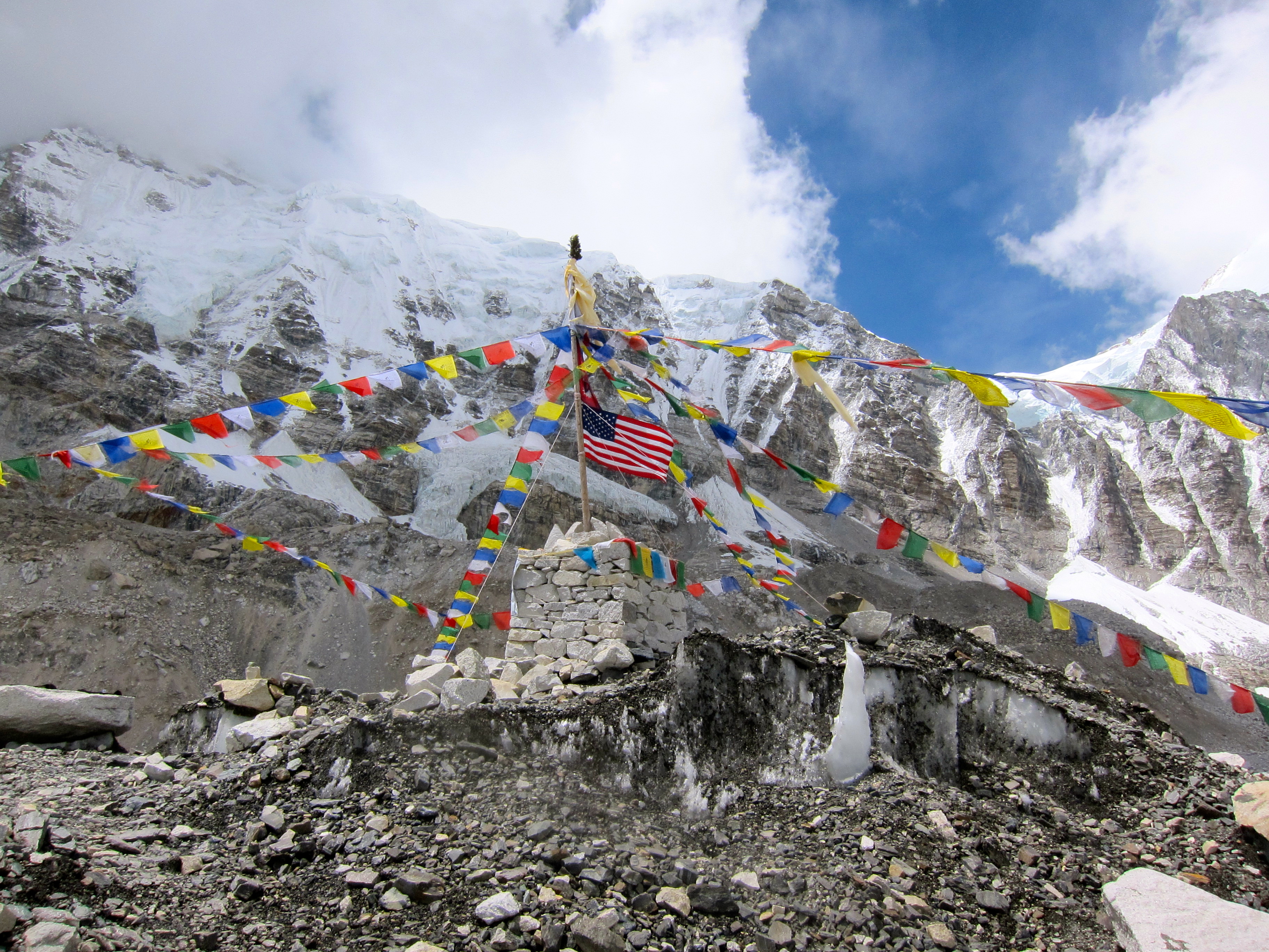
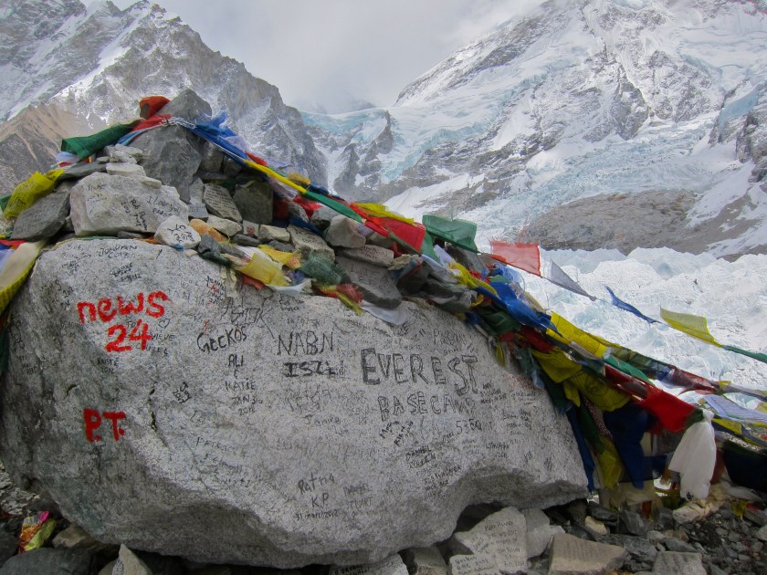
At long last, we had arrived at EBC! Rather than scrambling to look around at the sights (the summit teams! the colorful flags! Mt. Everest!!), we turned to each other and simply reveled in a long sappy embrace. We’d not only accomplished something that a few days ago we thought might be impossible, but we also knew this was the beginning of the end of something much greater than this trek.

IMG_2488  IMG_2500 IMG_2495
Base Camp, Mt. Everest

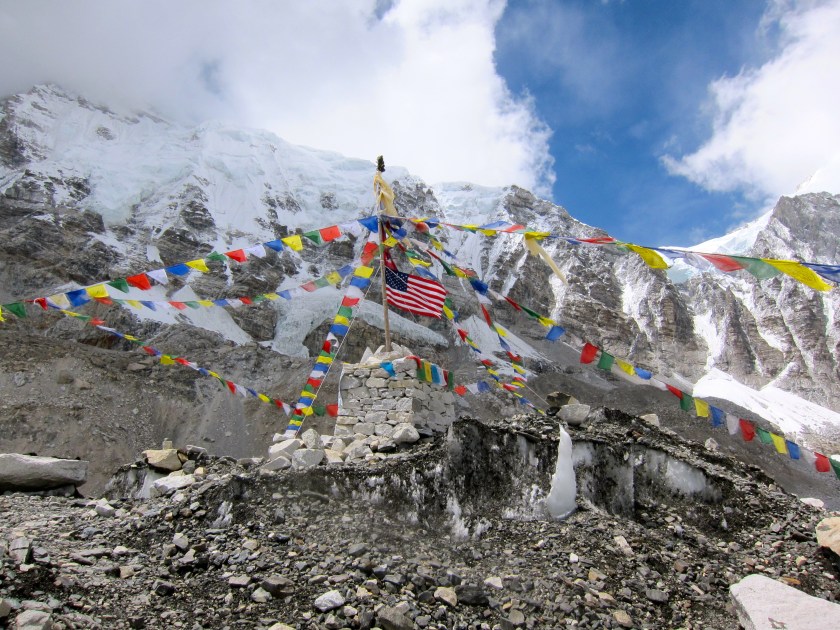
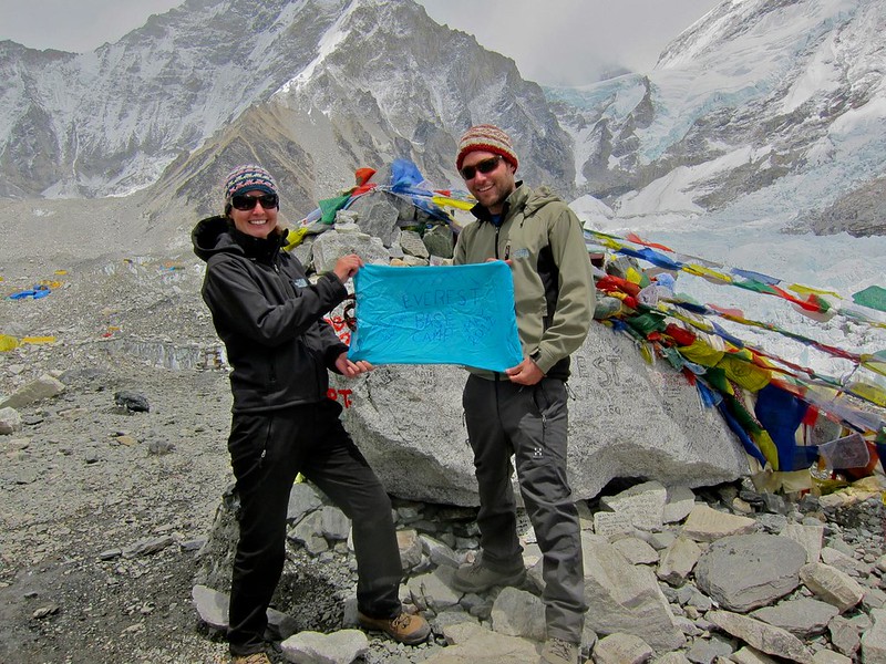
We had made a sign the night before out of a blue handsewn bag I had been given in India when I bought my shalwar kameez in Jaisalmer…

IMG_2486
Base Camp, Mt. Everest

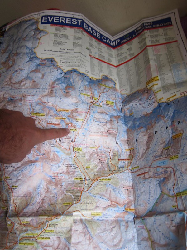
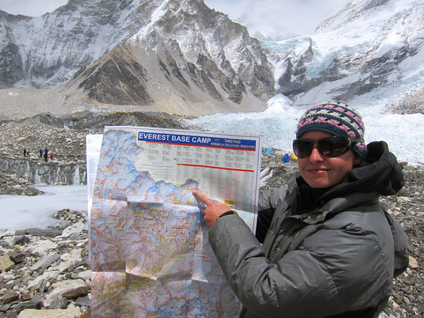
[The last picture of our worn, beloved (and very necessary!) map, marking our arrival at Everest Base Camp… only a couple of miles from the Tibetan border (in beige)]

IMG_2491
Base Camp, Mt. Everest

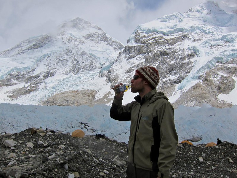
As a surprise to me, Scott had been carrying a tiny bottle of “Everest” whiskey to celebrate (essential items only…!).

Base Camp, Mt. Everest

A couple of guys from Europe asked to borrow our sign for a picture (I think they held up the other side, on which we had written “Hi Mom and Dad”…:))

Although many trekkers were being encouraged by their guides to turn around here, at the official “picture spot” of EBC, we had the freedom to walk into EBC and explore for as long as we wanted because we were on our own (as long as our lungs and the impending sunset would allow).

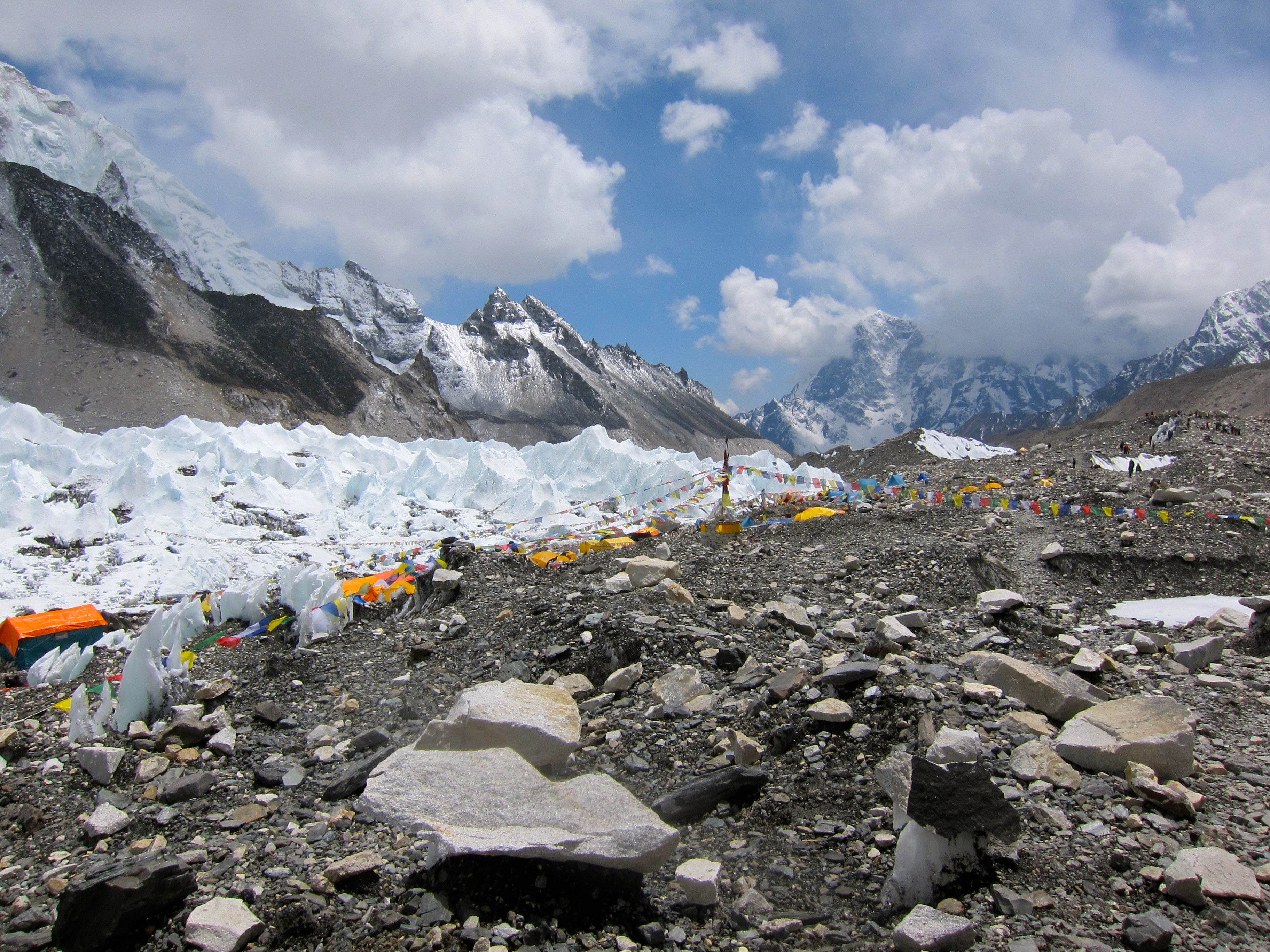
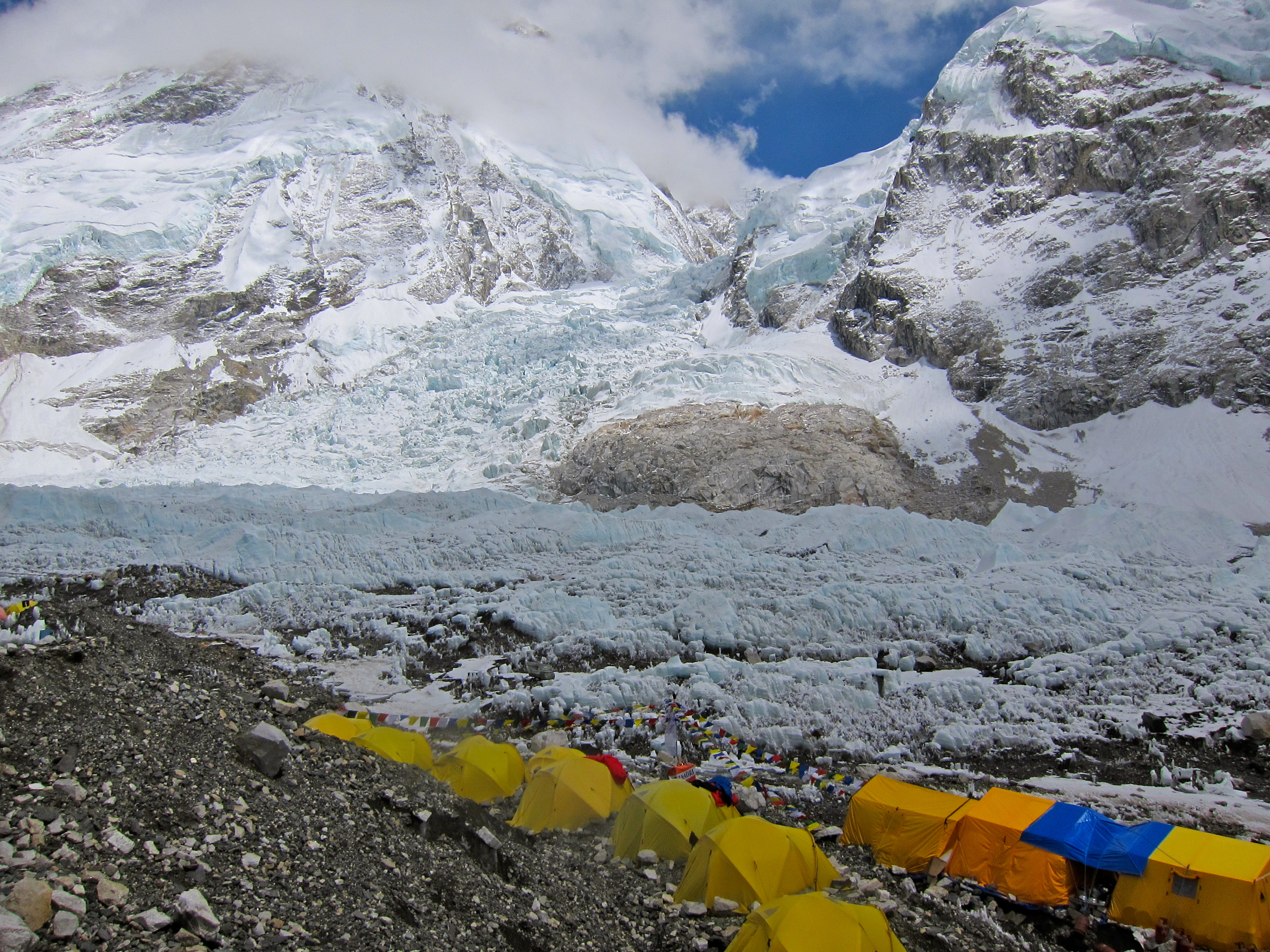
As we began the walk into the graveled, rocky trail that led through EBC, we noticed that we weren’t quite on solid ground. Every year, EBC is built upon the glacier that we were now walking on; therefore, every year EBC is set up a little differently to account for the shifting landscape. Although the ground felt solid, we were keenly aware of the groaning and shifting of the land and splashing of fallen rocks into the pools around us as the snow melted. Boulders were perched precariously on blocks of ice, as if they had been placed there by some other power. In a place with so little native life, EBC itself appeared alive!

IMG_2502 IMG_2501
Base Camp, Mt. Everest

Base Camp, Mt. Everest

Base Camp, Mt. Everest

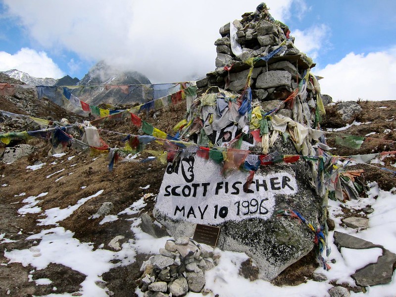
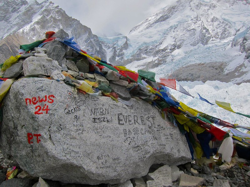
EBC was set up as one long trail that ran from the “photo spot” to the Khumbu Icefall, the true beginning of the trail to the summit. Hundreds of yellow tents lined the path, and flags declaring the summiting teams’ nationalities were prominently displayed. Summiters and their Nepali guides sat around in the their tents or in small groups chatting. Medical tents sat off to the sides, and make-shift mess-hall tents were erected within each summiting group’s camp. I couldn’t believe that after years of wondering what it would “feel” like to be at the base of Mt. Everest (would there be roads? what would the people look like?), I was finally here, and I was surrounded by people who would soon attempt to climb to its summit.

Base Camp, Mt. Everest

[Tents leading up to the Khumbu Icefall.]

Base Camp, Mt. Everest

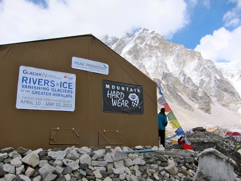
After walking about half a mile through the maze of tents, we saw a large beige tent with a sign that read “Glacier Works– Rivers of Ice: Vanishing Glaciers of the Greater Himalaya.” We had read about this exhibit before we had even arrived in Nepal; it was a photo exhibit that was on display simultaneously at both MIT in Boston and at Everest Base Camp in Nepal (we must have been destined to see this exhibit) to bring attention to the dramatic glacial melt that has been occurring in the Himalayas over the past 30 years.

IMG_2507
Base Camp, Mt. Everest

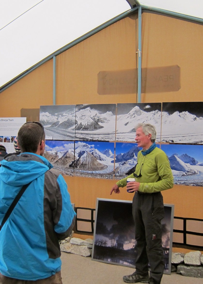
We stepped inside and were greeted warmly by an older blue-eyed American man named David, who walked us through the exhibit, picture by picture. He had taken the majority of the pictures himself over his 32-year climbing career, taking us out of the tent occasionally to point out the various mountains and melting glaciers in their real form. With the way he talked about the disappearance of the Khumbu Icefall and other important glaciers in the region, it was clear that this was his passion. Some of his stunning before and after photos can be found at the following site: http://www.glacierworks.org/

Base Camp, Mt. Everest

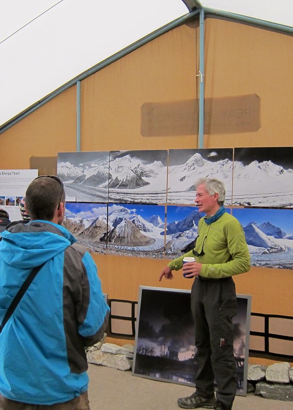
Just as the three of us were standing outside together, a frightening rumble and crash drew our attention to a nearby mountain to our right; although we couldn’t see it, David explained that it was “simply” an avalanche (“They happen several times a day,” he explained.). As the glaciers were melting and becoming more unstable, these avalanches were apparently much more common than they have been in years past, and they were making the accent up Mt. Everest much more dangerous. Hikers were being forced to hike over the Khumbu Icefall in the middle of the night before the sun rose, when the ice is most stable and less likely to fall and less likely to trigger an avalanche. It was all part of what David had been showing us in his pictures.

Once David learned that Scott was a web developer, he spent a good deal of time gathering advice from Scott about his Glacier Works website and the technology that the website was, or should be, using. It turned out that David was actually already working with one of Scott’s web developer friends back in Boston and that we were all three from Boston– small world…. Finally, he thanked us for coming, particularly because “trekkers don’t always feel welcomed into EBC by the ‘real’ hikers of Everest,” as he said, and he was glad we had ventured this “deep”.

Only when we were back in the safe, cozy confines of our hotel in Kathmandu 3 days later would we learn who this “David” guy really was. After looking up Glacier Works on the internet, we learned that this man, David Breashears, was kind of a big deal. He was a famous mountaineer and filmmaker who was the first American to summit Everest twice, had won 4 Emmy awards for his filmwork on mountaineering, and was the first person to transmit live footage from the summit of Everest in 1983. He had summited Everest FIVE times and co-directed and photographed the IMAX movie “Everest”, which we had just watched in Namche Bazaar before our push to EBC. I only wish I had known these details when we were standing there talking to him (he hadn’t even hinted that he had climbed Mt. Everest before, much less five times) … I would have had so many questions for him.

We retraced our steps through the meandering, rocky maze of EBC and found the clearing that marked its beginning edge.

We took one long last look at EBC (it’s a rather funny feeling when you look at a place and know that you will likely never see it again–), turned around, and literally began walking towards home.

That night we collapsed (and slept very well) at our lodge in Gorak Shep, a safe 2.5-hour walk away from the rumbles and crashes of EBC.

—–

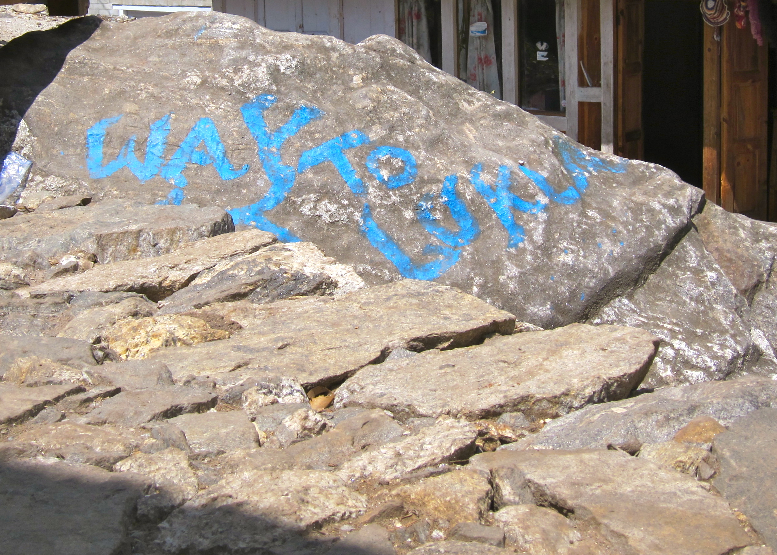
Leaving EBC marked the beginning of our return home from Asia, a symbolic end to our 8-month journey. Whereas the trip had felt like one long continuum of time and experiences until this point, turning from EBC marked the true start of our journey home– to Gorak Shep, and on to Lukla, to Kathmandu, and finally, of all places, JFK airport in New York. We didn’t yet have a place to call home (the road had been our home)… so JFK would have to do for now.


EBC trek Day 9: Dingboche to Lobuche

Total mileage on Day 9: 4.8
Beginning altitude (Dingboche): 14,272 ft
Final altitude (Lobuche): 16,160 ft

————————————————————

Today was one of the most beautiful days of our journey. With each step we took away from Dingboche, we encountered larger and larger snow-capped mountains that were made all the more grand by the tiny villages dwarfed in their shadows. Where yesterday there had been scrubby bush to guide us, there was now only packed dirt and rocks lacking any vegetation. The trail had fallen away to large plains again, with a river gorge on one side (with tiny Pheriche in the valley) and mountains on the other. We saw very few other trekkers for most of the morning and were elated to be wandering alone through this big beautiful world.

[Steph, alone in the wilderness…]
IMG_2408 2
Everest Base Camp Trek, Nepal

[Prayer flags leaving Dingboche]
IMG_2407
Everest Base Camp Trek, Nepal

Everest Base Camp Trek, Nepal

[Tiny Pheriche, bottom right, completely dwarfed by Ama Dablam and nearby peaks – still one of our favorite pictures from the entire trip]
Everest Base Camp Trek, Nepal
Screen Shot 2014-12-12 at 8.34.48 AM

Everest Base Camp Trek, Nepal

[A home? A resting outpost?]
Everest Base Camp Trek, Nepal
Screen Shot 2014-12-12 at 8.36.21 AM

[obligatory handstand; life is good.]
Everest Base Camp Trek, Nepal
Screen Shot 2014-12-11 at 12.17.08 PM

An hour or so into the trek, we ran into our cheery Zimbabwean friends from earlier in the trek. We told them that we were doing well but that I was still fighting a sinus infection that had not gotten any better. Their team leader was impressed I had even made it this far and offered to sell some (expired) amoxicillin to me. “You’ll take real medicine, right.. antibiotics?” – “Yes, I’m actually a microbiologist back home.” – “Gah, thank God… you wouldn’t believe how many hippies I encounter up here who insist on shoving some herbal gimmick up their butts instead.”

…nice to meet you too, sir. Life on the trail! 🙂

Everest Base Camp Trek, Nepal
Screen Shot 2014-12-11 at 12.17.18 PM

[Rescue helicopter overhead…]
Rescue

Everest Base Camp Trek, Nepal

As we continued on toward Dukla, the village in which we planned to rest and have lunch, bad weather began settling into the valley, and we worried whether we would make it to our final destination for the day, Lobuche.

Everest Base Camp Trek, Nepal

We reached Dukla after about 2.5 hours, where we had lunch and a nice rest at the Yak Lodge, the only building in town!
Everest Base Camp Trek, Nepal

Across from us were two girls about our age. One of them, a pale, red-headed girl, was visibly in distress, laying her head on her friend’s shoulder and blinking slowly. We overheard her friend say that the girl had severe altitude sickness and would be airlifted by helicopter back to Kathmandu in a few minutes. My heart broke for her, as I reflected on just how mentally challenging the trek had been up until now; I couldn’t imagine turning back this far along. As we finished our meals of Nepali noodle soup, we heard the helicopter overhead and ran out the door to watch it land and take the girl away, back to Kathmandu. So close to making it to EBC…

Rescue
Screen Shot 2014-12-12 at 8.45.24 AM

By the time we had finished lunch, I had almost convinced myself that I simply wanted to stay in Dukla– we were tired and the air was wet with drizzly rain. However, the daily chill of the trek had started to wear on us both emotionally and physically, and we didn’t want to add more cold nights if we didn’t need to. I was feeling the pull of warmer climes calling me back down the trail with every cold step forward that I took, and I knew I was nearing my limit. We would need to push on.

The next section was tough – 2 hours of uphill, winding switchbacks and bitter wind. We passed porters lumbering body-sized oxygen tanks for the summit teams at EBC, and even one guy carrying a western-style toilet on his back!

Luckily, after that very difficult climb, we were rewarded with some time spent exploring a valley with several memorials that had been erected; Nepali memorials were on one side, and those for foreigners were on the other. Probably one hundred or so memorials dotted the hillsides – there were notes left by parents and siblings who had hiked all the way here to pay their last respects to their children and loved ones. There were also larger memorials wrapped in Nepali prayer flags. We saw the memorials built for some of the more famous mountaineers who had died in the act of climbing Everest, including Scott Fischer and Rob Hall, members of the tragic 1996 summit expedition that resulted in the book “Into Thin Air,” and the IMAX Everest film (both recommended).

Everest Memorials

Everest Memorials
Screen Shot 2014-12-12 at 8.45.44 AM

After a few minutes, we pressed on toward Lobuche, forever pushing ourselves toward the snow-capped Himalayas in the distance!

Everest Base Camp Trek, Nepal

Everest Base Camp Trek, Nepal

We reached Lobuche after about another hour of flat walking by mid-afternoon and collapsed into our room. Although I was happy to stop in Lobuche regardless of what my Wikipedia printout on the EBC trail said, Lobuche is a mandatory acclimatization stop for most trekkers.

Everest Base Camp Trek, Nepal

Everest Base Camp Trek, Nepal

We tried to keep warm in the common room, but it was getting tough… [I have to laugh when I look at the following picture– I’m glad for posterity’s sake that I have it, but it’s clear that the cold, sunburn, and lack of shower (6 days now!) have not been kind…..]
Everest Base Camp Trek, Nepal

We ordered more Nepali tea and a big bowl of fresh hot popcorn, which quickly made us the most popular people in the room to the other trekkers. We eventually cozied up to the fireplace, where we took off our boots and tried to warm our tootsies, while we talked with the other trekkers who were also staying in the lodge that night (everyone had their own bowl of popcorn by then). They were Americans, and it was fun talking with people from places that felt like home, like Boston and even Alabama.

Sadly, one girl in their group started to feel dizzy and nauseas, and almost vomiting, feeling overcome with altitude sickness. Her friend tried to calm her, but we could see the fear rising in her eyes. She eventually decided that she needed to turn back– she was only one day away from Everest Base Camp, and she would never make it. Her friend bawled as the girl was escorted out the door into the dark night to be taken back to Pheriche over 3 hours away – another trekker, so close, but never getting the chance to finish.

Silently, we hoped that our own bodies would carry us through just one more day of climbing – tomorrow we would reach Everest Base Camp!

EBC trek Day 8: Rest day in Dingboche

Total mileage on Day 8: 0
Beginning and final altitude (Dingboche): 14,272 ft

————————————————————

We spent our mandatory acclimitization day in Dingboche reading our books in the lodge and wandering around the village and surrounding hillsides. Like most villages on the EBC trail, Dingboche was nestled into a small protected valley, surrounded by imposing snow-covered mountains. There was little to the village of Dingboche itself, except for a few lodges, barren farmlands, and a cell-modem internet cafe.

Everest Base Camp Trek, Nepal

The views surrounding the village, however, were spectacular.

Everest Base Camp Trek, Nepal
Screen Shot 2014-12-14 at 7.34.56 AM

We made a quick visit to the internet cafe, where Scott and I both scrambled to check our email and let our families (and Scott’s work) know we were OK within our allotted 20 minutes of paid internet time. The computers were clunky old Windows computers with sticky and/or missing keys, but the internet was unexpectedly fast.

[Email from me to my parents, dated May 5, 2012:

thanks for the emails mom!  im doing ok — still have the sinus
infection, but we are still moving up!  In Dingboche now (at 4,440
meters!), shold be at the top in 3 days.  I wont have internet after
today, so I will check in again once we are on the way back down!!
love yu so much, and dont worry, we are being so safe!!
love you….      ]

[Email from Scott to his parents (excuse typos from hunt-pecking frozen fingers)

Hey mom and dad – Still on our way to Base Camp and all is well – we’re acclimatizing well and taking it slow. In Dingboche now (at 4,440 meters!), shold be at the top in 3 days.  I wont have internet after today, so I will check in again once we are on the way back down!! love yu so much, and dont worry we are being so safe!!

Talk to you soon – hug the kitties for us.

Love you, Scott n Steph]

After leaving the internet cafe, we put out a half-hearted effort to do an “acclimatization hike”, in which we casually wandered around a small dirt hillside for 10 minutes, where we encountered nothing much but a somewhat surprised yet adorable yak munching on some dead branches.

Back in town after our grueling “hike”, we attended a presentation on altitude sickness that was being given by an English doctor who was currently stationed at one of the medical clinics nearby. She told us that there are two foreign-staffed medical clinics along the trail: one in nearby Pheriche and another one 2-days away at Everest Base Camp. Whereas we previously hadn’t known if there were any such medical services available on the trail, this information alone was enough to relieve us (or me, really) of our near-constant worry about acquiring altitude sickness. Although I had always known that a helicopter rescue was available, it was comforting to know that there was a less-serious (and less expensive…  heli-rescue would be $5,000 from this point) option available in a village nearby. She also reviewed all of the symptoms of altitude sickness and the full range of options that were available at the clinics (oxygen, full-body hyberbarric bags, adrenaline shots, among others). Medical services were free for Nepalis, she said, while foreigners were charged at cost.

Back at our lodge, we found a cozy semiprivate greenhouse with tables and benches, where we set up for some reading time and ordered a large cheese pizza (one can only eat fried momos for so many days). Although the cheese was unmistakably different than what we were used to (yak cheese!), the pizza was delicious and, most importantly, hot. After we moved back over to the main dining room (the greenhouse turned frigid after the sun fell behind the mountains), we noticed a hiking group that we had briefly spotted the day before. Unlike the Diamox-popping youngsters that were also staying in the lodge with us, this group seemed different. They were older and somehow seemed more serious (unlike the rest of us, they looked like they knew what they were doing). We wondered if they were perhaps on a summiting expedition, and if so, to where?

At dinner time, the lodge was packed with trekkers and hikers and their guides. We sat near one of the Nepali guides and struck up a conversation. His name was Rajiv Sumit and he had indeed ‘sumit’-ed Mount Everest before – six times, in fact. We got a kick out of his name, and immediately thought of Steph’s brother Rob back in the US, with his list of ironic inventor’s names – he would have loved this one!

“You’re the first person we’ve met firsthand who has summited Everest!” we exclaimed. He leaned in close. “Well that man sitting next to you is one of the greatest climbers in the world,” he said, motioning to the hiking group that we had spotted earlier. (We knew it!) “He’s summited several mountains much more challenging than Everest – most of the 8,000 meter peaks.” (26,000+ ft).

Curiously, we learned that Sumit’s wife was a PhD microbiologist, like me, and that she worked at a hospital in Kathmandu. Sumit gave us her business card and suggested that we ask her for a tour of the hospital after our return to the city. We never called her, however, since Sumit would still be on an expedition when we were in Kathmandu, and we figured that his wife might not appreciate his signing her up to be tour guide for the day. After dinner, we said goodbye to Sumit, who had wandered over to his group (probably to administer their daily dose of Diamox)!

We kept glancing over at the serious hikers, who were now enjoying a big bottle of wine– it looked so good, considering that we had decided to stop any alcohol consumption until we were on our way back down (apparently alcohol was bad for altitude sickness). Gradually, Scott got up the nerve to ask them where they were headed. Scott, as friendly as ever, leaned over to the closest (and unfortunately most gruel and rough-looking) member of the group and casually asked, “Are you guys on a hiking expedition?”

Nod from the rough-looking European.

“Ahh, nice. To where?” Scott continues.

The rough-looking European stared straight ahead, and in his best Alan Rickman voice, he grunted, “Lhotse.”

Offering us no friendly banter in return, he was clearly not interested in speaking to mere “trekkers”. Granted, he was probably tired of people not understanding the sheer difficulty and courageousness of climbing Lhotse (if they had heard of it in the first place). Afterall, Lhotse was only the 4th highest mountain in the world at 28,000 feet, with the steepest climbing face of its size on Earth, and very few successful summits (less than 400 to date). We understood its gravity but had probably been prematurely mislabeled as naive trekkers who believe that the one-and-only Everest is only true achievment of the Khumbu region. Too bad for us– we would have loved to have heard more about their expedition.

Shortly thereafter, we climbed into bed, hoping to get a good rest before our hard push to Lobuche in the morning.

EBC Trek, Day 7: Pangboche to Dingboche

Total mileage on Day 7: ~3
Beginning altitude (Pangboche): 13,254 ft
Final altitude (Dingboche): 14,272 ft

—————————————————————-

A sparkling sheet of snow coated the village of Pangboche when we awoke on day 7. We stuffed our bags and headed downstairs to the kitchen, where our host prepared us another breakfast of fried momos and sweet milk tea. I paid for an hour of charge for our cell phone for 300 rupees (about $3) and for our room ($3/night).

It was early as we began our trek out of town. The air was cold, but the lack of wind and the bright, clear skies made for fantastic hiking conditions. Although Steph was still suffering a head cold, she’d improved a lot since the day before. Bounding down the trail out of town, we were upbeat and thankful to be spending another day in such an amazing place.

[Our goal for that day was to reach the imposing mountain in the distance, Ama Dablam, abutting the village of Dingboche.]
Everest Base Camp Trek, Nepal
Screen Shot 2014-12-13 at 9.38.07 AM

[Helicopter rescue farther up the trail.]
Everest Base Camp Trek, Nepal

The beaten dirt path out of the village cut across the side of a wide valley with a glowing green glacial river flowing through its trough. We could see miles of the trail ahead, and it appeared as if we would follow this winding valley all the way to EBC.

Everest Base Camp Trek, Nepal

Everest Base Camp Trek, Nepal
Screen Shot 2014-12-13 at 9.39.22 AM

[Steph taking the low-road…]
Everest Base Camp Trek, Nepal

As we climbed, the landscape and vegetation had been gradually changing. We had reached the altitude at which taller trees stop growing, and all that was left between the patches of moss and dirt were smaller bushy shrubs. The harsher climate was noticeable in everything we passed, from the huge Tibetan yaks that were kept unshorn for warmth, to the Sherpa people we passed who maintained more stoic, wincing looks as they hiked past us (though we’d still usually get a greeting and a smile).

[This little guy looked so cold…]
Everest Base Camp Trek, Nepal

Along the way, we passed memorials to climbers and trekkers who had died exploring Everest in the past – an eerie reminder of the dangers of this incredible place.

Everest Base Camp Trek, Nepal
Screen Shot 2014-12-13 at 9.40.36 AM

Although we only had 3 miles total to cover, we expected the journey to Dingboche would take us most of the day because we were increasing our altitude by another 1,000 ft. Steph started singing the “Do you know the way to Dingboche” song in marching step. After a couple of hours pounding down the trail with gear on our backs, we began to tire again.  We were routinely left in the dust by Sherpa porters carrying twice our weight on their backs. It was amazing to see just how comfortable people could be at 14,000ft; merely jogging in place for 10 seconds would render us breathless!

Porters

Porters
Screen Shot 2014-12-13 at 9.41.22 AM

Our host the prior day, Ang, had recommended that once we get to Dingboche, we reserve a room at her friend’s lodge, the Snow Lion Inn. Ang had called ahead and confirmed a room for us. She gave us the hotel’s business card… only at this altitude do you see Helicopter Rescue advertised as a hotel ammenity!

Facilities.

The trail on this day was noticeably more barren and deserted than in days past. Instead of a clear-cut trail, the path had widened to the size of a football field crisscrossed with water-made ruts from the previous year’s snowmelt. We were crossing over a wide plain, where we occasionally had to turn our backs to the wind to warm up and keep moving. We found a tiny hut that we leaned against for some much-needed relief from the cold wind and had another Snickers bar. After traversing the plain, we crossed over a small stream and came to a fork in the trail. Looking at our map, we guessed that ‘right’ was more likely to be correct than ‘left’, and we were sent up and around a large mountain (often needing to watch our step to avoid that dropoff to the river below to our right!).

More walking to do still, but we could see that we were approaching a small village in the distance. We were excited to have a place to stop, enjoy the views, and ask how far we had left to Dingboche.

Everest Base Camp Trek, Nepal

…But as we were pulling into the village, a big surprise: this village was Dingboche after all! We’d made it sooner than we thought. Pictured below, an exhausted Steph almost in tears at the site of a Dingboche sign. Hah!

Everest Base Camp Trek, Nepal
Screen Shot 2014-12-13 at 9.42.11 AM

We found the Snow Lion Lodge on the outskirts of town and checked into our room. Similar conditions to the last room: a spare, unheated cabin room built out of plywood. Overall, it was growing increasingly colder and more uncomfortable, sure, but it was also getting a lot more fun. Our sense of adventure was back, and we felt like we were camping.

Everest Base Camp Trek, Nepal

Everest Base Camp Trek, Nepal

Posters in the lodge warning about the dangers ahead- we were getting close!
Screen Shot 2014-12-13 at 9.43.37 AM

[Notice the yellow oxygen canisters in the photo below– the exact ones we had seen in Ang’s memorabilia case in Pangboche!]
Everest Base Camp Trek, Nepal

Everest Base Camp Trek, Nepal

Everest Base Camp Trek, Nepal
Our new host offered us tea in the wind-protected yard in front of the lodge where several women from the village were chatting, and we relaxed in some rare warm sunshine before settling in for dinner inside.

Everest Base Camp Trek, Nepal

As dusk set in, we sat around a fireplace amongst a cheery crowd of other trekkers and climbers and watched with great curiosity as an entire hiking group was administered their daily dose of Diamox, an altitude sickness prevention and treatment drug. We’d heard that these guided groups need to keep to a schedule and often provide Diamox to everyone to avoid any delays, whether they need it or not! We had some Diamox in our bags, but had yet to use any ourselves – saving it in case of emergency, we figured.

We were pleased to find that the Snow Lion Lodge had a collection of books to borrow as well, since we would need to spend the following day acclimatizing at the lodge before proceeding onward.

As we were getting ready to turn in for the night, the host of our lodge came and asked Steph and I to bring our camera and follow her outside to the yard. What we found outside was a spectacular finish to an already great day. Dingboche is positioned in a valley beneath the monstrous Ama Dablam, the pointy mountain peak that dominated the horizon for the previous 2-3 days of our hike. There was a full moon that night, and it glowed just to the left of Ama Dablam and illuminated the frosty village of Dingboche below.

Standing under the beautiful glow of the moon and Ama Dablam, all we could hear was the wind…
Screen Shot 2014-12-14 at 7.34.09 AM Screen Shot 2014-12-14 at 7.34.19 AM

Moon over Ama Dablam

Dusk in Dingboche

Moon over Ama Dablam

Dusk in Dingboche

EBC Trek, Day 6: Rest Day in Pangboche

Total mileage on Day 6: 0
Resting altitude (Pangboche): 13,254 ft

—————————————————————-

Steph’s sinus infection had worsened throughout the previous days, and after her light-headedness, we worried that launching into yet another day of hiking could push her too far. Fortunately for us, we were on our own and our schedule was loose, so we decided a day of rest and reading in Pangboche was in order. We lumbered downstairs, where our host made us a delicious breakfast of fried vegetable-filled momos (as large as our hands) and hot milk cardamom tea. The inn was very cold in the morning, and she invited us to sit by the kitchen’s fire, where she was flipping and frying up our delicious breakfast.

After breakfast, we grabbed our laptops and books and locked up the room. We wanted to sit and read in our own inn’s common room, but it was too cold to stop shivering or concentrate on anything. Kindly, our innkeeper saw us suffering and set up two chairs for us outdoors in the sun. We lingered in those chairs as long as we could but eventually had to head to the inn next door to see if we could secure a seat in their warm dining room for the day.

We were welcomed by Ang again and told we could hang out as long as we’d like, so we snagged a seat and ordered a pot of hot water to use with the tea we’d brought along. And so began a nice and relatively uneventful day of recovery.

Everest Base Camp Trek, Nepal

Snow began to fall late in the morning, and we watched it come down while sipping tea, reading our books (The Alchemist and Midnight’s Children), and updating the travel blog. As we were the only guests in the dining room that day, we were able to spend some time chatting with our host as well.

Ang told us that a Sherpa had been killed the prior day by an avalanche while hiking in the Khumbu Icefall on the way to Everest Camp #1. It was the first death of the season, and she spoke of it like it was a bad omen. She talked about her husband’s duties up at EBC and that he actually used to guide expeditions to the summit. She used to worry about him, she said, but can rest easier nowadays knowing that he’s no longer climbing the mountain and instead staying safe at EBC. She pointed out piles of Everest memorabilia in the glass cases sitting around her dining room, including some original yellow and orange oxygen tanks that accompanied Edmund Hillary and Tenzing Norgay to the top of Mount Everest in the 1950’s. We could have listened to her speak about Everest history all day, but she eventually left us to our reading.

Mid-day, we heard a loud helicopter flying overhead (a common sight up here,  we would watch at least 1 or 2 helicopters fly overhead everyday for a rescue farther up the trail). As we watched the blue and yellow copter fly closer and closer to Pangboche, we saw it get very low to the ground, like it was searching for something. Just then, it landed right outside our window!

Rescue

Someone was loaded into the copter on a stretcher, and it headed back for Kathmandu. Probably a trekker with altitude sickness, we thought, but we would never find out what had happened.

As nighttime and the cold began to settle into Pangboche, we headed back to our lodge, where our innkeeper served us dinner and we spoke to a fellow trekker from Europe who had just summited nearby Island Peak (over 20,000 ft). He had experienced mild altitude sickness at the top, and his descriptions of severe nausea and headaches and thirst sounded awful. Another woman he had been hiking with, however, had gotten extremely sick to the point of stumbling and confusion and had to be evacuated off the mountain. We were glad we had been forced to take it so slowly due to Steph’s infection… as it may have unknowingly saved us from going too high too quickly.

Everest Base Camp Trek, Nepal

Everest Base Camp Trek, Nepal

Before turning in for the night, I ventured into the village to find an internet cafe so that I could check-in with work back home – it could very well be my last chance to do so for many days!

EBC Trek, Day 5: Tengboche to Pangboche

Total mileage on Day 5: ~3
Beginning altitude (Tengboche):  12,696 ft
Final altitude (Pangboche):  13,254 ft

—————————————————————-

We hiked out of Tengboche on a spectacular, clear day. The sky was a deep, intense blue, like an ocean, and the only clouds in the sky were the ones hovering over Mt. Everest in the distance.

Everest Base Camp Trek, Nepal

Everest Base Camp Trek, Nepal

We almost hadn’t made it out the door on this particular day– I was sicker than ever with my sinus infection and worried that I was making it worse by hiking. We agreed that we should try to go just a little farther and use the afternoon to rest. So we descended out of Tengboche and into a lush green forest, filled with rhododendron trees (and yaks).

Everest Base Camp Trek, Nepal

After about an hour, we reached a tiny village called Dingboche, where we had heard there was a Buddhist nunnery. We easily found the nunnery and walked around the grounds for a few minutes but didn’t see signs of any people.

[Me outside the nunnery; scriptures are carved into the stones.]
Everest Base Camp Trek, Nepal
Screen Shot 2014-12-13 at 9.30.58 AM

[Glacial water flowing below Dingboche]
Everest Base Camp Trek, Nepal

Although I was still feeling pretty good by the time we got to Dingboche, my energy had started to fall off precipitously thereafter. To keep me going, we passed the time singing, “Do You Know the Way to Pangboche? bah bah bah bah bah…” (…to the tune of Dionne Warwick).  It even became our theme song for the trek, since so many towns along the EBC trail rhyme with “San Jose” ( Tengboche, Pangboche, Dingboche, Pheriche………)

Heading toward Pangboche, with Ama Dablam, one of the most beautiful and recognizable peaks in the region, in the distance.

Everest Base Camp Trek, Nepal

Everest Base Camp Trek, Nepal
Screen Shot 2014-12-13 at 9.31.46 AM

The Pangboche stupa (one of my favorites):
Everest Base Camp Trek, Nepal
Screen Shot 2014-12-13 at 9.31.52 AM

The gates approaching outer Pangboche:
Everest Base Camp Trek, Nepal

We made it to Pangboche around 11:00 in the morning. Normally, we would break during the day around this time for lunch and then hit the trail again for the afternoon portion of the hike. However, on this particular day, I was barely standing by the time the time we reached Pangboche due to my infection, and we knew we needed to stop for the day. I clung to a rock wall while Scott ran inside a place called the Himalayan Motel to see if they had any rooms. While he was checking, one of the motel caretakers came up to me and asked me if I was OK, since I was clinging onto the rock wall so tightly. I was so, so tired. Unfortunately, they didn’t have any rooms available that night, so we checked into the guesthouse next door where a nice Nepali woman showed us our room. She gave us the best room in the lodge (we were the only guests) with a clear view of Ama Dablam; however, the wind was so fierce and cold on that side of the lodge that it blasted through the rickety single-pane windows and created and draft through the room. We asked to be moved to the other side of the lodge, which was fine with her, but I’m not sure how much warmer it was…

At the risk of sounding like a broken record, this village was again noticeably colder than the last. We were now at just over 13,000 feet, which is higher than either of us had ever been, and there was, of course, no heat in the buildings. We learned that the buildings aren’t heated because it is (thankfully) illegal to chop down and burn wood in the region. Innkeepers run their small wood stoves using dried out yak dung, but there usually isn’t much to use, and it’s certainly not worth using it when the temps are a robust 30 deg F! (When we asked if the innkeepers lower down on the trail could run the stove for us, they said it wasn’t the “cold season” yet!)

Like most lodges, this motel did have a Western-style toilet, although it was a bucket-flush set up (again, like most toilets on our entire trip). The problem that we were starting to encounter with the bucket-flush on the EBC trail was that, well, the flush water wasn’t exactly what I would call liquid. It was so cold that the water was more of a slushy ice bath, that we’d have to dip our fingers into to grab the bucket and fill it up. Brrrr!

Washing our hands was getting more difficult, as well. Innkeepers generally kept a jug full of water above their bathroom sinks (hooked up to a drain, but not hooked up to incoming water) that had a spigot at the bottom, where water would come out. The water was freezing (and often empty), so we resorted to just washing our fingertips. Needless to say, we were going on Day #3 without a shower, but neither of us had the courage to take one in this cold. That shower we had back in Namche 3 days ago would be our last shower until we headed back down……….

Once we had settled into our room, we headed down to the dining room of our lodge, where we were planning to catch up on our reading and blog writing. However, it was far too cold to concentrate, and we were shivering uncontrollably. Luckily, Scott had noticed that the lodge that didn’t have any rooms available had its wood stove running and that the common room was nice and toasty. So we went next door to the Himalayan Motel and ordered some hot water ($~3 per thermos) for our tea we had brought from India.

Ang, the owner of the lodge, was a fascinating Nepali woman who was eager to share some stories of her life in the Khumbu. Apparently, she and her husband are one of the most famous Sherpa families in the region– almost every “big” summit expedition stays at her lodge, and her husband in the manager of one of the summit teams at EBC. He used to lead climbers up Mt. Everest, she said, but now he just manages from Base Camp, which she seemed very relieved to say. Next to our table was a display case containing memorabilia from early expeditions, including an air tank from the Hillary expedition (the first to summit), which we found to be pretty inspiring. She had a CB radio that she would monitor throughout the day, listening for updates from EBC and the summiting expeditions.

Eventually Ang left the room, and Scott and I spent the next hour sipping our Indian tea and reading. Suddenly, I felt the strangest wave of cloudiness run up my entire body, closing in like a blackness around my eyes and face. Sounds in the room were getting farther and farther away from me and were replaced with a fuzzy humming sound. I knew I was asking Scott for help, but I couldn’t hear my voice. I knew this feeling; I had had the same feeling after receiving an immunization, right before my blood pressure plummeted off the charts and I nearly passed out in the doctor’s office. I knew I was losing blood pressure fast, but what I didn’t know was why. I’ve always had perfect blood pressure (outside of receiving that Hep B shot…), and I began panicking as to why it was happening now. Was it the altitude? Luckily, I knew the drill from before: I quickly laid down and rested my feet up on Scott’s shoulder, praying for the feeling to just go away. Scott tried to reassure me, trying not to let my mind make it into more than it was. All I could think was “I’m going to pass out, and I’m not going to wake up again. If I do wake up, where will I be when I wake up?” Quickly, I told Scott, “Ang said there is oxygen here. If I pass out, please get me oxygen. Please get me down the mountain. Please don’t let anything happen to me.” I was so scared.

For several minutes, I lay there, with that feeling of blackness coming and going in waves, while Scott rubbed my shin lying on his shoulder. I took deep breaths and tried to relax as much as possible. Eventually, the feeling started to fade and eventually went away. Slowly, I sat up, happy to be sitting simply in case anyone else came into the room– I didn’t want anyone else to know what was happening.

Less than 5 minutes later, it happened again. No! I thought. I laid down again and tried to relax. Unfortunately (or luckily?), Ang walked in while I was sprawled out in her dining room. I had to tell her what was happening. Concerned, she suggested that go down the mountain. She said oxygen was available here, but it was expensive. I would have heeded her advice about leaving Pangboche, except that I didn’t have any nausea or headache or any “hallmark” signs of altitude-sickness. I certainly would have gone down if I had, but my symptoms just didn’t seem to fit with altitude problems. Eventually Ang left us to make our decision, and I began to feel better again. We decided that it was more likely that it was the Indian tea I had been drinking– I had had at least 3 cups of it in less than an hour, and there was no telling how much caffeine (or other strange herbs) were in it. I stopped drinking it, and thankfully, the feeling never returned…and Ang never forced us to go back down the mountain.

Eventually, dinnertime arrived, and we strolled back over to our lodge, where I managed to do what I could to keep warm.

Everest Base Camp Trek, Nepal

Although I wasn’t trying to be so obvious about how cold I was, my sickness was making me shiver uncontrollably. Our innkeeper noticed me shivering and brought me at least 3 heavy rugs to place over my body and legs while I waited for dinner. I was so grateful.

I choked down a plate of spaghetti for dinner, which became cold as soon as it hit the plate and tasted like kerosene. Scott ordered the veggie momos (dumplings), which were the best we found along the trail. They were huge, like stuffed pita shells and panfried on both sides like pancakes. They were also warm and very tasty. 🙂

After dinner, we gathered the stamina to brave the cold and go get into our beds, which were made colder by the fact that we couldn’t push these beds together! I thought about reading but was too chilled to put my hands outside of the sleeping bag!

Everest Base Camp Trek, Nepal
Screen Shot 2014-12-11 at 12.15.50 PM

Although we heard that Pangboche had so much to offer outside of the lodges (the oldest monastery in the region, gorgeous hiking, a yeti hand!!!), I was too sick to explore on this day. So we promised ourselves that we would conserve our energy now and have a look around when we were on our way back down….

EBC Trek, Day 4: Namche Bazaar to Tengboche

Total mileage on Day 4: 4
Beginning altitude (Namche Bazaar): 11,286 ft
Final altitude (Tengboche):  12,696 ft

——————————————————-

As much as I had been trying to tell myself it was only my imagination, I woke up this morning to a face-full of reality. I had contracted a gnarly sinus infection, and it was only getting worse. This would complicate everything: How many additional rest days would we need to add to our trip? How would it affect my ability to acclimatize? Had this measly affliction just wrecked our plans of reaching EBC?

Even without the sinus infection, Scott and I had a tough day ahead of us. Although we would only be covering about 4 lateral miles, the hike would take most of the day and increase our elevation from Namche Bazaar to the tiny village of Tengboche at 12,600 feet… and we had heard that the final push to Tengboche was a grueling 2.5-hour uphill hike with no facilities at which to rest.

Scott graciously strapped my sleeping bag to his backpack, while I re-ducktaped my blistered toes and shoved a wad of Kleenex into my pockets (what a disaster I was — poor Scott). Winding our way out of Namche Bazaar, we came upon a fork in the road; to the right lie a flat, meandering path that led more-or-less to Tengboche, while to the left lie a far more grueling path that held the all-too-tempting prospect of passing by one of the best viewpoints of Mt. Everest on the entire hike to EBC. Needless to say, we didn’t hesitate to go left!

After a few minutes slugging up the steep hill out of Namche, I realized I was already very winded– a combination of both the sinus infection and the altitude. We paused to let other hikers pass by us and occasionally passed the same people back…everyone seemed exhausted. Luckily, the expansive mountain views and dry, cool air kept us energized…

Everest Base Camp Trek, Nepal

Everest Base Camp Trek, Nepal
Screen Shot 2014-12-13 at 9.22.23 AM Screen Shot 2014-12-13 at 9.22.31 AM

Me making my “meh, this is just OK” face:

Everest Base Camp Trek, Nepal

After about 45 minutes, we made it to the Everest look-out, and there it was again! Just amazing… That said, it didn’t look any closer than it had in Namche, and we still had another 25 miles to go until we reached it. (Everest is the little blip in the right-center of the pic, with its iconic white plume of snow blowing off the top.)

Everest Base Camp Trek, Nepal
Screen Shot 2014-12-13 at 9.22.41 AM

We jumped back on the trail, which we could see meandering ahead of us for miles..

Everest Base Camp Trek, Nepal
Screen Shot 2014-12-11 at 12.12.50 PM

As we hiked along the ridge of the mountain just past the lookout, we passed a middle-aged woman who had fallen behind her group that had passed us a while back. We offered a cheery “hello” as we passed and didn’t think much of it when she didn’t respond with more than a small grunt. She was clearly tired and obviously trying to conserve everything she had.

We quickly pulled ahead and crossed over a large dry, rocky field. Without thinking why, I glanced back to check on the woman’s progress, and was terrified to see her sitting down far back down the trail, nearly where we had left her, with her hands up in the air in a large “V”. Assuming she needed help, Scott and I jogged ahead to find her group’s leader, figuring that going back for her would make less sense than going forward to find someone who had medication or who could help her go back down to Namche, if needed (altitude sickness can often be cured simply by descending a few hundred meters for a day or two, and we found that the pace of many guided groups can be faster than some hikers may need – causing some to push a little too hard and get sick).

Scott and I frantically split up and began asking people along the trail if they knew the woman matching her description. No one did, but I soon passed a big group who was going back in her direction, and I asked them to please check on her while I continued to look for her group. I knew they would run into her after a few minutes and be able to help her back down the hill, if she needed it.

After the initial flurry had subsided, I finally realized that I was now in a predicament of my own: I had lost sight of Scott and had no way to contact him if I was unable to find him.

I ran ahead and came across a lodge that appeared to serve as a lookout and restaurant for hikers, where there were several groups gathered. Figuring Scott had gone inside to look for the group, I poked my head inside but didn’t see him. I ran back outside, somewhat frantically at this point, and ran ahead down the trail, thinking perhaps Scott had run ahead looking for the woman’s group. I ran for a few hundred feet and then climbed up onto a rocky outcrop, where I began yelling, “Scott! Scott!!!”

Knowing he wouldn’t have gone too far ahead, I again ran back in the direction of the lodge again and simply waited, hoping he wouldn’t think that I had run ahead down the trail. After what seemed like forever, Scott finally appeared on the steps of the lodge, where he had been inside talking to the various groups (the place was huge, and apparently, I just hadn’t seen him the first time). I ran to him and started crying. “Don’t ever do that to me again! I thought I had lost you,” I sobbed, realizing my emotions had gotten the best of me.  …Of course, I knew he hadn’t done anything wrong… I’d simply begun spinning ideas in my head of Scott moving ahead to the next village while I went looking for him in the other direction, for example), and we would have had no way to contact each other. We had one cell phone between us, and hadn’t made an emergency meeting point, since we had always planned to stay together. Thereafter, we made sure we always had a plan….

We never found the woman’s group at the lodge, so we felt like we could do more good by continuing on down the trail to look for them (in the direction we were going anyway), while the other hikers I had spoken to would have run into her in a matter of minutes.

So we continued to the village of Khumjung, halfway between Namche and Tengboche. We reached Khumjung and asked around, but never found the woman’s group. It seemed we had done what we could, so we pressed on toward Tengboche.

(Sign reads: “Way to Everest B.C., Tengboche”. Ama Dablam in the background!)
Everest Base Camp Trek, Nepal

Everest Base Camp Trek, Nepal

We passed many more yaks, each one more adorable than the last– not merely due to our growing fondess but largely owing to the fact that these were a different breed of cold-weather yaks from Tibet, and their keepers let them grow out their beautiful fluffy fur coats!

Everest Base Camp Trek, Nepal
Screen Shot 2014-12-13 at 9.25.13 AM

Eventually, we reached the last village before the uphill climb to Tengboche. This restaurant’s sign smartly read: “This is last stop. Thyangboche 2 more hours climbing. Ok see you.”

Everest Base Camp Trek, Nepal

We stopped for a rest and a bowl of soup, and pulled off our boots and just sat in tired silence. I probably would have talked myself into staying at this lodge if the caretaker hadn’t been a bit too pushy with us, but thankfully that encouraged us to press on!

Across from our table were 2 men in their early 40’s who we had been passing back-and-forth on the trail for several days. We had all exited Lukla airport together and started on the trail at the same time. They looked a lot more tired and worn than we did, and we later learned that they ended up sleeping in the lodge for the night and that one of them unfortunately never made it all the way to EBC.

We laced up our boots and hit the trail again… after the yaks cleared the suspension bridge!

Everest Base Camp Trek, Nepal

Everest Base Camp Trek, Nepal

Everest Base Camp Trek, Nepal

As usual, the trail was tougher than we expected– 2.5 hours of switchbacks along the side of a barren mountain– but we had nice company along the way, and a beautiful clear sunny day with incredible visibility. Near the bottom of the mountain, we met a Nepali woman who was returning to Tengboche after buying supplies in Namche. Her English was perfect, and she seemed well-educated. She told us that she ran a lodge in Tengboche that was open for only 6 months of the year, during the hiking season (like most of the lodges in the higher altitudes of the trail). In fact, she pointed out that no one lives any higher than Tengboche during the winter season and that everyone moves their families down to lower elevations to ride out the cold in the off-season. During hiking season, she said, she makes the day-long trek from Namche to Tengboche nearly twice a week– and to think I was worried I wouldn’t be able to do it once! Despite being many years our senior, she plowed on ahead of us after a little while, while I struggled to bring up the rear.

Right as the sun was starring to set, we finally tumbled into Tengboche.

Everest Base Camp Trek, Nepal
Screen Shot 2014-12-13 at 9.26.20 AM Screen Shot 2014-12-13 at 9.26.31 AM

We entered the first cozy-looking lodge and found a ruckus of activity in the dining area. There were at least 3 large groups all packed around the stoves and tables, drinking and chatting loudly. We worriedly asked the caretaker if there were any rooms– there was one (1!) left.

Most of the rooms had great views of Everest, but ours looked the other direction. Still, the view of the prayer flags and carved stones set against the inhospitable craggy peaks in the near distance was beautiful and serene, and gave us a fun, nervous feeling that the trek was becoming a little more serious.

Everest Base Camp Trek, Nepal

The comfort level of our accommodations had lowered a little with each stop, which made it fun in a camping/roughing-it sort of way, but also made us miss the coziness we had enjoyed days earlier. Our room was right next to the bathroom too – which smelled terribly for various reasons I will not disclose. (I had to brush my teeth while standing out in the hallway….)

The cold in the air was more evident in Tengboche than it had been anywhere on the trail so far. Our little room had no heat of course, so in usual fashion, we pushed our beds together and got our sleeping bags ready for maximal warmth.

Everest Base Camp Trek, Nepal

With our room ready for the night, we went back outside to explore the tiny town. Tengboche was nothing more than approximately 3 small lodges, a bakery, and a monastery, set upon a beautiful clearing. The town was surrounded by massive, beautiful, cold mountains with views of Everest in the distance.

[The bakery is in the back with the green roof. Monastery is on the left. Everest in the distance (obscured by a cloud). Scott, front and center. :)]
Everest Base Camp Trek, Nepal
Screen Shot 2014-12-13 at 9.28.29 AM

Sweet puppy that we found near the Nepali woman’s lodge who we had spoken to on the hike.

Everest Base Camp Trek, Nepal

Me freezing in Tengboche:
Everest Base Camp Trek, Nepal
(Our lodge is on the left.)

The Tengoboche stupa:
Everest Base Camp Trek, Nepal

We stopped into the bakery to warm up and take in some warm, homemade apple pie and hot Nepali milk tea….
Everest Base Camp Trek, Nepal

…and then crawled into bed. It was far too cold to think about taking a shower, and the prices for a shower were increasing (only about 200 rupees, or $4, which is admittedly very little, but we were working off of a fixed pile of on the trail cash and didn’t know how much we’d need towards the top), so we went to sleep dirty and still in our hiking clothes, ready to go up again the next day!


EBC Trek, Day 3: Rest day in Namche Bazaar

Total mileage on Day 3: 0
Beginning altitude (Namche Bazaar): 11,286 ft
Final altitude (Namche Bazaar): 11,286 ft

—————————————————————–

Today, we awoke early (a side-effect of going to bed at 8:00 pm to escape the cold in our room, I guess), but we didn’t manage to pull ourselves out of our beds for at least another hour. My nose, which was the only part of my body outside of the sleeping bag, was cold to the touch, and the air in the room was freezing. Last night, Scott and I had the idea to pile all of our clothes that we were going to wear the next day on top of our sleeping bags, not only for extra warmth during the night, but also so that we could pull our freezing clothes into the sleeping bag with us in the morning and warm them up before putting them on. After we couldn’t wait any longer, we courageously grabbed our clothes, stuffed them into the sleeping bag for a few minutes (holy goosebumps!!), and got dressed inside of our bags.

After getting dressed, we tiptoed down the dorm hallway to the shared bathroom and turned on the trickle of freezing water from the sink. The water was too cold to splash on my face or even my whole hands, so I merely resorted to rubbing some soapy water between my fingertips and rubbing them onto my nose and forehead for my “shower”. A real shower would have to wait until midday, when it was warmer.

Although our hike to Everest was scheduled to take 10 days, several of those days are scheduled to be “rest” days– not to fight off the inevitable fatigue and exhaustion that builds over the course of the hike, but to acclimatize slowly to the lack of oxygen in the air. Each day, we knew not to climb more than 300 net meters in altitude in a single day and to build in a rest day every third day.  Therefore, all hikers (even experienced ones) use Namche Bazaar as their first rest day on the EBC trail. So we headed out the door and found that the town of Namche Bazaar was surprisingly quiet (save for the occasional yeti or yak…).

Namche Bazar

Namche Bazar
Screen Shot 2014-12-13 at 9.16.57 AM

We set out in search of some Nepalese breakfast and thankfully found some deliciously piping hot noodle soup at a woman’s shop down the street (we had developed a small obsession for hot noodle soups for breakfast in Thailand and Cambodia and were thrilled to find that the Nepalese also adhered to this amazing concept!!). We ordered two different types of hot soups: one, a traditional Tibetan “thukpa” soup with wide noodles and vegetables in clear broth, and the other, a Nepalese ramen-style noodle soup out of a package. With the 30-degree temps barely creeping up outside (and no indoor heating….), both soups were hot, delicious, and very welcome.

Namche Bazar

After breakfast, we decided to explore the outskirts of Namche Bazaar. Up a small hill on the edge of town, we found some gargantuan mani wheels that rang each time they completed a circuit. Beautiful old murals and paintings on a canvas-like material adorned the walls around each of the wheels.

Namche Bazar
Screen Shot 2014-12-13 at 9.17.07 AM

Smaller tin mani wheels lined the many paths leading to Namche.

Namche Bazar

We knew we were going to need a lot of help if we were going to make it to Everest, so the wheels did a lot of ringing that day…

http://www.flickr.com/photos/scottjehl/8206515340/in/photostream
Screen Shot 2014-12-13 at 9.19.06 AM

Eventually, we reached the edge of town, where the town quite literally fell off the map: an enormous cliff dropping to the valley below separated Namche Bazarre from the Himalayas in the distance. With the high altitude and near-360-degree views, our lookout felt almost heavenly.

Namche Bazar

Screen Shot 2014-12-13 at 9.19.41 AM

On our walk back to Namche, we came across a small monastery. Outside were signs in English, inviting us to come in. We tiptoed inside and were greeted by a Nepali monk dressed in dark maroon and saffron robes. We couldn’t communicate with one another, but he beckoned for us to follow him inside the monastery, where dozens of yak butter candles lit the room.

Namche Bazar

Namche Bazar
Screen Shot 2014-12-11 at 12.12.14 PM  Screen Shot 2014-12-11 at 12.11.09 PM

Surrounded by pictures of the Dalai Lama and other monks were small shoebox-like boxes in the cubbies of the walls. We had previously learned that these were old handwritten holy scrolls that had been copied and re-copied over the years, with each chapter being kept in a separate box. Noticing our interest, the monk pulled one down off the wall and showed us the pages.

Namche Bazar
Screen Shot 2014-12-11 at 12.12.04 PM

Each line had indeed been carefully inscribed onto the delicate translucent pages in black ink.

I thanked the monk, pinched myself to make sure I wasn’t dreaming, and stepped back out into the twenty first century and on to Namche.

——-

Although we were instructed by our guidebook to do an “acclimitization hike”, where you hike higher each day than you plan to sleep that night, my feet looked like this from all the hiking in my new boots the day before:

Blisters

Oh yeah, that’s ducktape (covering some gnarly blisters)– we weren’t hiking anywhere. So we spent the afternoon reading books and chatting to fellow hikers in a small German bakery where the apple streudels and warm drinks were more abundant than the oxygen outside. Life was good. That night, we hung out at Liquid Bar again, where we toasted our last comfortable day that we would get with a large Everest beer, while watching a documentary on Everest by the filmaker David Breshears. It was nice to have a rest day– and with the difficult hike tomorrow rapidly approaching, we were going to need it.