Design a site like this with WordPress.com
Get started

EBC Trek, Day 4: Namche Bazaar to Tengboche

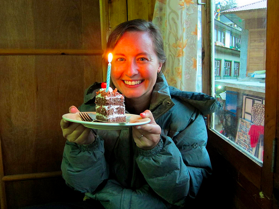
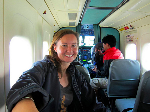
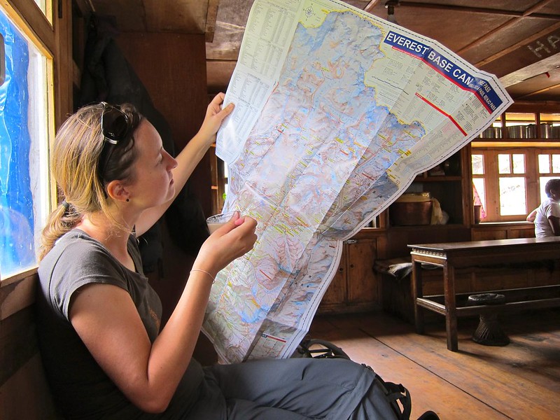
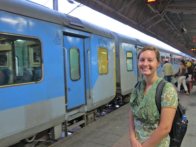
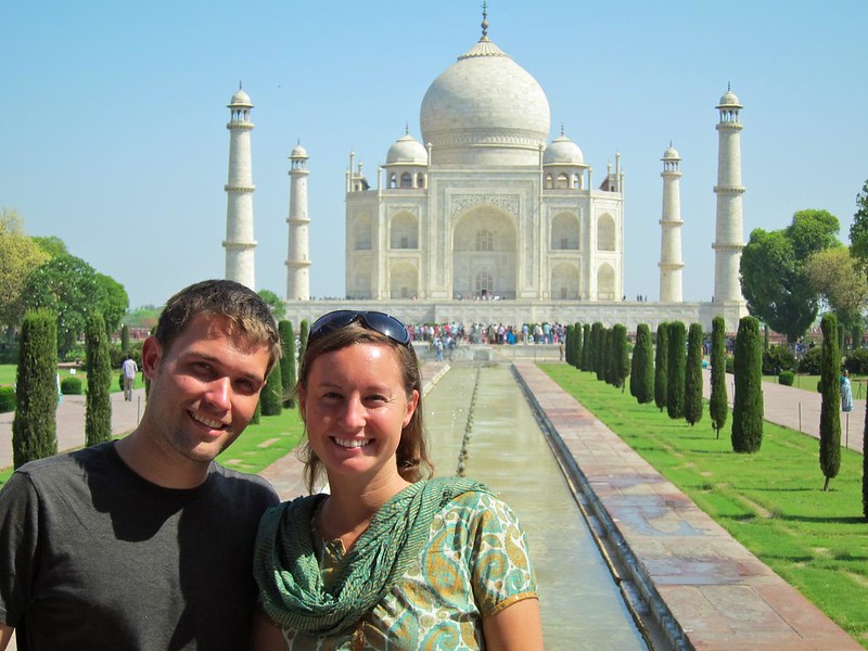
Total mileage on Day 4: 4
Beginning altitude (Namche Bazaar): 11,286 ft
Final altitude (Tengboche):  12,696 ft

——————————————————-

As much as I had been trying to tell myself it was only my imagination, I woke up this morning to a face-full of reality. I had contracted a gnarly sinus infection, and it was only getting worse. This would complicate everything: How many additional rest days would we need to add to our trip? How would it affect my ability to acclimatize? Had this measly affliction just wrecked our plans of reaching EBC?

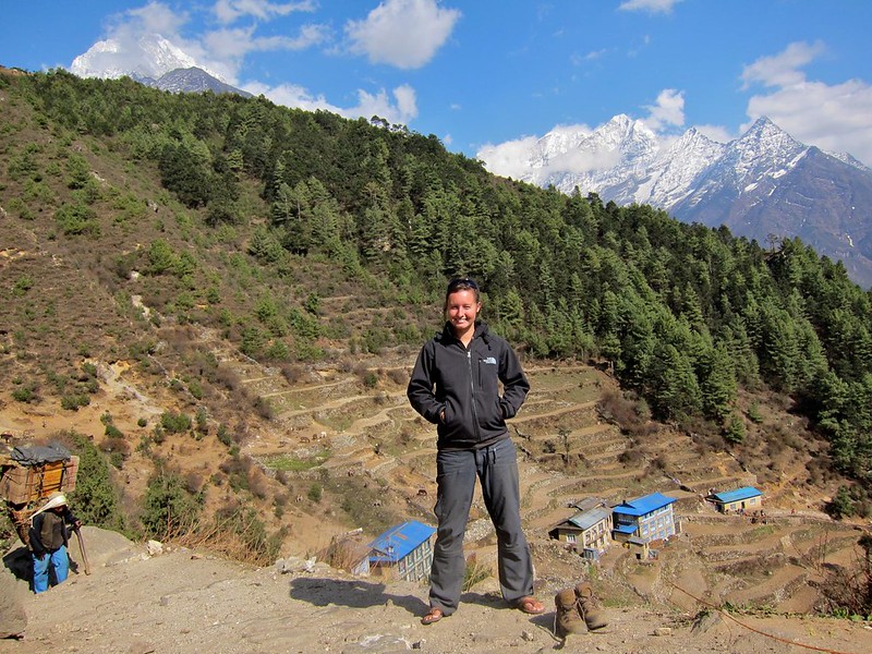
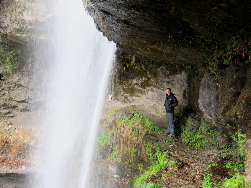
Even without the sinus infection, Scott and I had a tough day ahead of us. Although we would only be covering about 4 lateral miles, the hike would take most of the day and increase our elevation from Namche Bazaar to the tiny village of Tengboche at 12,600 feet… and we had heard that the final push to Tengboche was a grueling 2.5-hour uphill hike with no facilities at which to rest.

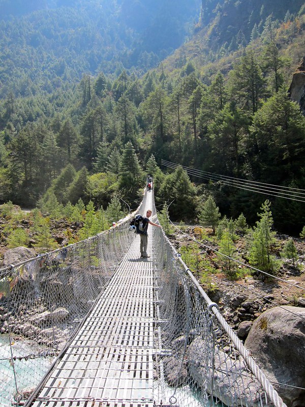
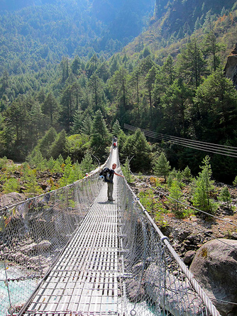
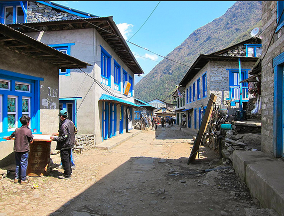
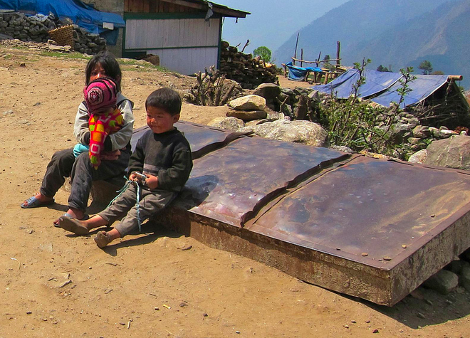
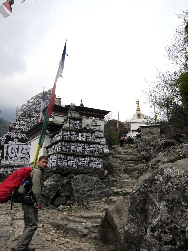
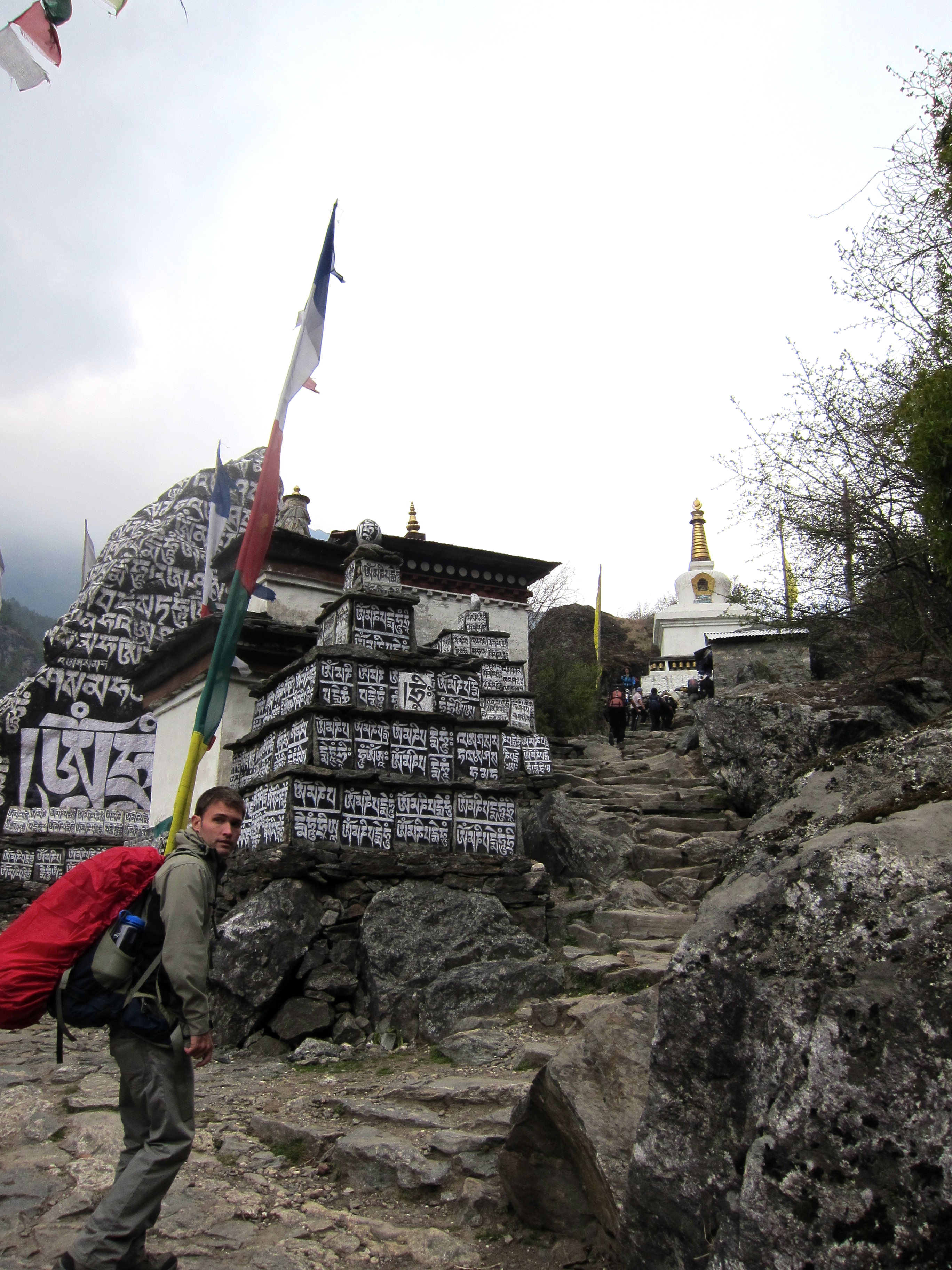
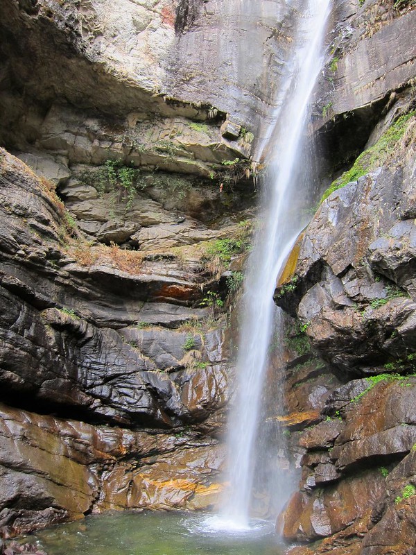
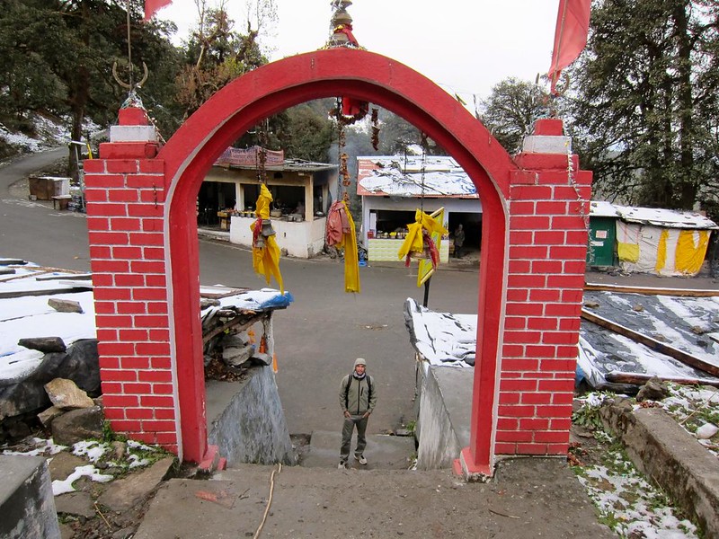
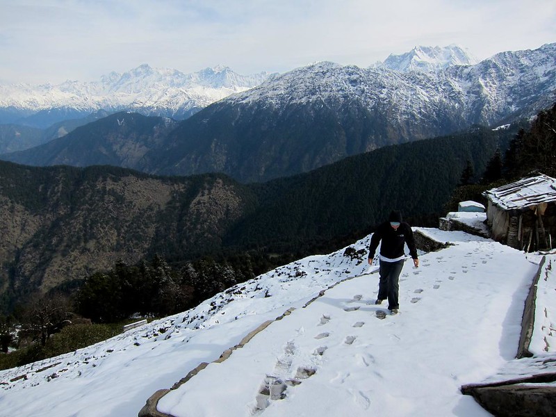
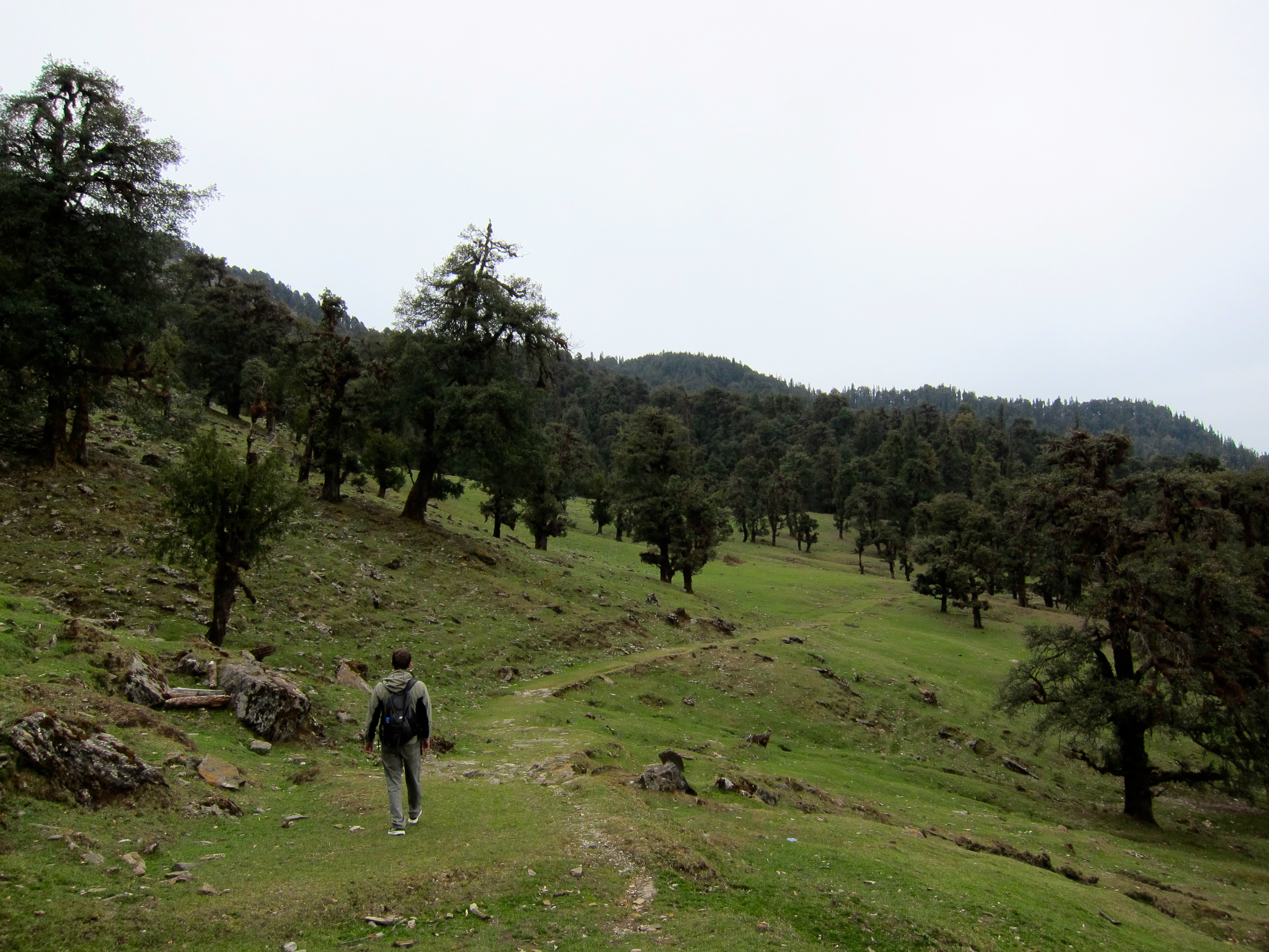
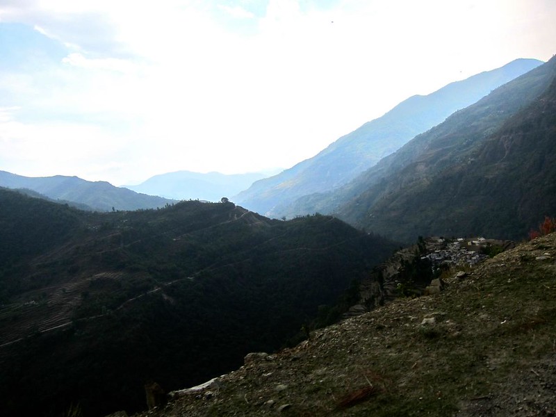
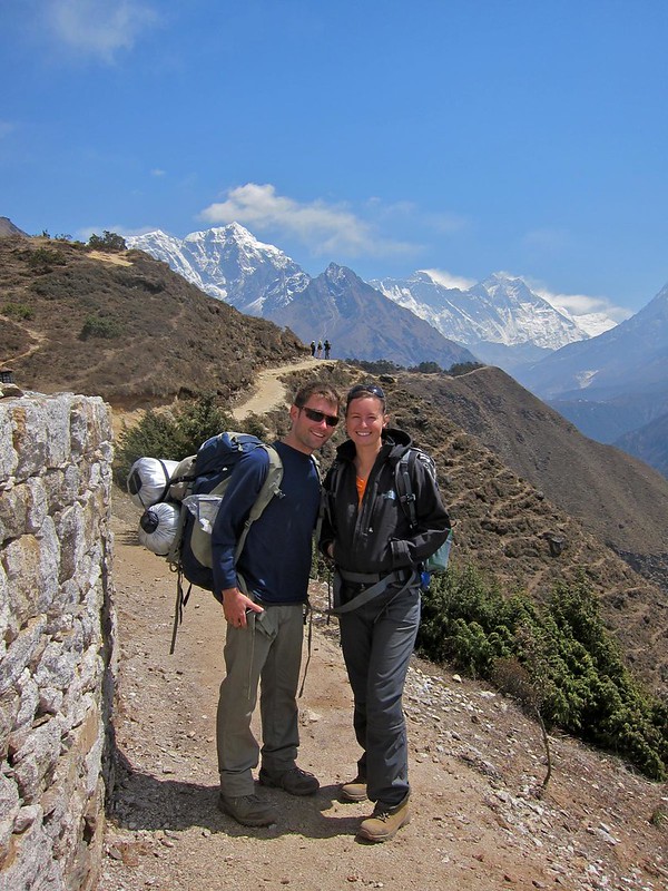
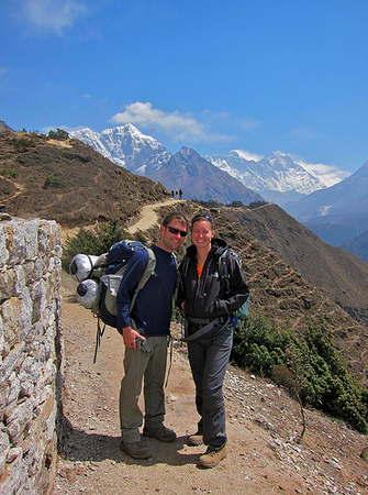
Scott graciously strapped my sleeping bag to his backpack, while I re-ducktaped my blistered toes and shoved a wad of Kleenex into my pockets (what a disaster I was — poor Scott). Winding our way out of Namche Bazaar, we came upon a fork in the road; to the right lie a flat, meandering path that led more-or-less to Tengboche, while to the left lie a far more grueling path that held the all-too-tempting prospect of passing by one of the best viewpoints of Mt. Everest on the entire hike to EBC. Needless to say, we didn’t hesitate to go left!

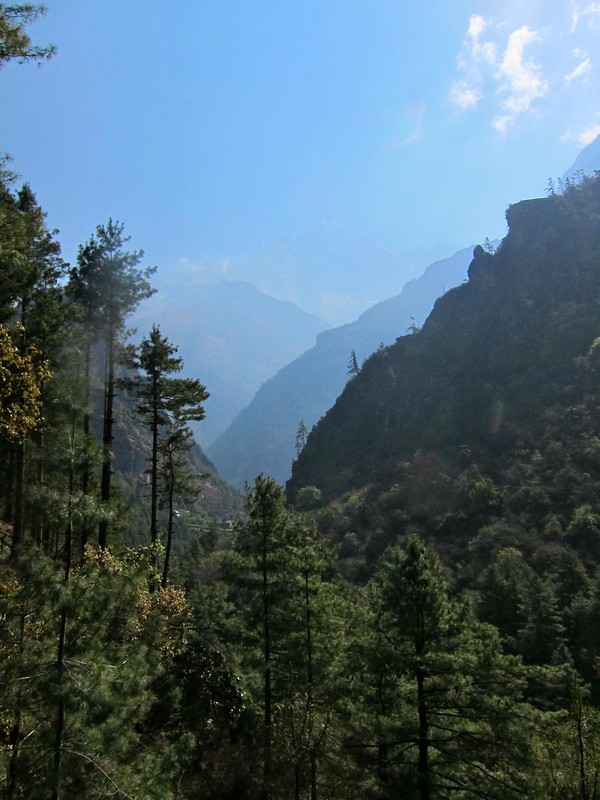
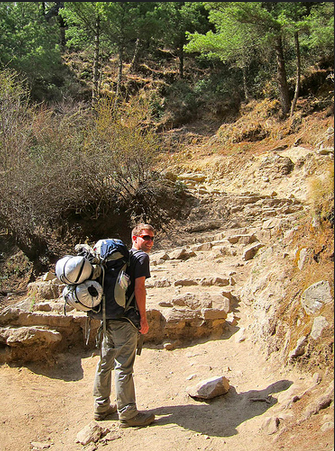
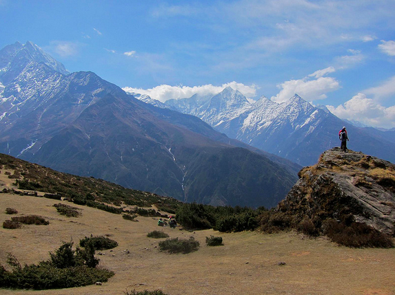
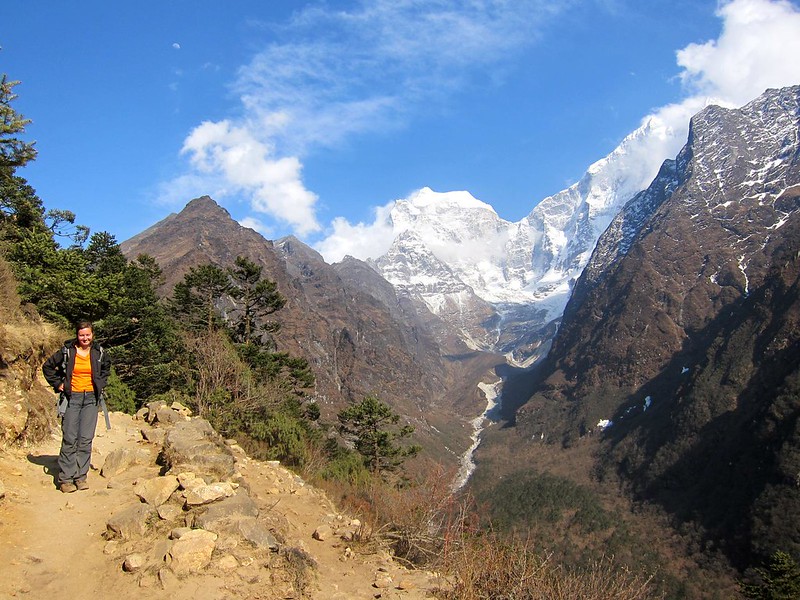
After a few minutes slugging up the steep hill out of Namche, I realized I was already very winded– a combination of both the sinus infection and the altitude. We paused to let other hikers pass by us and occasionally passed the same people back…everyone seemed exhausted. Luckily, the expansive mountain views and dry, cool air kept us energized…

Everest Base Camp Trek, Nepal

Everest Base Camp Trek, Nepal
Screen Shot 2014-12-13 at 9.22.23 AM Screen Shot 2014-12-13 at 9.22.31 AM

Me making my “meh, this is just OK” face:

Everest Base Camp Trek, Nepal

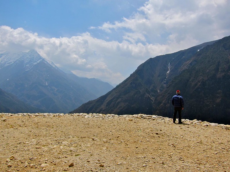
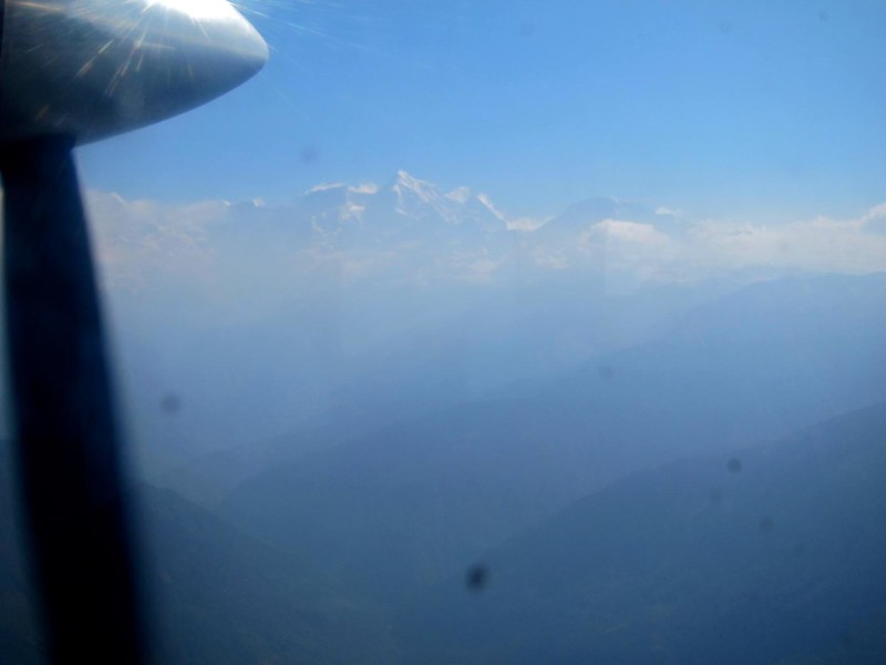
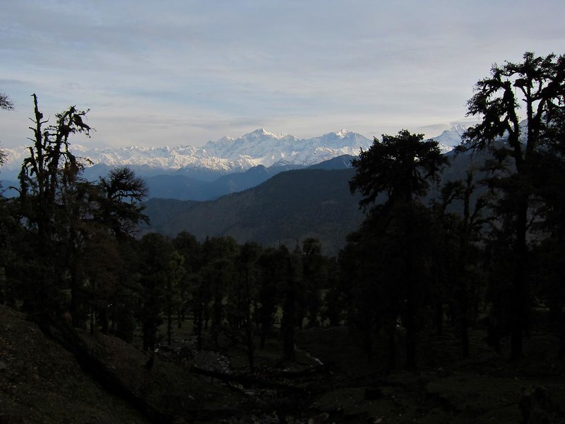
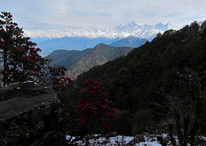
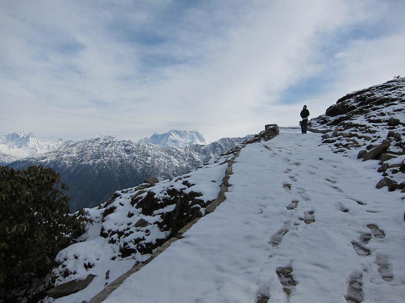
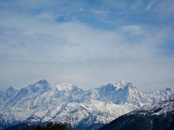
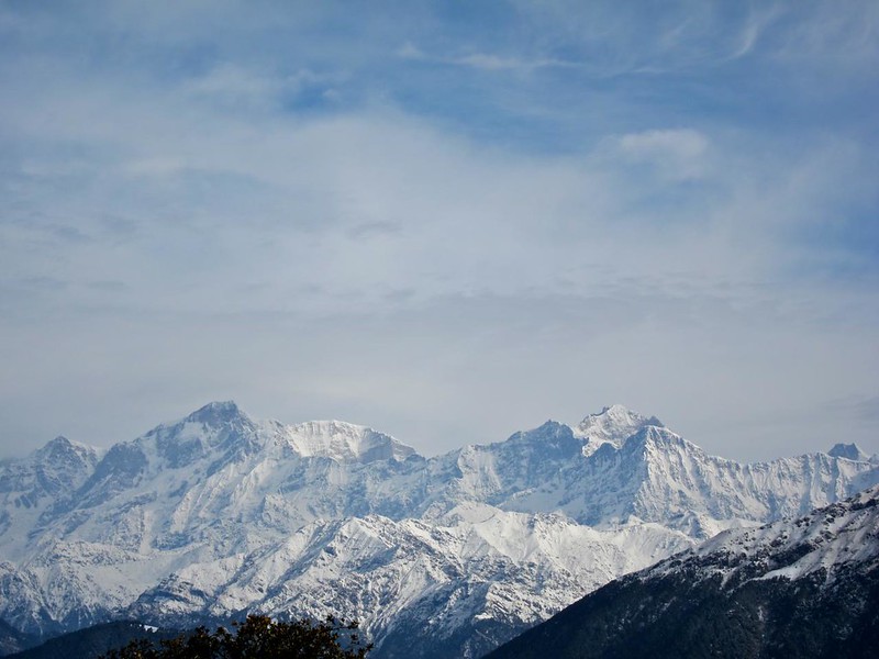
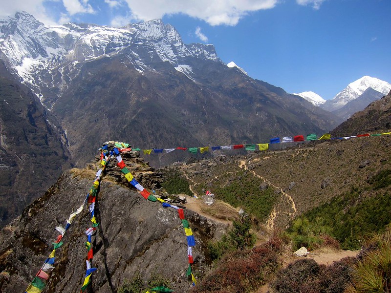
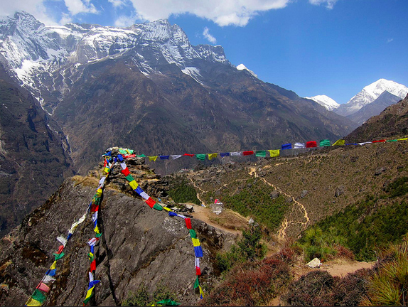
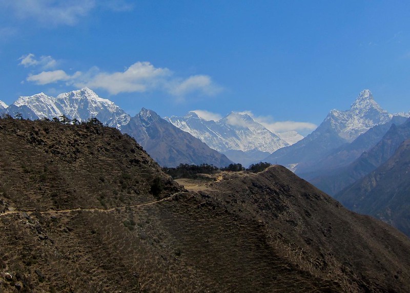
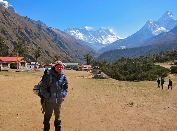
After about 45 minutes, we made it to the Everest look-out, and there it was again! Just amazing… That said, it didn’t look any closer than it had in Namche, and we still had another 25 miles to go until we reached it. (Everest is the little blip in the right-center of the pic, with its iconic white plume of snow blowing off the top.)

Everest Base Camp Trek, Nepal
Screen Shot 2014-12-13 at 9.22.41 AM

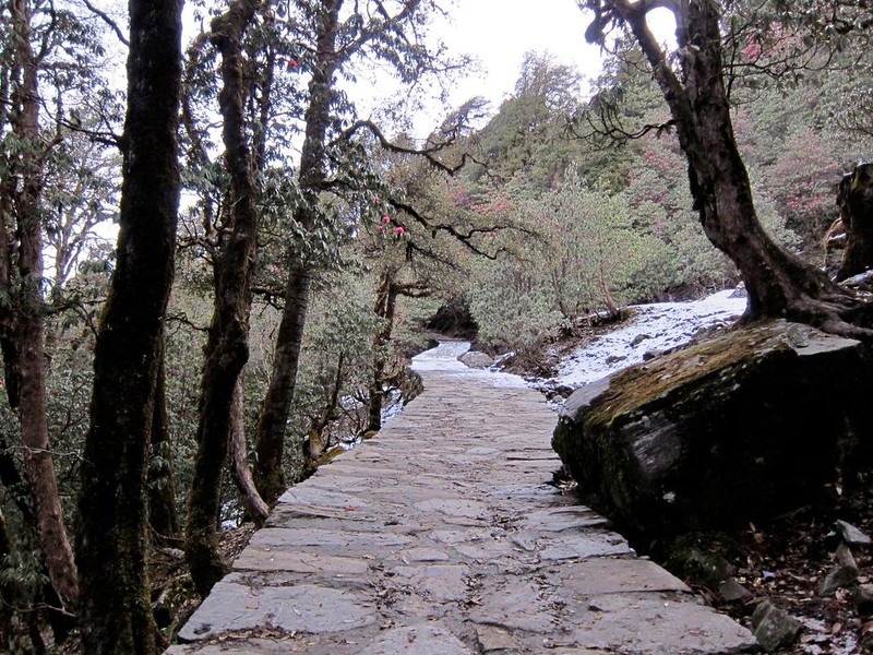
We jumped back on the trail, which we could see meandering ahead of us for miles..

Everest Base Camp Trek, Nepal
Screen Shot 2014-12-11 at 12.12.50 PM

As we hiked along the ridge of the mountain just past the lookout, we passed a middle-aged woman who had fallen behind her group that had passed us a while back. We offered a cheery “hello” as we passed and didn’t think much of it when she didn’t respond with more than a small grunt. She was clearly tired and obviously trying to conserve everything she had.

We quickly pulled ahead and crossed over a large dry, rocky field. Without thinking why, I glanced back to check on the woman’s progress, and was terrified to see her sitting down far back down the trail, nearly where we had left her, with her hands up in the air in a large “V”. Assuming she needed help, Scott and I jogged ahead to find her group’s leader, figuring that going back for her would make less sense than going forward to find someone who had medication or who could help her go back down to Namche, if needed (altitude sickness can often be cured simply by descending a few hundred meters for a day or two, and we found that the pace of many guided groups can be faster than some hikers may need – causing some to push a little too hard and get sick).

Scott and I frantically split up and began asking people along the trail if they knew the woman matching her description. No one did, but I soon passed a big group who was going back in her direction, and I asked them to please check on her while I continued to look for her group. I knew they would run into her after a few minutes and be able to help her back down the hill, if she needed it.

After the initial flurry had subsided, I finally realized that I was now in a predicament of my own: I had lost sight of Scott and had no way to contact him if I was unable to find him.

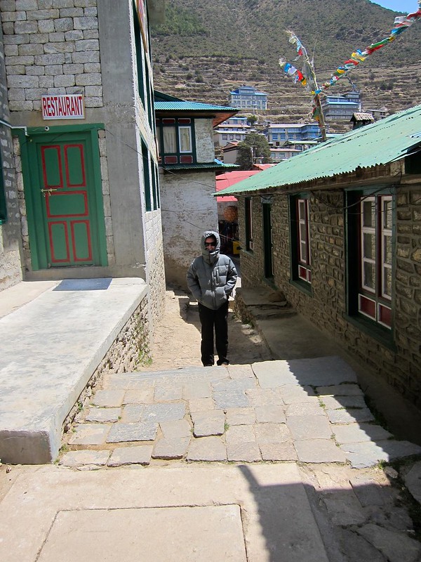
I ran ahead and came across a lodge that appeared to serve as a lookout and restaurant for hikers, where there were several groups gathered. Figuring Scott had gone inside to look for the group, I poked my head inside but didn’t see him. I ran back outside, somewhat frantically at this point, and ran ahead down the trail, thinking perhaps Scott had run ahead looking for the woman’s group. I ran for a few hundred feet and then climbed up onto a rocky outcrop, where I began yelling, “Scott! Scott!!!”

Knowing he wouldn’t have gone too far ahead, I again ran back in the direction of the lodge again and simply waited, hoping he wouldn’t think that I had run ahead down the trail. After what seemed like forever, Scott finally appeared on the steps of the lodge, where he had been inside talking to the various groups (the place was huge, and apparently, I just hadn’t seen him the first time). I ran to him and started crying. “Don’t ever do that to me again! I thought I had lost you,” I sobbed, realizing my emotions had gotten the best of me.  …Of course, I knew he hadn’t done anything wrong… I’d simply begun spinning ideas in my head of Scott moving ahead to the next village while I went looking for him in the other direction, for example), and we would have had no way to contact each other. We had one cell phone between us, and hadn’t made an emergency meeting point, since we had always planned to stay together. Thereafter, we made sure we always had a plan….

We never found the woman’s group at the lodge, so we felt like we could do more good by continuing on down the trail to look for them (in the direction we were going anyway), while the other hikers I had spoken to would have run into her in a matter of minutes.

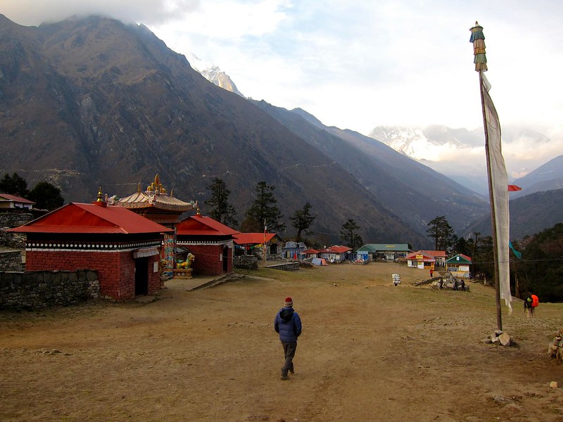
So we continued to the village of Khumjung, halfway between Namche and Tengboche. We reached Khumjung and asked around, but never found the woman’s group. It seemed we had done what we could, so we pressed on toward Tengboche.

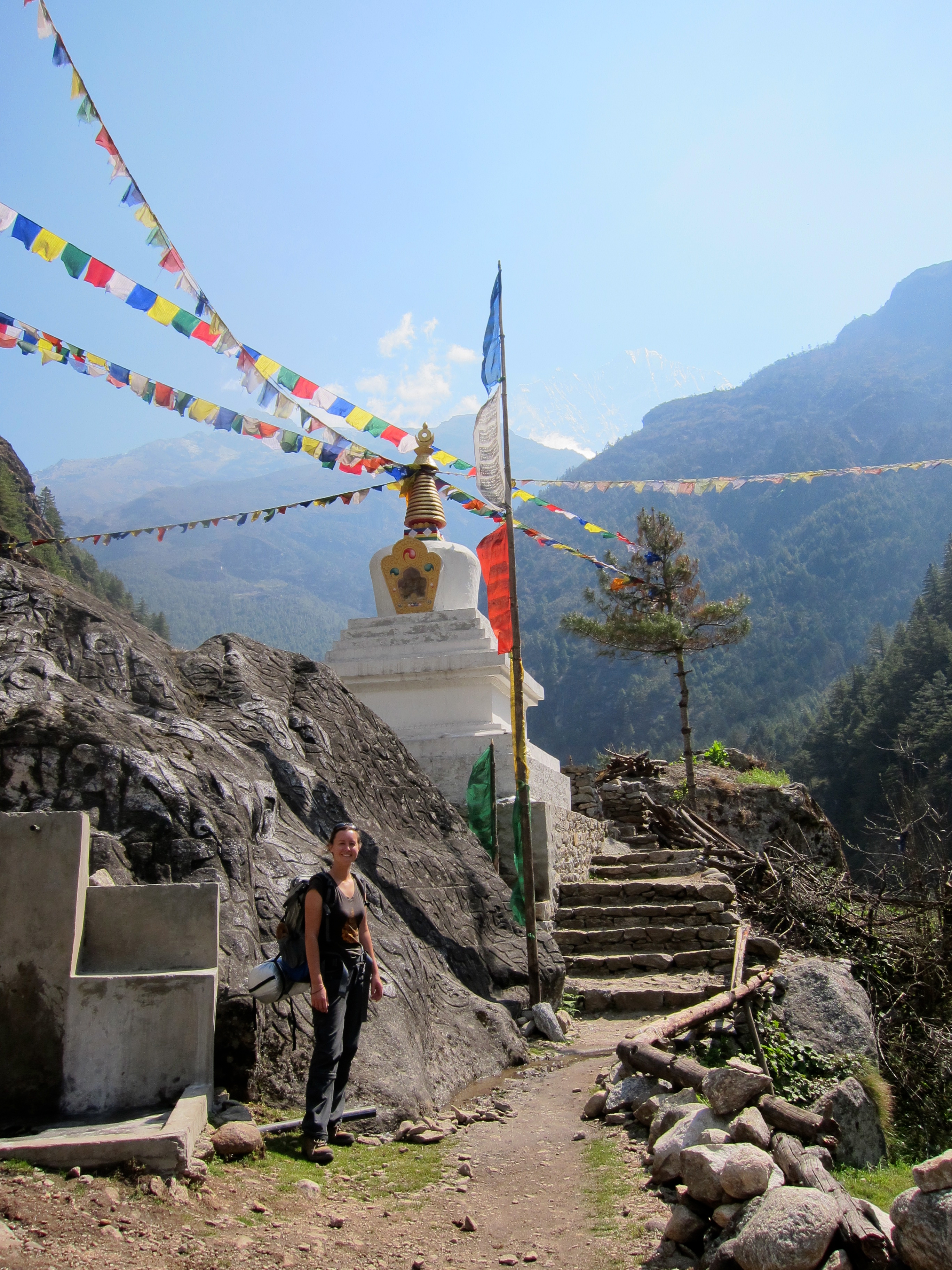
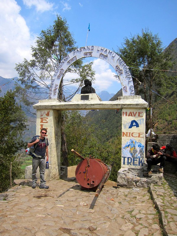
(Sign reads: “Way to Everest B.C., Tengboche”. Ama Dablam in the background!)
Everest Base Camp Trek, Nepal

Everest Base Camp Trek, Nepal

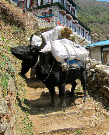
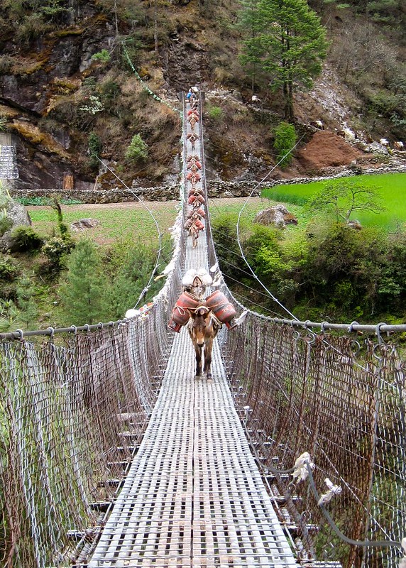
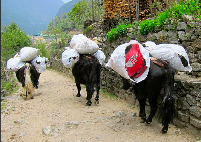
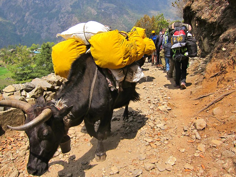
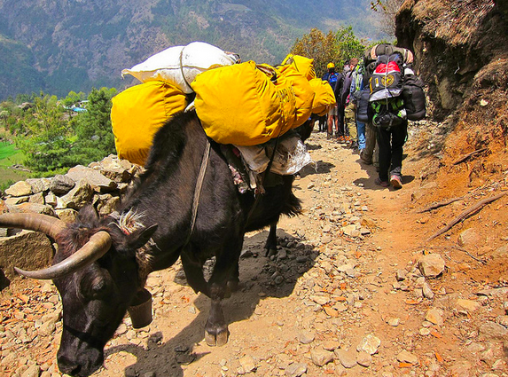
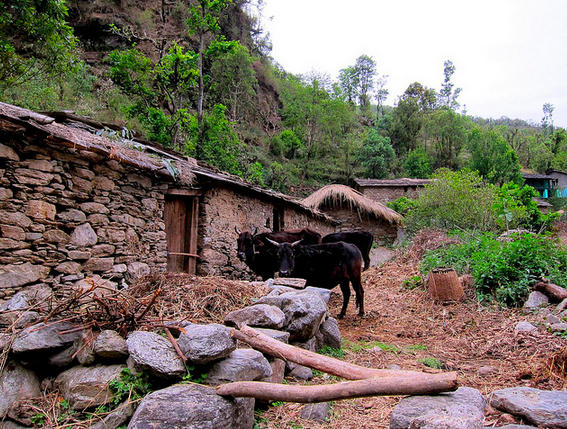
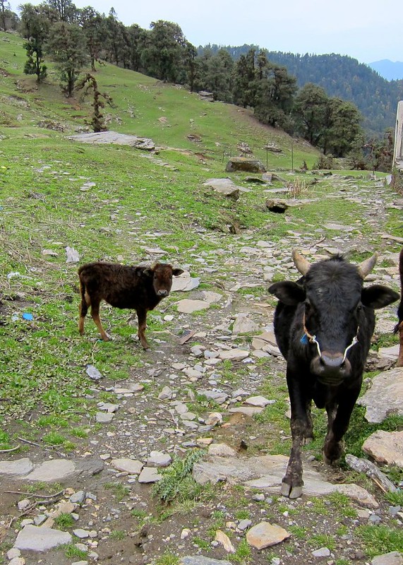
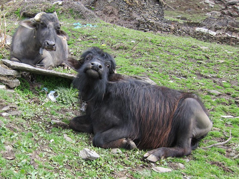
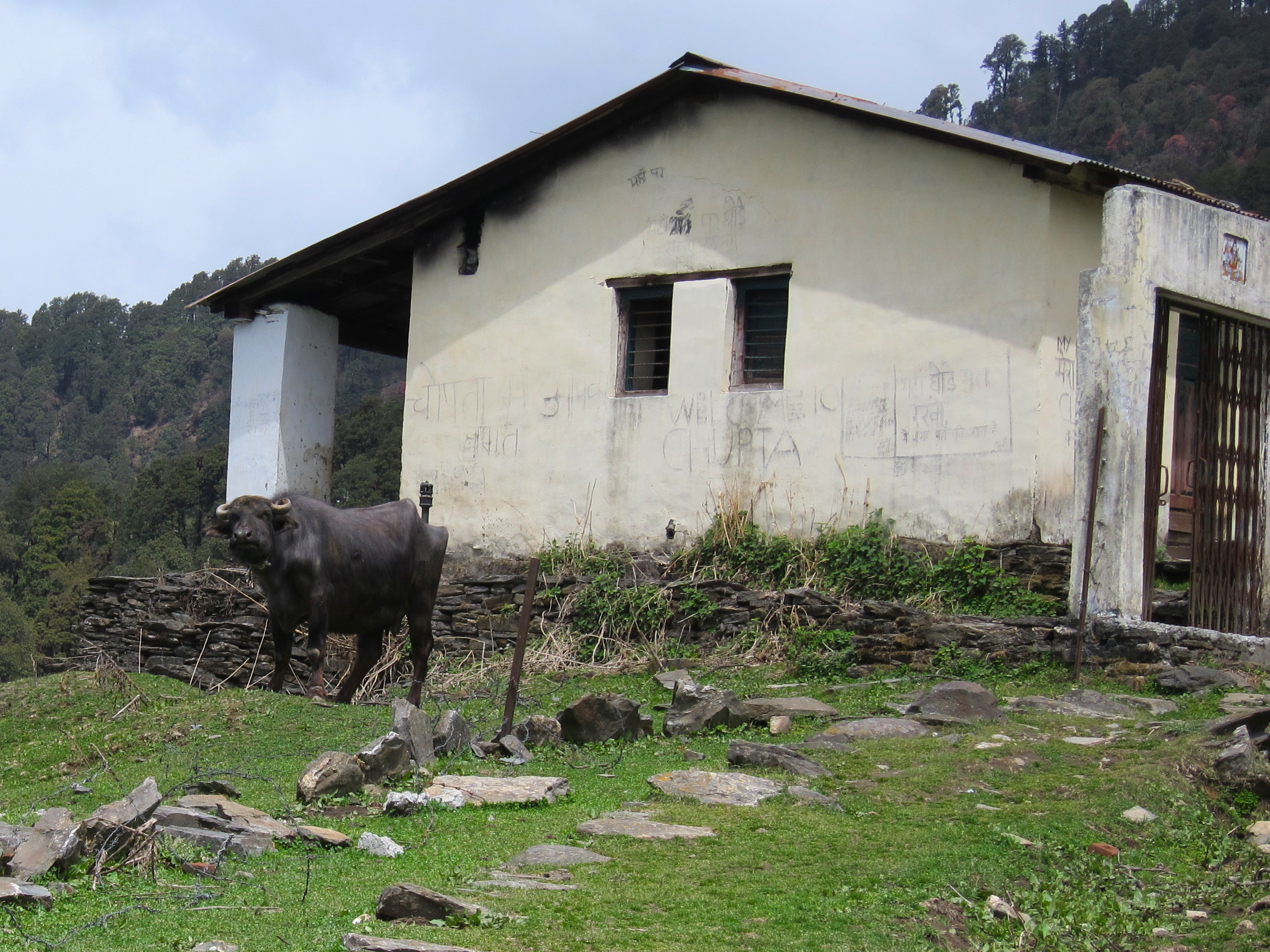
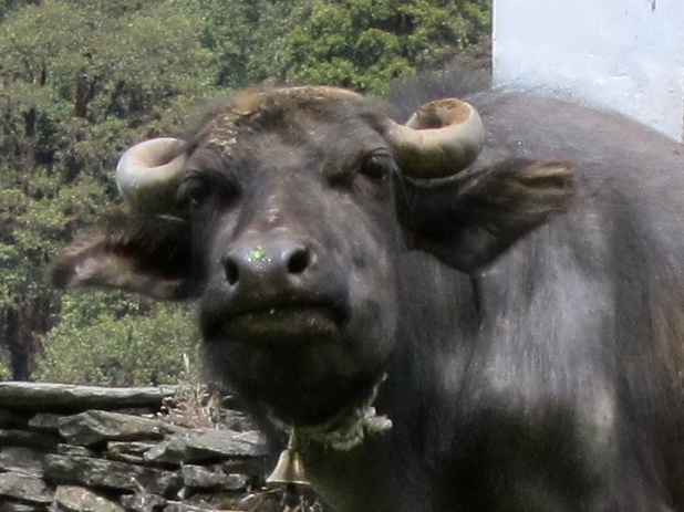
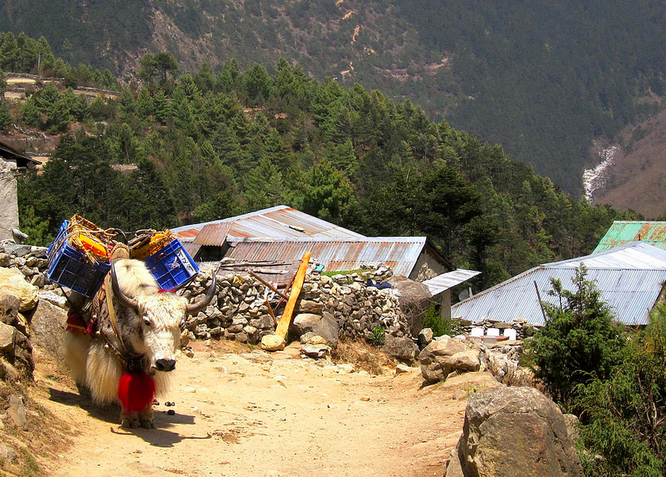
We passed many more yaks, each one more adorable than the last– not merely due to our growing fondess but largely owing to the fact that these were a different breed of cold-weather yaks from Tibet, and their keepers let them grow out their beautiful fluffy fur coats!

Everest Base Camp Trek, Nepal
Screen Shot 2014-12-13 at 9.25.13 AM

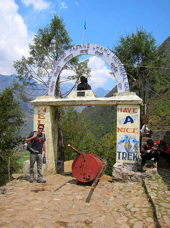
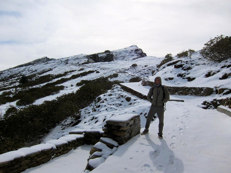
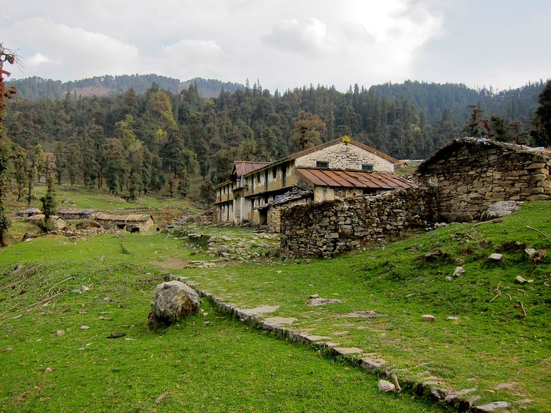
Eventually, we reached the last village before the uphill climb to Tengboche. This restaurant’s sign smartly read: “This is last stop. Thyangboche 2 more hours climbing. Ok see you.”

Everest Base Camp Trek, Nepal

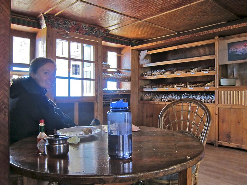
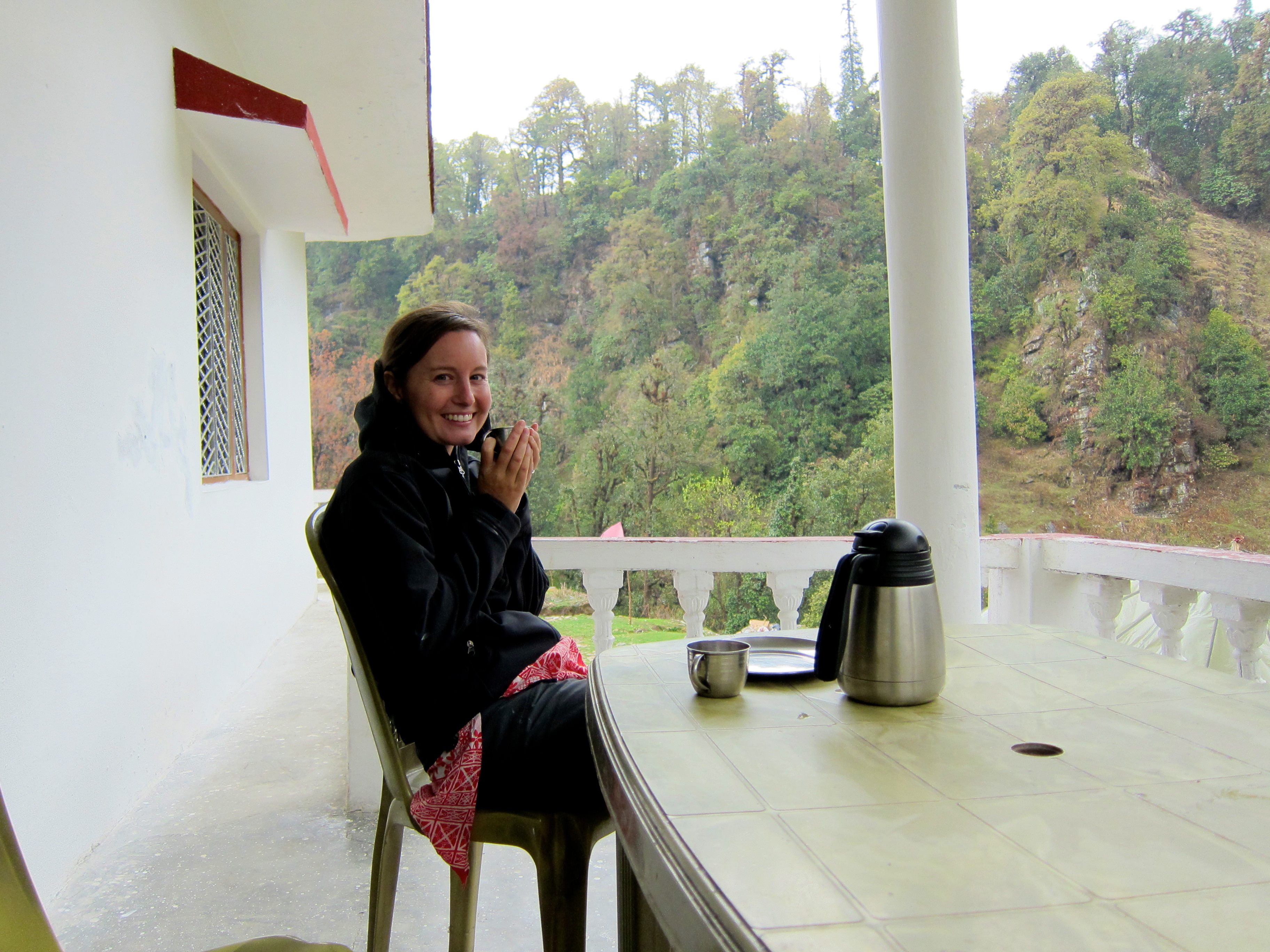
We stopped for a rest and a bowl of soup, and pulled off our boots and just sat in tired silence. I probably would have talked myself into staying at this lodge if the caretaker hadn’t been a bit too pushy with us, but thankfully that encouraged us to press on!

Across from our table were 2 men in their early 40’s who we had been passing back-and-forth on the trail for several days. We had all exited Lukla airport together and started on the trail at the same time. They looked a lot more tired and worn than we did, and we later learned that they ended up sleeping in the lodge for the night and that one of them unfortunately never made it all the way to EBC.

We laced up our boots and hit the trail again… after the yaks cleared the suspension bridge!

Everest Base Camp Trek, Nepal

Everest Base Camp Trek, Nepal

Everest Base Camp Trek, Nepal

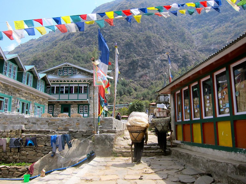
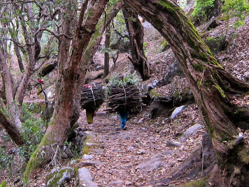
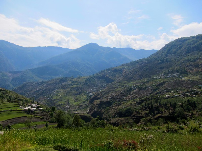
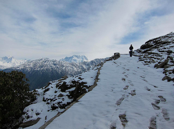
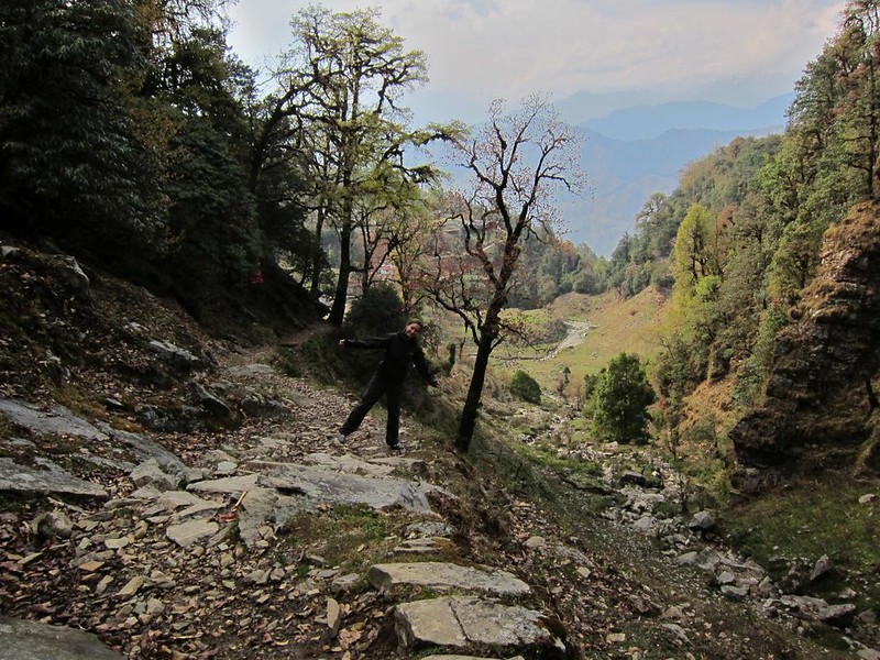
As usual, the trail was tougher than we expected– 2.5 hours of switchbacks along the side of a barren mountain– but we had nice company along the way, and a beautiful clear sunny day with incredible visibility. Near the bottom of the mountain, we met a Nepali woman who was returning to Tengboche after buying supplies in Namche. Her English was perfect, and she seemed well-educated. She told us that she ran a lodge in Tengboche that was open for only 6 months of the year, during the hiking season (like most of the lodges in the higher altitudes of the trail). In fact, she pointed out that no one lives any higher than Tengboche during the winter season and that everyone moves their families down to lower elevations to ride out the cold in the off-season. During hiking season, she said, she makes the day-long trek from Namche to Tengboche nearly twice a week– and to think I was worried I wouldn’t be able to do it once! Despite being many years our senior, she plowed on ahead of us after a little while, while I struggled to bring up the rear.

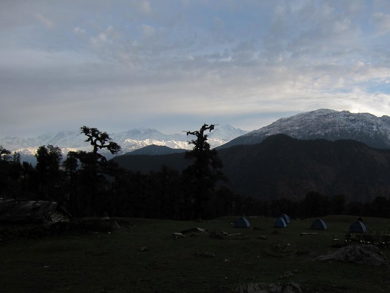
Right as the sun was starring to set, we finally tumbled into Tengboche.

Everest Base Camp Trek, Nepal
Screen Shot 2014-12-13 at 9.26.20 AM Screen Shot 2014-12-13 at 9.26.31 AM

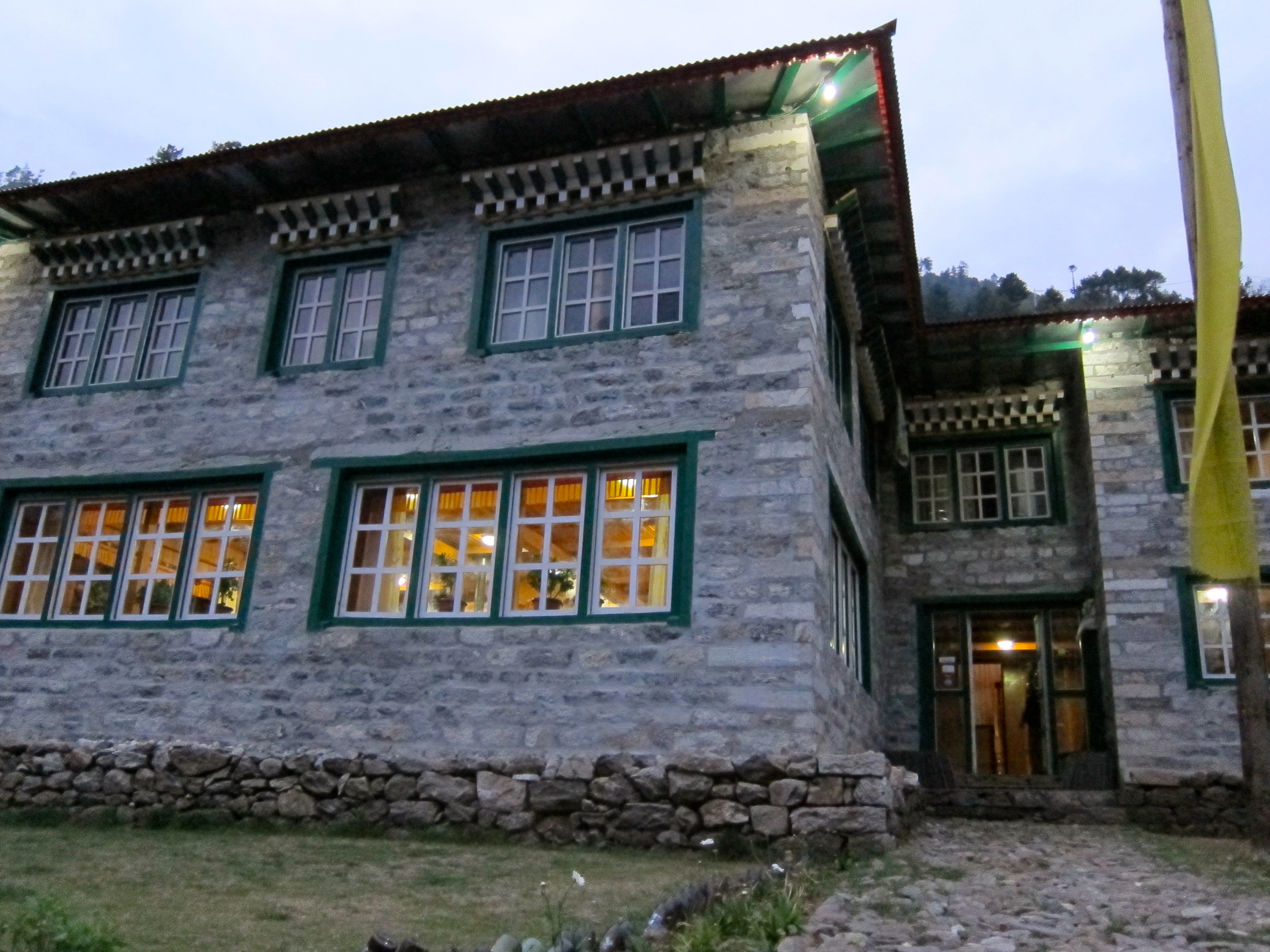
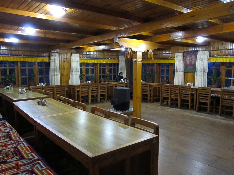
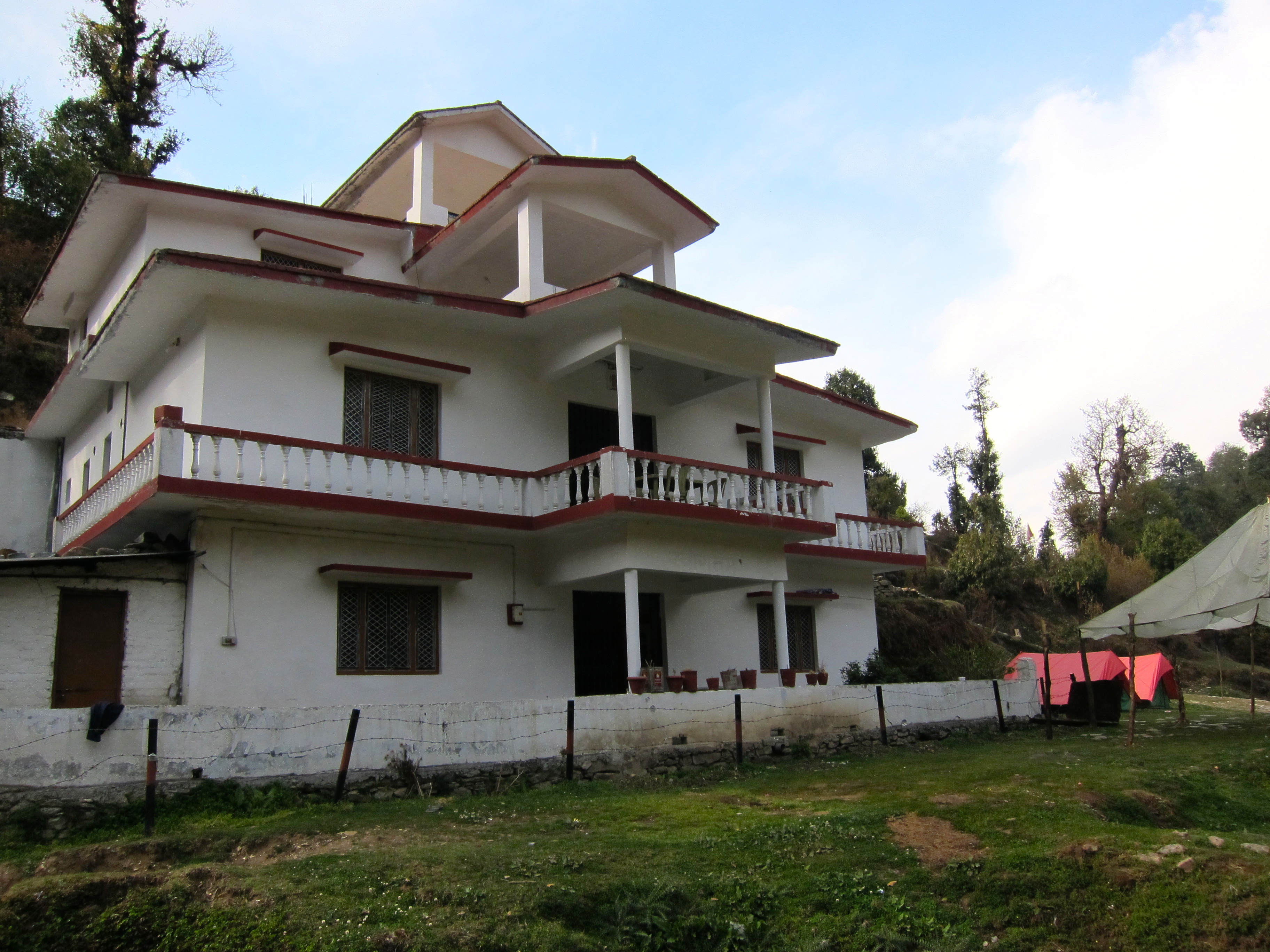
We entered the first cozy-looking lodge and found a ruckus of activity in the dining area. There were at least 3 large groups all packed around the stoves and tables, drinking and chatting loudly. We worriedly asked the caretaker if there were any rooms– there was one (1!) left.

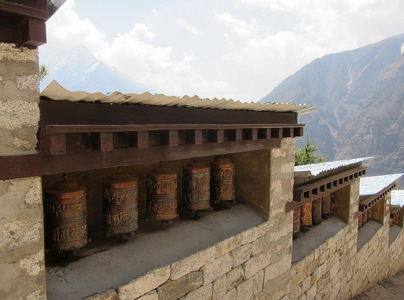
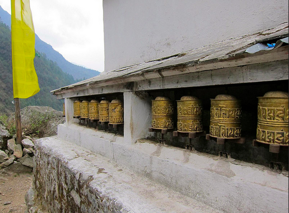
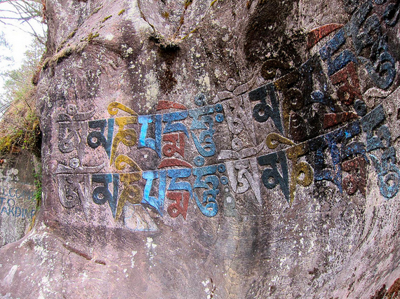
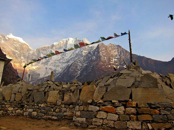
Most of the rooms had great views of Everest, but ours looked the other direction. Still, the view of the prayer flags and carved stones set against the inhospitable craggy peaks in the near distance was beautiful and serene, and gave us a fun, nervous feeling that the trek was becoming a little more serious.

Everest Base Camp Trek, Nepal

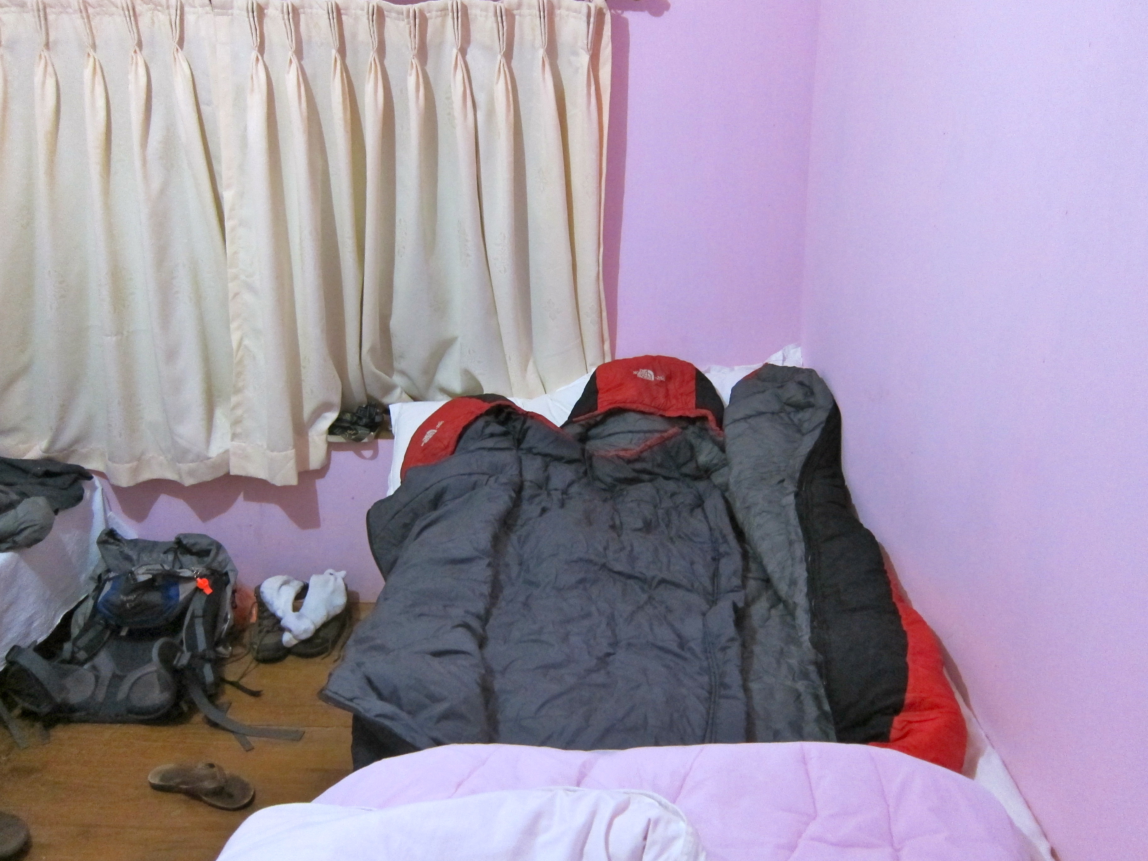
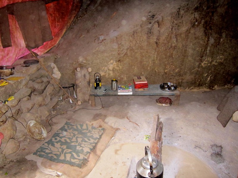
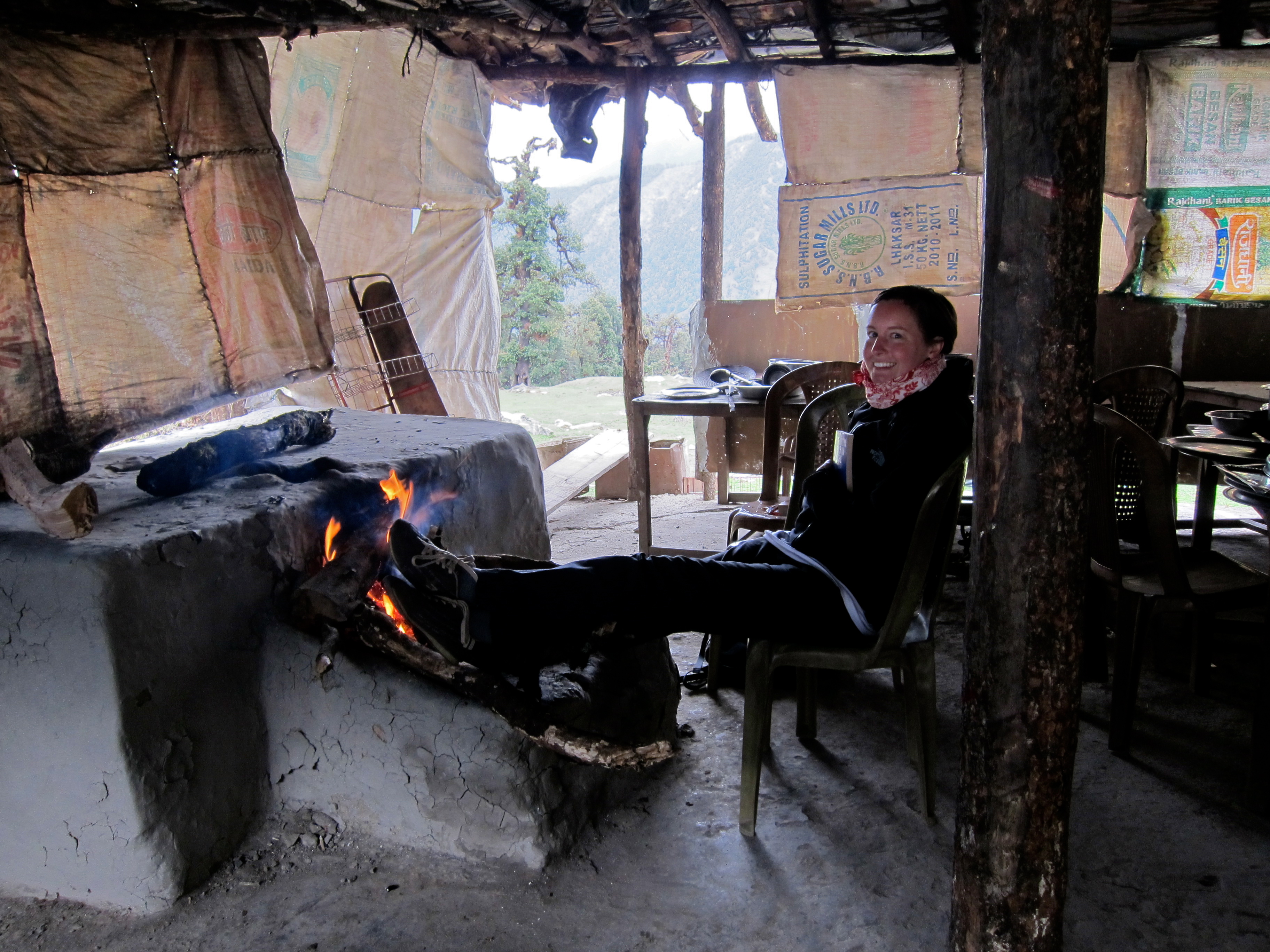
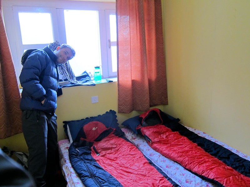
The comfort level of our accommodations had lowered a little with each stop, which made it fun in a camping/roughing-it sort of way, but also made us miss the coziness we had enjoyed days earlier. Our room was right next to the bathroom too – which smelled terribly for various reasons I will not disclose. (I had to brush my teeth while standing out in the hallway….)

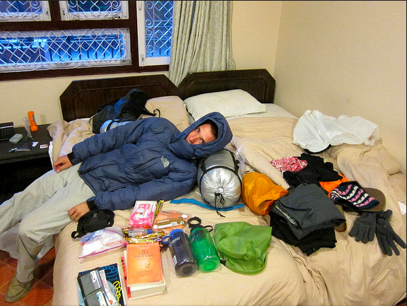
The cold in the air was more evident in Tengboche than it had been anywhere on the trail so far. Our little room had no heat of course, so in usual fashion, we pushed our beds together and got our sleeping bags ready for maximal warmth.

Everest Base Camp Trek, Nepal

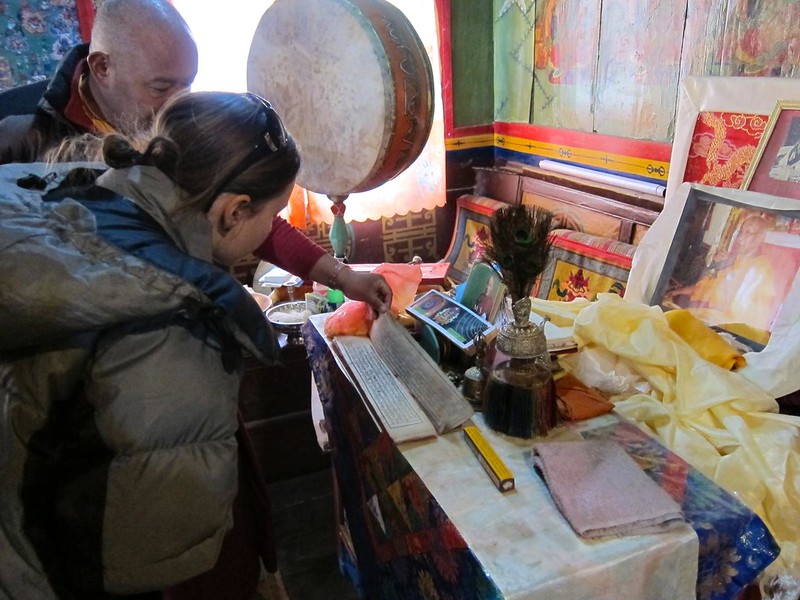
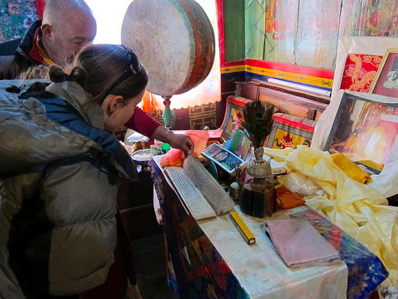
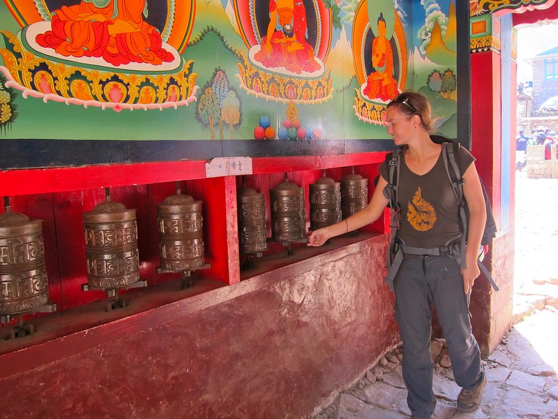
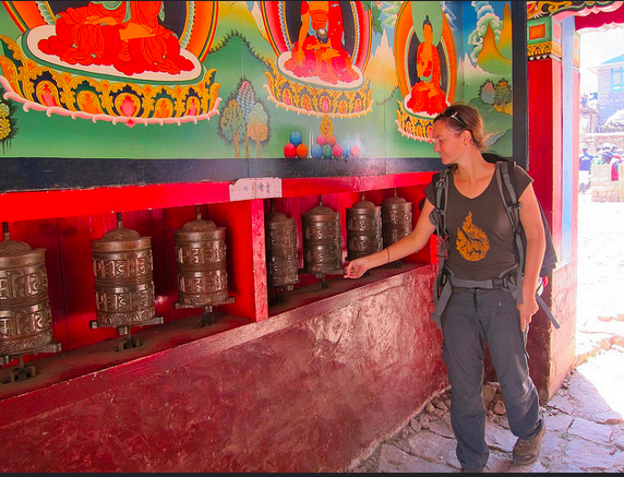
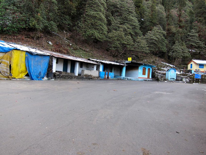
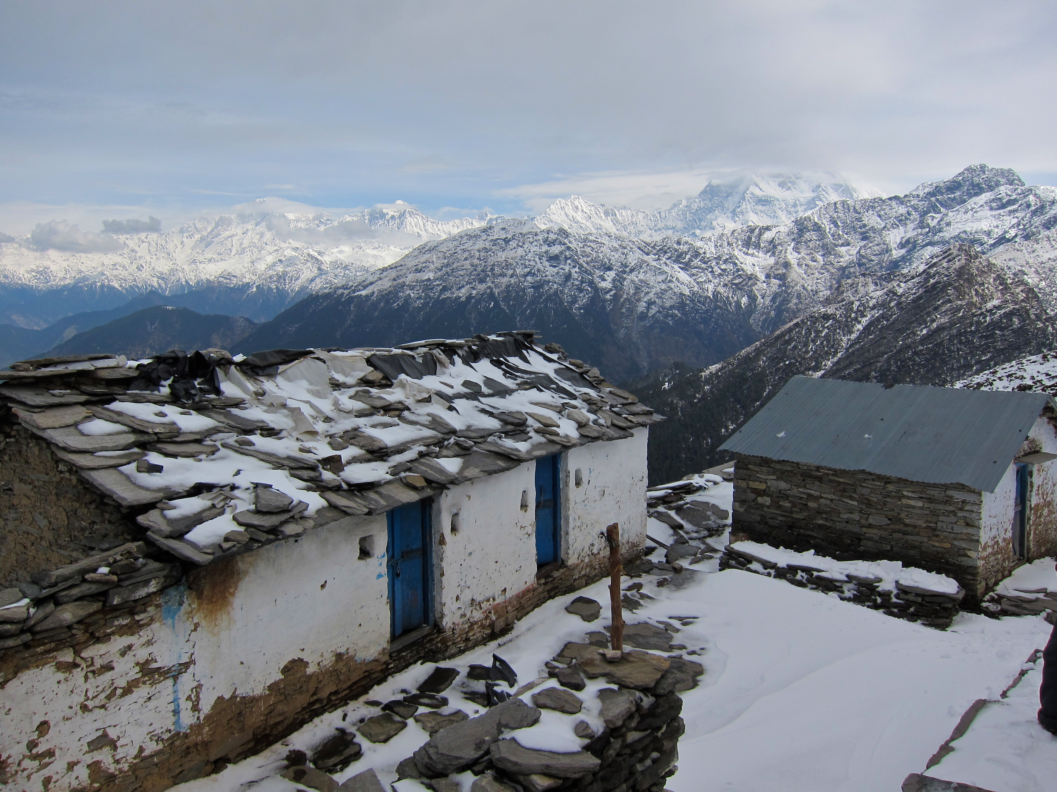
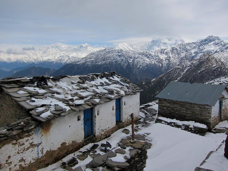
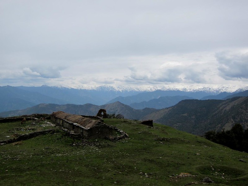
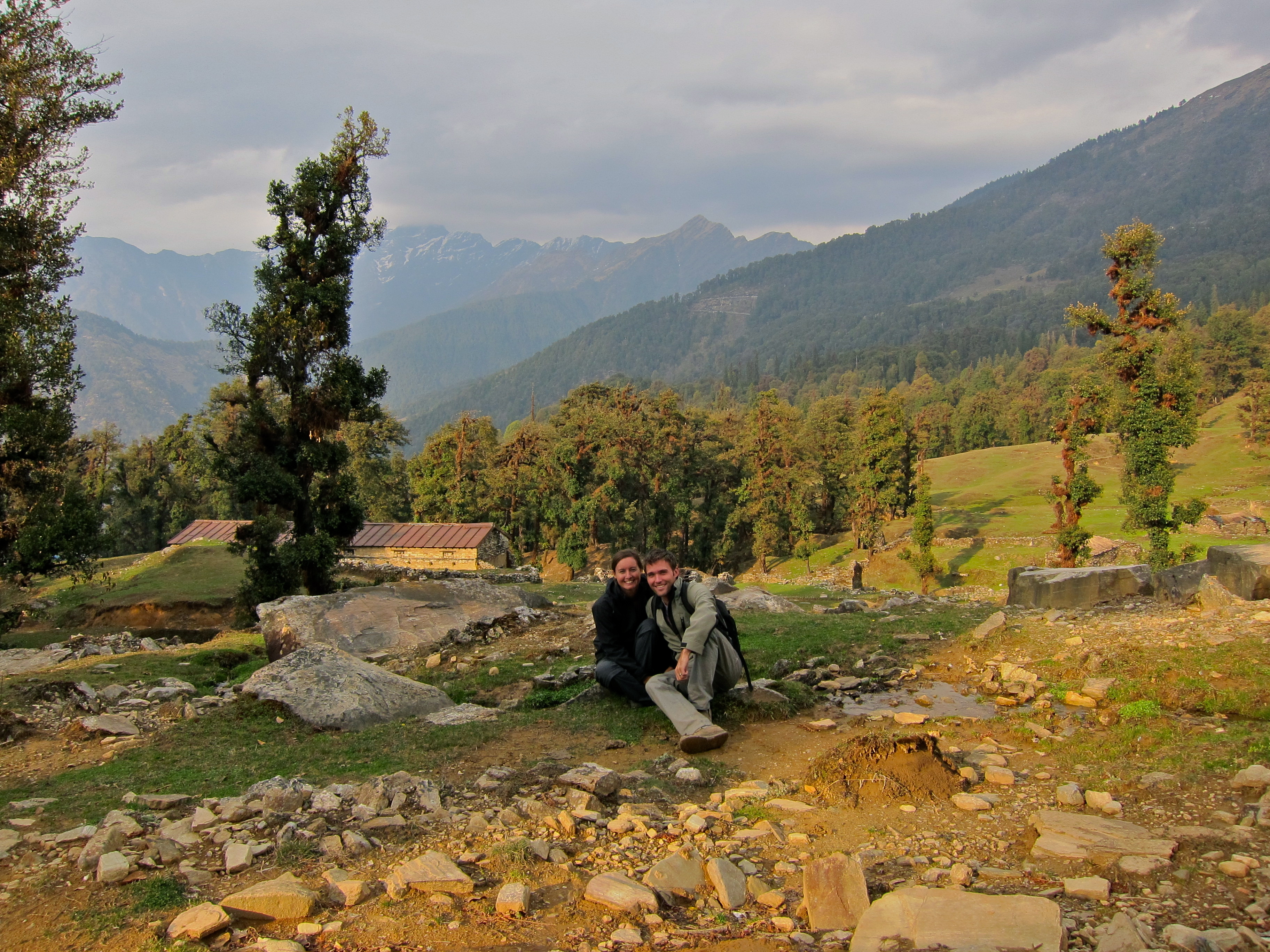
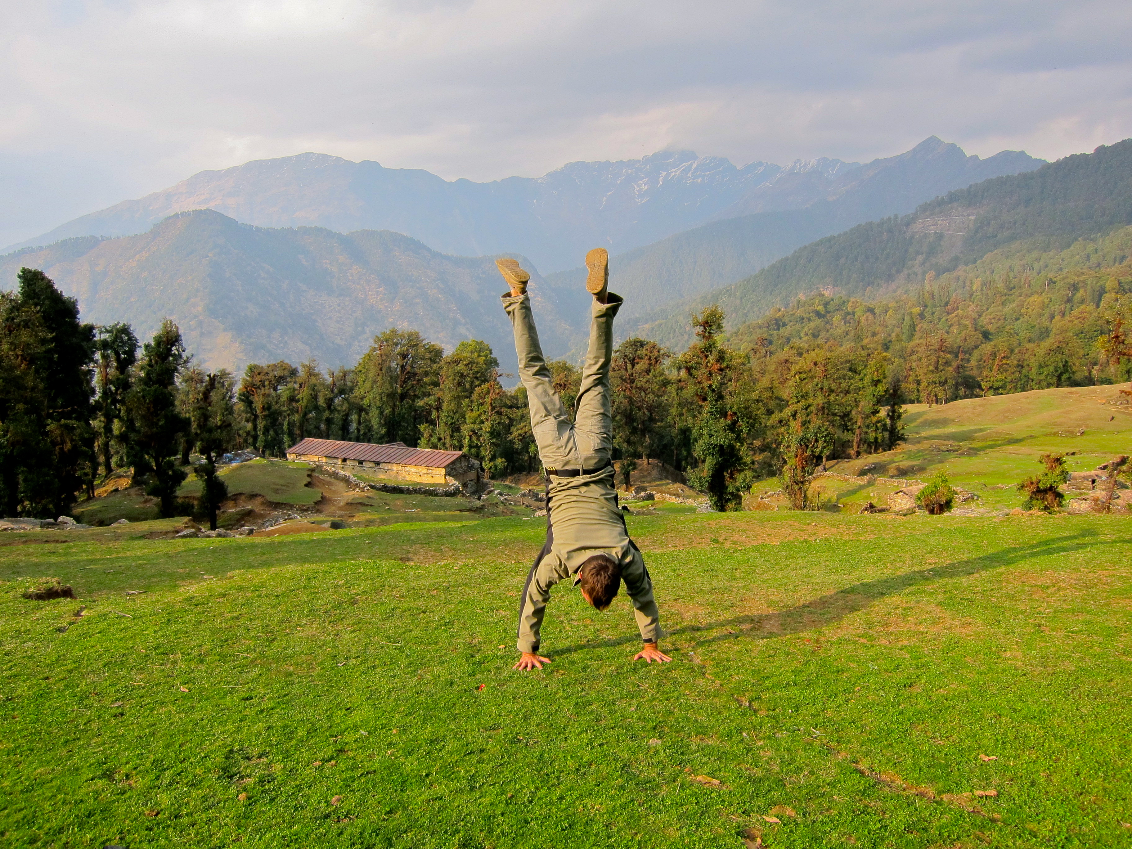
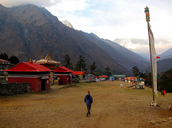
With our room ready for the night, we went back outside to explore the tiny town. Tengboche was nothing more than approximately 3 small lodges, a bakery, and a monastery, set upon a beautiful clearing. The town was surrounded by massive, beautiful, cold mountains with views of Everest in the distance.

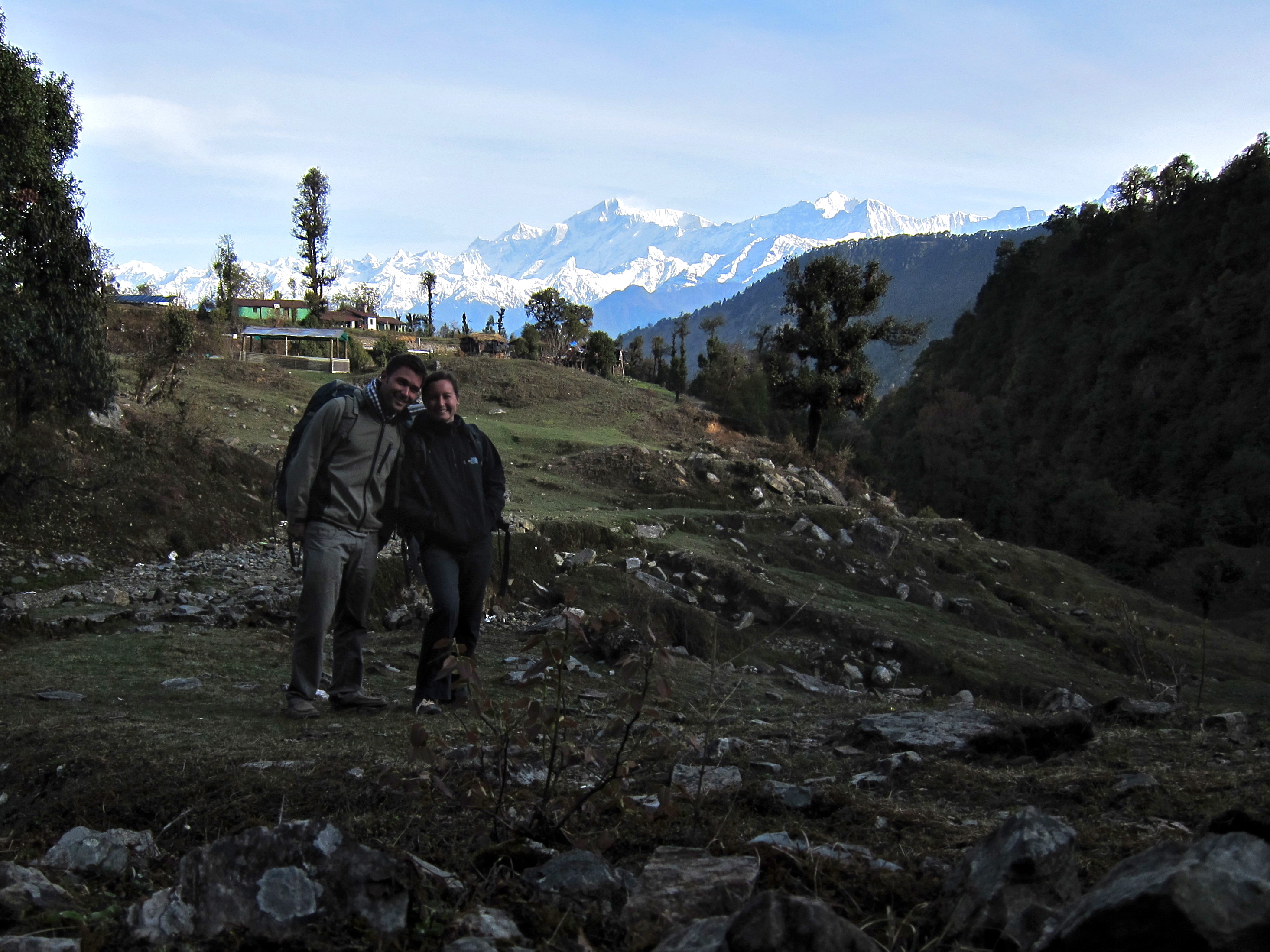
[The bakery is in the back with the green roof. Monastery is on the left. Everest in the distance (obscured by a cloud). Scott, front and center. :)]
Everest Base Camp Trek, Nepal
Screen Shot 2014-12-13 at 9.28.29 AM

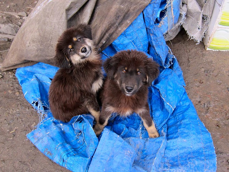
Sweet puppy that we found near the Nepali woman’s lodge who we had spoken to on the hike.

Everest Base Camp Trek, Nepal

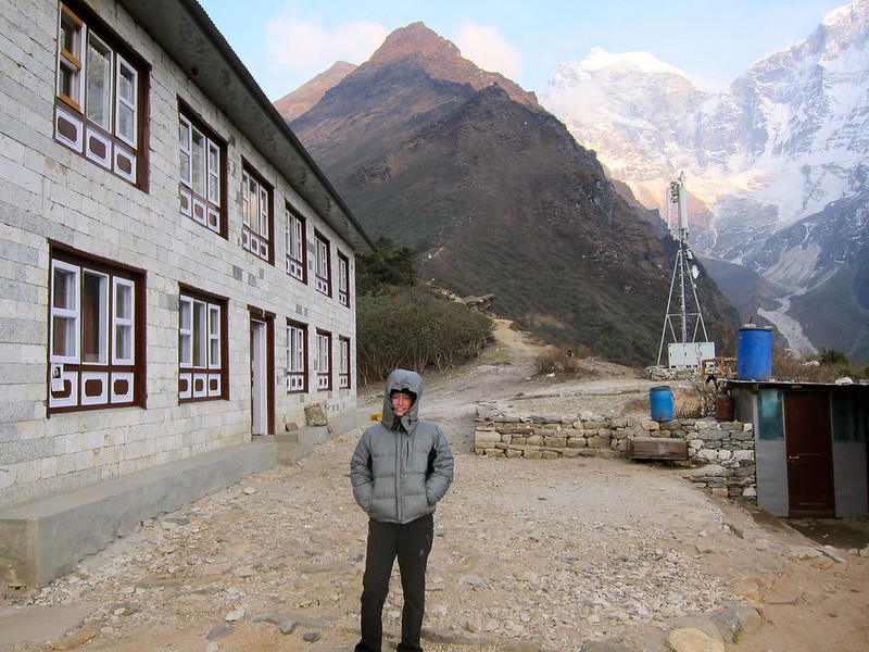
Me freezing in Tengboche:
Everest Base Camp Trek, Nepal
(Our lodge is on the left.)

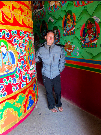
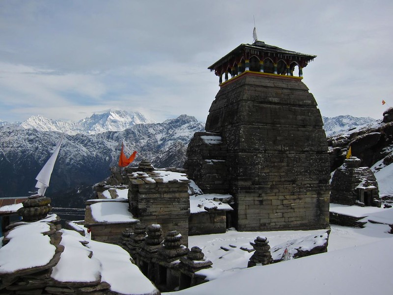
The Tengoboche stupa:
Everest Base Camp Trek, Nepal

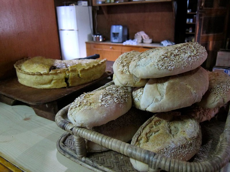
We stopped into the bakery to warm up and take in some warm, homemade apple pie and hot Nepali milk tea….
Everest Base Camp Trek, Nepal

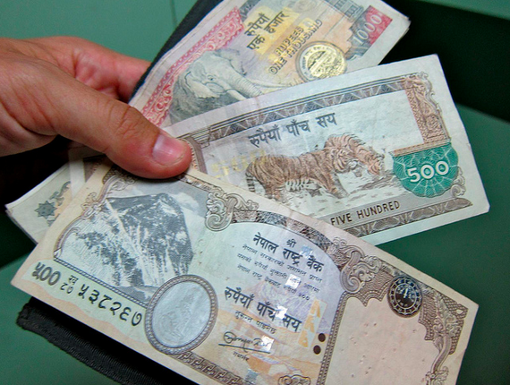
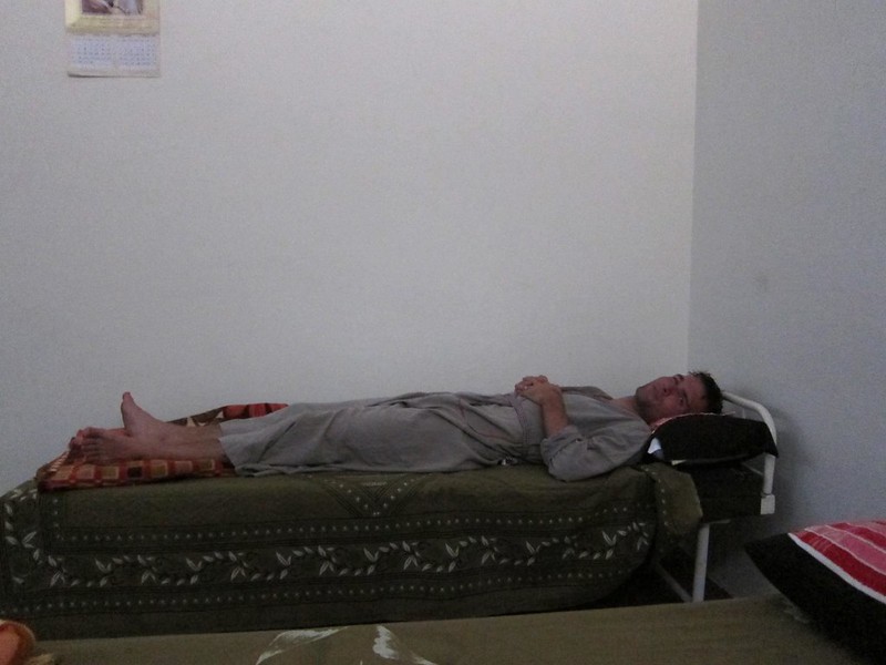
…and then crawled into bed. It was far too cold to think about taking a shower, and the prices for a shower were increasing (only about 200 rupees, or $4, which is admittedly very little, but we were working off of a fixed pile of on the trail cash and didn’t know how much we’d need towards the top), so we went to sleep dirty and still in our hiking clothes, ready to go up again the next day!


Advertisement

EBC Trek, Day 3: Rest day in Namche Bazaar

Total mileage on Day 3: 0
Beginning altitude (Namche Bazaar): 11,286 ft
Final altitude (Namche Bazaar): 11,286 ft

—————————————————————–

Today, we awoke early (a side-effect of going to bed at 8:00 pm to escape the cold in our room, I guess), but we didn’t manage to pull ourselves out of our beds for at least another hour. My nose, which was the only part of my body outside of the sleeping bag, was cold to the touch, and the air in the room was freezing. Last night, Scott and I had the idea to pile all of our clothes that we were going to wear the next day on top of our sleeping bags, not only for extra warmth during the night, but also so that we could pull our freezing clothes into the sleeping bag with us in the morning and warm them up before putting them on. After we couldn’t wait any longer, we courageously grabbed our clothes, stuffed them into the sleeping bag for a few minutes (holy goosebumps!!), and got dressed inside of our bags.

After getting dressed, we tiptoed down the dorm hallway to the shared bathroom and turned on the trickle of freezing water from the sink. The water was too cold to splash on my face or even my whole hands, so I merely resorted to rubbing some soapy water between my fingertips and rubbing them onto my nose and forehead for my “shower”. A real shower would have to wait until midday, when it was warmer.

Although our hike to Everest was scheduled to take 10 days, several of those days are scheduled to be “rest” days– not to fight off the inevitable fatigue and exhaustion that builds over the course of the hike, but to acclimatize slowly to the lack of oxygen in the air. Each day, we knew not to climb more than 300 net meters in altitude in a single day and to build in a rest day every third day.  Therefore, all hikers (even experienced ones) use Namche Bazaar as their first rest day on the EBC trail. So we headed out the door and found that the town of Namche Bazaar was surprisingly quiet (save for the occasional yeti or yak…).

Namche Bazar

Namche Bazar
Screen Shot 2014-12-13 at 9.16.57 AM

We set out in search of some Nepalese breakfast and thankfully found some deliciously piping hot noodle soup at a woman’s shop down the street (we had developed a small obsession for hot noodle soups for breakfast in Thailand and Cambodia and were thrilled to find that the Nepalese also adhered to this amazing concept!!). We ordered two different types of hot soups: one, a traditional Tibetan “thukpa” soup with wide noodles and vegetables in clear broth, and the other, a Nepalese ramen-style noodle soup out of a package. With the 30-degree temps barely creeping up outside (and no indoor heating….), both soups were hot, delicious, and very welcome.

Namche Bazar

After breakfast, we decided to explore the outskirts of Namche Bazaar. Up a small hill on the edge of town, we found some gargantuan mani wheels that rang each time they completed a circuit. Beautiful old murals and paintings on a canvas-like material adorned the walls around each of the wheels.

Namche Bazar
Screen Shot 2014-12-13 at 9.17.07 AM

Smaller tin mani wheels lined the many paths leading to Namche.

Namche Bazar

We knew we were going to need a lot of help if we were going to make it to Everest, so the wheels did a lot of ringing that day…

http://www.flickr.com/photos/scottjehl/8206515340/in/photostream
Screen Shot 2014-12-13 at 9.19.06 AM

Eventually, we reached the edge of town, where the town quite literally fell off the map: an enormous cliff dropping to the valley below separated Namche Bazarre from the Himalayas in the distance. With the high altitude and near-360-degree views, our lookout felt almost heavenly.

Namche Bazar

Screen Shot 2014-12-13 at 9.19.41 AM

On our walk back to Namche, we came across a small monastery. Outside were signs in English, inviting us to come in. We tiptoed inside and were greeted by a Nepali monk dressed in dark maroon and saffron robes. We couldn’t communicate with one another, but he beckoned for us to follow him inside the monastery, where dozens of yak butter candles lit the room.

Namche Bazar

Namche Bazar
Screen Shot 2014-12-11 at 12.12.14 PM  Screen Shot 2014-12-11 at 12.11.09 PM

Surrounded by pictures of the Dalai Lama and other monks were small shoebox-like boxes in the cubbies of the walls. We had previously learned that these were old handwritten holy scrolls that had been copied and re-copied over the years, with each chapter being kept in a separate box. Noticing our interest, the monk pulled one down off the wall and showed us the pages.

Namche Bazar
Screen Shot 2014-12-11 at 12.12.04 PM

Each line had indeed been carefully inscribed onto the delicate translucent pages in black ink.

I thanked the monk, pinched myself to make sure I wasn’t dreaming, and stepped back out into the twenty first century and on to Namche.

——-

Although we were instructed by our guidebook to do an “acclimitization hike”, where you hike higher each day than you plan to sleep that night, my feet looked like this from all the hiking in my new boots the day before:

Blisters

Oh yeah, that’s ducktape (covering some gnarly blisters)– we weren’t hiking anywhere. So we spent the afternoon reading books and chatting to fellow hikers in a small German bakery where the apple streudels and warm drinks were more abundant than the oxygen outside. Life was good. That night, we hung out at Liquid Bar again, where we toasted our last comfortable day that we would get with a large Everest beer, while watching a documentary on Everest by the filmaker David Breshears. It was nice to have a rest day– and with the difficult hike tomorrow rapidly approaching, we were going to need it.

Everest Base Camp Trek, Day 2: Phakding to Namche Bazaar


Total mileage on Day 2: 4
Beginning altitude (Phakding): 8,500 ft
Final altitude (Namche Bazaar): 11,286 ft

—————————————————————–

Today was one of those days that can only happen once in one’s lifetime: the day we got our first glimpse of Mt. Everest.

When we booked our airline tickets to Nepal over 6 weeks ago, our entire trip was planned so that we would make it to the first Everest viewpoint on this day, April 29 – my birthday. This second day of the EBC hike is infamous for being very difficult (the hike involves a “leisurely” 2.5 hour stroll at 8,500ft, followed by a grueling 4-hour near-vertical climb that ends at over 11,000 ft – with backpacks, in our case!), and we were going to have to push through whatever hurdles we might encounter to make it to the viewpoint before sundown for a birthday celebration!!

We set out from our lodge in Phakding at 8am on the morning of April 29th and bounded up the trail. We both had surprising amounts of energy to burn, and we were powering past other groups, left and right.

[…the beautiful scenery and old mani stone carvings certainly didn’t hurt in powering us along…]

Phakding to Namche Bazar

Phakding to Namche Bazar

Phakding to Namche Bazar

Phakding to Namche Bazar
Screen Shot 2014-12-13 at 9.02.11 AM Screen Shot 2014-12-13 at 9.02.18 AM

[Buddhist prayer flags near Jorsale.]
Phakding to Namche Bazar
IMG_2224 2

After a few minutes, we were so hot from bounding over boulders that Scott decided to change into his lighter-weight pants behind a large rock, while I awkwardly stood guard. From behind the rock, Scott waved to our Zimbabwean friends that we had met the day before, and eventually we were on our way again. (Thirty minutes later down the trail, it was my turn!)

Feeling much lighter in our new garb, we were able to pick up our pace again and make excellent time to the Sagarmatha National Park entrance, near the village of Jorsale.

Phakding to Namche Bazar

[Spinning Tibetan Buddhist prayer wheels; praying for safe travels to EBC.]
Phakding to Namche Bazar
Screen Shot 2014-12-13 at 9.09.36 AM

At the entrance, we had our passes stamped again, and began to descend a long a series of steps. Although I normally prefer going downhill over uphill, this trail was quickly teaching me to abhor “down” nearly as much, as we were discovering that the EBC trail is far from being a steady uphill climb. Rather, by the time you reach EBC (at almost 10,000ft higher elevation than Phakding), you’ve probably climbed closer to 30,000 feet worth of “ups”. (To be honest, I was glad we didn’t know this before setting out on the trek.)

In addition to the ups and downs, the trail cut back and forth between different sides of the valley, connected by tall steel suspension bridges.

Phakding to Namche Bazar

Between Phakding and Jorsale, we crossed at least 4 suspension bridges, which spanned several hundred feet above the river in places. The bridges were surprisingly well-maintained and felt safe, even with 10 fully-loaded donkeys (carrying gas tanks) coming at us!

Everest Base Camp Trek, Nepal

With a long-held fear of heights, Scott was not a huge fan of the bridges, particularly those that let you see straight through to the rivers below…

Screen Shot 2014-12-13 at 9.07.44 AM

After stopping for a lunch of veggie momos (Nepalese fried dumplings) and milk tea, we passed over another suspension bridge that brought us to a fork in the trail.

Phakding to Namche Bazar

One direction was clearly meant to be the main trail, but the porters all seemed to be taking a smaller path to the side that looked like a shortcut. We thought about following the porters, but we reasoned that they were probably taking a longer, flatter side-trail to better handle their heavy loads and that we should stick to the main trail. Additionally, our host at the lodge last night said that our first glimpse of Everest could be had soon after leaving Jorsale, and we were reluctant to miss out on the possibility of a viewpoint by taking a shortcut.

We started into the insane set of crumbling stone steps that lay ahead of us, while other trekkers hit the flat side-trail to our left. Ha! We’d show them when we’d see Everest first!

Needless to say….. our decision was a huge mistake. The portion of trail we took was abnormally difficult and grueling: up for 100 feet, down for 100 feet; then repeat. With the prospect of seeing Everest keeping our spirits up, we dragged ourselves along the trail, looking in every direction for a tall mountain (problem was, they were everywhere). After 45 minutes of stumbling along, we met up with another trail– the same side-trail that we had elected not to follow. Although this time we had a perfect view of the shortcut along the side of the mountain (the one that we had just climbed up and over). The sidetrail was a perfectly flat, curving 10-minute shortcut that offered beautiful views of the river below. Happy trekkers that we had passed eating lunch an hour ago were now flying by us. Adding insult to injury, we hadn’t even seen Everest by going the other way.

We crossed one final bridge and, looking up at the steeps ahead, we could tell we’d just finished the “leisurely” part of the day. Now, we were faced with the real start to the uphill climb to Namche Bazaar, the “capitol” of the Khumbu region and (relatively) large trading post for people in the region. Namche is also home to the first official viewing spot of Mt. Everest along the trek…therefore, we’d need to make it there before sundown if we were going to make it in time for the b-day viewing.

We began the 4-hour uphill climb at a decent clip, even following the porters up steep, tricky shortcuts to get around slow hikers. However, it wasn’t long before I found myself running out of steam. The climb we had just needlessly opted-into had sapped my last energy reserves for the day. We decided to split one of the Snickers bars from our small stockpile (which we had been trying to conserve) before continuing up the trail.

Even with a little sugar boost, we were stopping every 3-4 minutes to rest. The air had already become noticeably thinner, and my legs would become exhausted after only a few stairs. Scott graciously volunteered to carry my sleeping bag for me, so we tied it onto his pack and continued to climb for a couple of more hours by taking a few steps, stopping to rest, and taking a few more.

[My porter…]
Phakding to Namche Bazar
Screen Shot 2014-12-13 at 9.09.50 AM

A few hours along, we stopped a young guy coming down the trail from Namche and asked him how much longer we had until we reached the town. “I just made it downhill from there to here in 10 minutes, so you can probably do it uphill in 20. You’re almost there!” Whether or not he was lying to cheer us up, we took his encouragement to heart and twenty minutes later, sure enough found ourselves stumbling into Namche Bazaar– or what we thought was Namche Bazaar– and had our passes stamped.  When I saw the map saying “You Are Here”, I nearly cried in relief.

Phakding to Namche Bazar

A few seconds later, I wanted to cry when I realized that the Namche outpost was still a long set of steps away from the village itself.

[Doh!]
Phakding to Namche Bazar

We began taking the final steps toward Namche one at a time and eventually made it to the edge of town. Suddenly, I started to feel dizzy from the altitude and had to sit down to rest. Being located at over 11,000 feet, Namche is often the first village along the trail where trekkers begin to experience altitude sickness, so we were purposely being overly cautiously. While I rested, Scott bought a Coke for me and then decided that he should carry not only my sleeping bag (which he already had) but my entire backpack, as well!

[Sherpa Scott]
Scott Sherpa

Because I was ALSO getting blisters at this point, we decided I should change into my flipflops for the remainder of the walk to find a hotel. So I strolled into Namche Bazaar with no backpack, wearing flip flops, with a cold Coke in my hand.

Birthday in Namche

One trekker came up to me and asked “Whoa, did you hike the whole way in those??” motioning to my flops. Then he noticed the blisters. “Oh.”

On our way into the village, we also saw our friends from Zimbabwe again. “You made good time for carrying all of your own bags,” one of them said, motioning to Scott’s 2-backpack setup. “He’s my porter,” I joked. 🙂

We easily found a hotel and collapsed into our room, utterly exhausted. This room was similar to the one in Phakding (two twin beds, nothing else), but the price had already begun to come up (OK, $3 instead of $2…).

[View from our room…]
Namche Bazar
Namche Bazar

Just when I was about to curl up into a ball with my sore, aching legs and blistered toes, Scott reminded me: “We still have to go see Mt. Everest! It’s your birthday!”

I opened one eye in pain. “I can’t decide: Best birthday ever? Or worst birthday ever?”

“It’s gonna be amazing! Let’s go!!”, he said, literally dragging me off the bed.

So we re-bundled ourselves in our winter gear and began what we thought would be a leisurely 5 minute walk up to the viewing point just outside of Namche. Twenty minutes of oxygen-deprived climbing later, we were approaching the grassy outcrop where the viewpoint was located just as the sun was preparing to set over the horizon. The angle from which we climbed up to the viewpoint was such that Everest would be at our backs as we made the last few steps to the outcrop….

Knowing that Everest was at our backs, we held hands and counted…”1… 2… 3!!”

We spun around together– Gray stone rising up to the left of Lhotse, with its iconic white plume of snow glazing off the summit– Mt. Everest!

Namche Bazar, first view of Everest (round peak, left of center)
Birthday view of Mt. Everest
IMG_2244 2

Screen Shot 2014-12-13 at 9.13.59 AM

“Happy Birthday,” Scott whispered, as he gave me a huge hug.

I should mention that at first, we were confused whether Lhotse (the 4th tallest mountain in the world, next to Everest) was actually Everest, since Lhotse was the taller, more imposing mountain in the center of our view, but a fellow hiker verified for us the real Everest, just to the left. Everest was still over 25 miles away and thus appeared less monstrous than some of the closer surrounding mountains.

Knowing we’d get better views in a couple of days, we spent just a few minutes at the look-out and then headed back into Namche Bazaar to see what the town was all about.

Surrounded by jagged, snow-covered mountains, Namche Bazaar was a colorful, well-maintained Sherpa village reminiscent of a tiny Swiss ski village, with rocky cobblestone footpaths and quaint stone chalets with red and blue and green roofs. Most of the buildings were hotels; the remainder were trekking shops or restaurants, including (for better or worse) Namche’s very own Irish Pub, German bakery, pizza parlor, and Jamaican reggae bar.

[Overlooking Namche Bazaar– gateway to Everest.]
Namche Bazar

We were ravished from our hike, so we indulged in a huge “pepperoni” pizza at the pizza parlor. (Don’t order meat when in Nepal. The meat didn’t taste bad, but the “pepperoni” were little chunks of purple Spam-like substance that pushed the definition of meat.)

As we were finishing our last slices of pizza, I looked up to see a slice of carrot cake with a candle in it coming my way!!! Scott had arranged for our waiter to deliver the cake to me, and luckily, they just happened to have a candle in the restaurant.

Birthday in Namche
Screen Shot 2014-12-11 at 12.10.31 PM

We finished the night with a couple of Everest beers at a little bar across from our hotel called Liquid Bar, which was a surprisingly hip cave-like bar with a few fellow trekkers gathered around a soccer match.

[Enjoying Liquid Bar with our down jackets on.]

Birthday in Namche

We were too exhausted from the day’s events to stay out very long, though, and we quickly found ourselves buried inside our sleeping bags, fast asleep….

Everest Base Camp trek, Day 1: Kathmandu to Phakding

Total mileage: 5
Beginning altitude (at Lukla): 9,000 feet
Final altitude in Phakding: 8,500 feet (the hike on Day 1 has a net negative climb.)

—————————————————————————————–

Early on the morning of May 28th, we arrived at the Kathmandu Airport and were put into a queue of people who were all waiting to fly to Lukla, the town where the EBC trailhead begins. Air bookings for domestic flights in Nepal are unlike anywhere else that I know of: having a ticket guarantees you a flight for some time that day (or week) if the weather is good, but it does not assign you to any specific flight, time of departure, or seat. We arrived at the airport and were put on an 8:30am flight with Agni Air.

Flight to Lukla, Nepal
Screen Shot 2014-12-11 at 12.07.46 PM

When Scott and I boarded the tiny plane (which only held 10 passengers and 2 pilots), we both scrambled for seats on the left side of the place, since we were told that the left side offers the best views of the Himalayas. Our flight was relatively smooth, but occasionally we’d hit a pocket of air that would send a nervous chatter throughout the cabin. As much as we all tried to let the loud drone of the engines drown out any bad thoughts, everyone was keenly aware that our little plane was battling typical Himalayan wind patterns and flying only hundreds of feet away from some of the tallest mountains in the world. The only thing I could do to distract myself from the flight was to look out at the incredible view in the distance– the Himalaya!

Flight to Lukla, Nepal

Flight to Lukla, Nepal

Flight to Lukla, Nepal
Screen Shot 2014-12-11 at 12.07.58 PM Screen Shot 2014-12-11 at 12.08.13 PM

Twenty-five minutes after leaving Kathmandu, we were approaching the landing strip at Lukla Airport, a tiny strip of asphalt at 9,000 feet that begins at the edge of a cliff and ends abruptly at the face of a mountain wall. Lukla airport has has the honor of being named the world’s most dangerous airport. And because the landing strip is so short, it was built at a 12 degree angle, both to help landing planes stop more quickly and to help taking off planes gain speed faster before flying off the edge of the cliff. Thankfully, we neither clipped the edge of the cliff on the way in nor ran into the mountain at the end of it; however, I did see one plane that attempted to land and aborted at the last minute and another plane that skidded to a stop right before the face of the mountain, causing the gawking airport staff to run outside to see who the pilot was. Needless to say, I was too nervous to stand around watching other flights come in… We’d be back here in two weeks to fly back out.

[Lukla airstrip, where Everest stands a mere 30 miles away.]
Flight to Lukla, Nepal

(If you’re interested, look up some YouTube videos on Lukla Airport; it’s pretty fascinating. (Mind you, only do this if you’re not interested in flying into Lukla or going to Mt. Everest one day.))

Scott and I had decided not to use a guide or a porter to carry our bags for our trek to Everest; we wanted the “romantic” adventure of transporting ourselves and our gear from village to village, deciding where we wanted to stop, not worrying about consulting anyone if we wanted to take a detour or add an extra day to rest. So we literally walked off the airstrip in Lukla with our bags on our backs and realized…we didn’t quite know which way to go. Casually trying to play it cool, acting like we were “adjusting” our backpacks, we decided that “left” looked more lively than “right”, and we headed in that direction.

[Me going “left”. Me also looking incredibly awkward and reminiscent of Quasimodo. At the least, this shot shows my setup: Scott and I each carried one backpack on our backs with a sleeping bag tied to the outside. We each had a refillable waterbottle within reach on the sidepocket of our bags.]
Lukla to Phakding

A mere 5 steps later, we came to a German bakery, which smelled too good to pass up. We had heard that European bakeries could be found all along the Everest trail, owing to the large population of European hikers that have been paving their way along this trail for decades, bringing their high-energy strudels and danishes along with them. Solely out of our effort to embrace the local culture wherever we go, we split a seriously decadent, enormous, dense, rich apple strudel for breakfast and then hopped back on the trail.

[If you ever visit the region, do have an apple strudel at this bakery (the first one you come to when leaving the airport).]

Lukla to Phakding

A few hundred feet later, we came to Lukla town (“left” was indeed the right way!), where a Nepali policeman stamped our hiking permits. While we waited, we met a guided group of fellow hikers from Zimbabwe. They were shocked to learn that we were hiking the trail on our own. They were clearly concerned for our safety (worried that we would hike too high too fast, I suppose), and we had to convince them that we would be fine. It certainly raised an interesting point though: whereas we thought that independent trekkers would dominate the trail, over the course of our hike we discovered the opposite to be true. Almost all of the other trekkers had guides with them. Not only did we appear to be the only independent trekkers on the trail, we also quickly noticed that very few people around us were carrying their own packs, and we wondered whether it was something we would regret. But in the end, we would be so happy that we had chosen to undertake the adventure on our own.

We passed through the welcome gates of the EBC Trek, and just like that, we were off! Our backpacks felt light and comfortable, our new boots weren’t rubbing any blisters, the temperature and humidity were spectacular– we were happy to be hiking out into the big beautiful world of the unknown!

[We’re off!]
Lukla to Phakding

Lukla to Phakding

Lukla to Phakding
Screen Shot 2014-12-11 at 12.08.32 PM Screen Shot 2014-12-11 at 12.09.01 PM

[Passing through the welcome gates of The EBC Trek, near Lukla.]

Lukla to Phakding

Lukla to Phakding
Screen Shot 2014-12-13 at 8.51.11 AM Screen Shot 2014-12-13 at 8.51.20 AM

As we weaved our way along the mountain out of Lukla, we caught our first glimpse of the porters, whose back-breaking work is so vital to this region of Nepal. Known as the Khumbu region, this region is a remote, mountainous area completely devoid of any roads (it would be nearly impossible to build them, given the mountainous terrain, rivers, and gorges). Therefore, everything in the Khumbu region that cannot be derived from the mountains is hiked into the region on foot by porters or yaks. Every windowpane, every can of Coke, every gas cylinder for cooking, every Western-style toilet, was carried on someone’s back up the mountain for days or weeks, depending on its final destination. (I really did see a porter carrying a toilet up the mountain on his back one day– I think that any tourist who demands one while in the Everest region should have to carry his own!)

Lukla to Phakding

Lukla to Phakding
Screen Shot 2014-12-11 at 12.08.52 PM

A porter’s load is carried on the porter’s back, held in place by a leather head strap that transfers a significant portion of the weight to the porter’s forehead. Although one of the best jobs for men in the Khumbu region is to be a trekking guide or camp manager in the Everest region, many young men often end up becoming porters, perhaps because they cannot communicate in a foreign language or because it’s the best job available to them at the time. The porters are paid per job based on how much they carry, and we were told that the loads can sometimes exceed 250 pounds (!).

Although porters in Nepal are often mistakenly referred to as “Sherpas,” we learned that Sherpas are a specific ethnic group of Nepali people, and although many of them are porters, the words are not interchangeable. Sherpas are of Tibetan decent, and are the major tribe present in the Everest region. They are the people who have been shuttling people up Everest, running lodges, and supporting the entire tourist industry in the region for decades. Because the Sherpas have been living at high-altitudes for hundreds (thousands?) of years, they can function more easily in the low-oxygen environments, making them excellent guides on Everest and, of course, excellent porters.

Yaks also share a part of the burden in the Everest region, of course, which is good news for the porters and sometimes bad news for hikers– yaks are known for their ability to accidentally “push” hikers to their deaths off of mountain cliffs , due to the yaks’ failure to yield to human traffic and their abnormally wide loads on their backs. After hearing this, Scott and I were always sure to yield to the yaks by standing on the mountain-side of the trail ather than the cliff-side…

Lukla to Phakding
Screen Shot 2014-12-13 at 8.51.28 AM

But back to our hike…. The Everest Trail is largely confined to one in-and-out trail, and I was acutely aware that every step that I took forward was a step that I would have to take back in just a couple of weeks. Our first day, we had no definitive plans for how far along the trail we might get, but the “suggested itinerary” for the EBC trek that I had hurriedly scribbled down the day before suggested that we try to make it to a little village called Phakding, about 5 hours walking from Lukla.

The trail near Lukla was crowded, and we repeatedly passed the same groups of European hikers, only to have them pass us again if one of us stopped to tie a shoe. As we walked, I carefully scrutinized each person that we passed going in the opposite direction as us, back toward Lukla: Had they made it all the way to Basecamp? What had they been thinking when they were in my position two weeks ago? Some people were jovial and in good condition; other people limped on one leg or leaned on their walking sticks a bit too heavily. One young woman asked her guide if she could walk around the measly little set of rock steps that lay in front of her, rather than go over them and punish her knees any more than she had already. But our week of hiking in the high-altitude hills in Chopta was paying off, as I kept mentioning how surprised I was that climbing steep stairs with a fully loaded backpack felt so easy. Once we had warmed up, we were flying past the other groups on the trail, barely stopping to catch our breath.

Eventually, it was the weather that forced us to slow down, as light rain began coming down on us and we ducked inside a tea shop to escape it. It was there that we had our first cup of Khumbu Nepali milk tea– black tea brewed with spices and milk, served inside one of the traditional tea shops that has served as resting place for Nepali porters for hundreds of years. The walls of the one-room shack were lined with benches covered in old rugs and cushions, where porters (and some adventurous hikers) sleep, with a wood-burning stove set up in the middle of the room. Although we didn’t need the warmth of the stove on this day (we were hiking in T-shirts with light jackets), I had no idea how much we would come to rely on them farther along the hike…

[Judging how far we have to go before Phakding…]

Lukla to Phakding

We paid for our teas and continued on to Phakding, passing though tiny villages every half mile or so. Along the way, we stopped for lunch at another tea shop, which offered beautiful views over the green forest while blocking the equally ferocious winds that encouraged us to sit inside.

[“Mani stones” (Tibetan Buddhist prayers, carved into rocks and then painted) line the Everest trail.]

Lukla to Phakding

Lukla to Phakding

Lukla to Phakding
IMG_2208 2

[Tiny monastery with prayer wheel on the way to Phakding..]
Lukla to Phakding
IMG_2266

We reached Phakding around  2:00 in the afternoon.

Phakding, Nepal

Despite the 5-hour walk we’d just completed, we felt oddly energized and decided to push past Phakding to get a head-start on the hoards of backpackers that we would find ourselves alongside the following morning. We hiked through the village and got our first taste of what the lodges and towns along the Everest Trail would be like. Dozens of lodges reminiscent of old Swiss hiking lodges lined the road of the tiny, single-road village. A few shops sold the items that people might have forgotten to buy in Kathmandu (socks, bandages, beanies, walking poles, maps..….) at exorbitant prices.  Because we had no knowledge of what lodging prices were like along the trail, we began asking lodge owners what their prices were when we arrived into town. We were relieved when we asked the first lodge owner for the price of a double room: 100 rupees…about $2.

Just out of town, we found a nice stone lodge that we decided to sleep in for the night.

[Our hotel. Not bad at $2/night!]
Phakding, Nepal
IMG_2214 2

[The common room. Me, in the background, reading and drinking some hot mint tea.]
Phakding, Nepal

Phakding, Nepal

The lodge was on a lush green, mountainous outcrop overlooking Phakding. It was well-maintained by the 3 young guys who lived and worked there during the high-season, with a wood paneled common room and two floors of basic hotel rooms. Tonight, we would be the only guests.

Although we had been spoiled by hot showers and free use of the electricity in Kathmandu, the case was certainly going to be different on the Everest trail. Our room was clean but basic, with nothing but two twin beds and a window. The only electric outlet on the second floor of the hotel was located outside the one shared bathroom, with a sign over it that read “Outlet use: 100 rupees per hour”. Luckily, we had charged our camera in Kathmandu. When I asked the guys if I could take a hot shower, they winced a little and told me to wait until they turned the boiler on around 4pm. I patiently waited until 4, when they turned on the water and stood outside the bathroom to make sure it was working properly for me. It was, but to call it a “shower” is a little misleading. It was a faucet at knee level that I used to gather water in my hands and throw it onto myself. Mind you, the hotel itself (or any hotel on the trail) was not heated, and I was “showering/ throwing water at myself” in a 50-degree tiled room. It was freezing.

Luckily, the shower experience taught me a lot, and from that day forward, I would choose my showers and shower times on the EBC trail very carefully (to be divulged in later posts…)

I eventually rejoined Scott in the common room (he declined a shower), where we had vegetable momos (dumplings) for dinner and spent a while talking to the young hotel manager. He was raised in the Khumbu region and had been to EBC many times. He was obviously proud to be from the area, and he happily told us about what lay ahead on the trail and where we could get our earliest view of Everest. He had aspirations of eventually reaching the summit of Everest one day, and we were suddenly so revived to be on the trail– we’re really here! People here climb Mt. Everest! This guy was going to climb Everest one day, too! Wow!! Wisely, his plan was to train to be a mountain guide and get paid to summit the mountain, rather than paying to hike it, as most tourists do. He gave us a book to take up the trail with us (we decided to leave it with him and leave the extra weight out of our bags in the end).  After talking with him for what must have been an hour, we finally decided to turn in to our sleeping bags in our [very unheated] room and get some sleep….

Phakding, Nepal

Godsend.
IMG_2217 2


Everest Base Camp Trek: Day 0, getting prepared…

Though I’d always dreamed of seeing Mt. Everest one day, the idea of actually doing it only started churning in my head the day I met Annie, a pediatrician who I met at Angkor Hospital for Children in Cambodia, while we were both volunteering at the hospital. Annie, her husband, and her two kids had taken a year off from their lives in California to travel around the world together. Listening to Annie’s stories of Italy and Africa and Turkey, I found myself a little envious of what they were doing, and I had to pinch my arm to remind myself that I was in fact doing a similar thing. (Funny how that happens.) I think the feeling of envy I had only resulted from the fact that they were taking a year off with their middle school-aged kids in tote, which for me, took it to a whole new level (and is something that I dream of doing one day as well). I had read stories about families who had done similar things but had never met anyone who had really done it.

Annie and I were taking a Cambodian language class together, and before every class I would bombard her with questions about their travels over the past few months. I loved listening to her stories of maneuvering her family across the globe, through the slums of Mumbai to an organic farm in Thailand. One of the memories that Annie gushed on about the most was the day her family caught their first glimpse of Mount Everest. She could barely put it into words. RIght there, I made my decision: I was going to see Everest too.

Growing up, I never knew it was possible to hike to the base of Mt. Everest if you don’t plan on climbing the whole darn thing; I imagined the tallest mountain in the world being in some snowy, inaccessible area of Nepal, closed off to all but the most serious mountain climbers. Well, Everest is indeed in an extremely snowy, inaccessible area of Nepal, but it turns out that the trek to the mountain’s base is one attempted by thousands of people every year. And some of them actually make it – as long as they’re willing to walk for 14 days at elevations of over 17,000 feet. It was going to be one of the most challenging things Scott and I had ever attempted, but we were willing to try.

I began reading up on the logistics of getting to Mt. Everest through some websites (WikiTravel…) and found that what Annie and her family had done was a shorter, four-day roundtrip hike to the first viewing point of Everest, still 25 miles away from the mountain itself. Her family didn’t have a lot of time in Nepal, so they had turned around at that viewing point and headed back down to the trailhead. However, I learned that many people choose to keep hiking over the course of ten or eleven days to reach the base of Everest itself, where “Everest Base Camp” (EBC) is located. I could barely contain my excitement; EBC is where people intending to climb to the summit camp out for weeks (months?) as they acclimatize and wait for their summit push. For years, I had been fascinated with stories of people climbing Everest, reading books and watching documentaries on the subject (including having a near-religious devotion to the Discovery series “Everest: Beyond the Summit”, which follows the famed basecamp manager Russell Brice as he attempts to get hikers onto the summit).

Once Scott and I learned that trekkers can make the journey to EBC without being on a full-scale climbing expedition, we decided that getting a glimpse of the mountain just wasn’t going to be enough. We wanted to make the two-week trek to base camp itself and stand on that mountain. And so, from our apartment in Cambodia, we booked a plane ticket to Nepal that moment and found ourselves sitting in Kathmandu, the country’s capitol, eight weeks later. (It still amazes me what hitting that little “Submit” button on Expedia.com can do in this day and age!)

When we arrived in Kathmandu, we had one (ONE!) free day before our flight to the trailhead of the EBC trek. Almost everything that we would need on our two-week unassisted trip would have to be bought in Kathamandu, since the provisions available after starting the trek were said to be either extremely limited or extremely expensive (bad time to get a blister or find that you forgot your toothpaste!). Because we had been traveling in hot-weather climates for the past 6 months, we had no cold-weather clothing or gear with us, and we needed to acquire everything that we would need to help us survive a two-week trek in freezing temperatures – in a single day.

That day was the shortest day of my life. We were in a congested, ancient capitol city that we had never seen before, and we were running (literally) all over town obtaining hiking permits from the Travel Bureau; buying hiking boots (so much for breaking them in first!), long johns, thermal base layer shirts, warm socks, hats, gloves, sunscreen, anti-alititude sickness pills from the pharmacy, loads of Snickers Bars (food, especially high-energy candy, is very expensive on the Everest trail); renting sleeping bags and down jackets; pulling money from every ATM in town (there are no ATMs in the Everest region); sorting all of our gear into the “take” or “don’t take” (to be left in our hotel’s Left Luggage Facility) pile; buying our plane tickets to Lukla (the village at the start of the trailhead); washing our undies one last time (it would be the last time for the next two weeks!); and many more things I’m surely forgetting. (I’ll lay out our total cost for the trip and these items in a later post.)

[Dodging busses, bikes, people, and rickshaws during our race for gear in Kathmandu…]
Kathmandu
Screen Shot 2014-12-13 at 8.13.28 AM

Kathmandu was a city of contrasts, where ancient Tibetan tea pots and singing bowls sat alongside state-of-the art hiking boots and Gor-Tex snow jackets. The section of Kathmandu geared towards trekking tourism was a little hiking village of sorts, where every storefront sold some type of equipment that you might need to get you to the top of Mt. Everest or to any of the other big-time mountain ranges in the area (Annapurna, Lhotse..).

Kathmandu, Nepal

[Boots that will take you to the top of Mt. Everest and have probably been there before…]

http://www.flickr.com/photos/scottjehl/7127665571/in/set-72157629931429581
Screen Shot 2014-12-13 at 8.13.06 AM

Getting enough money to bring with us on the trek was a strategic nightmare. We would need to carry all of the money that we needed for two weeks, and we also needed cash to buy all of our gear in Kathmandu. However, we didn’t know how much housing or food would cost up on the trail, and our ATM cards had a strict daily limit. Earlier in the day, we had stupidly paid for our round-trip plane tickets to Lukla with our cash reserves (rather than just using a credit card and paying an extra fee), which cost a total of about $500 for two people. After trying multiple ATM machines around town to find one that would take our card, we finally found one and pulled the largest sums we could until we hit our card’s daily limit– rats! Then we waited 24 hours (right around the time we needed to be heading to sleep) and pulled the limit again. We were going to be hitting the trail with that fixed amount (about $800 USD), and it needed to last for two weeks of food, accommodations, and anything unexpected….

[Massive amounts of Monopoly money (AKA Nepali rupees)…]
Nepali Cash
Screen Shot 2014-12-13 at 8.12.58 AM

That night, we packed in the dark by the light of our flashlights; Kathmandu is infamous for cutting off its residents’ electricity for up to 16 hours a day, in order to ration it to different areas of the overloaded city. We managed to fit it a quick, early celebration of my upcoming 29th birthday (which we would be celebrating on the EBC trail), and then we fell into bed far too late, totally exhausted, and tried to get some sleep before the nerve-wracking flight that lay ahead….
[Early birthday presents…]
Steph's Birthday in Nepal

Everest Training

————————————————————————

Our packing list:    (KTM= bought or obtained in KTM on May 28)

Essentials

  • wallets/passports
  • TIMS card (hiking permit for the Khumbu region) from the Bureau of Tourism (KTM)
  • Nepali rupees (no ATMs after leaving Kathmandu) (KTM)
Footwear
  • cold weather waterproof hiking boots (KTM)
  • flip-flops for showering and walking around in the lodges
Clothing
  • lightweight T-shirts (2 each) (Steph’s bought in KTM)
  • -20°C down jackets (rented by the day) (KTM)
  • Northface (or NorthFAKE in this case) shell under-layer jackets from India
  • fleece-lined waterproof hiking pants (1 pair each) (KTM)
  • thermal tights (1 pair for Steph) (KTM)
  • lighter-weight pants (1 pair each)
  • thick hiking socks (1 pair each) (KTM)
  • sock liners (2 pairs each)
  • evening-time wool socks (1 pair each) (KTM)
  • boxer shorts (Scott– 2 pairs )
  • undies (Steph– 3 pair)
  • (no pajamas; will be sleeping in hiking clothes)
Gear
  • beanies (KTM)
  • mid-weight snow gloves (KTM)
  • sunglasses
  • -20°C down cold-weather sleeping bags (rented by the day – KTM)
  • refillable water bottles (KTM; fake REI bottles)
  • headlamps for getting around after dark
  • new batteries for headlamps (forgot to buy)
  • walking stick (never got one)
  • Camera (Canon s95)
  • disposable backup camera (never got one)
  • watch with alarm (bought, then forgot in Kathmandu)
  • matches (for candles) (never got)
  • warm scarf for Steph and for use as a towel (ended up using Scott’s)
  • water purification tablets (our SteriPen was too heavy to bring. Wanted iodine tablets but only found chlorine; bought in Lukla (on the trail)!) (KTM)
  • sunblock (KTM)
  • a pen that actually works (a chronic problem during the trip) (KTM)
  • lightweight books (Scott: The Last Lecture; Steph: The Alchemist)
  • large-billed hat for blocking sun (India)
  • stuff sacks for collecting laundry
  • extra sunglasses in case others get broken/lost
  • cell phone and charger for emergencies
  • USB cell dongle for Scott to work for the first 2 days of hiking
  • plastic bags, just in case
  • Steph’s contacts and glasses
  • printout of everest trail map (luckily, we found a nicer map in Lukla) (KTM)
  • padlock and chain for our backpacks
  • rain ponchos
  • notepad

Toiletries

  • travel shampoo/ bar of soap
  • comb
  • deodorant/ toothpaste/ toothbrushes/ contact solution
  • toilet paper (to be disposed in garbage – not for flushing, but hecccck no, I’m not using the bucket method in 10 degree weather)
  • hand sanitizer (KTM)
  • baby wipes (for bathing, in lieu of showers, at cold higher altitudes) (KTM)

Medicine bag

  • diamox pills (for altitude sickness) (KTM)
  • azithromycin (antibiotics) (never got any)
  • ciprofloxacin (antibiotics)
  • mole skin for blisters (never found any…big mistake!!)
  • ibuprofen

[The gear (and a potential yeti sighting?) all set out, ready to go into the bag.]
Packing for Everest B.C.
Screen Shot 2014-12-13 at 8.13.38 AM


A day at the Taj…

On our last day in India, we visited the most romantic, most admired, most lavish declaration of love in India, and maybe the world: the Taj Mahal. Despite seeing photos of the architectural masterpiece my entire life, I had never learned the story behind the Taj until today…

[Anxiously awaiting the train for a day-trip to Agra, home of the Taj Mahal…]

The Taj Mahal, Agra, India
Screen Shot 2014-12-14 at 7.42.20 AM

Built in 1632, the Taj Mahal is a symbol of the love that the Mughal emperor Shah Jahan had for his third (and favorite) wife, Mumtaz Muhal. During the birth of their 14th child, Mumtaz died, and Shah Jahan went into mourning for a year. When he finally emerged, he built the Taj Mahal as Mumtaz’s final resting place. After spending so much of the empire’s money to build the Taj (and threatening to build a duplicate black version of the Taj Mahal for his own tomb!), Shah Jahan’s son sent his father to prison in Agra Fort, where Shah Jahan was able to gaze out his prison window at his wife’s mausoleum until his death. Although there were originally no plans for Shah Jahan’s body to be placed inside the Taj Mahal, his son extended him the courtesy of burying Shah Jahan beside his wife, where he remains today.

When we arrived in Agra (the city where the building is located), I was unsure whether I would really be moved by my first sight of the Taj Mahal. As we entered the courtyard and rounded the corner of the gardens, it appeared in the near-distance through an archway… and took my breath away. It was more beautiful than I had imagined. Against the perfect blue sky, it almost looked fake, exactly like the flat, hazy pictures of it that had formed my only memory of it until now.

The Taj Mahal, Agra, India
IMG_2095

Just inside the inner arch, dozens of people, mostly Indians, were taking family photos in front of the monument and pretending to “hold” the top minaret of the building:


Screen Shot 2014-12-14 at 7.42.49 AM

The Taj Mahal
Screen Shot 2014-12-14 at 7.57.27 AM

The Standard
I love the above pictures because, throughout our trip, we often felt too intrusive to take photos of the local people, and thus, we have very few pictures of the people that we were interacting with. These pictures capture so perfectly the true nature of my now-fading memory of many of the Indian men that we met, in terms of their style of dress, appearance, and [sometimes quirky] personalities. 🙂

[Note: the photo below is not a photo back-drop; we were really there.] 🙂

Screen Shot 2014-12-14 at 7.43.26 AM
The Taj Mahal, Agra, India

The Taj Mahal, Agra, India

We were surprised to learn that the Taj Mahal, which is built entirely of white marble with inlaid jasper, jade, crystal, and turquoise from all over the Eastern world, is covered in black Arabic writing that depicts over 14 chapters of the Quran, some of which are read as part of Islamic funeral ceremonies.

The Taj Mahal, Agra, India
Screen Shot 2014-12-14 at 7.51.15 AM

[Us doning our cloth booties, which everyone is required to wear to protect the Taj’s pristine white marble floor.]

The Taj Mahal, Agra, India
Screen Shot 2014-12-14 at 7.49.59 AM

Before we entered the building, we sat in the shade of one of its minarets and listened to the audio tour that we had picked up out front.

But before long, I had embarrassingly become the main attraction for other tourists at the site….

Celeb!
IMG_2122

As I peacefully sat trying to listen to my audio tour, increasingly more and more people started appearing in my quiet little corner and asking to take their picture with me. One lady even placed her baby in my lap and then stood next to me for what must have been a 5-minute photoshoot! Although Scott didn’t get a picture during the peak of the craziness, we easily had 15 people gathered into the frame at one point, with at least that many more people looking on.

Celeb!
Screen Shot 2014-12-14 at 7.50.59 AM

Although I didn’t really mind posing with them (even though my cheek muscles would beg to differ), eventually the Taj Mahal’s security guard left his post to disperse the crowd that had gathered around me– although some of them still managed to sneak in a few more photos before dispersing… 🙂

On the other side of things, this little dude jokingly would not get out of the frame of my picture until I took his photo….so I did:

The Taj Mahal, Agra, India
IMG_2141

..and we still managed to get some cool shots without any people at all…

The Taj Mahal, Agra, India

The Taj Mahal, Agra, India

When we entered the main mausoleum, we found ourselves in a large circular room with a large sarcophagus centered in the middle, the tomb of Mumtaz. In their quest to construct a perfect building, the Mughals built the Taj Mahal to be perfectly symmetrical– and it is, save for the sarcophagus of Shah Jahan that now sits just to the left of his wife (Jahan never intended for himself to be laid to rest there). Keeping with the symmetry of the building, the only way to view the tombs is to complete a perfect clockwise circle around the lovebirds and then exit the same way you entered.

After we left the main mausoleum, we decided to simply spend the day lounging in front of the Taj. We found some empty benches, pulled out our books, and just relaxed.

The Taj Mahal, Agra, India
Screen Shot 2014-12-14 at 7.57.58 AM

Of course, in typical fashion, less than 10 minutes later three Indian guys had appeared on the bench next to us and were eager for some English practice. We talked about politics, the U.S., how we liked India, what book Scott had in his hand (Rushdie’s “Midnight’s Children”)…. Needless to say, we didn’t get any reading done, and by 4pm we were on our way back to the Agra train station and on our way to Delhi, where we would fly to Nepal the next day.

The Taj proved a magnificent way to end our 6-week tour of India, and we found it almost ironic that our last day and last morning in India were the easiest and most peaceful of our entire hectic 6 weeks there….

But not to let us go easily, India had one more trick up its sleeve, which reared its head during the first 2 minutes of our flight on Air India bound for Nepal. Our flight took off into a violent lighting storm and went through a series of terrifying drops and arcs while we were still very close to the ground. Scott was sitting one seat behind me, and we clung to each others’ sweaty hands through the opening in the seats, as others throughout the plane screamed with each drop. My entire body was filled with a level of anxiety I can’t describe or even remember now, and I kept thinking “It’s not worth it, it’s not worth it, just let me get home this one last time.” After we had passed through the worst of the drops, Scott asked me for a piece of paper and a pen.  A few minutes later, he slipped me a note between the seats. It was a love note… and although I’ll always keep it private and safe, I thought it was poignant to this post that he mentioned that as we were bouncing around in the sky, the thought occurred to him that if we hadn’t “made it”, our family back home would have found it fitting that we had spent our last day together at the Taj Mahal, the ultimate testament to love.  Fortunately of course, we would indeed survive another day.  (To pester them mostly :))

Now, people ask me if I’ll ever go back to India. I would go, but I have a long list of other places I want to see before I would ever consider going back. I would travel to the southern, tropical part of the country and try to find some interesting new foods to try, maybe go on a trek or two. I won’t be flying Air India though, and I won’t look forward to using the public bathrooms.

India, you were a roller coaster. So long!


Feeling at home in Ranikhet, India

We had some time before we needed to be back in Delhi (where we would be flying out of India), so we decided to break up the long drive from our homestay in Gopeshwar with a stopover in Ranikhet, one of the many “hill stations” (where families travel to higher climes to escape the often unbearable Indian summer heat) we had kept hearing about. What we thought would be a quick 3 hour hop-skip-jump on a bus turned out to be a 9-hour ride, rife with nerve-bending cliffs, gut-wrenching bathrooms,  and… chickens.

First, we kindly convinced our homestay owner to kindly take us to the bus station at 4:30 in the morning, where we hopped on a bus and spent the better part of the day bumping along on dusty foothill roads, with the bus pausing at every local stop along the way either to deliver a package (the bus actually doubled as the local mail service) or add more passengers to our already-full bus. Many passengers were on their way to or from the market, and many carried the sort of cargo you hear mentioned in common stories of travel in the developing world – big sacks of produce, livestock, motorbikes, etc – much of which had to be stacked on the roof.

One such piece of cargo, a large box of peeping chicks, was too precious to keep outside the bus, so a few passengers shoved around to let three women in saris and their box of birds squeeze in just behind our seat – with their box. Sitting in the increasingly hot and crowded bus with loudly-chirping chicks being loaded in behind us, Steph leaned over and whispered something about this being prime conditions for an H1N1 outbreak. Fortunately, we didn’t end up catching the flu, but in the process of letting the women board, one side of the box unexpectedly opened up and the baby chicks poured out the hole– right down the backs of our shirts… Not wanting to get infected with anything, we kindly just leaned forward and waited for a man to gather the chicks off of our seat behind us… and spent the next hour or two listening to their peeping behind our seat.

This particular bus trip also reminded us about one of the most mundane, most basic issues that we regularly encounter when traveling in places where we don’t know the local language….  Every time the driver stops a bus that we’re on, we don’t know whether it will be a short stop (<1 min), a longer stop (2-5 min), or a very long stop (1+ hours), because we don’t really have the skills to ask…. which presented obvious problems when knowing when we would have time to use the bathroom and/or grab a snack during our bus layovers.

The first time we got into one of these situations, we were 2+ hours into our 9-hour ride when Steph had to use the bathroom. The first time we stopped, Steph figured that the total journey would only take 3 hours, so she decided to hold it. Five minutes, 15 minutes, 30 minutes later we were still idling in the middle of a village. Apparently, it would be a _ridiculously_ long stop. Eventually, Steph was on the verge of losing it, but we couldn’t ask the driver if we still had a while to wait or whether the minute Steph found a bathroom, she’d come out to find dust where the bus had once been. Steph finally decided to go for it. Feeling a little embarrassed, she walked up to the driver, who was by now working on his third cigarette outside, and pulled out her toilet paper and smiled. He motioned for her to follow him, and he stared asking around in Hindi where there was a toilet. In the end, no one really knew, and Steph was left to do the same toilet-paper-song-and-dance for the local restauranteur, who was working over a steaming bowl of chana masala. He led her down an alley stairwell, where the public bathrooms lined a wall across from his restaurant. Luckily, I didn’t have to use them, but sadly Steph reported that they were one of the most disturbing bathrooms she had had to use on our entire trip. The bathroom was a concrete block room, with a plywood door, no lights, and a slanted concrete floor. There was no toilet, no hole in the ground, only a trough tucked underneath the back wall of the room, where the lowest edge of the trough “emptied”. As far as Steph could tell, the object was to use the floor as the bathroom and then wash everything away using a cup of water (there was a spigot in the room) – And that’s exactly what she did, save for the fact that there was no water available to wash the floor. Ugh! She survived the whole experience but returned feeling pretty disheartened and frustrated about the state of India’s hygiene and infrastructure, particularly given that that we were in one of its most wealthy, educated states. Luckily, she made it back before the bus peeled out and continued its path towards Ranikhet.

Not one to be outdone in the nerve-wracking-bathroom-experiences category, I was the next one of us to have to play will-the-bus-leave-me-before-I-get-back roulette the next time we stopped. Not to mention, Steph was getting hungry and cranky and asking that I buy her some Doritos (her one occasional western weakness during the trip). I took off for the bathroom with my grocery list, grabbed the Doritos, and managed to find myself mid-stream just in time to hear the bus driver laying on the horn. I sprinted out of the bathroom, saw Steph waving me over to the bus frantically, and jumped onto the rolling and honking bus, just in time for the door to slam shut behind me. (Note to future travelers: learn to ask how long until the bus leaves in your country-of-choice’s local language.)

After a while, the crowd on the bus thinned out and a local fellow passenger chatted us up about the villages we were passing, the wedding he was headed to, and his thoughts on India’s upcoming elections (and ours back in the US), all of which helped the ever-longer bus ride pass a little faster. Soon, we were climbing up windy roads through noticeably cooler weather and tall pine forests, and we finally, finally reached Ranikhet. What looked to be only 100 km (60 miles) on the map had indeed taken us a solid 9 hours to cross. And we weren’t over schedule either!

In Ranikhet, we had already booked a place to stay at a homestay in the area, so we just had to recharge our internet sim card and grab a taxi over to their house – sounds easy, right? Not in India. Recharging the SIM meant spending over an hour on the phone with cell carriers, and the taxi driver got us to agree to a too-high price to drive what amounted to about 4 miles. (We only paid him about ~$10, but we later learned from our host that it should have cost us $1). Nonetheless, around dinner time we finally made it to the homestay, and right away we knew we’d found a good place to drop our bags.

Upon arriving at our homestay, Shree Haidakhan Guesthouse, our very warm hosts Mr. and Mrs. Seth made us feel at home right away with a great cup of Chai milk tea and cookies on the porch outside our very clean room.

Ranikhet, India

Ranikhet, India

Monkeys on the porch outside our room:
Screen Shot 2014-12-14 at 9.03.55 AM

Ranikhet, India
Ranikhet, India

The Seths gave us a tour of the property, during which we learned that the Seths live downstairs in the home during the high-season and rent out the top floor of their home to guests. (During the cold low-season, they back move to their home in Agra, farther south, for 6 months.) We also learned that Mr. Seth was a lawyer before he retired and entered the home-stay business, and together the Seths have two grown, married daughters, who live in India and Thailand.

For the next few days, we were treated like family and spent much of our time around the property just talking with them about life in Ranikhet, their winters in Agra (site of the Taj Mahal), Mr. Seth’s love of U.S. movies (including Jurassic Park and The Terminator, among others), and their family. They proudly gave us a tour of their rose garden and simply gave us insight into how a typical middle class family in India lives and thinks about the state of India and the world.

At the Seths’ house, we received the best food we had in our entire 6 weeks in India, cooked at home in their kitchen by Mrs. Seth. In particular, her dahl (lentil) soup was amazing (we just received the recipe from her via email!).

One night, the Seths’ daughter from Thailand was home for a visit with her parents and a friend, and we were invited to her friend’s birthday party with the family. The Seths, who wanted to keep the 6-person “party” a surprise, asked us to “casually” come downstairs at 9pm on the dot and act like we were helping Mr. Seth with his website, at which time Mrs. Seth sprang from the kitchen with a cake singing Happy Birthday! Mrs. Seth had made a traditional Indian cake (unleavened milk cake) that we shared; she was disappointed that it was not her best version of the cake. It was a little dense and more like our version of cornbread than cake, but we enjoyed both it and the evening immensely.
Screen Shot 2014-12-14 at 9.05.08 AM Screen Shot 2014-12-14 at 9.05.19 AM
Ranikhet, India

Ranikhet, India

One day, Mr. Seth said that he heeded some help on his website, and when he discovered that I was a web developer, he was overjoyed. Apparently, for years his website form had been sending reservation requests from potential guests to the wrong email address– the address of the person who had built the website for him, in fact. Apparently, the woman who had built the site for him wasn’t timely in her ability to forward emails to Mr. Seth (he acknowledged that it certainly wasn’t her job to have to do so, in the first place), so he would often receive reservation requests much later than a guest would want to reserve a room. When we found out about it, the 3 of us all got a big laugh out of it, and I promptly got to work fixing the issue. Five minutes later, Mr. Seth’s reservation requests were finally heading to the correct email address (i.e., his).

From then on, Mr. Seth decided to take me under his wing a bit– he would express his concern about the posture that I use when using my laptop and and council us on the dangers of climbing the Everest Trail (which we had mentioned we were doing next). We assured him many, many times that we would be extremely careful and would update him as soon as we were safely off of the mountain.

One day, Mr. Seth suggested we visit Ranikhet’s famous Bhole Baba Ayurvetic Hospital, which was established on the teachings of Mahavatar Babaji, a prophet or saint of sorts in the Hindu religion, from what I gather. He said it would help “purify the toxins from our bodies” and leave us feeling young and healthy. The hospital offered treatments ranging from massage to many-month-long ayurvedic healing, which involves a very strict diet, hours of daily meditation, yoga, and loads of unusual treatments we’d never before heard of – often involving oil being poured over you in one way or another. On Mr. Seth’s recommendation, we decided to schedule a massage and lunch at the clinic.

Aruvedic Research Center, Ranikhet, India

The massage itself was… memorable, to say the least. Upon arrival, Steph and I were first counseled by a doctor who informed us that the massage would cause toxins in our bodies to be absorbed into our colons, where they would be permanently purified from our bodies upon our morning bowel movements the next day! (…We uh, couldn’t wait!) We were then whisked off to separate, private rooms for the next hour, in which we were both instructed to strip down to well– nothing– after which they adorned us each with a loin cloth. Mind you, we did not have the luxury of getting into our birthdays suits in private or putting the loincloths on ourselves– all in the name of medicine, I suppose!

Then, we were asked to sit in a wooden chair (naked, all but the loincloth), while one masseuse gave us each a head massage with oil. (In case you were skimming the above paragraph, I was to re-emphasize that Steph and I were in separate rooms for our entire treatments– This was not some romantic experience, and I’m only saying “we” because we were given identical treatments.). Next, our personal 2-person therapist teams coated each of us with hot oil and did this sort of head-to-toe back-and-forth pressure massage, racing back and forth with their hands, while we laid face-up and then later, face-down. Apparently, the goal was to press the hot oil into our pores, which would eventually help with digestion and the release of toxins, sort of like a cleanse, apparently (?). After the oil “absorbed” for 20 minutes or so, I was directed to sit on another chair inside a trapezoidal metal box that looked more like a torture chamber than a treatment chamber. I was instructed to sit inside it, with my head poking out a hole at the top, and the door was closed around me. The box was then pumped full of very hot steam, and I sat in it for roughly 10 minutes. I wasn’t much for the massage technique, myself, but I must say this part was pretty nice. (Steph wasn’t a huge fan of either part, however; apparently she not only has a fear of being in enclosed spaces but also a fear of being naked in front of strange women.)

After that, we were given bathrobes and directed to the “resting” room, where posters of Mahavatar Babaji were plastered all over the grey concrete walls. We were told to rest as long as we wanted on the twin beds provided, although we weren’t really able to relax, being all oily and sweaty and…gross. Steph snapped a picture of me in the nap room, still steaming from the hotbox treatment and feeling not entirely clear about the benefits of the massage.

Aruvedic Research Center, Ranikhet, India

After not-napping for 10 minutes, we walked over to the shower rooms, where we were given a bucket (to fill with water to pour over ourselves) and some gritty orange veggie-based powder to get the oil off of our skin. Once clean again (albeit with clumpy orange flakes tangled into our still-oily hair), we enjoyed a very good lunch at the hospital’s “canteen room”, which served ayurvedic food designed to aid in digestion after the cleansing massage. The lunch included yellow lentils, sliced cucumbers, fruit, and filtered water, which we were told to eat in silence, in order to concentrate on the food we were eating and appreciate each and every morsel. Nearby, a table full of German women were whispering away, and we later found out that one of them was here for a full 3 months for treatments and was very much feeling the health benefits of her treatment. We weren’t sure our treatments did anything for our bodies other than covering them in a thick oil that would take days to fully wash away, but we were happy about having undergone the whole experience…and had a good time laughing at whatever the heck it was we just did.

The next day, we moved on from Raniket. Luckily, we kept in touch with the Seths after we left and continue to do so to this day. Because so many of our stories focus on the difficulties of interacting with people in India, we felt it was important to include a sampling of their very endearing emails to us here to give a more balanced perspective of our time there….

Dear Scott,
 Trust you must have reached Delhi very comfortably. Which transport you
 took from Haldwani to Delhi?
 Send me photos of the base camp where you intend to go in Nepal.
 My wife joins me in sending loving regards to Stephanie.
--------------------------
Dear Scott and Stephnie,
My younger daughter and my son in law along with my grand daughter are here. Having good time. Where are you nowadays? More photos are required.
Love to both of you.
----------------------------------------
----------------------------------------
[After seeing some of our Flickr pictures....]
You have been to Taj Mahal also! Really having a good times.
N JOY
------------------------------------------
Dear Stephanie,
Wish you a very happy and enjoyable birthday and lot of Blessings from me and my wife.
You people have taken wonderful photos.
Namche Bazar must be around 12000 ft from sea level. It seems a very interesting place.
Send me more photos.
-------------------------
Dear Scott and Stephanie
Trust you both are well. My wife and me quite often remember you both. We hope you must have reached home by now.
Please share your experiences with us.
--------------------------------------
Dear Scott and Stephanie,
 Hope you would have returned to your home by now. I am reminding you to send
 photos of the base camp in Nepal to me. Write me about the places you
 visited after India.Love to you both.
---------------------------------------------

{And the latest email…}

My Dear Scott,
Trust you are all well. Have you returned to the house near sea?

I am enclosing recipe for Moong Dal.

My wife tell me that all Dals are made in almost same style but the frying ingredients differ from each other. Instead of butter use Indian Ghee (Butter oil) if available there which will give you a much better flavor.
Best wishes to both of you.

Tea with a Baba

If there is one lesson that I have learned about traveling, it is this: never can we plan the most memorable moments of our trips.

Our hike that day in Gopeshwar (India) had started out like any other hike on our trip. Our guide for the day, Rishidash, wanted to show us a waterfall high up on a mountain in a remote area of northern India. Finding it, he said, would require passing through a small village and then climbing a steep path for several hours.

We set out in a light rain early that morning, with Rishidash walking far ahead of us (as our guides always seemed to do). We passed through the village built of tiny one-room concrete homes, set in a lush valley with rivers running along its western bank.
Screen Shot 2014-12-14 at 9.15.11 AM

Gopeshwar, India

Gopeshwar, India

Eventually, we reached the base of the mountain (we didn’t catch its name), where women carrying heavy loads of sticks piled high on their backs were just finishing their morning shifts.

Gopeshwar, India

We began winding up the meandering rocky path, full of tight switchbacks, and we could occassionally steal glances of the beautiful valley and the now dollhouse-like village that we had just passed through.

Gopeshwar, India

After a couple of hours of climbing, we passed through an old monastery set near the top of the mountain; we thought we had reached the top of the mountain (we had indeed rung the monastery’s bell at the top, proving that we had made it..), but mysteriously more and more trail kept appearing in front of us, and we kept winding our way higher and higher up its face.

Gopeshwar, India

Gopeshwar, India

As we were crossing over a small stream using a felled-tree, I noticed a purple tarp pulled across the front of a cave to our left, with some bright yellow cloths scattered about the rocks.  “Do you think someone is living in there??” I whispered to Scott, wondering why someone would choose to live so remotely and humbly.  Then I noticed the miniature solar panels that were set up just outside the cave entrance… some pretty well-off hermit, I suppose. We stared at the set-up for a few seconds and shrugged and continued in the direction of the waterfall.

Gopeshwar, India

We eventually came around a bend and found ourselves halfway up the face of the massive waterfall. We continued walking along the path toward the fall, when we found ourselves blocked by a rockface wall with nothing but a sheer drop (that must have been over one hundred feet long) to the right.  Wondering how we would navigate around this wall, Rishidash pointed to the downward-facing arrow that had been spray-painted on the wall in front of us. We couldn’t read the Hindi writing that was next to it, but Rishidash’s movements told us all that we needed to know: we were going under the rockface. RIshidash went first, pulling himself through the tiny crawlspace below the boulder.
Screen Shot 2014-12-14 at 9.14.15 AM

The only way through.

As Scott began pulling himself under the rocks, my heart began pounding harder and harder, my palms sweating profusely… Being claustrophobic, this was my idea of torture. When I could see Scott’s feet stand up on the other side of the crawlspace, I took a few deep breaths and dove right in– I knew that if I hesitated for one second longer, I wouldn’t do it. I began pulling myself along the cold rough rock floor, slightly wet from the spitting mists let off by the waterfall. It was much harder than I had imagined; my instinct was to lift myself to my knees so that I could crawl, but there simply wasn’t enough room. I would try to lift up, only to have my lower back hit the rocks above. I knew I’d have to continue flat on my belly or not at all. My only means of leverage was to use the very tips of my fingers to dig into the rocks and to push myself along inch-by-inch with my toes, scraping up my clothes in the process. I was terrified of having a claustrophobia-induced attack, so I pulled and pushed and slithered the whole way with my eyes completely closed… which might seem like a good idea, were it not for the sheer drop-off that hung only inches away from my right. Unfortunately, the rock floor was slightly slanted towards the drop-off, and I could hear Scott coaching me as I crawled toward him at an awkward angle with my eyes shut: “Left! Go more left!!!”.

Screen Shot 2014-12-14 at 9.20.11 AM
The only way through.

(Above, fake smile for the camera. Notice the sheer drop-off on my right.)

In less than a minute, I was through. I want to say that it felt exhilarating to have it behind us, but I knew that to get home, we’d have to pass through it one more time on the way back. Needless to say, my enjoyment of the waterfall was dampened; it was one of the tallest waterfalls I had ever seen, but I was filled with such incredible anxiety and trepidation, afraid that I physically wouldn’t be able to go through the crawlspace even one final time. I would, forever, be stuck on this side of the waterfall.
Screen Shot 2014-12-14 at 9.17.34 AM

Gopeshwar, India

(Above, notice the crawlspace on the far left in the pic: the only way back to the real world. And yep, you’re looking in the right spot; it was really that small. Did I mention it was horrible?)

Although I’ve seen a few waterfalls in my life, this one was truly special. We were able to walk behind it, half-way up the wall of water and watch it hit far below. We were never able to capture its full height in the camera lens, and it was much more more impressive than it appears in any of our pictures.
Screen Shot 2014-12-14 at 9.17.18 AM

Gopeshwar, India

Gopeshwar, India

As we were getting ready to leave, I started sweating again, and Rishidash could sense my rising fear about shimmying back through the crawlspace-of-death. With motions and some broken English, he half-way indicated that there might be another way out. “Yes!” I exclaimed, hoping that what I thought he was saying was correct. We obediently followed, trying not to raise our hopes of an easier escape…

Rishidash had us crawl down onto some rocks in the pool of the waterfall itself, and –voila– there was indeed a second trail that led out of the falls and back to the original trail!

Although we had begun heading back towards Gopeshwar and our day-hike was half-way over, we could never have known that the highlight of our hike had yet to come…

As we once again passed over the felled tree, Rishidash pointed out the purple tarp that we had noticed before. “A baba (guru/religious elder) lives there,” he said. Noticing our interest, Rishidash poked his head inside the tarp covering the face of the cave and said “…but the baba is not home today. See, have a look inside his home.”

Scott cautiously approached the cave and stuck his head inside the tarp, as I stood back and watched. Suddenly, Scott’s face retreated as quickly as it had entered – “The baba is home!” he exclaimed, just as a stern-faced man wearing a faded orange beanie beanie and a green cloak poked his head out after Scott. The baba was definitely home. And he was not happy about us poking our faces inside his house.

Rishidash quickly began speaking in Hindi, trying to offer an explanation as to why we had just invaded his space. The baba stood silently as we all listened to Rishidash’s tireless excuses, embarrassed for the situation that was unfolding. After the baba had heard enough, he reached into his cave and pulled out a faded, brown notebook. He flipped to an empty page and began writing. Rishidash began looking over the baba’s shoulder, nodding and answering whatever the baba was writing on the notepad.

“Wow. I think he’s taken a vow of silence!” I whispered to Scott, perhaps a little too loudly, although I figured the baba didn’t speak English anyway– he certainly would have been one of the only people to know English in our last 2 weeks of traveling through the state of Uttarakhand.

The baba turned to look at us next. He had a kind face, and his smooth brown shiny skin and soft brown eyes made him appear years younger than his greying beard implied. His curved lips were pursed in a way that made him seem like he were constantly on the verge of spilling a private joke. Red and yellow lines of paint decorated his forehead, and his bare toes spread in such a manner that suggested he had never worn a closed-toe pair of shoes.

He whipped open his notebook and scrawled something on one of the pages. Instead of showing it to Rishidash this time, he showed it to Scott. In English, it read “Which country?”

Shocked that he knew English (let alone, written English), Scott and I laughed and eventually gathered ourselves enough to reply “America.” The baba smiled and wagged his head in approval.

“What is your name?” he scribbled. And then “Would you like some tea?”

When we said we would love a cup of tea, he motioned for us to remove our shoes and leave them outside of the cave. He led us inside in our stockinged-feet and unrolled a green straw mat on the cave floor for us to sit on.

My eyes took several minutes to fully adjust to the darkness, and for those minutes, I simply sat in the pitch dark in this baba’s cave, in the middle of India, and just smiled.

There are a handful of moments from our travels that I look back on with that feeling of completely surreality. This was one of those moments.  With questions swirling in my head (“Where am I?” and “How do I wind up in these situations?”), I slowly began to make out the various shapes around the room, while the baba busied himself gathering firewood for our tea.

Waiting for our tea:
Tea at the Baba's
Screen Shot 2014-12-14 at 9.18.00 AM

We were sitting to the right side of the main entryway, where on the floor there lay an unlit wood pile and, to the side of that, a wooden platform serving as a bed. Around the edges of the room were low wooden planks tacked up to the wall as shelves. Behind us were a few steel glasses for serving tea and a few more notebooks. Ahead of us was another shelf holding a lantern, another notepad, and a single thick white textbook: “Computers” by Peter Norton:

Screen Shot 2014-12-14 at 9.17.51 AM
Tea at the Baba's

To our right was another low platform in a very dark corner of the cave; apparently, this was where the baba had been meditating when Scott poked his head into his hut and woken him up.

The baba eventually returned with the firewood and began pouring water, milk creamer, tea, pepper, and other spices into a silver pot that was set on top of the fire.

Screen Shot 2014-12-14 at 9.18.09 AM
Tea at the Baba's

Everyone was silent; Scott and I didn’t know whether to remain silent out of respect or whether we could freely ask him questions. Finally, as if reading our minds, the baba broke the awkward “silence” and wrote:

“Who will win the next U.S. election?”

Laughing, we answered with who we hoped would win the next election in November. After a few minutes, I gathered the courage to ask him the same question. He motioned to both of us and nodded– his answer was the same.

He returned to tending the tea, then picked up his pad again.  “Colorado– is it a city or a province?”

I answered and then laughed, “You know about Colorado?”

He laughed and gave me a look that said “Do I look like I live in a cave or something?”……….

He eventually responded, “I met a police official from the U.S. last year. She was from Colorado.” And then, “What state are you from?”

“Florida state,” I answered. Scott answered “Massachusetts. Do you know Boston?”

“M.I.T.”, wrote the smiling Baba.

“Haha, yes! And do you know Harvard also? I went there!”, I said, which was answered by a big head-wag from the baba.

Finally feeling like the good-natured baba didn’t mind scribbling every few minutes as he prepared our tea, I asked him, “How long have you lived here?”

The baba held up a single finger.
“One year?” I asked.
Nod.
“How long do you plan to stay here?”
“Indefinite.”

While we waited for the tea to boil, the baba made us some tiny sandwiches by spreading strawberry jam on some round crackers. Perhaps I was just hungry from our hike, but the jam was the best I’ve ever tasted. When the tea was finally ready, we were busy chatting away with Rishidash, who had just learned that I was a biologist (so is he, apparently). The baba began snapping his fingers at us to get our attention so that we could hand him the tea filter that was sitting behind us…we quickly obliged! He filtered the hot milk tea and poured it into 4 small steel cups, passing one to me first and then Scott.

As we sat and sipped the deliciously sweet tea, Scott finally asked, motioning to the book across from us, “You’re learning about computers?”

Nod from the baba. Then he wrote, “I’m working on a little problem on bio-computation–”

More scribbling…

” –of the human mind….”

(Hmmm, is this the part where we get abducted and “donate” our brains to science?)

With the elephant in the room looming larger by the minute, I eventually couldn’t stand it any longer: “How long do you stay silent?”

“Till noon,” he wrote.

“And how long do you usually meditate in a day?”

“6-8 [hours].”

Then Scott said to the baba, “Your English is very good; where did you learn it?”

The baba simply pointed to the sky and smiled.

He thought about it a minute more and then wrote, “If you follow an honest path, the Lord will provide for your every need.” (We were tempted by the urge to test out this divine ability by trying out his Spanish, but we resisted. Kidding……)

He continued, “I used to be an eye surgeon. In Uttar Pradesh, near Lucknow.”

“You are no longer a surgeon, then?”

The baba shook his head.  “I have devoted my life to a higher purpose entirely.”

I nodded and asked, “Are you a follower of Hindu? Lord Shiva?”

He answered, “India is a land of religions.” Then, “The one true God has many names.”More scribbling… “Lord Shiva is also Jesus.”

I nodded and placed my hand over my chest. “I think so too.”

We sat in silence for a few more minutes, then I leaned over to place my empty tea glass on the hearth surrounding the fire. The baba shook his finger at my cup vigorously, still managing to remain silent– apparently the hot cup was bad news for his newly constructed cowdung hearth. I apologized profusely, quickly pulling it back onto the rock floor. Then he tossed a piece of charcoal into each of our glasses and instructed us to swirl them around to clean the glasses. Then we followed him out the entrance of the cave to the river nearby, where we gave the glasses a final swish and declared them clean.

As we were putting on our shoes to leave, the baba approached us again and wrote, “My mobile phone is not charging properly. Have a look.”

Having a look at his mobile was the least we could do to thank him, so Scott followed him back inside the cave. Scott found the charger properly plugged into the solar panel that we had seen sitting outside of the cave, but he instantly figured out (from our past week in freezing Chopta) that the phone battery was simply too cold to charge properly. Scott rubbed the battery in his hands for a few minutes, and voila! It started working. The baba was grateful.

We thanked the baba for his generosity and turned to go, but he waved us back once more.

“Have a visit to a Ram Krishna Mission Centre in the U.S. There are many viz. Boston.” Scribbling….. “It will do you tremendously good.” We nodded politely and smiled, but the baba decided to really drive his point home: “You need insight.”   (As I’m thinking, Isn’t it noon yet?? Why don’t you just say that out loud, buddy?)

For good measure, he copied his advice again onto a separate sheet of paper that we could take home with us:

Screen Shot 2014-12-14 at 9.18.25 AM
A note from the Baba

We again thanked the baba for his generosity and turned with Rishidash to continue on our long hike home.

That night, we settled back into our homestay in Gopeshwar, where Rishidash and his family lived and were providing for us. Normally, the women prepared humble but delicious meals for us consisting of rice, yellow lentil soup, hot chai, salted cucumbers, and curried vegetables. Although our trip with Rishdash did not cost us that much, the payment seemed to be a welcome treat for his family, and that night we and the family were dining on thick, grizzly cuts of roast mutton… As I gnawed away at the spiced mutton bones by candlelight, thoughts from the day swirled in my head:  …”a little problem on bio-computation of the human mind”??? A random woman from Colorado? Had the baba gone off the deep-end? Had he really been an eye-surgeon at all? And, What kind of insight did I really need???

A pilgrimage to Tungnath Temple, Chopta, India

Aside from being a beautiful place, Chopta is well-known as being the base village for those wishing to climb Tungnath Mountain, one of the highest Himalayan peaks in India. We didnt really have plans to climb the mountain before arriving it Chopta, but it was there, so, we did.

The morning of our climb, we stuffed some Digestif high-energy biscuits in our pockets and set out from our guesthouse a little past 6 in the morning.  The weather was clear, and the view of the Himalayas was just incredible.

Screen Shot 2014-12-14 at 9.26.25 AM
Climbing Tungnath

About 4km up the hill from our hotel, we reached the village center of Chopta, which we discovered is not much more than a couple of noodle shops, a guesthouse, and a few single-room shacks for the 30 or so residents who live there.

Climbing Tungnath

..well, that, and adorable sheepdog puppies…
Screen Shot 2014-12-14 at 9.28.11 AM

Sheepdog pups

From there, we passed under the arch that marks the start of the climb up Tungath, ringing the bell as we went.

Climbing Tungnath

We started down an ancient cobblestone pathway, lined by green trees bursting with pink rhododendrons. The air around us was silent, and it appeared that we were the first and only people climbing Tungnath that day. A light dusting of snow had fallen overnight, and it made the rhododendrons along path all the more colorful.
Screen Shot 2014-12-14 at 9.03.54 PM

Climbing Tungnath

Climbing Tungnath

Climbing Tungnath

Monal (pheasant-like bird) tracks along the path.

http://www.flickr.com/photos/12339764@N00/6942339838/in/set-72157629840757187

Climbing Tungnath

As we climbed up and past the tree line, the terrain changed from lush greenery to harsh and frozen terrain, where snow had accumulated from the storm the night before….

Screen Shot 2014-12-14 at 9.04.56 PM
Climbing Tungnath

Climbing Tungnath

Climbing Tungnath

Climbing Tungnath

..and the incredible Himalayans in the distance finally came into view as we neared the top.

Screen Shot 2014-12-14 at 9.06.29 PM
Climbing Tungnath

Rest huts for pilgrims:

Climbing Tungnath

Climbing Tungnath

As we rounded the final corner of the trail, after 4 hours of hiking, we reached a series of buildings– we had expected there to be a temple at the top, but we were not expecting to see what appeared to be an entire village!  Steph rung the giant bell at the entrance to announce our presence. As we looked around, however, we realized we were the only ones there.

At over 12,000 feet high, the temple at the top of Tungnath (meaning Lord of the peaks) is one of the highest in the world. It is the highest Hindu shrine dedicated to the god Shiva, and we were told by several locals that the temple is over 5,000 years old… the Wikipedia entry has it listed at at 1,000 years old, but who knows…
IMG_1986IMG_1997

Climbing Tungnath

Climbing Tungnath

Climbing Tungnath

Although the entrance into the temple would be closed for another month (it is only open during summer months), we wandered through the snow-covered grounds of the temple complex, where we also found a small monastery, what appeared to be a school, and a smattering of other small buildings. Across the valley from Tungnath, it seemed we could see all of the Indian Himalayas.

We were shocked that only 1,000 feet farther down the mountain we had been enjoying balmy T-shirt weather, while now we were trudging through fresh knee-deep snow! Although we would have liked to have spent more time gazing at the views, Steph’s tennis shoes were thoroughly soaked, and and her toes were going numb by the time we decide to turn around and head down.

Just as we were began our descent, we were stopped in our tracks…

IMG_2001
Climbing Tungnath

Could that be? Barefoot prints in the snow? (Just to be clear: it was utterly freezing at the top of Tungnath… 12,000 feet doesn’t afford much in the way of heat!)  But sure enough, just as soon as Steph slipped on an ice slick onto her butt, the Barefoot Baba (yogi, religious person) himself came upon us. “Namaste!” we greeted each other. (If he spoke English, he probably would have told us that you get better traction on these ice slicks when you’re barefoot.) Later, we were told that he lives at the top of Tungnath, caring for the temple alone during the winter, and that he lives extremely minimally, and indeed, does not wear any shoes.
IMG_2000 2

Climbing Tungnath

Some scenes from the way back down…

IMG_2009
Climbing Tungnath

Climbing Tungnath

Climbing Tungnath

Climbing Tungnath

A large white-headed monkey.

Chopta, India

After our trek, we packed up our belongings and enjoyed our last night in Chopta, assuming our usual positions by the outdoor dung fire. We were really getting tired of the cold and had devised every method to try to overcome it: bringing hot coals into our room at night; wearing 6 shirts each at all times (seriously); not bathing. Steph really took it to the next level on this particular night and ended up melting her shoes in the fire while attempting to thaw out her frozen feet.

The following morning, we loaded into an old safari “Maxx” jeep and took off for our next stop, Gopeshwar (…a completely random choice on the map that would eventually take us back to Delhi in time for the following week). The road between Chopta and Gopeshwar is not really a road, it turns out– it’s more like an off-road dirt track, full of downed-trees and pot-holes. Indeed, our hotel’s caretakers had to call several taxi drivers before one would even agree to take us. Needless to say, it was more than a little bumpy…

Chopta, India

Chopta, India

Chopta, India

Chopta was an experience. Despite cold temperatures, painful sickness, and less than comfortable living conditions, the quiet beauty of Chopta and friendliness of its people combined to make it one of our favorite stops of all…

On to Gopeshwar!

Thank you Jesus for Chopta

As our taxi to the tiny, remote village of Chopta approached the Himalayan foothills, our frustrations from a very rough start began to melt away. The road climbed higher and higher and slimmed to a winding, dusty line, barely clinging to the steep sides of the mountains. We sped along, passing the occasional overloaded utility truck barreling down the mountain, and looking out our window at the Ganges hundreds of feet below made us glad we were on the inside of corner on the turns.

River Ganges, India

Knowing we were headed into the mountains where cell service can be spotty, I whipped out my Macbook to get some work done while Steph attempted to rekindle a friendship with our driver.

Chopta, India

To prepare for the weeks holed up in the mountain villages ahead, we stopped off at the last major town and unloaded all that its ATM machine would give us.  Back in the car, time seemed to fly by, and before long, we saw our first peek (peak?) of the majestic Himalayan mountains in the distance… Steph grabbed my arm and let out a dramatic gasp; it was massive and beautiful. (…and the mountains were pretty nice too. 🙂 ).

The villages on the map slowly began to tick away. We were having fun; yes, this was traveling again! Our taxi climbed ever upward, eventually towering over a bright green maze of stepped farming terraces.

Chopta, India

Rain set in as our taxi rounded the final ridges leading into Chopta. But thankfully, traffic this far out was nonexistent (I noticed that the cell service was as well…). Only minutes earlier, I’d uploaded all of the work I’d done that day up to the web server so my colleagues back in Boston wouldn’t be inconvenienced – whew. Another hair-raising, foggy corner or two, and we were finally there.

Maya Deep Herbal Resort, Chopta

We paid our driver the agreed-upon amount, without bothering to bring up his brother again (amazing what a change in scenery can do!), and we wandered down a small dirt road following a sign to a guesthouse we’d found recommended online, The Maya Deep Herbal Resort. When we arrived at the hotel, the old caretaker greeted us and showed us our room in his beautiful red-roofed cottage, while his sons served us hot milk chai tea.

IMG_1900IMG_1898

Ahhhhh- this place was exactly what we were looking for. Just a day earlier, we were dodging beeping traffic and pooping cows in a crazy city (as much as we loved Amritsar, really, it was batshit crazy walking around there); now, we could finally exhale, stretch our arms to either side without touching another person, hear nothing but our own breath and the flapping of birds’ wings.

Chopta, India

It was the first time on our trip that we had encountered any semblance of cold weather, and the crisp cool air reminded us of the fall season we had missed back home.  As soon as the sun dipped behind the Himalayas in the background, it started to get cold…fast. Soon enough, we heard pounding on the roof of our room and ran outside to find hail, and eventually snowpelting the grounds of the hotel! Good thing we bought those North Fake jackets (for $27! 🙂) back in Rishikesh!

We decided to stay at Maya Deep for a couple of nights.  I should note that we never did figure out what was particularly “herbal” or “resort”-like about it… but that was fine with us. It was completely quiet (we were the only people there) and relaxing and a much-needed break from the crazy cities of India. About the only problem with the place was the complete lack of cell service, which I’d need to get any work done online. I knew I’d need to get creative to post my work, but at least for that night, I was covered by my earlier post.

Another tiny problem that we should have taken to heart more seriously that first night was the issue of showering in Chopta. There is no internal heating or insulation in any of the buildings in Chopta (or anywhere else we ventured in northern India), meaning our room and bathroom were freezing– definitely hitting somewhere in the 40s at times. We were able to order a bucket of hot water from the kitchen to pour over us for baths, and the first time around, it was a little exciting (we were used to taking bucket baths, but never heated bucket baths, delivered by the hotel staff…) What was at first sort of fun and novel got real old, real fast, and it became impossible to bathe some days. Even in spite of the heated water, there were long stretches of time between throws of water when I’d need both hands free to soap up, where I was left shivering uncontrollably and utterly miserable. More on that later.

On our first morning, we spent the day hiking the various hills in the area surrounding our guesthouse. Chopta was gorgeous, like a miniature Switzerland: cows with bells ringing on their necks grazed in the green hills, cobblestone cottages dotted the landscape, villagers worked the land all around.

Chopta, India

IMG_1905 2IMG_1908

Chopta, India

IMG_1926 2http://www.flickr.com/photos/12339764@N00/7088378931/in/set-72157629840757187

Chopta, India

That night, our host family served us a delicious dinner in our room: dahl (lentil) curry soup, chapati (unleavened bread– the ubiquitous utensil of India), papad (a spicy, thin fried cracker), sliced cucumbers with masala seasoning, curried cauliflower, hot chai tea, and steamed rice.

IMG_1910 2http://www.flickr.com/photos/12339764@N00/7088371087/in/set-72157629840757187

Looking at that image above, I don’t need to tell you hold cold it was in Chopta, especially at night. During dinner, we would bundle up as much as possible during dinner and throw blankets from the bed over our legs just to stop shivering. After dinner, we would immediately go to bed (usually by 7:30pm!) and not leave its confines until we absolutely had to.

A challenge in getting work done…

Throughout most of our trip, getting my work done while on the road has been unexpectedly easy; the biggest challenge was usually figuring out which time of day would be best. In Chopta, it was a bit harder. This part goes out to my friends at work…

Unfortunately, despite the freezing rain that pelted our hotel each night, I still had to find a way to send the work I’d done that afternoon to my colleagues back in Boston.  I had to wait until nighttime each day to post my work, because there is no electricity in Chopta, and the hotels in town only turn on their generators for an hour or two each evening (usually starting at 7:00). Again, there was no cell service on the grounds of the hotel, so after charging my laptop for 30 minutes I would have to hike out into the mountains to find a signal. This particular night, I had just finished getting some charge into my laptop by around 8pm, so I strapped my headlamp on, grabbed my macbook, internet dongle, rain jacket and umbrella, and set off down the stairs. Because the caretaker locks the gates to the hotel each night immediately after dinner, he agreed to wait up while I went to the top of the hill to “make a call”, and I set out into the dark, driving rain. It was pouring. It was freezing. It was pitch black.

I began walking down the dirt road that we’d come in on, knowing it led up to the road where a tea stall was located, and supposedly, a decent cell signal. I kept walking, the light of my headlamp bouncing off the trees around me. But the road was going downhill instead of up, right instead of left, closing in instead of opening up…. The woods around me were getting thicker, and the surroundings looked completely unfamiliar. After a few minutes of walking, I decided to turn back and see where I went wrong – surely I missed a turn. After a while, I reached the guesthouse again without seeing any turnoffs for the main road along the way. Strange. I asked our host which way to go and in the little we could communicate, he assured me I was headed the right way. But I knew the road was no more than 50 feet in length – that just wasn’t it, and oddly, I never had noticed a second path during the day…

I ventured out again, and despite looking hard with my flashlight, I was soon on the path in the same part of the woods, listening to crackling forest sounds and getting increasingly nervous. I’d already gone back once, so I pressed on. The path just kept going, and the rain was getting heavier and heavier. At this point, I knew I was on the wrong road, and merely hoped that it too would lead to the main road. I came to a fork in the path, chose a left turn, then promptly stepped deep into a puddle, soaking my socks. Frustrated, my heart beginning to race, I picked up the pace and wound around a couple more turns. I began hearing my footsteps echo in the trees around me, and to my nervous mind it sounded like I was being followed. Suddenly, I came to a guardrail – the main road at last! By then I was about 300 feet down from the tea stalls. I hiked up and found one of the shops, and ducked inside one of the tarp walls, as the rain was too hard to open my computer outside, even under an umbrella. Despite my last-minute worry as I went in, thankfully, nobody was sleeping inside, and I sat down, pulled out my computer, and hooked up the internet dongle. Fingers crossed….

No service.

I tried all I could fiddling with the settings, but there was nothing there. No bars.

I had my Android phone in my pocket – maybe it’d get a better signal than the dongle? I turned it on and switched on internet tethering, making a wifi cafe of this tin little tea shop with tarpaulin walls. A faint single bar signal appeared on the Android – a surprise! I connected my Mac to the wifi and pressed the send button. Fail. Pressed again. Fail. No web connection. It wasn’t going to happen from the tea shops.

I considered walking further up the road where I knew there was a ridge and probably better service. But we’d been told that these mountains have large cats – cougars, and even tigers in the lower elevations – I admit I was scared to walk up the hill at night. As responsible as I always try to be, my work would have to wait this time. I resolved to walking back to the guesthouse, this time easily finding the 50-foot long road that took me straight in.

When I got back, Steph was surprised to hear about a second path from the house, as well. We certainly hadn’t seen it during the day. Where the heck had I gone? We fell asleep entertaining ourselves with scary, made-up stories of paths that only appear in the shadow of the night…:)

Moving up the hill

The next morning, we loaded up our packs onto our backs and trekked up the hill to the next hotel. When we reached the ridge, I was able to check-in online and post my work; fortunately, the delay didn’t appear to be a major inconvenience to anyone back home. What a relief and a nice benefit to working in a timezone 12 hours apart!

We unpacked our bags at the next guesthouse, Chihuan, and with a second glance at the cellphone signal, we were there to stay.

Unfortunately, our stay at Chihuan did not start out easily, as Steph and I both became quite sick for a couple of days. This wasn’t the first time we’d been ill in India, but being sick in Chopta was particularly unenjoyable: no heat in the rooms, no electricity aside from 2 hours of generator power around dinner time, no warm water for washing (they would also, however, deliver hot water buckets from the kitchen during the day if we asked), and the bathroom was cold as ice, with an open window that exposed it to the outdoors. I won’t soon forget getting out of bed in the dark to vomit (and more) in the pitch-black  freezing bathroom, shivering, only to clean up with numbingly cold ice water from the faucet!

The day Steph became sick, she had just taken a hot-water bucket shower (she didn’t know she was sick yet); when she got out, she was so cold that she was shaking uncontrollably and continued shaking for several hours after, despite being fully dressed and bundled up. I put her out in the sun and and gave her some hot tea, but nothing helped. She eventually relegated herself to lying under the covers in our room under 4 heavy winter blankets (where she remained for the next 3 days)… but even with that, she was unable to get warm. Eventually, Steph realized she wasn’t just cold– her body wasn’t handling the cold because she probably had a fever. Sure enough, it was 103 the first time we thought to check it. We got a little worried, and did some research to make sure we’d be able to get her down off the mountain if it reached a dangerous enough temp (another 0.5 degrees higher was our breaking point). Despite lying in an absolutely freezing room with no electricity and suffering from major bouts of boredom, Steph got better after a few days  – no small thanks to some very kind Ukrainian girls we met who offered up some excellent fever-reducing pills!

At first, we’d assumed we were sick due to the unhygienic conditions in the kitchen. The guys who ran the hotel, who were fantastic hosts, unfortunately spent much of the day fixing up the stoves and ovens of the hotel, which were made of yak dung (a lot like mud as a  building material). Despite sometimes cleaning up before cooking, they– well– didn’t use many utensils when preparing our food… However, one day, after asking them if they could refill Steph’s water bottle for her, I learned the real reason that we had been sick. As she lay shivering and sick in bed, I took her water bottle outside to have it filled and came back into the room a few minutes later: “Well, I know why you’re sick.” After handling her bottle to one of our hosts, he had carried it across the road and filled it from the river stream that flowed by the hotel – the same stream that runs through the buffalo pastures. Before then, we’d wrongly assumed that the drinking water at the guesthouse was being boiled, but now we knew, and without any purification on-hand (our Steri-pen’s batteries had died), buying water was the plan for the remainder of our time.

Chopta, India

The rest of our time in Chopta was a relaxing mix of trekking, reading, keeping warm by the fire, and getting work done here and there. Despite the cold and the sicknesses, we really loved Chopta. We kept saying to ourselves, “Chopta keeps trying to make me hate it– why do I still love it?!” It was so open and beautiful, and the fresh air was such a welcome change from the rest of India. I’m saving the write-up of big trek that we did in Chopta for the next post, but here are the remainder snapshots from our time spent roaming around the hills and hanging out in the [mostly outdoor] lodge:

Chopta, India

Chopta, India

IMG_1951The friendly neighborhood buffalo/yaks…

Chopta, India

IMG_1931http://www.flickr.com/photos/12339764@N00/6942311036/in/set-72157629840757187

IMG_1932 - Version 2