Design a site like this with WordPress.com
Get started

EBC Trek, Day 3: Rest day in Namche Bazaar

Total mileage on Day 3: 0
Beginning altitude (Namche Bazaar): 11,286 ft
Final altitude (Namche Bazaar): 11,286 ft

—————————————————————–

Today, we awoke early (a side-effect of going to bed at 8:00 pm to escape the cold in our room, I guess), but we didn’t manage to pull ourselves out of our beds for at least another hour. My nose, which was the only part of my body outside of the sleeping bag, was cold to the touch, and the air in the room was freezing. Last night, Scott and I had the idea to pile all of our clothes that we were going to wear the next day on top of our sleeping bags, not only for extra warmth during the night, but also so that we could pull our freezing clothes into the sleeping bag with us in the morning and warm them up before putting them on. After we couldn’t wait any longer, we courageously grabbed our clothes, stuffed them into the sleeping bag for a few minutes (holy goosebumps!!), and got dressed inside of our bags.

After getting dressed, we tiptoed down the dorm hallway to the shared bathroom and turned on the trickle of freezing water from the sink. The water was too cold to splash on my face or even my whole hands, so I merely resorted to rubbing some soapy water between my fingertips and rubbing them onto my nose and forehead for my “shower”. A real shower would have to wait until midday, when it was warmer.

Although our hike to Everest was scheduled to take 10 days, several of those days are scheduled to be “rest” days– not to fight off the inevitable fatigue and exhaustion that builds over the course of the hike, but to acclimatize slowly to the lack of oxygen in the air. Each day, we knew not to climb more than 300 net meters in altitude in a single day and to build in a rest day every third day.  Therefore, all hikers (even experienced ones) use Namche Bazaar as their first rest day on the EBC trail. So we headed out the door and found that the town of Namche Bazaar was surprisingly quiet (save for the occasional yeti or yak…).

Namche Bazar

Namche Bazar
Screen Shot 2014-12-13 at 9.16.57 AM

We set out in search of some Nepalese breakfast and thankfully found some deliciously piping hot noodle soup at a woman’s shop down the street (we had developed a small obsession for hot noodle soups for breakfast in Thailand and Cambodia and were thrilled to find that the Nepalese also adhered to this amazing concept!!). We ordered two different types of hot soups: one, a traditional Tibetan “thukpa” soup with wide noodles and vegetables in clear broth, and the other, a Nepalese ramen-style noodle soup out of a package. With the 30-degree temps barely creeping up outside (and no indoor heating….), both soups were hot, delicious, and very welcome.

Namche Bazar

After breakfast, we decided to explore the outskirts of Namche Bazaar. Up a small hill on the edge of town, we found some gargantuan mani wheels that rang each time they completed a circuit. Beautiful old murals and paintings on a canvas-like material adorned the walls around each of the wheels.

Namche Bazar
Screen Shot 2014-12-13 at 9.17.07 AM

Smaller tin mani wheels lined the many paths leading to Namche.

Namche Bazar

We knew we were going to need a lot of help if we were going to make it to Everest, so the wheels did a lot of ringing that day…

http://www.flickr.com/photos/scottjehl/8206515340/in/photostream
Screen Shot 2014-12-13 at 9.19.06 AM

Eventually, we reached the edge of town, where the town quite literally fell off the map: an enormous cliff dropping to the valley below separated Namche Bazarre from the Himalayas in the distance. With the high altitude and near-360-degree views, our lookout felt almost heavenly.

Namche Bazar

Screen Shot 2014-12-13 at 9.19.41 AM

On our walk back to Namche, we came across a small monastery. Outside were signs in English, inviting us to come in. We tiptoed inside and were greeted by a Nepali monk dressed in dark maroon and saffron robes. We couldn’t communicate with one another, but he beckoned for us to follow him inside the monastery, where dozens of yak butter candles lit the room.

Namche Bazar

Namche Bazar
Screen Shot 2014-12-11 at 12.12.14 PM  Screen Shot 2014-12-11 at 12.11.09 PM

Surrounded by pictures of the Dalai Lama and other monks were small shoebox-like boxes in the cubbies of the walls. We had previously learned that these were old handwritten holy scrolls that had been copied and re-copied over the years, with each chapter being kept in a separate box. Noticing our interest, the monk pulled one down off the wall and showed us the pages.

Namche Bazar
Screen Shot 2014-12-11 at 12.12.04 PM

Each line had indeed been carefully inscribed onto the delicate translucent pages in black ink.

I thanked the monk, pinched myself to make sure I wasn’t dreaming, and stepped back out into the twenty first century and on to Namche.

——-

Although we were instructed by our guidebook to do an “acclimitization hike”, where you hike higher each day than you plan to sleep that night, my feet looked like this from all the hiking in my new boots the day before:

Blisters

Oh yeah, that’s ducktape (covering some gnarly blisters)– we weren’t hiking anywhere. So we spent the afternoon reading books and chatting to fellow hikers in a small German bakery where the apple streudels and warm drinks were more abundant than the oxygen outside. Life was good. That night, we hung out at Liquid Bar again, where we toasted our last comfortable day that we would get with a large Everest beer, while watching a documentary on Everest by the filmaker David Breshears. It was nice to have a rest day– and with the difficult hike tomorrow rapidly approaching, we were going to need it.

Advertisement

Everest Base Camp Trek, Day 2: Phakding to Namche Bazaar


Total mileage on Day 2: 4
Beginning altitude (Phakding): 8,500 ft
Final altitude (Namche Bazaar): 11,286 ft

—————————————————————–

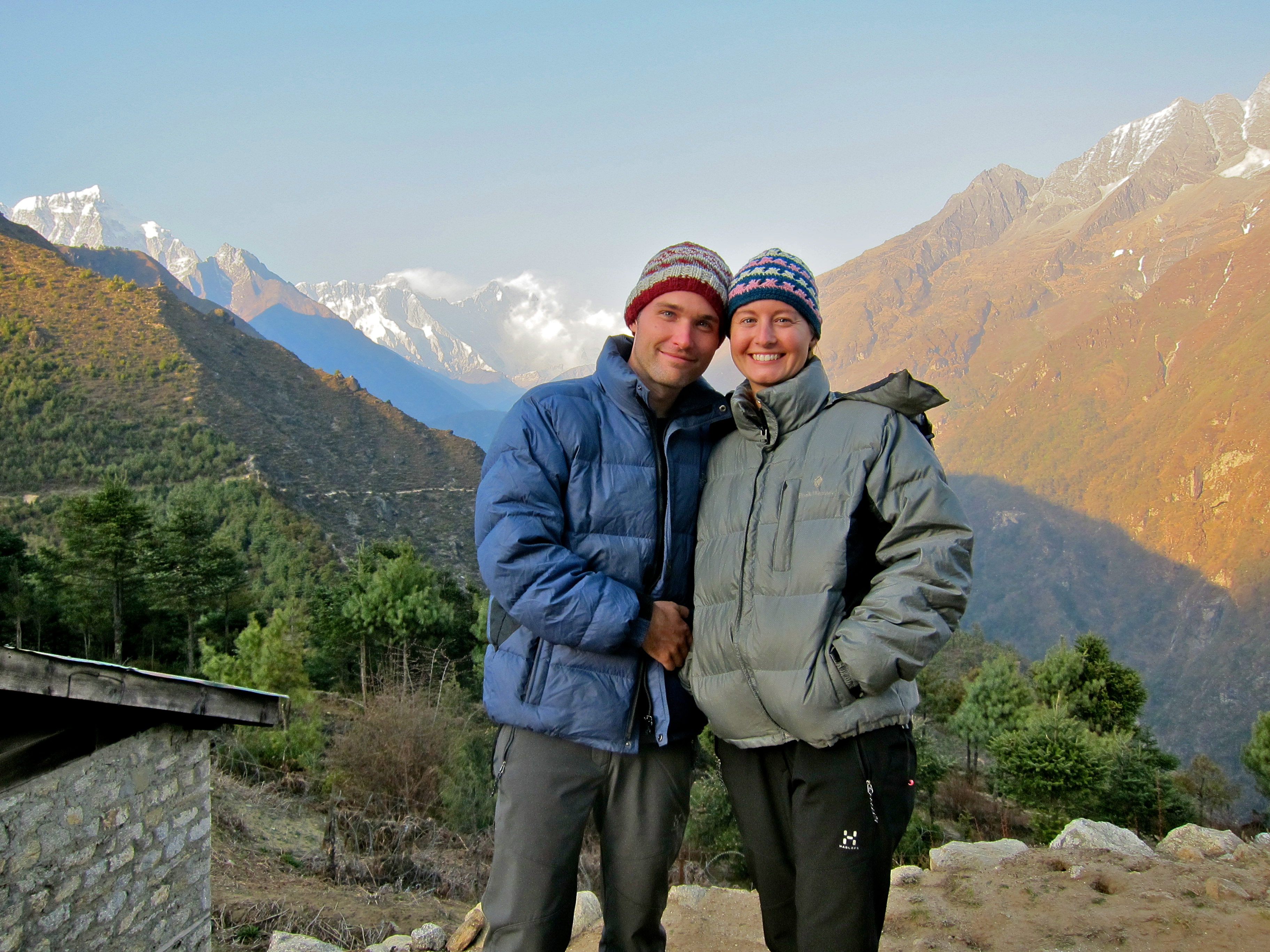
Today was one of those days that can only happen once in one’s lifetime: the day we got our first glimpse of Mt. Everest.

When we booked our airline tickets to Nepal over 6 weeks ago, our entire trip was planned so that we would make it to the first Everest viewpoint on this day, April 29 – my birthday. This second day of the EBC hike is infamous for being very difficult (the hike involves a “leisurely” 2.5 hour stroll at 8,500ft, followed by a grueling 4-hour near-vertical climb that ends at over 11,000 ft – with backpacks, in our case!), and we were going to have to push through whatever hurdles we might encounter to make it to the viewpoint before sundown for a birthday celebration!!

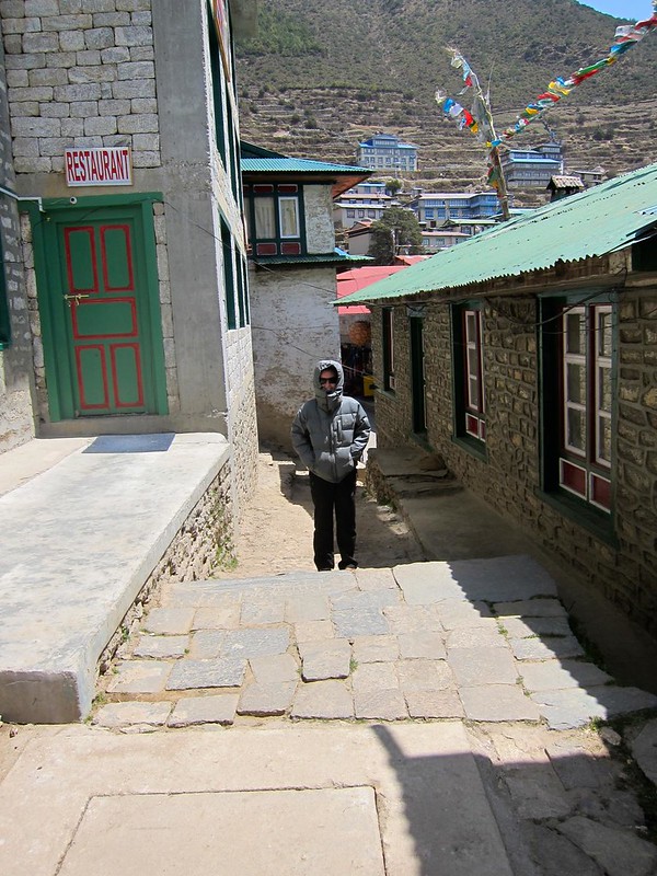
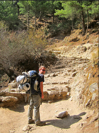
We set out from our lodge in Phakding at 8am on the morning of April 29th and bounded up the trail. We both had surprising amounts of energy to burn, and we were powering past other groups, left and right.

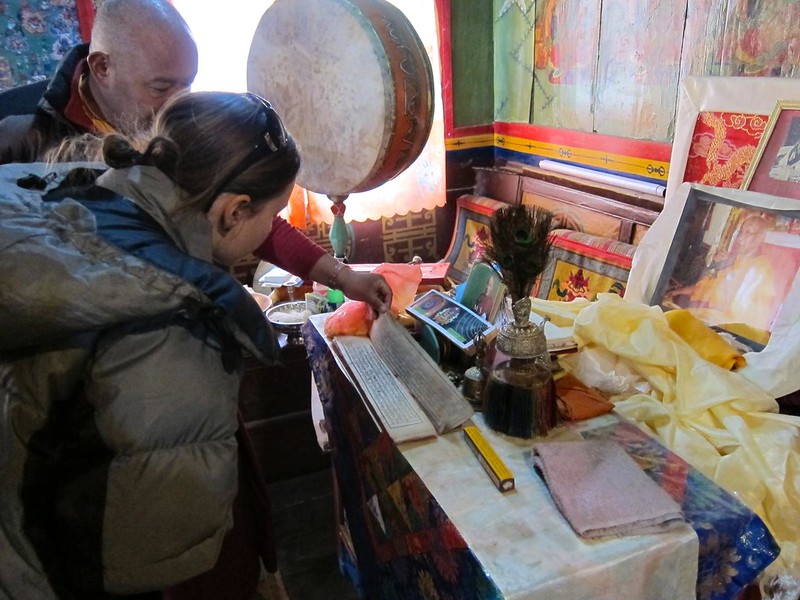
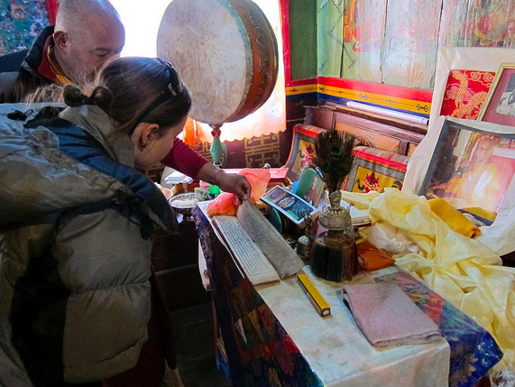
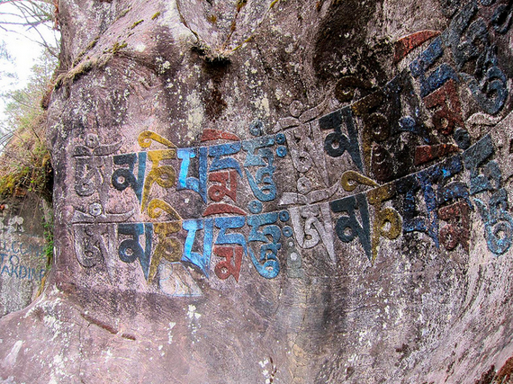
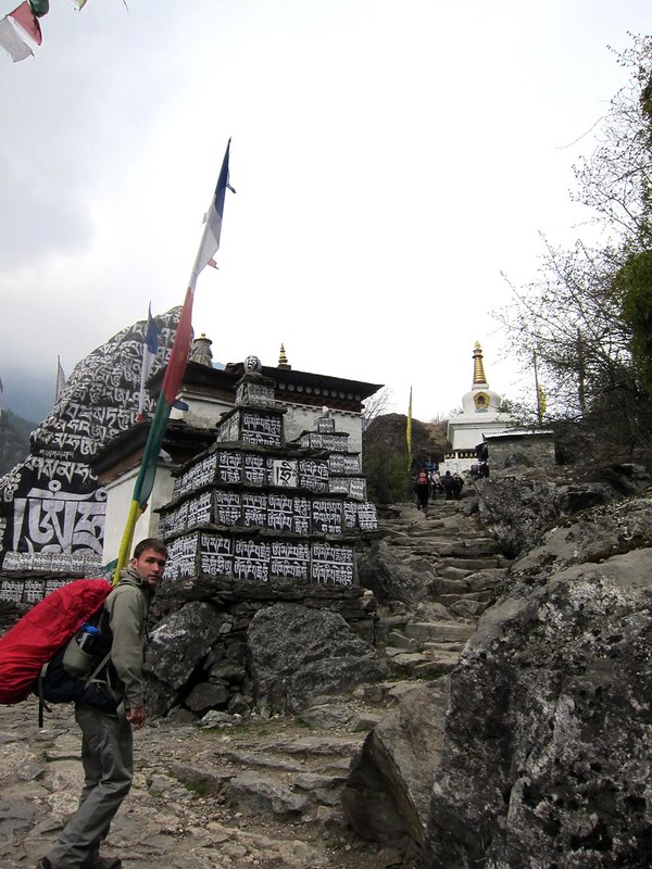
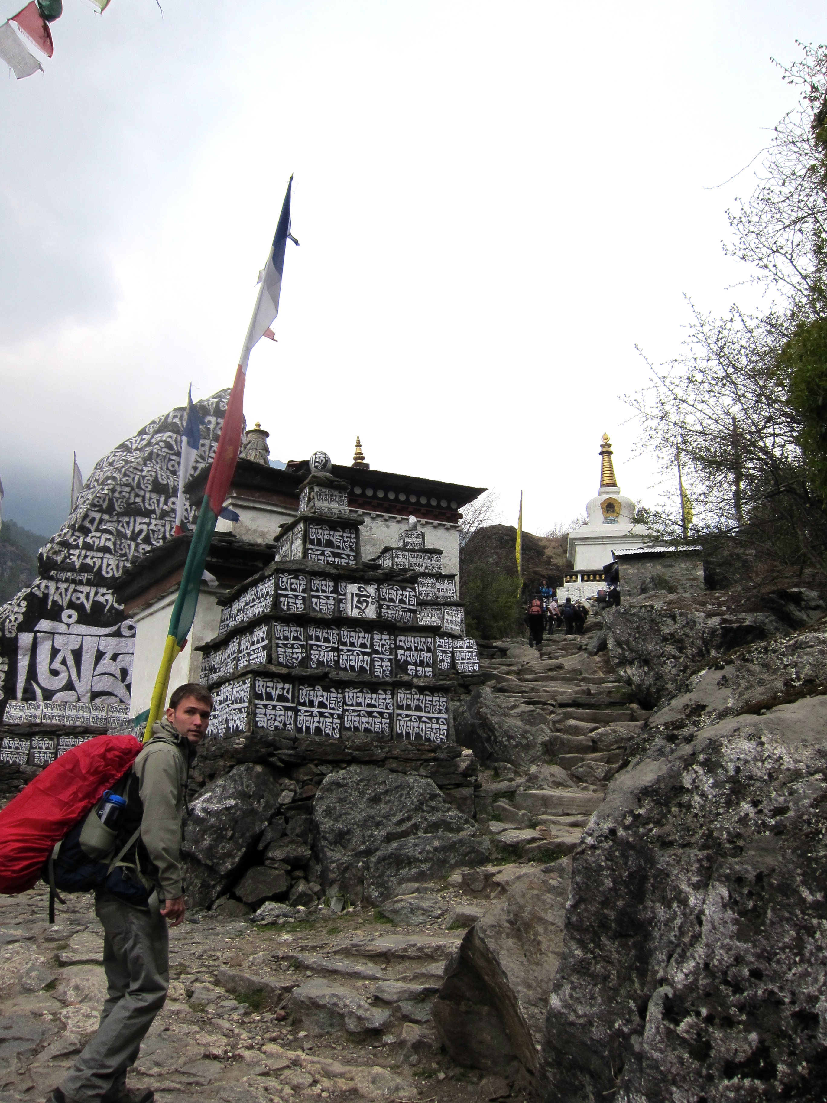
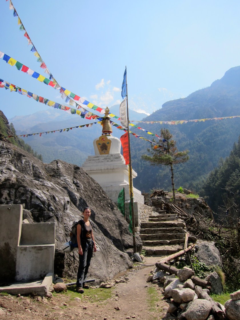
[…the beautiful scenery and old mani stone carvings certainly didn’t hurt in powering us along…]

Phakding to Namche Bazar

Phakding to Namche Bazar

Phakding to Namche Bazar

Phakding to Namche Bazar
Screen Shot 2014-12-13 at 9.02.11 AM Screen Shot 2014-12-13 at 9.02.18 AM

[Buddhist prayer flags near Jorsale.]
Phakding to Namche Bazar
IMG_2224 2

After a few minutes, we were so hot from bounding over boulders that Scott decided to change into his lighter-weight pants behind a large rock, while I awkwardly stood guard. From behind the rock, Scott waved to our Zimbabwean friends that we had met the day before, and eventually we were on our way again. (Thirty minutes later down the trail, it was my turn!)

Feeling much lighter in our new garb, we were able to pick up our pace again and make excellent time to the Sagarmatha National Park entrance, near the village of Jorsale.

Phakding to Namche Bazar

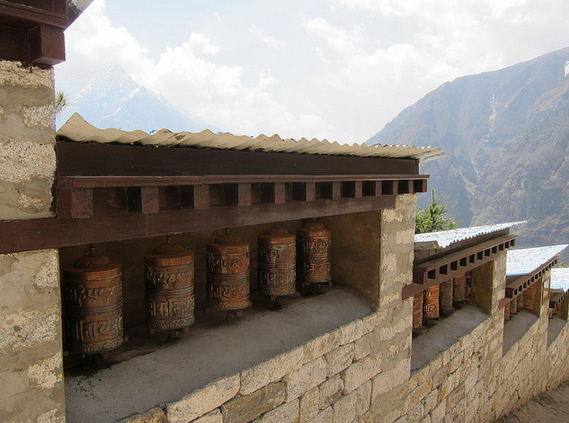
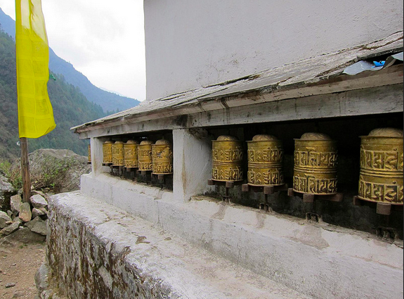
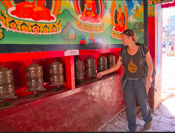
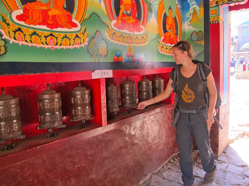
[Spinning Tibetan Buddhist prayer wheels; praying for safe travels to EBC.]
Phakding to Namche Bazar
Screen Shot 2014-12-13 at 9.09.36 AM

At the entrance, we had our passes stamped again, and began to descend a long a series of steps. Although I normally prefer going downhill over uphill, this trail was quickly teaching me to abhor “down” nearly as much, as we were discovering that the EBC trail is far from being a steady uphill climb. Rather, by the time you reach EBC (at almost 10,000ft higher elevation than Phakding), you’ve probably climbed closer to 30,000 feet worth of “ups”. (To be honest, I was glad we didn’t know this before setting out on the trek.)

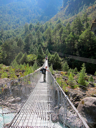
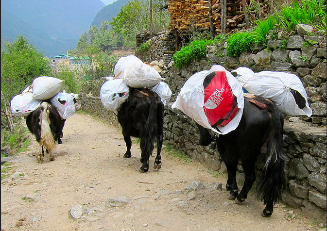
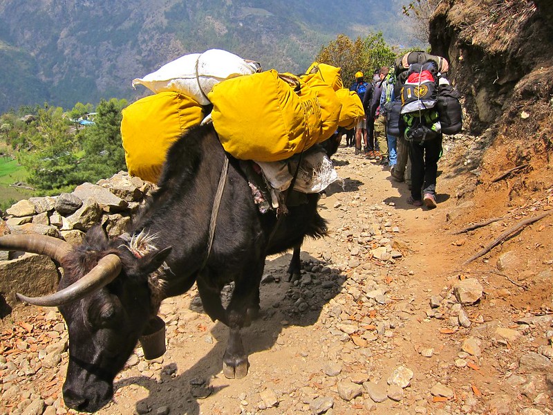
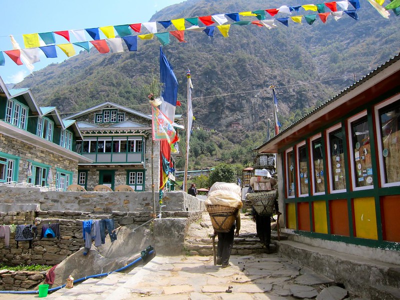
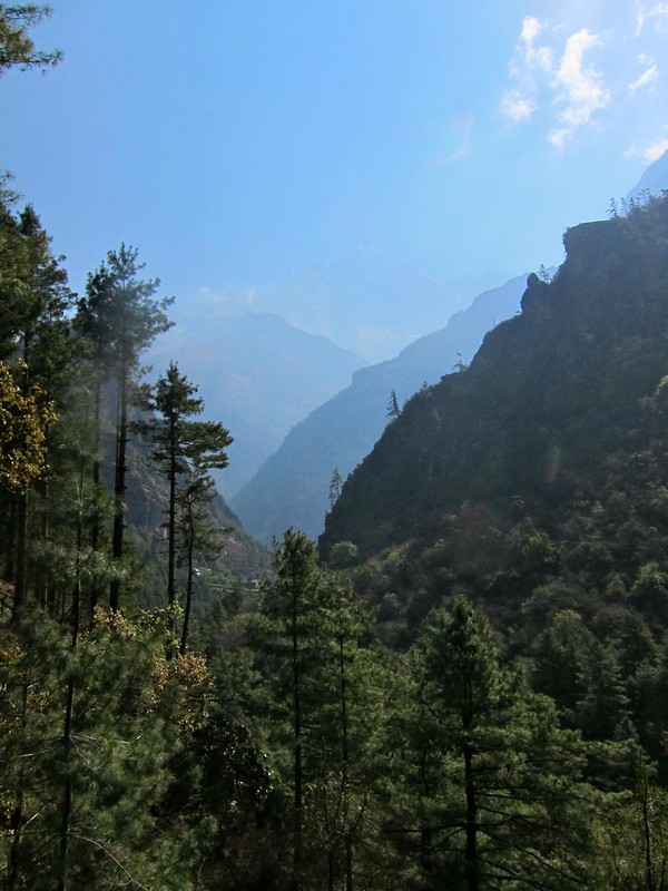
In addition to the ups and downs, the trail cut back and forth between different sides of the valley, connected by tall steel suspension bridges.

Phakding to Namche Bazar

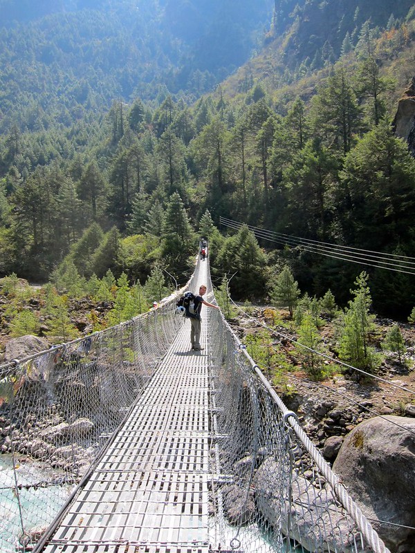
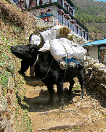
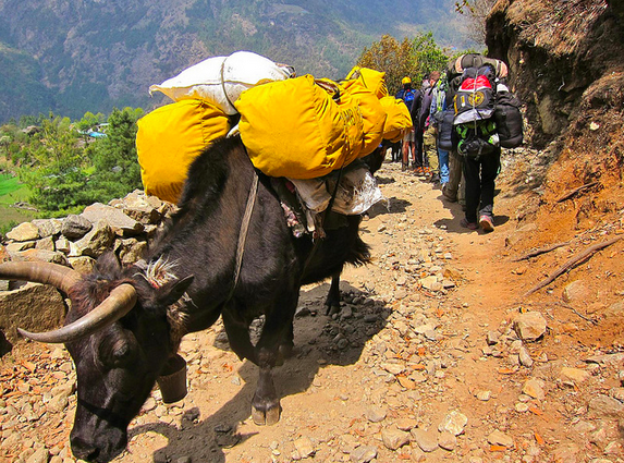
Between Phakding and Jorsale, we crossed at least 4 suspension bridges, which spanned several hundred feet above the river in places. The bridges were surprisingly well-maintained and felt safe, even with 10 fully-loaded donkeys (carrying gas tanks) coming at us!

Everest Base Camp Trek, Nepal

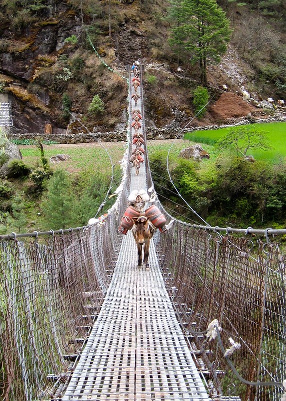
With a long-held fear of heights, Scott was not a huge fan of the bridges, particularly those that let you see straight through to the rivers below…

Screen Shot 2014-12-13 at 9.07.44 AM

After stopping for a lunch of veggie momos (Nepalese fried dumplings) and milk tea, we passed over another suspension bridge that brought us to a fork in the trail.

Phakding to Namche Bazar

One direction was clearly meant to be the main trail, but the porters all seemed to be taking a smaller path to the side that looked like a shortcut. We thought about following the porters, but we reasoned that they were probably taking a longer, flatter side-trail to better handle their heavy loads and that we should stick to the main trail. Additionally, our host at the lodge last night said that our first glimpse of Everest could be had soon after leaving Jorsale, and we were reluctant to miss out on the possibility of a viewpoint by taking a shortcut.

We started into the insane set of crumbling stone steps that lay ahead of us, while other trekkers hit the flat side-trail to our left. Ha! We’d show them when we’d see Everest first!

Needless to say….. our decision was a huge mistake. The portion of trail we took was abnormally difficult and grueling: up for 100 feet, down for 100 feet; then repeat. With the prospect of seeing Everest keeping our spirits up, we dragged ourselves along the trail, looking in every direction for a tall mountain (problem was, they were everywhere). After 45 minutes of stumbling along, we met up with another trail– the same side-trail that we had elected not to follow. Although this time we had a perfect view of the shortcut along the side of the mountain (the one that we had just climbed up and over). The sidetrail was a perfectly flat, curving 10-minute shortcut that offered beautiful views of the river below. Happy trekkers that we had passed eating lunch an hour ago were now flying by us. Adding insult to injury, we hadn’t even seen Everest by going the other way.

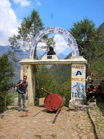
We crossed one final bridge and, looking up at the steeps ahead, we could tell we’d just finished the “leisurely” part of the day. Now, we were faced with the real start to the uphill climb to Namche Bazaar, the “capitol” of the Khumbu region and (relatively) large trading post for people in the region. Namche is also home to the first official viewing spot of Mt. Everest along the trek…therefore, we’d need to make it there before sundown if we were going to make it in time for the b-day viewing.

We began the 4-hour uphill climb at a decent clip, even following the porters up steep, tricky shortcuts to get around slow hikers. However, it wasn’t long before I found myself running out of steam. The climb we had just needlessly opted-into had sapped my last energy reserves for the day. We decided to split one of the Snickers bars from our small stockpile (which we had been trying to conserve) before continuing up the trail.

Even with a little sugar boost, we were stopping every 3-4 minutes to rest. The air had already become noticeably thinner, and my legs would become exhausted after only a few stairs. Scott graciously volunteered to carry my sleeping bag for me, so we tied it onto his pack and continued to climb for a couple of more hours by taking a few steps, stopping to rest, and taking a few more.

[My porter…]
Phakding to Namche Bazar
Screen Shot 2014-12-13 at 9.09.50 AM

A few hours along, we stopped a young guy coming down the trail from Namche and asked him how much longer we had until we reached the town. “I just made it downhill from there to here in 10 minutes, so you can probably do it uphill in 20. You’re almost there!” Whether or not he was lying to cheer us up, we took his encouragement to heart and twenty minutes later, sure enough found ourselves stumbling into Namche Bazaar– or what we thought was Namche Bazaar– and had our passes stamped.  When I saw the map saying “You Are Here”, I nearly cried in relief.

Phakding to Namche Bazar

A few seconds later, I wanted to cry when I realized that the Namche outpost was still a long set of steps away from the village itself.

[Doh!]
Phakding to Namche Bazar

We began taking the final steps toward Namche one at a time and eventually made it to the edge of town. Suddenly, I started to feel dizzy from the altitude and had to sit down to rest. Being located at over 11,000 feet, Namche is often the first village along the trail where trekkers begin to experience altitude sickness, so we were purposely being overly cautiously. While I rested, Scott bought a Coke for me and then decided that he should carry not only my sleeping bag (which he already had) but my entire backpack, as well!

[Sherpa Scott]
Scott Sherpa

Because I was ALSO getting blisters at this point, we decided I should change into my flipflops for the remainder of the walk to find a hotel. So I strolled into Namche Bazaar with no backpack, wearing flip flops, with a cold Coke in my hand.

Birthday in Namche

One trekker came up to me and asked “Whoa, did you hike the whole way in those??” motioning to my flops. Then he noticed the blisters. “Oh.”

On our way into the village, we also saw our friends from Zimbabwe again. “You made good time for carrying all of your own bags,” one of them said, motioning to Scott’s 2-backpack setup. “He’s my porter,” I joked. 🙂

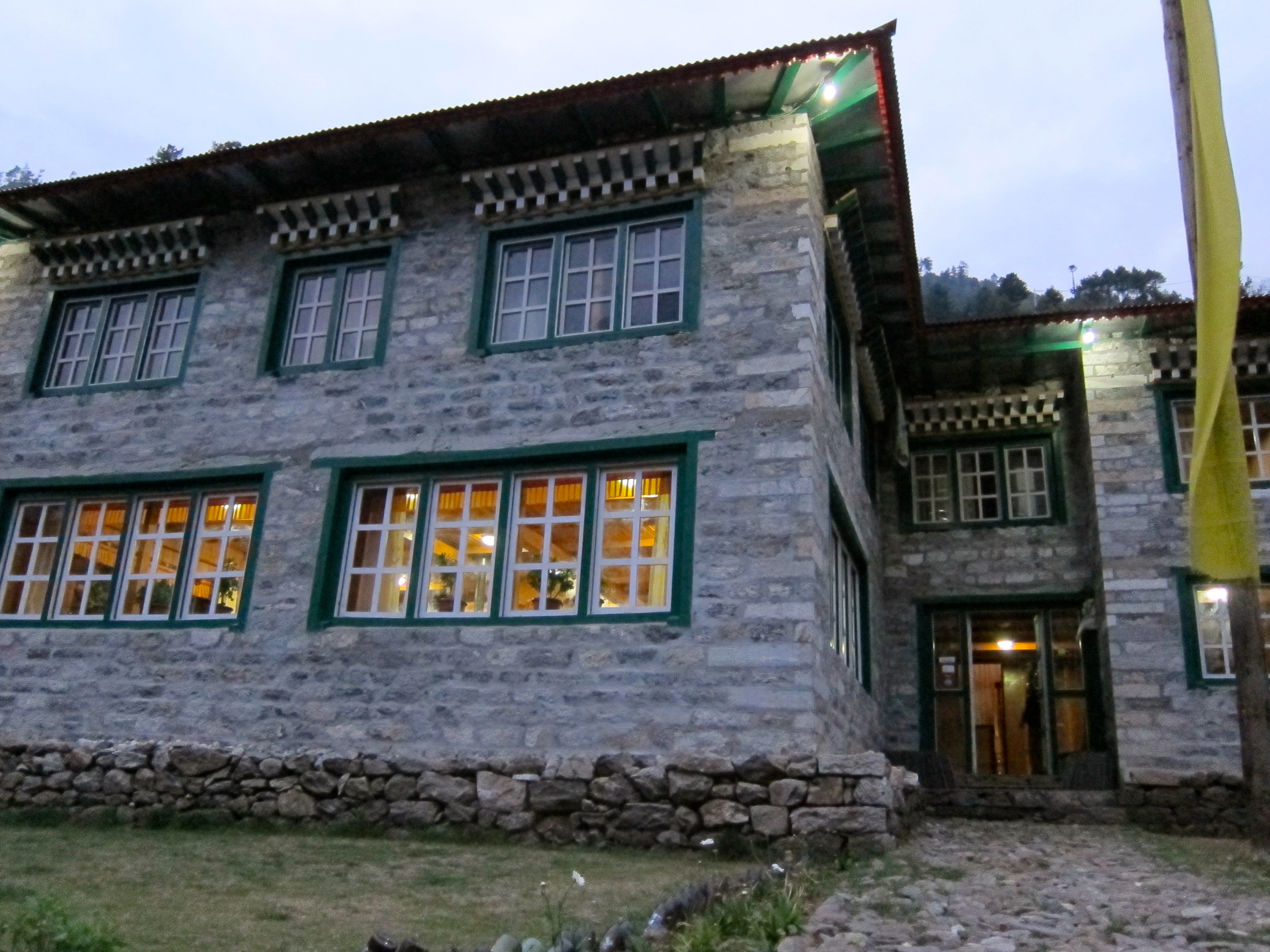
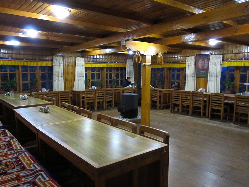
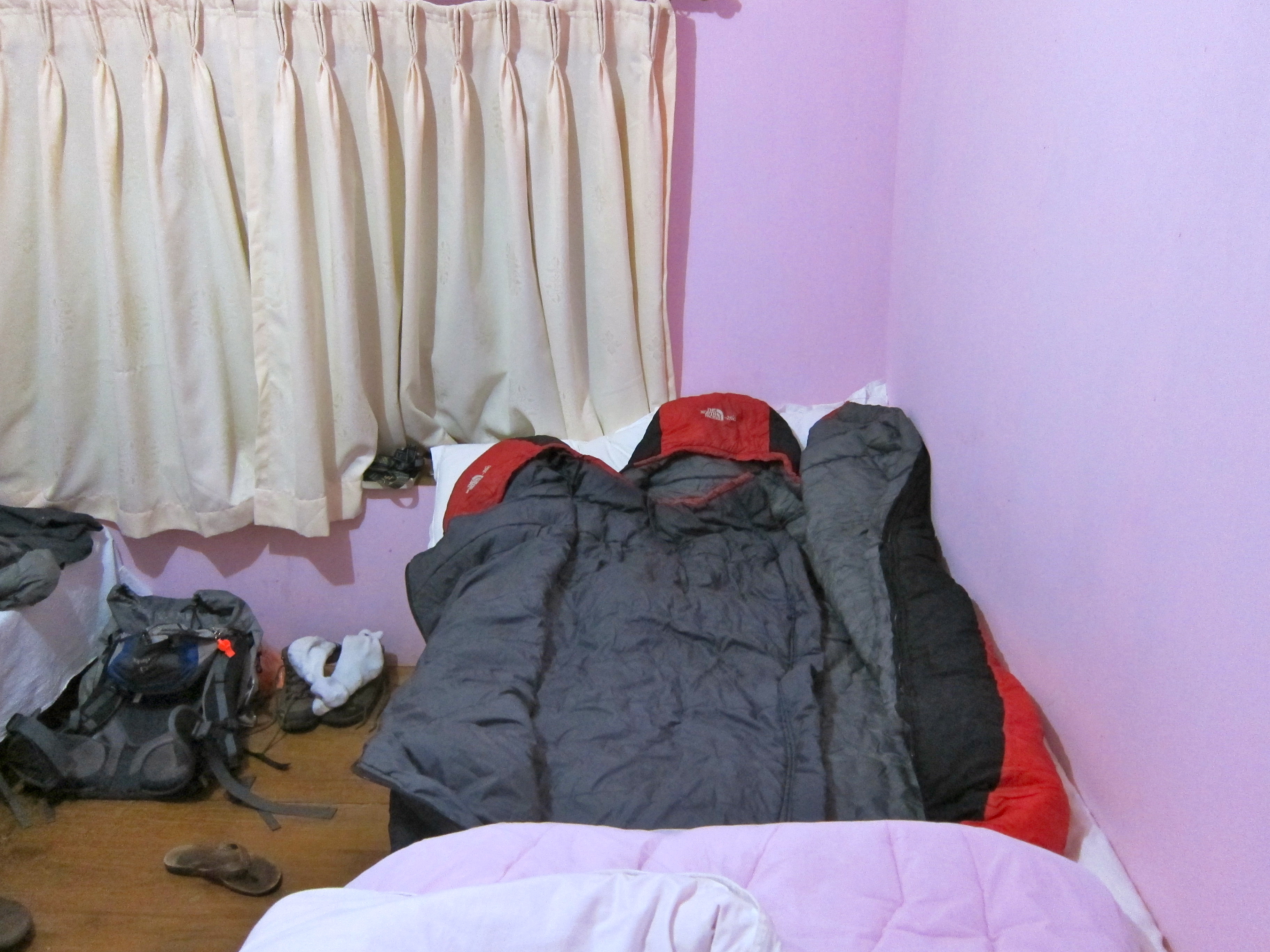
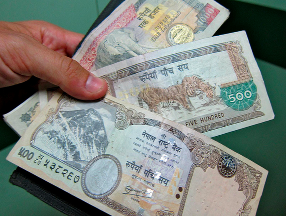
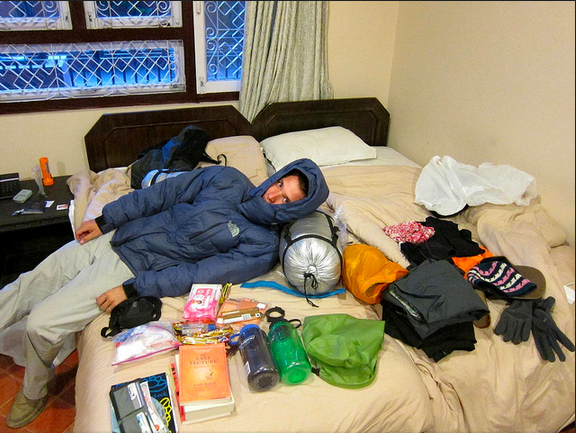
We easily found a hotel and collapsed into our room, utterly exhausted. This room was similar to the one in Phakding (two twin beds, nothing else), but the price had already begun to come up (OK, $3 instead of $2…).

[View from our room…]
Namche Bazar
Namche Bazar

Just when I was about to curl up into a ball with my sore, aching legs and blistered toes, Scott reminded me: “We still have to go see Mt. Everest! It’s your birthday!”

I opened one eye in pain. “I can’t decide: Best birthday ever? Or worst birthday ever?”

“It’s gonna be amazing! Let’s go!!”, he said, literally dragging me off the bed.

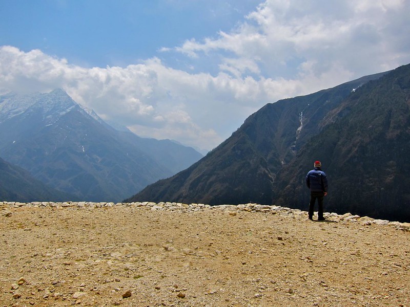
So we re-bundled ourselves in our winter gear and began what we thought would be a leisurely 5 minute walk up to the viewing point just outside of Namche. Twenty minutes of oxygen-deprived climbing later, we were approaching the grassy outcrop where the viewpoint was located just as the sun was preparing to set over the horizon. The angle from which we climbed up to the viewpoint was such that Everest would be at our backs as we made the last few steps to the outcrop….

Knowing that Everest was at our backs, we held hands and counted…”1… 2… 3!!”

We spun around together– Gray stone rising up to the left of Lhotse, with its iconic white plume of snow glazing off the summit– Mt. Everest!

Namche Bazar, first view of Everest (round peak, left of center)
Birthday view of Mt. Everest
IMG_2244 2

Screen Shot 2014-12-13 at 9.13.59 AM

“Happy Birthday,” Scott whispered, as he gave me a huge hug.

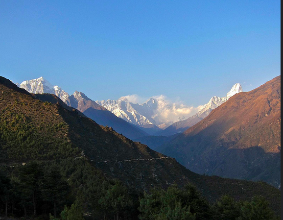
I should mention that at first, we were confused whether Lhotse (the 4th tallest mountain in the world, next to Everest) was actually Everest, since Lhotse was the taller, more imposing mountain in the center of our view, but a fellow hiker verified for us the real Everest, just to the left. Everest was still over 25 miles away and thus appeared less monstrous than some of the closer surrounding mountains.

Knowing we’d get better views in a couple of days, we spent just a few minutes at the look-out and then headed back into Namche Bazaar to see what the town was all about.

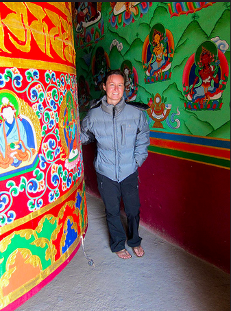
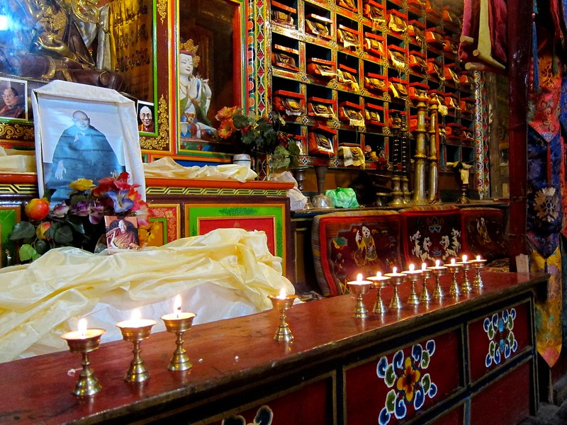
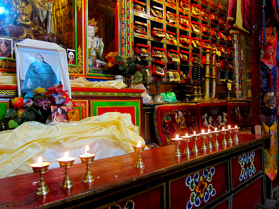
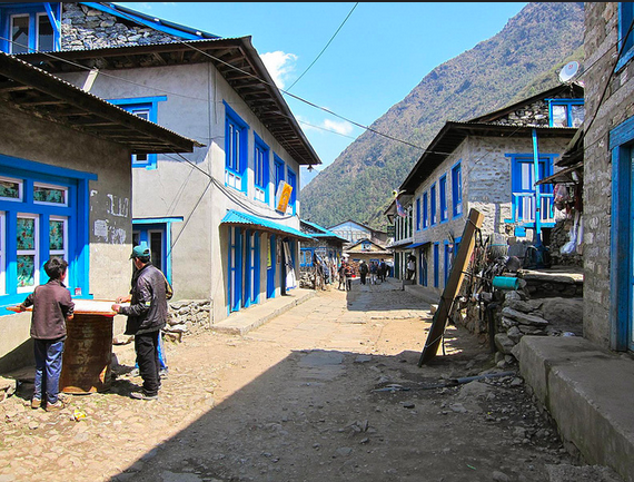
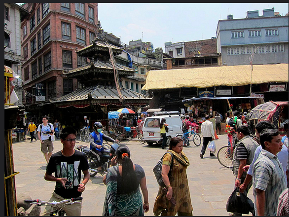
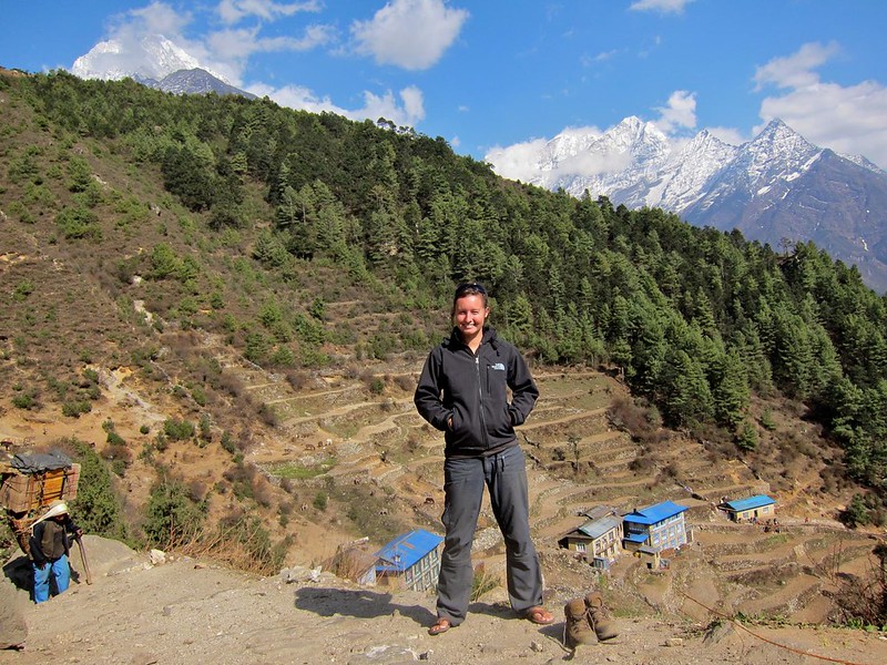
Surrounded by jagged, snow-covered mountains, Namche Bazaar was a colorful, well-maintained Sherpa village reminiscent of a tiny Swiss ski village, with rocky cobblestone footpaths and quaint stone chalets with red and blue and green roofs. Most of the buildings were hotels; the remainder were trekking shops or restaurants, including (for better or worse) Namche’s very own Irish Pub, German bakery, pizza parlor, and Jamaican reggae bar.

[Overlooking Namche Bazaar– gateway to Everest.]
Namche Bazar

We were ravished from our hike, so we indulged in a huge “pepperoni” pizza at the pizza parlor. (Don’t order meat when in Nepal. The meat didn’t taste bad, but the “pepperoni” were little chunks of purple Spam-like substance that pushed the definition of meat.)

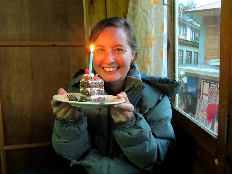
As we were finishing our last slices of pizza, I looked up to see a slice of carrot cake with a candle in it coming my way!!! Scott had arranged for our waiter to deliver the cake to me, and luckily, they just happened to have a candle in the restaurant.

Birthday in Namche
Screen Shot 2014-12-11 at 12.10.31 PM

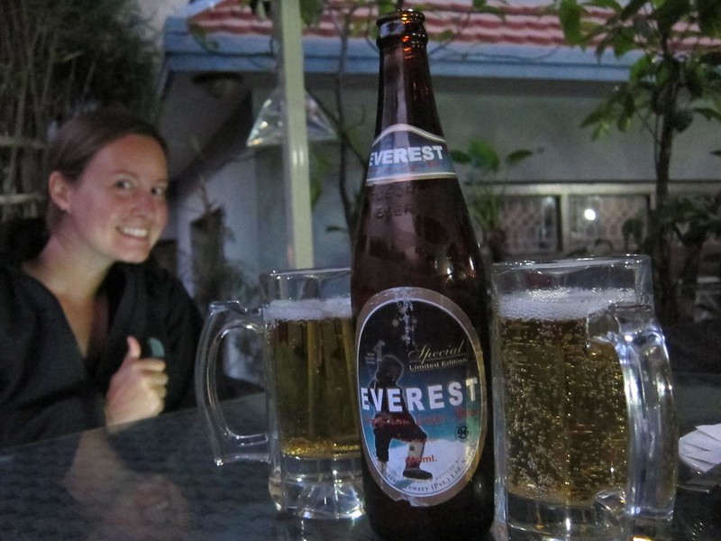
We finished the night with a couple of Everest beers at a little bar across from our hotel called Liquid Bar, which was a surprisingly hip cave-like bar with a few fellow trekkers gathered around a soccer match.

[Enjoying Liquid Bar with our down jackets on.]

Birthday in Namche

We were too exhausted from the day’s events to stay out very long, though, and we quickly found ourselves buried inside our sleeping bags, fast asleep….

Everest Base Camp trek, Day 1: Kathmandu to Phakding

Total mileage: 5
Beginning altitude (at Lukla): 9,000 feet
Final altitude in Phakding: 8,500 feet (the hike on Day 1 has a net negative climb.)

—————————————————————————————–

Early on the morning of May 28th, we arrived at the Kathmandu Airport and were put into a queue of people who were all waiting to fly to Lukla, the town where the EBC trailhead begins. Air bookings for domestic flights in Nepal are unlike anywhere else that I know of: having a ticket guarantees you a flight for some time that day (or week) if the weather is good, but it does not assign you to any specific flight, time of departure, or seat. We arrived at the airport and were put on an 8:30am flight with Agni Air.

Flight to Lukla, Nepal
Screen Shot 2014-12-11 at 12.07.46 PM

When Scott and I boarded the tiny plane (which only held 10 passengers and 2 pilots), we both scrambled for seats on the left side of the place, since we were told that the left side offers the best views of the Himalayas. Our flight was relatively smooth, but occasionally we’d hit a pocket of air that would send a nervous chatter throughout the cabin. As much as we all tried to let the loud drone of the engines drown out any bad thoughts, everyone was keenly aware that our little plane was battling typical Himalayan wind patterns and flying only hundreds of feet away from some of the tallest mountains in the world. The only thing I could do to distract myself from the flight was to look out at the incredible view in the distance– the Himalaya!

Flight to Lukla, Nepal

Flight to Lukla, Nepal

Flight to Lukla, Nepal
Screen Shot 2014-12-11 at 12.07.58 PM Screen Shot 2014-12-11 at 12.08.13 PM

Twenty-five minutes after leaving Kathmandu, we were approaching the landing strip at Lukla Airport, a tiny strip of asphalt at 9,000 feet that begins at the edge of a cliff and ends abruptly at the face of a mountain wall. Lukla airport has has the honor of being named the world’s most dangerous airport. And because the landing strip is so short, it was built at a 12 degree angle, both to help landing planes stop more quickly and to help taking off planes gain speed faster before flying off the edge of the cliff. Thankfully, we neither clipped the edge of the cliff on the way in nor ran into the mountain at the end of it; however, I did see one plane that attempted to land and aborted at the last minute and another plane that skidded to a stop right before the face of the mountain, causing the gawking airport staff to run outside to see who the pilot was. Needless to say, I was too nervous to stand around watching other flights come in… We’d be back here in two weeks to fly back out.

[Lukla airstrip, where Everest stands a mere 30 miles away.]
Flight to Lukla, Nepal

(If you’re interested, look up some YouTube videos on Lukla Airport; it’s pretty fascinating. (Mind you, only do this if you’re not interested in flying into Lukla or going to Mt. Everest one day.))

Scott and I had decided not to use a guide or a porter to carry our bags for our trek to Everest; we wanted the “romantic” adventure of transporting ourselves and our gear from village to village, deciding where we wanted to stop, not worrying about consulting anyone if we wanted to take a detour or add an extra day to rest. So we literally walked off the airstrip in Lukla with our bags on our backs and realized…we didn’t quite know which way to go. Casually trying to play it cool, acting like we were “adjusting” our backpacks, we decided that “left” looked more lively than “right”, and we headed in that direction.

[Me going “left”. Me also looking incredibly awkward and reminiscent of Quasimodo. At the least, this shot shows my setup: Scott and I each carried one backpack on our backs with a sleeping bag tied to the outside. We each had a refillable waterbottle within reach on the sidepocket of our bags.]
Lukla to Phakding

A mere 5 steps later, we came to a German bakery, which smelled too good to pass up. We had heard that European bakeries could be found all along the Everest trail, owing to the large population of European hikers that have been paving their way along this trail for decades, bringing their high-energy strudels and danishes along with them. Solely out of our effort to embrace the local culture wherever we go, we split a seriously decadent, enormous, dense, rich apple strudel for breakfast and then hopped back on the trail.

[If you ever visit the region, do have an apple strudel at this bakery (the first one you come to when leaving the airport).]

Lukla to Phakding

A few hundred feet later, we came to Lukla town (“left” was indeed the right way!), where a Nepali policeman stamped our hiking permits. While we waited, we met a guided group of fellow hikers from Zimbabwe. They were shocked to learn that we were hiking the trail on our own. They were clearly concerned for our safety (worried that we would hike too high too fast, I suppose), and we had to convince them that we would be fine. It certainly raised an interesting point though: whereas we thought that independent trekkers would dominate the trail, over the course of our hike we discovered the opposite to be true. Almost all of the other trekkers had guides with them. Not only did we appear to be the only independent trekkers on the trail, we also quickly noticed that very few people around us were carrying their own packs, and we wondered whether it was something we would regret. But in the end, we would be so happy that we had chosen to undertake the adventure on our own.

We passed through the welcome gates of the EBC Trek, and just like that, we were off! Our backpacks felt light and comfortable, our new boots weren’t rubbing any blisters, the temperature and humidity were spectacular– we were happy to be hiking out into the big beautiful world of the unknown!

[We’re off!]
Lukla to Phakding

Lukla to Phakding

Lukla to Phakding
Screen Shot 2014-12-11 at 12.08.32 PM Screen Shot 2014-12-11 at 12.09.01 PM

[Passing through the welcome gates of The EBC Trek, near Lukla.]

Lukla to Phakding

Lukla to Phakding
Screen Shot 2014-12-13 at 8.51.11 AM Screen Shot 2014-12-13 at 8.51.20 AM

As we weaved our way along the mountain out of Lukla, we caught our first glimpse of the porters, whose back-breaking work is so vital to this region of Nepal. Known as the Khumbu region, this region is a remote, mountainous area completely devoid of any roads (it would be nearly impossible to build them, given the mountainous terrain, rivers, and gorges). Therefore, everything in the Khumbu region that cannot be derived from the mountains is hiked into the region on foot by porters or yaks. Every windowpane, every can of Coke, every gas cylinder for cooking, every Western-style toilet, was carried on someone’s back up the mountain for days or weeks, depending on its final destination. (I really did see a porter carrying a toilet up the mountain on his back one day– I think that any tourist who demands one while in the Everest region should have to carry his own!)

Lukla to Phakding

Lukla to Phakding
Screen Shot 2014-12-11 at 12.08.52 PM

A porter’s load is carried on the porter’s back, held in place by a leather head strap that transfers a significant portion of the weight to the porter’s forehead. Although one of the best jobs for men in the Khumbu region is to be a trekking guide or camp manager in the Everest region, many young men often end up becoming porters, perhaps because they cannot communicate in a foreign language or because it’s the best job available to them at the time. The porters are paid per job based on how much they carry, and we were told that the loads can sometimes exceed 250 pounds (!).

Although porters in Nepal are often mistakenly referred to as “Sherpas,” we learned that Sherpas are a specific ethnic group of Nepali people, and although many of them are porters, the words are not interchangeable. Sherpas are of Tibetan decent, and are the major tribe present in the Everest region. They are the people who have been shuttling people up Everest, running lodges, and supporting the entire tourist industry in the region for decades. Because the Sherpas have been living at high-altitudes for hundreds (thousands?) of years, they can function more easily in the low-oxygen environments, making them excellent guides on Everest and, of course, excellent porters.

Yaks also share a part of the burden in the Everest region, of course, which is good news for the porters and sometimes bad news for hikers– yaks are known for their ability to accidentally “push” hikers to their deaths off of mountain cliffs , due to the yaks’ failure to yield to human traffic and their abnormally wide loads on their backs. After hearing this, Scott and I were always sure to yield to the yaks by standing on the mountain-side of the trail ather than the cliff-side…

Lukla to Phakding
Screen Shot 2014-12-13 at 8.51.28 AM

But back to our hike…. The Everest Trail is largely confined to one in-and-out trail, and I was acutely aware that every step that I took forward was a step that I would have to take back in just a couple of weeks. Our first day, we had no definitive plans for how far along the trail we might get, but the “suggested itinerary” for the EBC trek that I had hurriedly scribbled down the day before suggested that we try to make it to a little village called Phakding, about 5 hours walking from Lukla.

The trail near Lukla was crowded, and we repeatedly passed the same groups of European hikers, only to have them pass us again if one of us stopped to tie a shoe. As we walked, I carefully scrutinized each person that we passed going in the opposite direction as us, back toward Lukla: Had they made it all the way to Basecamp? What had they been thinking when they were in my position two weeks ago? Some people were jovial and in good condition; other people limped on one leg or leaned on their walking sticks a bit too heavily. One young woman asked her guide if she could walk around the measly little set of rock steps that lay in front of her, rather than go over them and punish her knees any more than she had already. But our week of hiking in the high-altitude hills in Chopta was paying off, as I kept mentioning how surprised I was that climbing steep stairs with a fully loaded backpack felt so easy. Once we had warmed up, we were flying past the other groups on the trail, barely stopping to catch our breath.

Eventually, it was the weather that forced us to slow down, as light rain began coming down on us and we ducked inside a tea shop to escape it. It was there that we had our first cup of Khumbu Nepali milk tea– black tea brewed with spices and milk, served inside one of the traditional tea shops that has served as resting place for Nepali porters for hundreds of years. The walls of the one-room shack were lined with benches covered in old rugs and cushions, where porters (and some adventurous hikers) sleep, with a wood-burning stove set up in the middle of the room. Although we didn’t need the warmth of the stove on this day (we were hiking in T-shirts with light jackets), I had no idea how much we would come to rely on them farther along the hike…

[Judging how far we have to go before Phakding…]

Lukla to Phakding

We paid for our teas and continued on to Phakding, passing though tiny villages every half mile or so. Along the way, we stopped for lunch at another tea shop, which offered beautiful views over the green forest while blocking the equally ferocious winds that encouraged us to sit inside.

[“Mani stones” (Tibetan Buddhist prayers, carved into rocks and then painted) line the Everest trail.]

Lukla to Phakding

Lukla to Phakding

Lukla to Phakding
IMG_2208 2

[Tiny monastery with prayer wheel on the way to Phakding..]
Lukla to Phakding
IMG_2266

We reached Phakding around  2:00 in the afternoon.

Phakding, Nepal

Despite the 5-hour walk we’d just completed, we felt oddly energized and decided to push past Phakding to get a head-start on the hoards of backpackers that we would find ourselves alongside the following morning. We hiked through the village and got our first taste of what the lodges and towns along the Everest Trail would be like. Dozens of lodges reminiscent of old Swiss hiking lodges lined the road of the tiny, single-road village. A few shops sold the items that people might have forgotten to buy in Kathmandu (socks, bandages, beanies, walking poles, maps..….) at exorbitant prices.  Because we had no knowledge of what lodging prices were like along the trail, we began asking lodge owners what their prices were when we arrived into town. We were relieved when we asked the first lodge owner for the price of a double room: 100 rupees…about $2.

Just out of town, we found a nice stone lodge that we decided to sleep in for the night.

[Our hotel. Not bad at $2/night!]
Phakding, Nepal
IMG_2214 2

[The common room. Me, in the background, reading and drinking some hot mint tea.]
Phakding, Nepal

Phakding, Nepal

The lodge was on a lush green, mountainous outcrop overlooking Phakding. It was well-maintained by the 3 young guys who lived and worked there during the high-season, with a wood paneled common room and two floors of basic hotel rooms. Tonight, we would be the only guests.

Although we had been spoiled by hot showers and free use of the electricity in Kathmandu, the case was certainly going to be different on the Everest trail. Our room was clean but basic, with nothing but two twin beds and a window. The only electric outlet on the second floor of the hotel was located outside the one shared bathroom, with a sign over it that read “Outlet use: 100 rupees per hour”. Luckily, we had charged our camera in Kathmandu. When I asked the guys if I could take a hot shower, they winced a little and told me to wait until they turned the boiler on around 4pm. I patiently waited until 4, when they turned on the water and stood outside the bathroom to make sure it was working properly for me. It was, but to call it a “shower” is a little misleading. It was a faucet at knee level that I used to gather water in my hands and throw it onto myself. Mind you, the hotel itself (or any hotel on the trail) was not heated, and I was “showering/ throwing water at myself” in a 50-degree tiled room. It was freezing.

Luckily, the shower experience taught me a lot, and from that day forward, I would choose my showers and shower times on the EBC trail very carefully (to be divulged in later posts…)

I eventually rejoined Scott in the common room (he declined a shower), where we had vegetable momos (dumplings) for dinner and spent a while talking to the young hotel manager. He was raised in the Khumbu region and had been to EBC many times. He was obviously proud to be from the area, and he happily told us about what lay ahead on the trail and where we could get our earliest view of Everest. He had aspirations of eventually reaching the summit of Everest one day, and we were suddenly so revived to be on the trail– we’re really here! People here climb Mt. Everest! This guy was going to climb Everest one day, too! Wow!! Wisely, his plan was to train to be a mountain guide and get paid to summit the mountain, rather than paying to hike it, as most tourists do. He gave us a book to take up the trail with us (we decided to leave it with him and leave the extra weight out of our bags in the end).  After talking with him for what must have been an hour, we finally decided to turn in to our sleeping bags in our [very unheated] room and get some sleep….

Phakding, Nepal

Godsend.
IMG_2217 2


Everest Base Camp Trek: Day 0, getting prepared…

Though I’d always dreamed of seeing Mt. Everest one day, the idea of actually doing it only started churning in my head the day I met Annie, a pediatrician who I met at Angkor Hospital for Children in Cambodia, while we were both volunteering at the hospital. Annie, her husband, and her two kids had taken a year off from their lives in California to travel around the world together. Listening to Annie’s stories of Italy and Africa and Turkey, I found myself a little envious of what they were doing, and I had to pinch my arm to remind myself that I was in fact doing a similar thing. (Funny how that happens.) I think the feeling of envy I had only resulted from the fact that they were taking a year off with their middle school-aged kids in tote, which for me, took it to a whole new level (and is something that I dream of doing one day as well). I had read stories about families who had done similar things but had never met anyone who had really done it.

Annie and I were taking a Cambodian language class together, and before every class I would bombard her with questions about their travels over the past few months. I loved listening to her stories of maneuvering her family across the globe, through the slums of Mumbai to an organic farm in Thailand. One of the memories that Annie gushed on about the most was the day her family caught their first glimpse of Mount Everest. She could barely put it into words. RIght there, I made my decision: I was going to see Everest too.

Growing up, I never knew it was possible to hike to the base of Mt. Everest if you don’t plan on climbing the whole darn thing; I imagined the tallest mountain in the world being in some snowy, inaccessible area of Nepal, closed off to all but the most serious mountain climbers. Well, Everest is indeed in an extremely snowy, inaccessible area of Nepal, but it turns out that the trek to the mountain’s base is one attempted by thousands of people every year. And some of them actually make it – as long as they’re willing to walk for 14 days at elevations of over 17,000 feet. It was going to be one of the most challenging things Scott and I had ever attempted, but we were willing to try.

I began reading up on the logistics of getting to Mt. Everest through some websites (WikiTravel…) and found that what Annie and her family had done was a shorter, four-day roundtrip hike to the first viewing point of Everest, still 25 miles away from the mountain itself. Her family didn’t have a lot of time in Nepal, so they had turned around at that viewing point and headed back down to the trailhead. However, I learned that many people choose to keep hiking over the course of ten or eleven days to reach the base of Everest itself, where “Everest Base Camp” (EBC) is located. I could barely contain my excitement; EBC is where people intending to climb to the summit camp out for weeks (months?) as they acclimatize and wait for their summit push. For years, I had been fascinated with stories of people climbing Everest, reading books and watching documentaries on the subject (including having a near-religious devotion to the Discovery series “Everest: Beyond the Summit”, which follows the famed basecamp manager Russell Brice as he attempts to get hikers onto the summit).

Once Scott and I learned that trekkers can make the journey to EBC without being on a full-scale climbing expedition, we decided that getting a glimpse of the mountain just wasn’t going to be enough. We wanted to make the two-week trek to base camp itself and stand on that mountain. And so, from our apartment in Cambodia, we booked a plane ticket to Nepal that moment and found ourselves sitting in Kathmandu, the country’s capitol, eight weeks later. (It still amazes me what hitting that little “Submit” button on Expedia.com can do in this day and age!)

When we arrived in Kathmandu, we had one (ONE!) free day before our flight to the trailhead of the EBC trek. Almost everything that we would need on our two-week unassisted trip would have to be bought in Kathamandu, since the provisions available after starting the trek were said to be either extremely limited or extremely expensive (bad time to get a blister or find that you forgot your toothpaste!). Because we had been traveling in hot-weather climates for the past 6 months, we had no cold-weather clothing or gear with us, and we needed to acquire everything that we would need to help us survive a two-week trek in freezing temperatures – in a single day.

That day was the shortest day of my life. We were in a congested, ancient capitol city that we had never seen before, and we were running (literally) all over town obtaining hiking permits from the Travel Bureau; buying hiking boots (so much for breaking them in first!), long johns, thermal base layer shirts, warm socks, hats, gloves, sunscreen, anti-alititude sickness pills from the pharmacy, loads of Snickers Bars (food, especially high-energy candy, is very expensive on the Everest trail); renting sleeping bags and down jackets; pulling money from every ATM in town (there are no ATMs in the Everest region); sorting all of our gear into the “take” or “don’t take” (to be left in our hotel’s Left Luggage Facility) pile; buying our plane tickets to Lukla (the village at the start of the trailhead); washing our undies one last time (it would be the last time for the next two weeks!); and many more things I’m surely forgetting. (I’ll lay out our total cost for the trip and these items in a later post.)

[Dodging busses, bikes, people, and rickshaws during our race for gear in Kathmandu…]
Kathmandu
Screen Shot 2014-12-13 at 8.13.28 AM

Kathmandu was a city of contrasts, where ancient Tibetan tea pots and singing bowls sat alongside state-of-the art hiking boots and Gor-Tex snow jackets. The section of Kathmandu geared towards trekking tourism was a little hiking village of sorts, where every storefront sold some type of equipment that you might need to get you to the top of Mt. Everest or to any of the other big-time mountain ranges in the area (Annapurna, Lhotse..).

Kathmandu, Nepal

[Boots that will take you to the top of Mt. Everest and have probably been there before…]

http://www.flickr.com/photos/scottjehl/7127665571/in/set-72157629931429581
Screen Shot 2014-12-13 at 8.13.06 AM

Getting enough money to bring with us on the trek was a strategic nightmare. We would need to carry all of the money that we needed for two weeks, and we also needed cash to buy all of our gear in Kathmandu. However, we didn’t know how much housing or food would cost up on the trail, and our ATM cards had a strict daily limit. Earlier in the day, we had stupidly paid for our round-trip plane tickets to Lukla with our cash reserves (rather than just using a credit card and paying an extra fee), which cost a total of about $500 for two people. After trying multiple ATM machines around town to find one that would take our card, we finally found one and pulled the largest sums we could until we hit our card’s daily limit– rats! Then we waited 24 hours (right around the time we needed to be heading to sleep) and pulled the limit again. We were going to be hitting the trail with that fixed amount (about $800 USD), and it needed to last for two weeks of food, accommodations, and anything unexpected….

[Massive amounts of Monopoly money (AKA Nepali rupees)…]
Nepali Cash
Screen Shot 2014-12-13 at 8.12.58 AM

That night, we packed in the dark by the light of our flashlights; Kathmandu is infamous for cutting off its residents’ electricity for up to 16 hours a day, in order to ration it to different areas of the overloaded city. We managed to fit it a quick, early celebration of my upcoming 29th birthday (which we would be celebrating on the EBC trail), and then we fell into bed far too late, totally exhausted, and tried to get some sleep before the nerve-wracking flight that lay ahead….
[Early birthday presents…]
Steph's Birthday in Nepal

Everest Training

————————————————————————

Our packing list:    (KTM= bought or obtained in KTM on May 28)

Essentials

  • wallets/passports
  • TIMS card (hiking permit for the Khumbu region) from the Bureau of Tourism (KTM)
  • Nepali rupees (no ATMs after leaving Kathmandu) (KTM)
Footwear
  • cold weather waterproof hiking boots (KTM)
  • flip-flops for showering and walking around in the lodges
Clothing
  • lightweight T-shirts (2 each) (Steph’s bought in KTM)
  • -20°C down jackets (rented by the day) (KTM)
  • Northface (or NorthFAKE in this case) shell under-layer jackets from India
  • fleece-lined waterproof hiking pants (1 pair each) (KTM)
  • thermal tights (1 pair for Steph) (KTM)
  • lighter-weight pants (1 pair each)
  • thick hiking socks (1 pair each) (KTM)
  • sock liners (2 pairs each)
  • evening-time wool socks (1 pair each) (KTM)
  • boxer shorts (Scott– 2 pairs )
  • undies (Steph– 3 pair)
  • (no pajamas; will be sleeping in hiking clothes)
Gear
  • beanies (KTM)
  • mid-weight snow gloves (KTM)
  • sunglasses
  • -20°C down cold-weather sleeping bags (rented by the day – KTM)
  • refillable water bottles (KTM; fake REI bottles)
  • headlamps for getting around after dark
  • new batteries for headlamps (forgot to buy)
  • walking stick (never got one)
  • Camera (Canon s95)
  • disposable backup camera (never got one)
  • watch with alarm (bought, then forgot in Kathmandu)
  • matches (for candles) (never got)
  • warm scarf for Steph and for use as a towel (ended up using Scott’s)
  • water purification tablets (our SteriPen was too heavy to bring. Wanted iodine tablets but only found chlorine; bought in Lukla (on the trail)!) (KTM)
  • sunblock (KTM)
  • a pen that actually works (a chronic problem during the trip) (KTM)
  • lightweight books (Scott: The Last Lecture; Steph: The Alchemist)
  • large-billed hat for blocking sun (India)
  • stuff sacks for collecting laundry
  • extra sunglasses in case others get broken/lost
  • cell phone and charger for emergencies
  • USB cell dongle for Scott to work for the first 2 days of hiking
  • plastic bags, just in case
  • Steph’s contacts and glasses
  • printout of everest trail map (luckily, we found a nicer map in Lukla) (KTM)
  • padlock and chain for our backpacks
  • rain ponchos
  • notepad

Toiletries

  • travel shampoo/ bar of soap
  • comb
  • deodorant/ toothpaste/ toothbrushes/ contact solution
  • toilet paper (to be disposed in garbage – not for flushing, but hecccck no, I’m not using the bucket method in 10 degree weather)
  • hand sanitizer (KTM)
  • baby wipes (for bathing, in lieu of showers, at cold higher altitudes) (KTM)

Medicine bag

  • diamox pills (for altitude sickness) (KTM)
  • azithromycin (antibiotics) (never got any)
  • ciprofloxacin (antibiotics)
  • mole skin for blisters (never found any…big mistake!!)
  • ibuprofen

[The gear (and a potential yeti sighting?) all set out, ready to go into the bag.]
Packing for Everest B.C.
Screen Shot 2014-12-13 at 8.13.38 AM